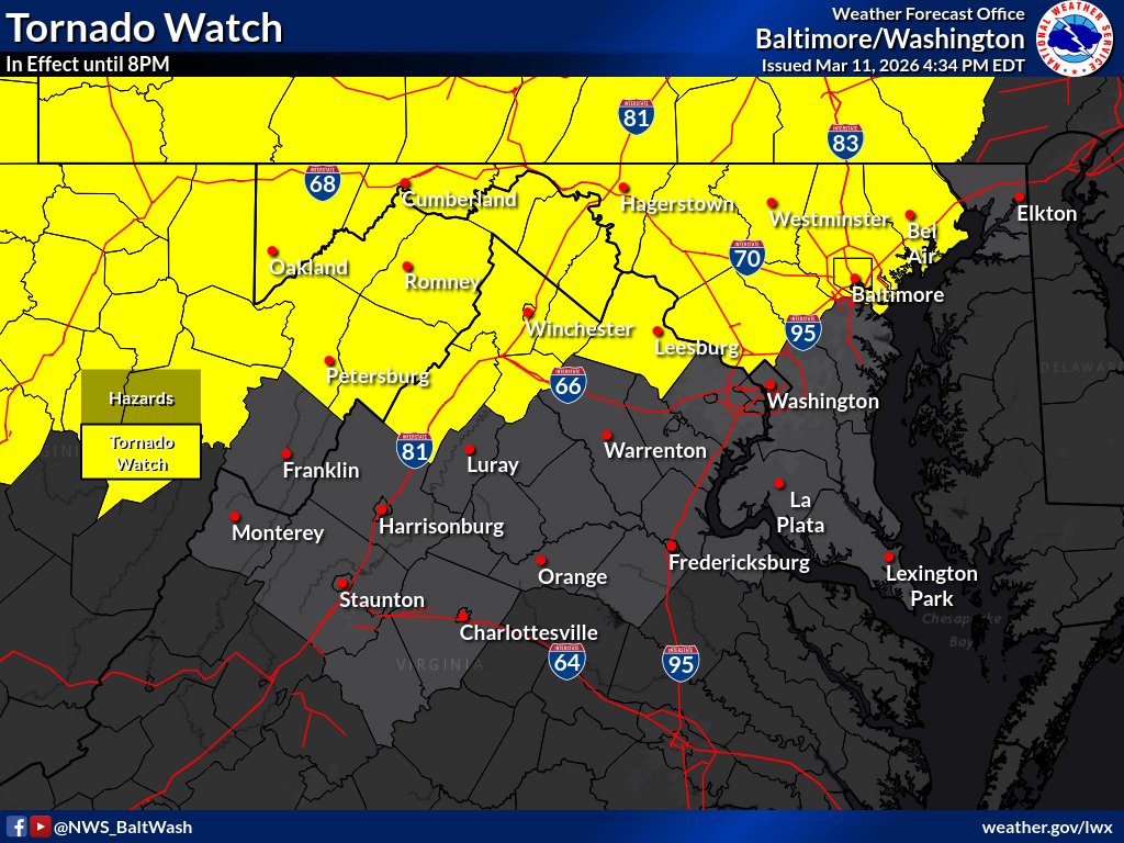
The Tornado Watch was expanded further east to include portions of Northern VA towards the Baltimore metro areas. The Watch remains in effect until 8 PM.
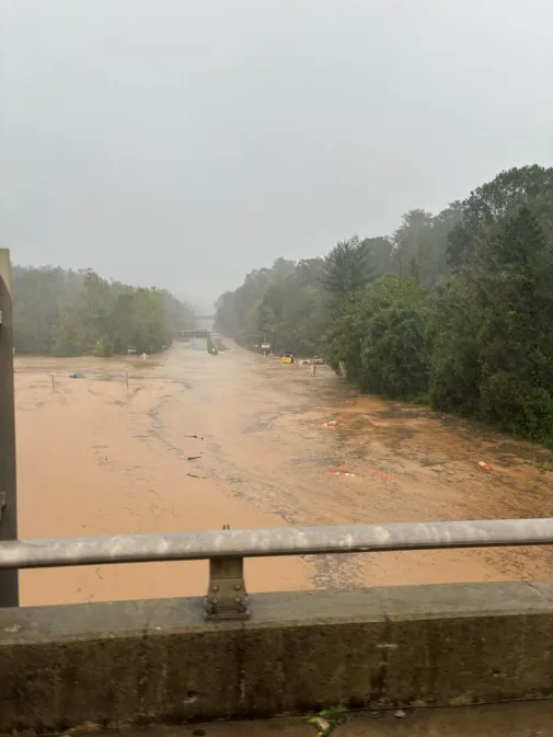
Left: What standing on I-40, looking down at US 74 normally looks like.
Right: Same view, with flooding from the hurricane
(that's the Blue Ridge Parkway bridge in the distance)
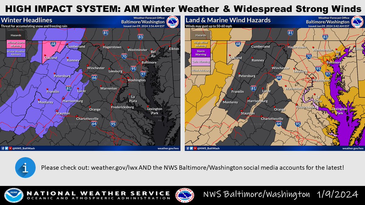
I’m sure you’ve heard by now, but our coverage area is under a Winter Weather Advisory for tomorrow. Don’t be surprised if some areas are upgraded to a Winter Storm Warning as the latest models are trending towards the upper end of advisory parameters.
Snow squall approaching the area could bring a burst of light to moderate snowfall. Untreated surfaces could become icy for a period of time. Little accumulation is expected.
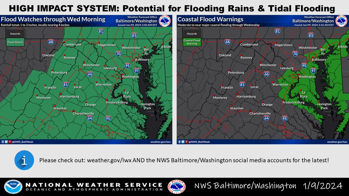
A high impact system is set to impact the area today into Wed. Flooding rains, coastal flooding, strong winds, and mountain wintry precipitation are all expected. Conditions deteriorate after dark as a brunt of the storm tracks from I-95 toward the Bay. #MDwx#VAwx#DCwx#WVwx
Tropical Storm Ophelia continues to gain strength prior to landfall. Our area can expect periods of heavy rain and gusty winds this weekend. If it continues to strengthen, don’t be surprised if tropical storm watches/warnings are extended up the bay.
The NWS SPC has issued a Tornado Watch for the entire region until 9PM tonight. Continue to monitor the NWS and local news outlets for updates.
https://t.co/rhEgzn9ayl
***MAJOR SEVERE WEATHER OUTBREAK POSSIBLE THIS AFTERNOON & EVENING***
Damaging hurricane force winds and even strong tornadoes are possible for the area this afternoon and evening. Follow updates from the NWS throughout the day.
https://t.co/rMFnPvsQEZ
The National Weather Service in Sterling Virginia has issued a
* Severe Thunderstorm Warning for...
Central Harford County in northern Maryland...
East central Baltimore County in northern Maryland...
* Until 745 PM EDT.
https://t.co/tlU3kHX16q
The National Weather Service in Sterling Virginia has issued a Severe Thunderstorm Warning for...
West central Harford County in northern Maryland...
Central Baltimore County in northern Maryland...
Until 715 PM EDT.
https://t.co/COZ3CddcyB
There is an Enhanced risk of severe weather for parts of the Carolinas into the Mid-Atlantic. The primary hazard will be scattered damaging winds. Large hail may also occur with the strongest storms. Please stay weather aware in these areas this afternoon and evening.
Folks in the Baltimore Metro are going to want to be #WeatherAware tomorrow. Parts of our region are in an area with an enhanced risk of severe weather. Damaging winds, hail, and possibly a tornado or 2.
📡KLWX RADAR OUTAGE: June 20-30, 2023 for some major upgrades. Fortunately, as noted on the graphic, there are many NWS (black) and FAA (white) radars to utilize across the Mid-Atlantic. Radar data can be found at: https://t.co/4ZBtSbSZEy. #MDwx#VAwx#DCwx#WVwx
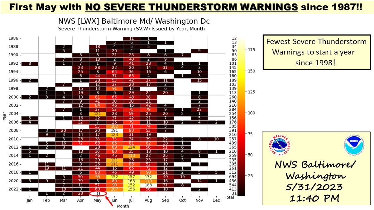
If anyone has noticed, the severe weather season has been slow to evolve across the region. Stats do not lie as our office did not issue a single Severe Thunderstorm Warning in May (last May this occurred was 1987). #MDwx#VAwx#DCwx#WVwx