

Top Tweets for #96l


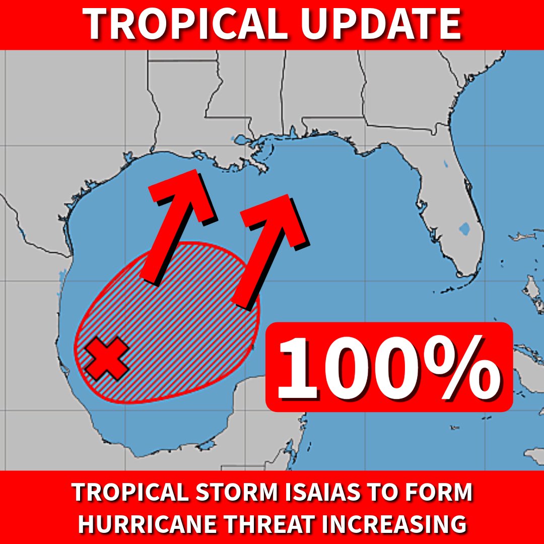
The National Hurricane Center now calls for a 100% chance of #Isaias forming in the Gulf. A cone and watches are coming later today or tonight.
All residents from Louisiana to the Florida Panhandle should be on alert with a hurricane threat coming on Friday or Saturday. 🌀

#96L will be classified as TS Dolly. I think it'll probably be short-lived due to the hostile shear and potential land interaction ahead.

NHC will initiate advisories on Tropical Storm Dolly (formerly AL96) located in the central Tropical Atlantic, at 1100 AM EDT (1500 UTC).


[ACTUALIZACIÓN] 8:00 am El Centro Nacional de Huracanes establece que de mantenerse la organización del invest #96L es posible que inicien advertencias asociadas al fenómeno hoy. El próximo nombre de la lista es Dolly. Hay 90% probabilidad de desarrollo ciclónico. El razonamiento del pronóstico no lo he cambiado. Para la explicación completa, vea mi publicación anterior en video.


It appears we have a chance for some rain in PR over the weekend and early next week with #96L It's still too early to nail down exactly what we will have here, but it appears from guidance it won't be much as atmospherics actually get worse for development the deeper into the week and weekend we get. Guidance does hold 96L together enough so that should a small window present itself the system could get a name. The question over time is though, does it have enough to keep it.
The hope here is for beneficial rainfall in the Lesser Antilles. Hopefully people can catch the runoff from their roofs as the 48 hour on/off water rule continues in PR.
@TropicalTidbits
@weathermodels_


Imho, invest #96L in the Eastern Tropical Atlantic has very likely become a bonafide tropical cyclone (TC) this evening
The consolidated and very persistent bursting pattern with some curved banding is often a tell tale sign of a legit, well-defined TC vortex
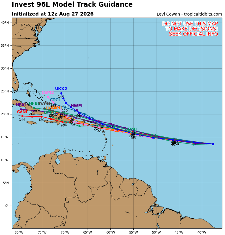
Here are the 0z spaghetti models for #96L. We will see what is left when it arrives in the SW Atlantic (remember those people saying it was a fish 😆)
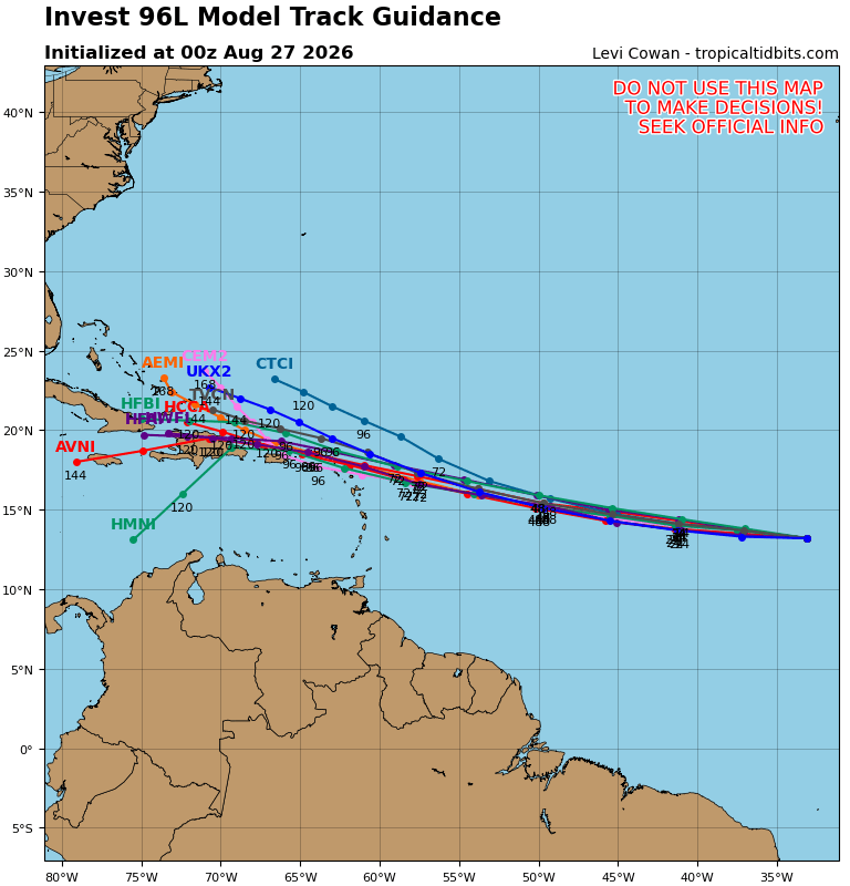
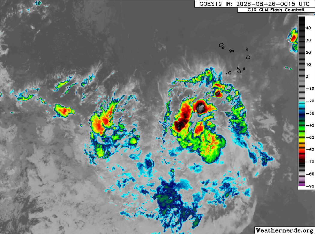
Invest #96L looks healthier tonight out over the MDR, with more concentrated convection. The circulation is apparently not defined enough for it to be classified yet. It still has another day or so before conditions become more hostile and it runs out of time.
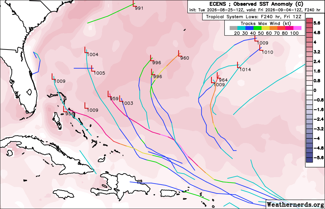
Long-term is still uncertain. There's a slight chance it could redevelop in the Bahamas or Gulf but I think the most likely scenario is the remnants fizzle over Hispaniola.


#96L looking very much like a TC atm . . .

🔄 Invest #96L cerca de Depresión Tropical. Podría traer lluvias en Puerto Rico y República Dominicana
Imágenes y datos de satélite sugieren que el Invest #96L está mostrando señales de organización y debe de estar cerca de ser una depresión tropical. Las condiciones son favorables para que una depresión tropical se forme durante las próximas 36 horas, antes de que viento cortante y aire seco y estable debilite al disturbio.
Los modelos proyectan que pasaría sobre las islas del norte de las Antillas Menores, Puerto Rico y República Dominicana entre el domingo y lunes. Se anticipa un aumento en lluvias que podrían ser beneficiosas para aliviar la sequía.
A largo plazo, puede ser de interés para Las Bahamas y Florida.


🌀TROPICAL TROUBLE?🌀
UPDATE: The NHC has changed the odds of Invest #96L developing to 60%. The fact that the system hasn't developed yet makes it more of an issue for #Florida as it will track further westwards.
It's too early to know where it will go, but the google deepmind ensemble mean does have the center moving across the state, so we will want to keep a close eye on this system. As always, we'll keep you updated!
#flwx

The overall structure of #96L is fairly healthy, with some spiral banding and shallow convection firing even at the diurnal minimum. The biggest issue short-term is the dry/stable air just to the north that is getting pulled into the circulation, limiting the depth and coverage of the convection.


Seems pretty clear that #96L is a tropical depression, perhaps even a tropical storm based on the few 34+ kt wind barbs in the SE quadrant


NEW: Model intensity (12z run) for Invest #96L over the next 5-7 days. If it tries to form, doesn't look to be anything too strong over the next week. Again, it will be contending with some higher shear and also drier air. Better chance for organization and strengthening would be around 7 days out and beyond. But what will it be by then? Nothing or a tropical system? Stay tuned...

TROPICAL UPDATE: Consensus model (TVCN) trend over the past 24 hours for Invest #96L. Yellow is 24 hours ago, Pink is most recent. More west, largely due to this model (and others) delaying development. NHC just recently lowered odds from 70% to 60%. Hypothetically, if it was stronger and developed sooner, it would be more likely to take a turn north out to sea into the Central Atlantic. The weaker it stays in the short-term, the more west it will go.

TROPICAL UPDATE: Consensus model (TVCN) trend over the past 24 hours for Invest #96L. Yellow is 24 hours ago, Pink is most recent. More west, largely due to this model (and others) delaying development. NHC just recently lowered odds from 70% to 60%. Hypothetically, if it was stronger and developed sooner, it would be more likely to take a turn north out to sea into the Central Atlantic. The weaker it stays in the short-term, the more west it will go.
Invest #96L continues to fire some convection out over the MDR this morning. It's a little more concentrated but still pretty linear, with a lot of dry air to the north. Models have been backing off on the long term future for this system and are mostly showing it falling apart near the islands. It's still somewhat possible it could come back later near the Bahamas, but fewer models are showing that at this point. NHC has lowered development probability to 60% this morning.


Invest #96L continues to bubble in the eastern Atlantic. Guidance tracks it west and once it develops keeps it as a tropical storm at this time. Its brush with the islands would be over the second half of the weekend, but the question is how much. We have time to watch it. Some guidance kills it before the islands and google doesn't have much at all.
On a morning we mourn the loss of an American icon, the next name on the list is Dolly. The real Dolly Parton gave millions to victims of weather related disasters like the Gatlinburg Fire in 2016 and even Helene in 2024.

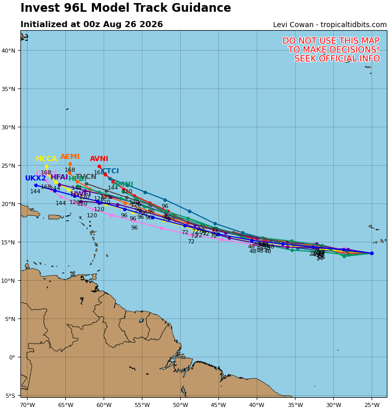
#96L is still showing some signs of organization, though convection isn't the most healthy. I'll be curious to see if this is able to get classified in the next day or two. That might be its best opportunity to do so.
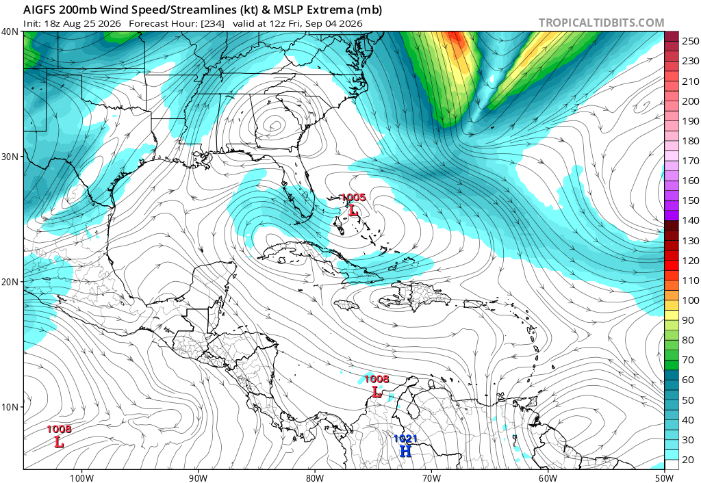
Models pretty much unanimously now show a hostile environment near the islands causing the system to likely weaken and potentially fall apart completely. ECMWF, AIFS, and their ensembles mostly show this scenario, with nothing left of the system past the islands.
If it can survive past the TUTT near 60W, there's a chance it could revelop (or potentially develop for the first time) further west near the Bahamas in a slightly more favorable upper pattern. But there are a lot of obstacles to overcome for that to even be a possibility.
Most Popular Users

Elon Musk 
@elonmusk
241.5M followers

Barack Obama
@barackobama
118.8M followers

Cristiano Ronaldo
@cristiano
114.6M followers

Donald J. Trump
@realdonaldtrump
111.8M followers

Narendra Modi
@narendramodi
107.1M followers

Rihanna
@rihanna
98.7M followers

NASA
@nasa
92.3M followers

Justin Bieber
@justinbieber
91.8M followers

KATY PERRY
@katyperry
90.1M followers

Taylor Swift
@taylorswift13
84M followers

Lady Gaga
@ladygaga
75.5M followers

Virat Kohli
@imvkohli
73.5M followers

Kim Kardashian
@kimkardashian
70.9M followers

YouTube
@youtube
68.8M followers

Neymar Jr
@neymarjr
66.5M followers

Bill Gates
@billgates
65.3M followers

Selena Gomez
@selenagomez
63.1M followers

The Ellen Show
@theellenshow
62.2M followers

CNN
@cnn
61.7M followers

X
@x
60.7M followers