

Top Tweets for #Fridaylidar

#FridayLidar of The King’s Stables: an artificial pool from Bronze Age Ireland. Containing fragments of sword moulds, articulated animal remains and a portion of a human skull, it may have been a place for the deposition of votive offerings.
🆓 https://t.co/KliQIfg0rI

#FridayLidar map of Cerro Patlachique, south of Teotihuacan, annotated with locations of monuments.
Depictions of the Mesoamerican Storm God & Water Goddess are prevalent, suggesting the mountain's summit was a place of convocation with water deities.
🆓 https://t.co/FQfeqAjJkC

#FridayLidar of the Lowland #Maya site of Ceibal, Guatemala. Excavation of a burial ground indicates the development of permanent cemeteries c.1000 BC could have been the catalyst that lead to permanent settlement and land ownership.
🆓 https://t.co/EnrceQY5DZ

1802 map, 1950 excavation plan and 2019 lidar scan of the Iron Age fortified site of Gamleborg on the island of Bornholm.
A strategically important location in the Baltic Sea since prehistory, fortifications have rarely been investigated.
🆓 https://t.co/ZgPkv8n7pA
#FridayLidar

#FridayLidar of the #medieval Castle Kolno, Poland.
Excavating in the moat of the castle, archaeologists uncovered an amethyst set in silver gilt. Likely part of a brooch, it is a rare example of a high-status find from an everyday context.
🆓 https://t.co/jvPN0b7kBT

Here's some #FridayLidar of the unrecorded Maya city of Valeriana, reported in Antiquity last year!
Hidden in the dense jungle of Campeche, Mexico, this discovery suggests the central Maya Lowlands may have been urbanised and densely settled.
🆓 https://t.co/C6NSrlzhiT

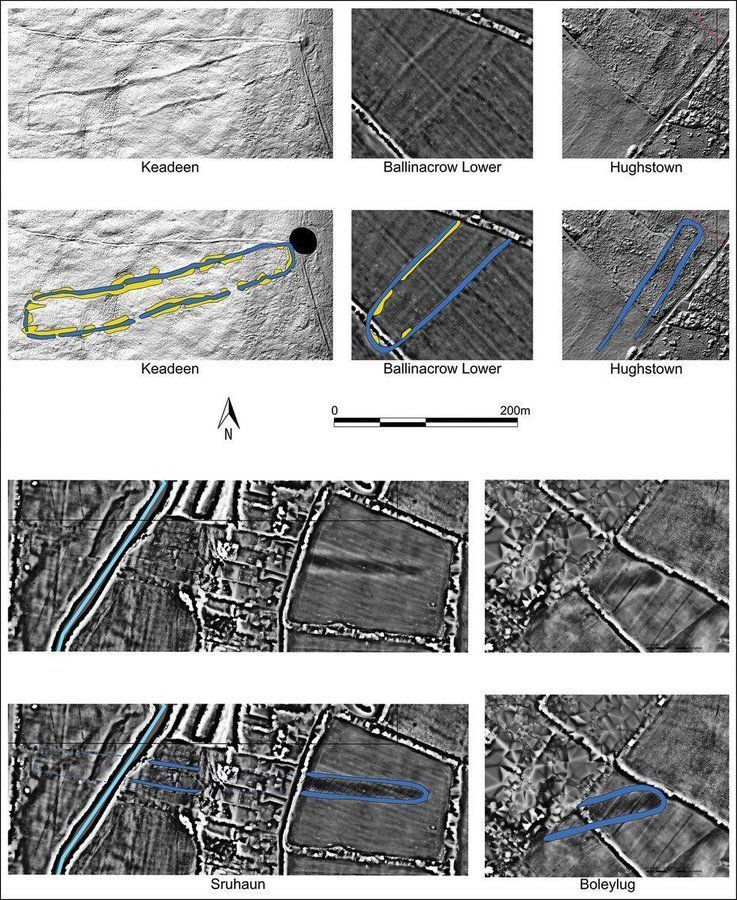
Lidar of 5 cursus monuments at Baltinglass 🇮🇪 It is one of the largest cursus clusters found in Ireland or Britain, indicating Baltinglass was intensively settled from the Neolithic to Bronze Age #FridayLidar
🔗 to research published #OnThisDay in 2024 🆓 https://t.co/JQ0Cem5FkV
Lidar map of the Szpęgawski Forest, Poland, showing locations of Second World War mass graves #FridayLidar
2413–7000 people murdered by the Nazis were buried here. A new project is uncovering the material evidence of these crimes against humanity.
🆓 https://t.co/YifZKlkFZo

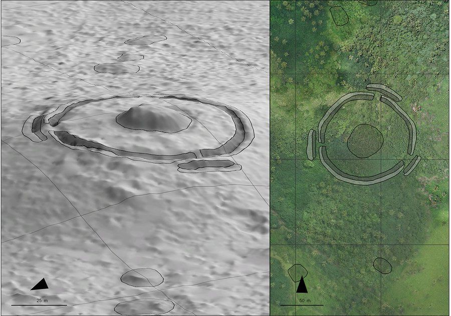
Lidar of 1500-year-old Mala'e Vakapuna mound on Tongatapu, Tonga #FridayLidar
It is currently the best-dated structure in West Polynesia, and its early date suggests politically complex chiefdoms developed there before eastern islands were settled.
(£) https://t.co/RR5Uctv2VU
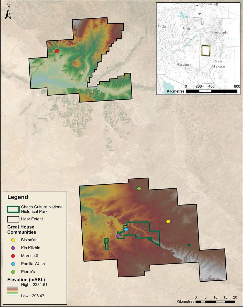
Lidar imagery showing five Chacoan great-house communities in Chaco Canyon, New Mexico #FridayLidar
Computer modelling suggests these communities were constructed around the sound of conch-shell trumpets.
🆓 https://t.co/qIUl0EtCz6
Lidar imagery of five cursus monuments in the Baltinglass landscape of County Wicklow. This is one of the largest cursus clusters found in Britain or Ireland, indicating Baltinglass was intensively settled from the Neolithic to Bronze Age #FridayLidar
🆓 https://t.co/Fb2QiRoW97

Lidar can famously 'see-through' vegetation to reveal the archaeology below. But it can also look through water.
Here it reveals a now-submerged stone fish trap built by Indigenous Australians at Cape Missiessy #FridayLidar
🔗 from 2018 🆓 https://t.co/F59Z1CfFvH

Lidar images from the 19th century settlement of Marathodi, southern Africa, showing the main centre. #FridayLidar
Combining statistical methods with ethnohistorical knowledge helps measure inequality in large southern African farming communities.
🆓 https://t.co/umYGtoLQqH

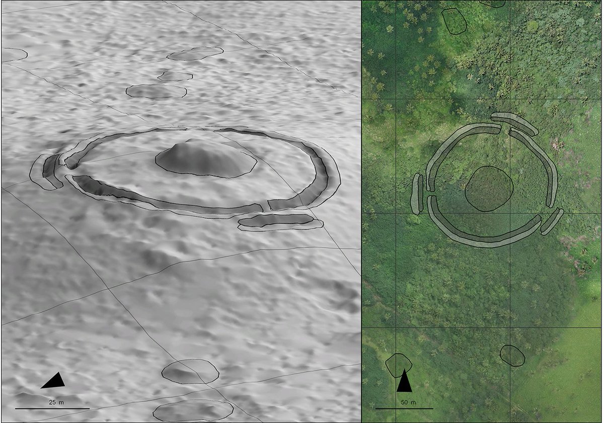
Lidar of 1500-year-old Mala'e Vakapuna mound on Tongatapu, Tonga #FridayLidar
It is currently the best-dated structure in West Polynesia, and its early date suggests politically complex chiefdoms developed there before eastern islands were settled.
(£) https://t.co/WfMXt5oB0e
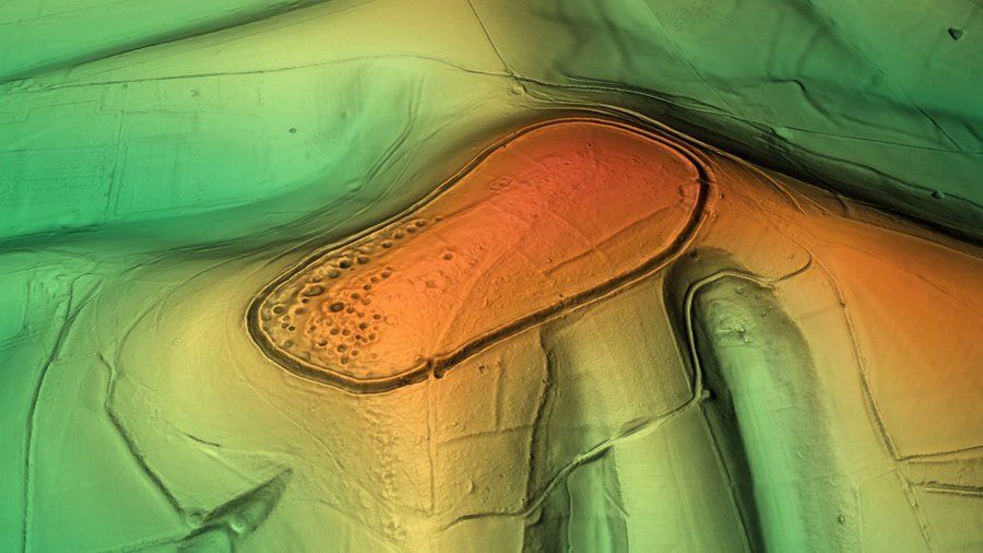
This is lidar of Cissbury Ring, an Iron Age hillfort in West Sussex and the second largest in England. It captures the pockmarks left on the hill by earlier Neolithic flint mines. #FridayLidar 1/2
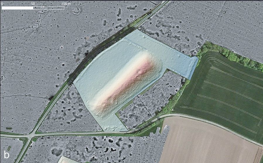
LiDAR survey of one of the Tusson long mounds 🇫🇷 showcasing evidence of quarrying #FridayLiDAR
Antler was deposited in the quarries after their use. Radiocarbon dating placed the antler at ~4600 BC, which lines up with dates for occupation of the nearby settlement of Le Peu. 1/2

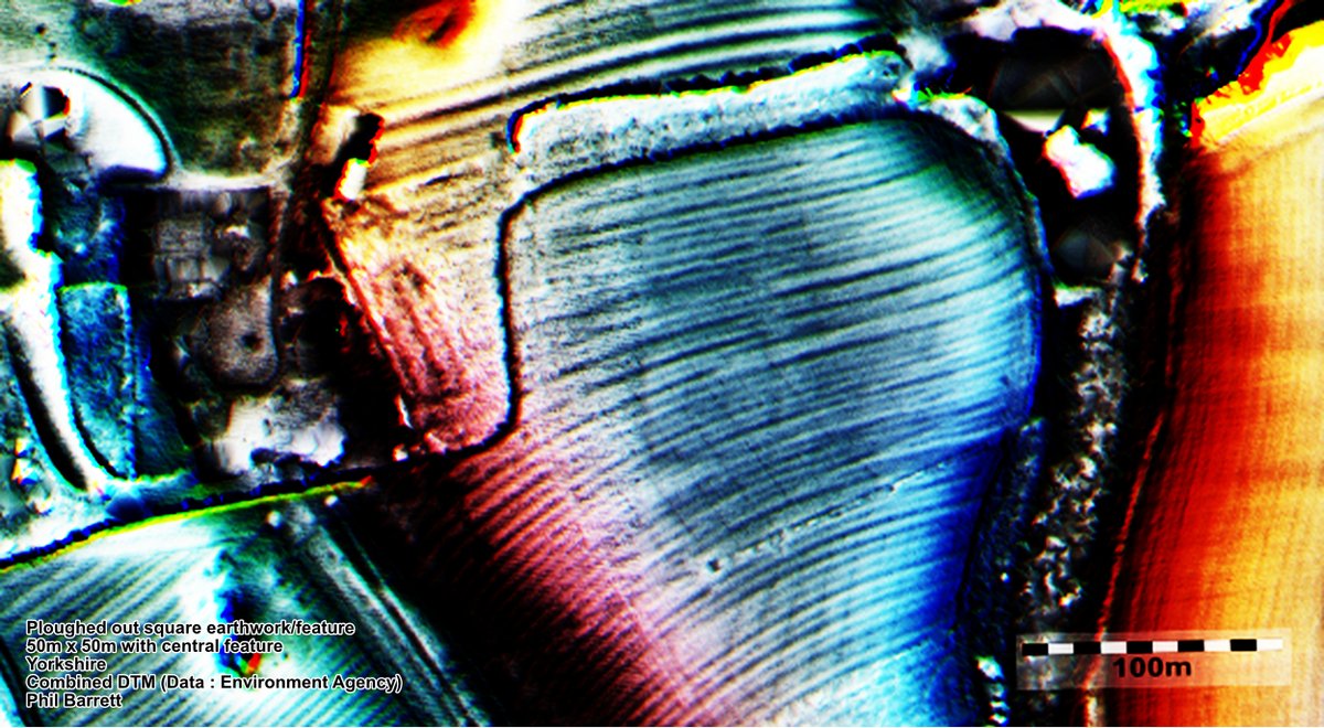
Here's an very ephemeral #earthwork on a hill in Yorkshire. A well ploughed out 50m square with 15m square 'thing' at the centre.
In an area of both #Prehistoric and #Roman activity.
🤔
Unrecorded and will remain so 'til ploughed to oblivion.
#FindsFriday #FridayLidar #Lidar
LiDAR map of the the 5th century AD Zōzan tomb group (🇯🇵). It contains one of Japan's largest mounded tombs #FridayLiDAR
The possible existence of a moat around the largest mound suggests wide political connections across the region.
🆓 https://t.co/5OmTt5wzor

#FridayLiDAR
A #BronzeAge burial ground in Bosnia discovered using #LiDAR
Grave goods sourced from as far away as Greece suggest that the inhabitants of the cemetary had far-reaching connections.
(£) https://t.co/7pOSKKC7uE
📷 I.M. Petschko


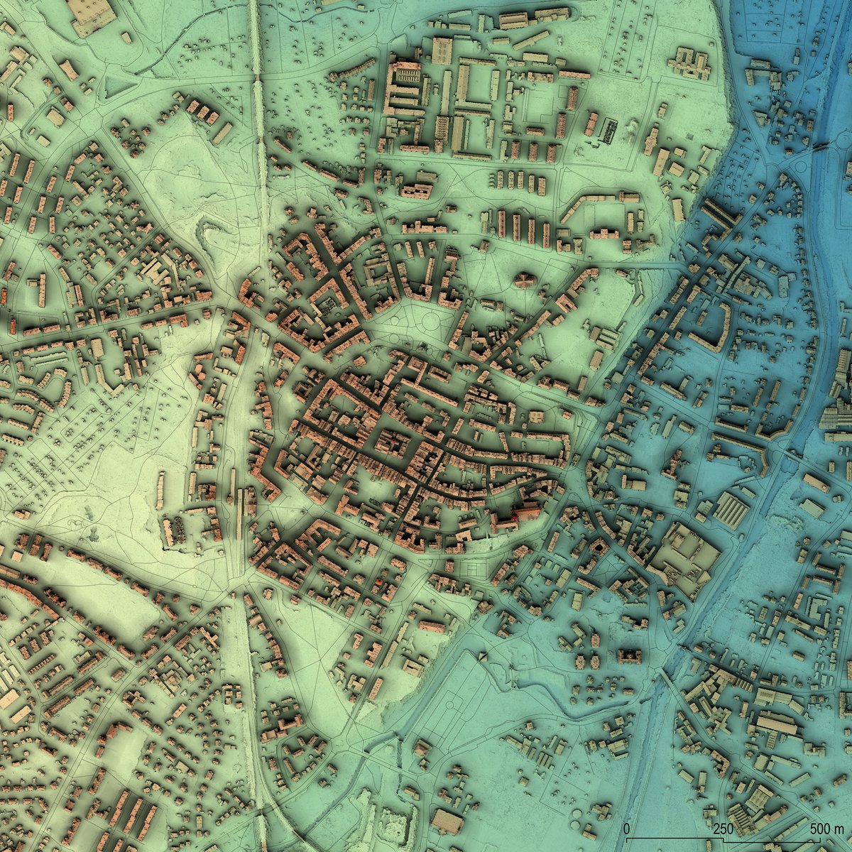
The contemporary urban layout of the Old Town in #Świdnica, PL. I really enjoy using #LiDAR data for mapping cities. It's a nice change from constantly staring at hillforts and burial mounds. ;) #FridayLidar
Last Seen Hashtags on Sotwe
Most Popular Users

Elon Musk 
@elonmusk
241.7M followers

Barack Obama
@barackobama
119M followers

Cristiano Ronaldo
@cristiano
114.5M followers

Donald J. Trump
@realdonaldtrump
111.9M followers

Narendra Modi
@narendramodi
107.2M followers

Rihanna
@rihanna
98.7M followers

NASA
@nasa
92.4M followers

Justin Bieber
@justinbieber
91.8M followers

KATY PERRY
@katyperry
90M followers

Taylor Swift
@taylorswift13
84M followers

Lady Gaga
@ladygaga
75.5M followers

Virat Kohli
@imvkohli
73.4M followers

Kim Kardashian
@kimkardashian
70.9M followers

YouTube
@youtube
68.8M followers

Neymar Jr
@neymarjr
66.4M followers

Bill Gates
@billgates
65.2M followers

Selena Gomez
@selenagomez
63.1M followers

The Ellen Show
@theellenshow
62.3M followers

CNN
@cnn
61.8M followers

X
@x
60.7M followers