This account will be closed on April 5th. Please follow us on Threads or Instagram at @hcema_ne or on Facebook @ Hamilton County Nebraska Emergency Management.
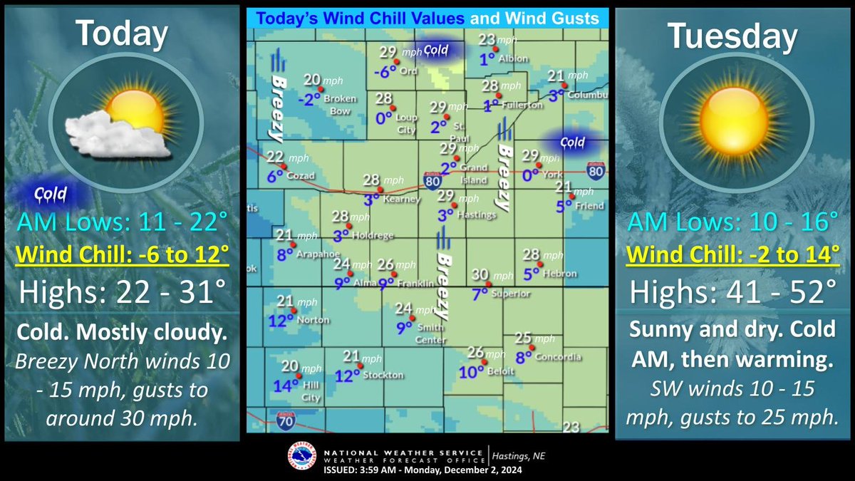
Overnight lows: 11-22. N winds 10-15 mph, gusts to 30 mph today. Wind chill values below zero this morning for portions of central NE, single digit values for much of the area. Highs: 22-31. Dry. Mostly cloudy. Cold AM Tues. Lows 10-16. Highs: 41-52. SW winds 25 mph. #NEwx#KSwx
Overnight lows: 8-20. Anticipate areas of AM patchy fog/possibly freezing fog, mainly W of Hiway 10. Highs today: 33-47. Partly cloudy skies clearing by late afternoon. Dry with light winds. Highs Mon: 23-32. Dry. Partly cloudy. N winds 10-20 mph. Highs Tues: 40-50. #NEwx#KSwx
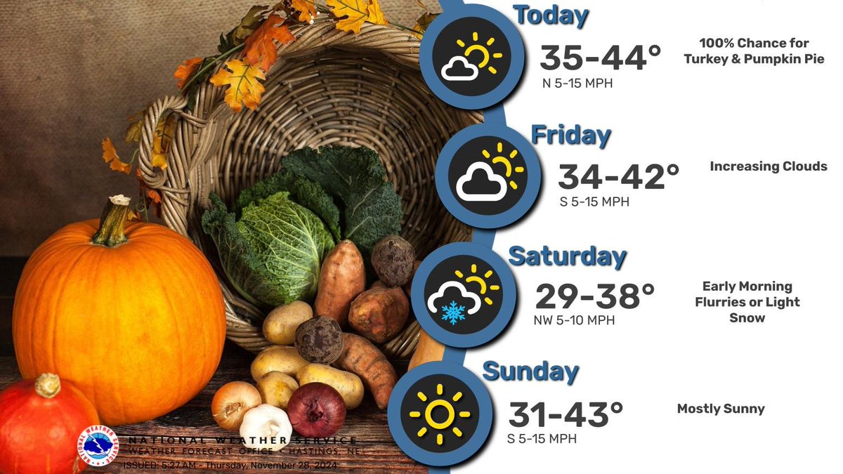
Most spots remain dry through the Thanksgiving weekend. There is only a low chance for light snow late Friday night into Saturday morning. Daytime highs will only be in the 30s for most, with overnight lows in the teens. #NEwx#KSwx
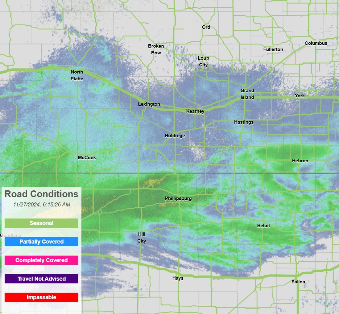
6:25am Wednesday: Light mix of precipitation persists across southern parts of the area, but there have not been any reports of impacts to roads yet. #NEwx#KSwx
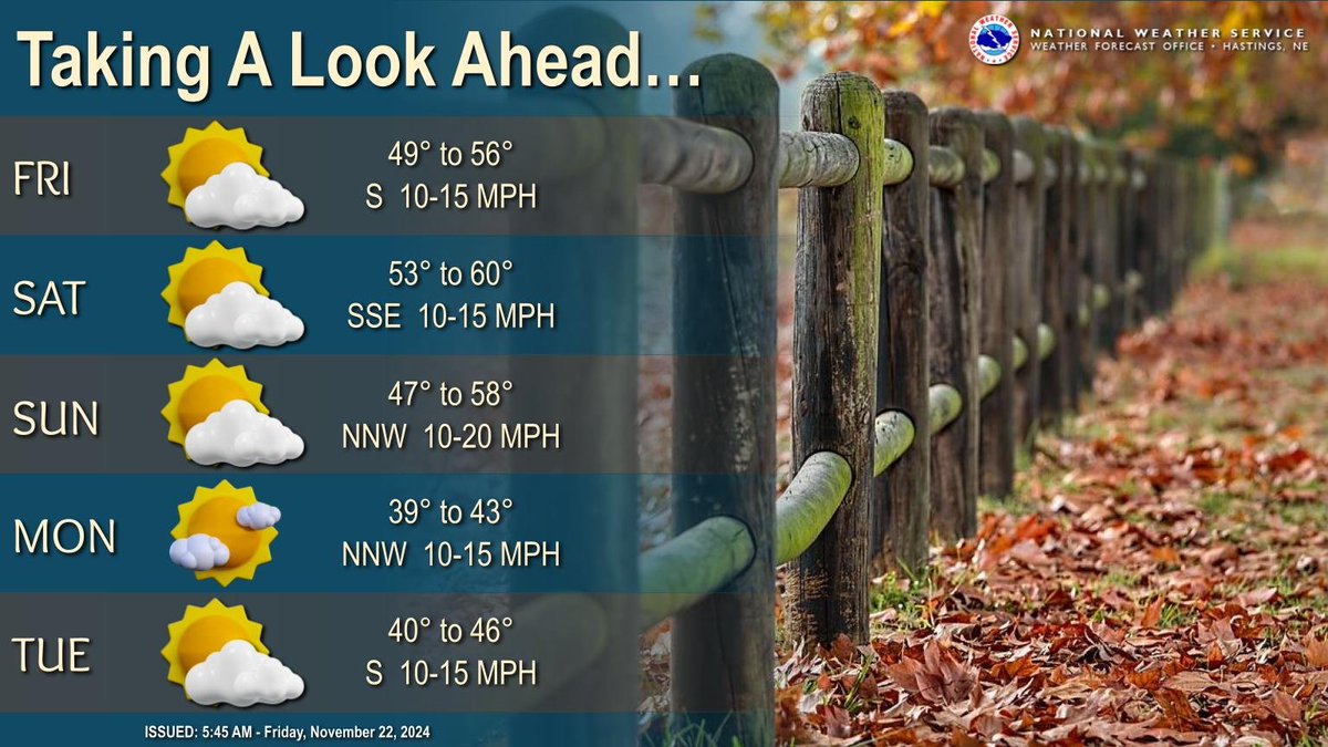
Overall dry conditions expected the rest of this week on into the start of the new week, with generally partly cloudy skies. Warming trend continues, peaking Saturday with highs in the 50s-near 60. Cold front Sunday drops highs for Monday back into the 30s-40s. #newx#kswx
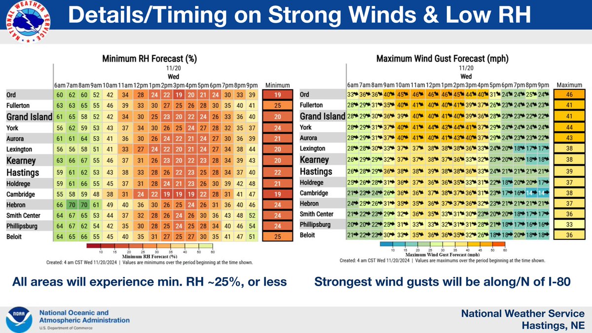
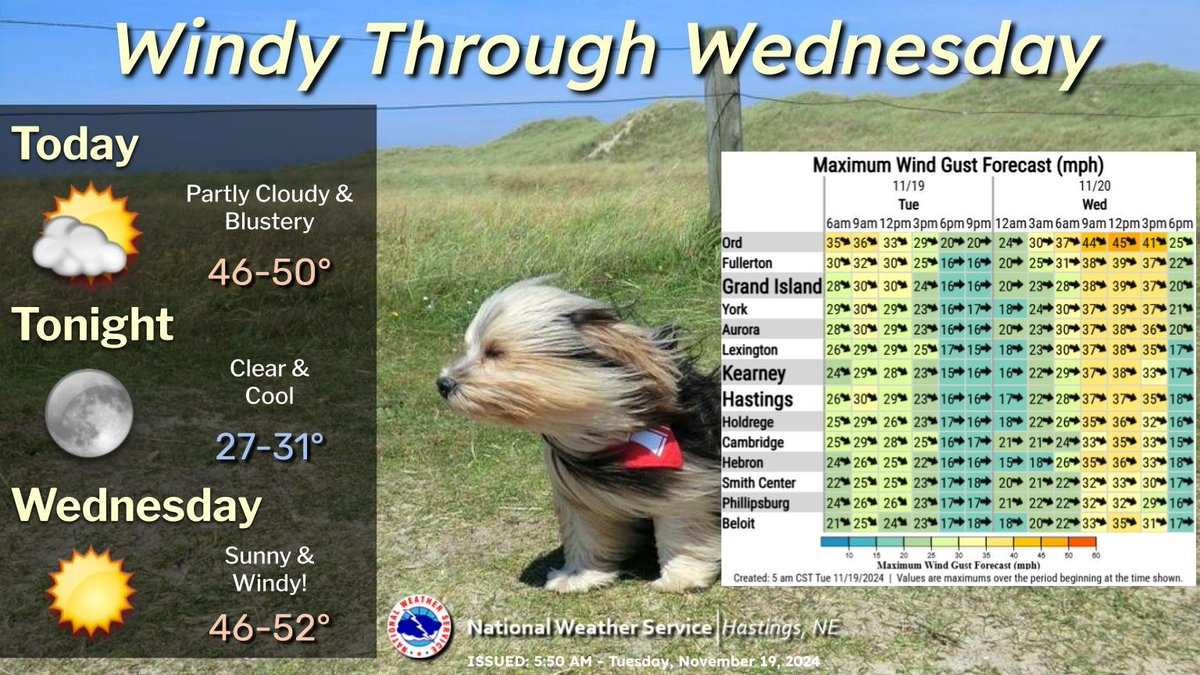
Main story over the next couple of days will be strong W-NW wind gusts, 30-35 MPH today, and 35-45 MPH on Wednesday, highest N of I-80. Otherwise, expect dry conditions and seasonable temperatures #NEwx#KSwx
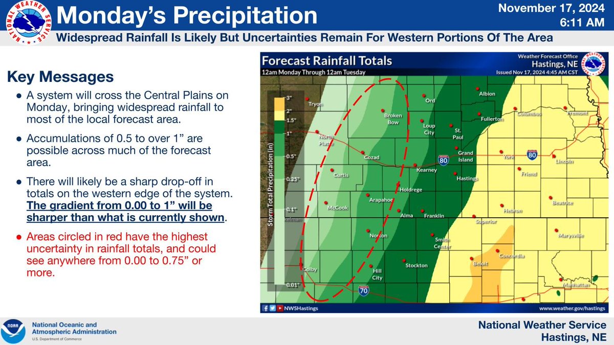
Rain will move into the area this morning. Accumulations of 0.5-1" or more are expected for much of the area. There will likely be a sharp drop in rainfall accumulations across western portions of the area, with amounts ranging from 0.10-0.75” over a short distance. #NEwx#KSwx
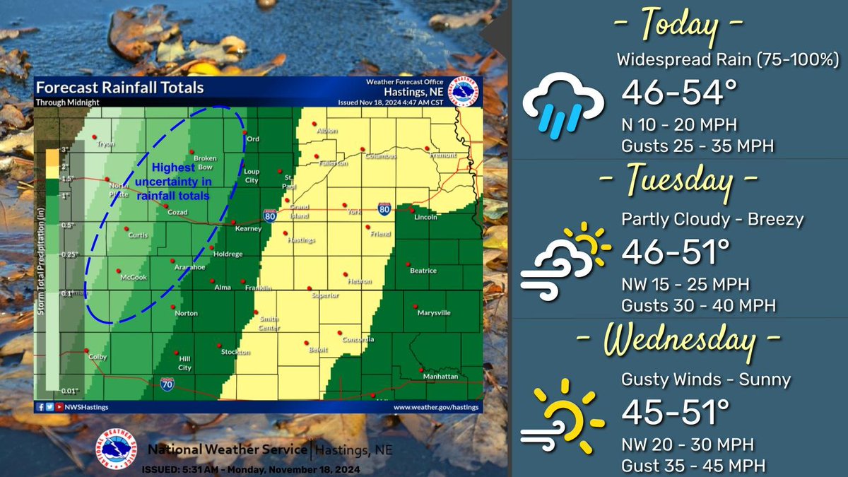
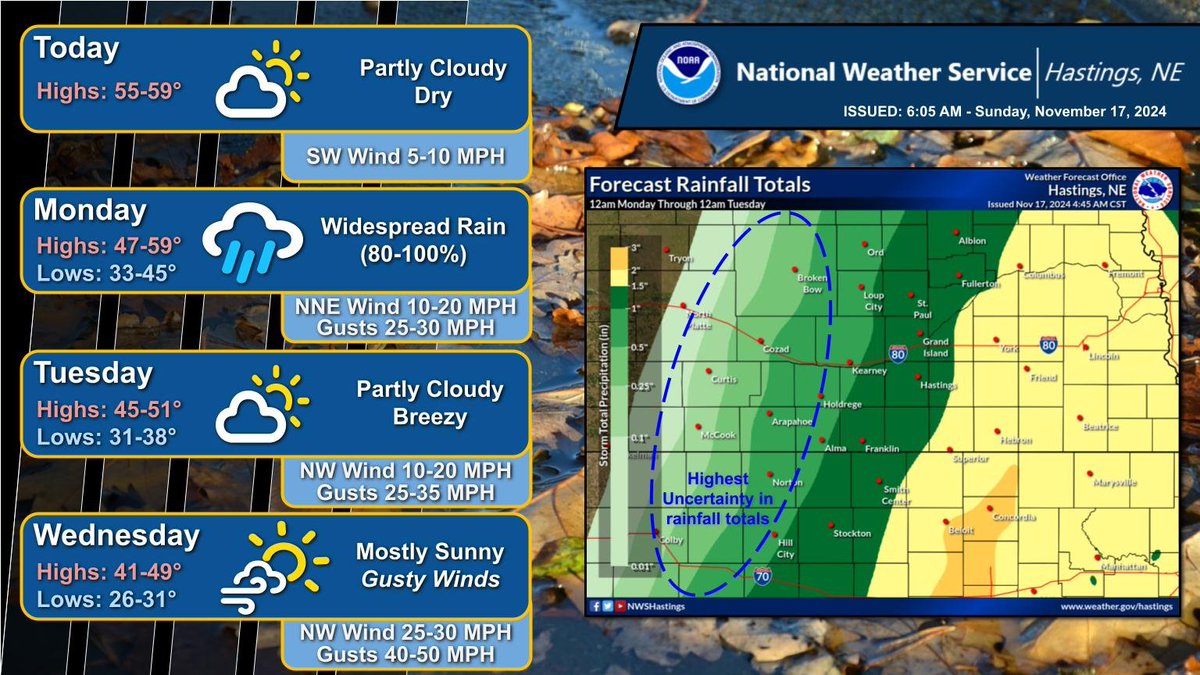
Rain moves into the area this morning, bringing widespread rain to the area. Accumulations of 0.5 to 1 inch or more are expected for much of the area. Gusty winds on Tuesday and Wednesday, with gusts of 30 to 45 mph. Highs in the mid 40s to low 50s through Wednesday. #NEwx#KSwx
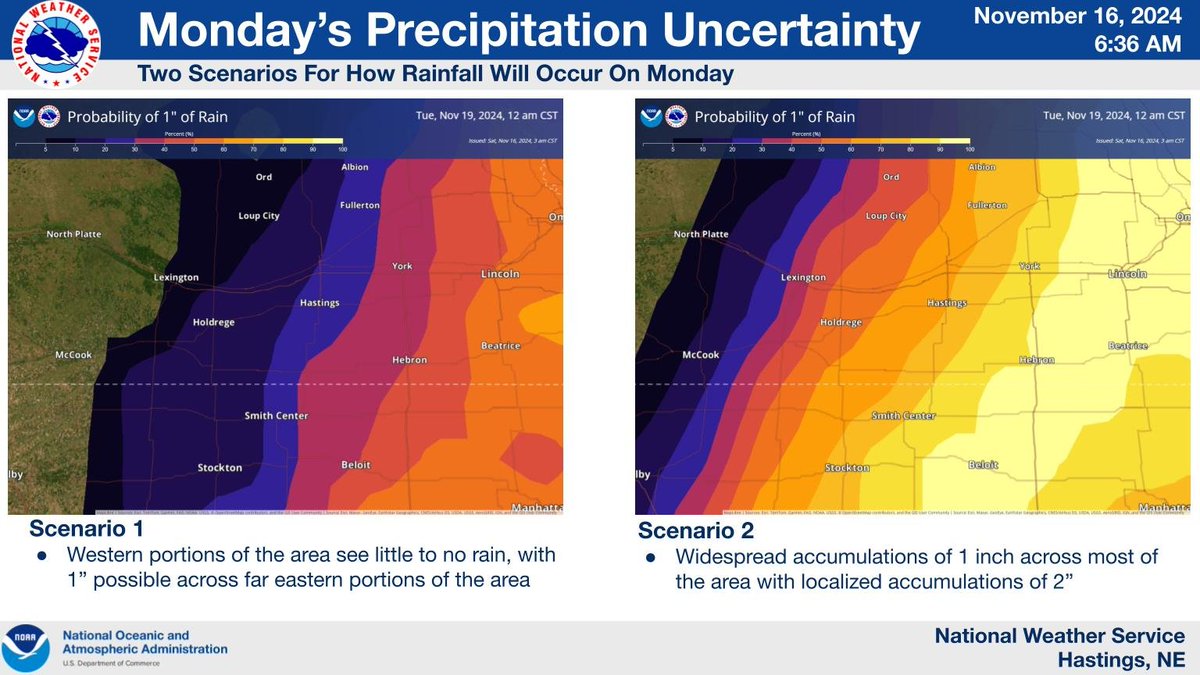
Widespread rain will move into the area on Monday. Accumulations of 0.5 to 1 inch or more are possible across much of the forecast area. There remains uncertainty with the western edge of the precipitation, with a large range in rainfall possible. #NEwx#KSwx
Highs today will be in the 50s with light winds. Rain moves into the area on Monday. Accumulations of 0.5-1 inch or more are expected for most of the forecast area. Gusty winds expected Tuesday and Wednesday #NEwx#KSwx
Widespread rain is expected on Monday however there remains uncertainty on how widespread rain will be. Western portions of the area have the highest uncertainty in rainfall as there will likely be a sharp drop off in rainfall totals on the western edge of the system #NEwx#KSwx
Highs today and Saturday will be in the 60s with breezy southerly winds gusting 25-35mph. Cooler weather on Sunday with highs in the 50s. Rain returns to the area on Monday, with the heaviest rain falling across eastern portions of the area. #NEwx#KSwx
High temperatures today through Sunday will be in the 50s and 60s. Overnight lows will range from the mid 20s to mid 40s. There is up to a 20% chance of rain on Sunday across portions of north central Kansas. #newx#kswx
Rain is expected to continue across portions of the area today. Winds today will become gusty out of the northwest with gusts as high as 40 mph. High temperatures today through Saturday will be in the 50s and 60s. #newx#kswx
Rain is possible this evening through early Wednesday afternoon. High temperatures today through Thursday will be in the 50s and 60s. Gusty winds will be across the area today and Wednesday. #newx#kswx
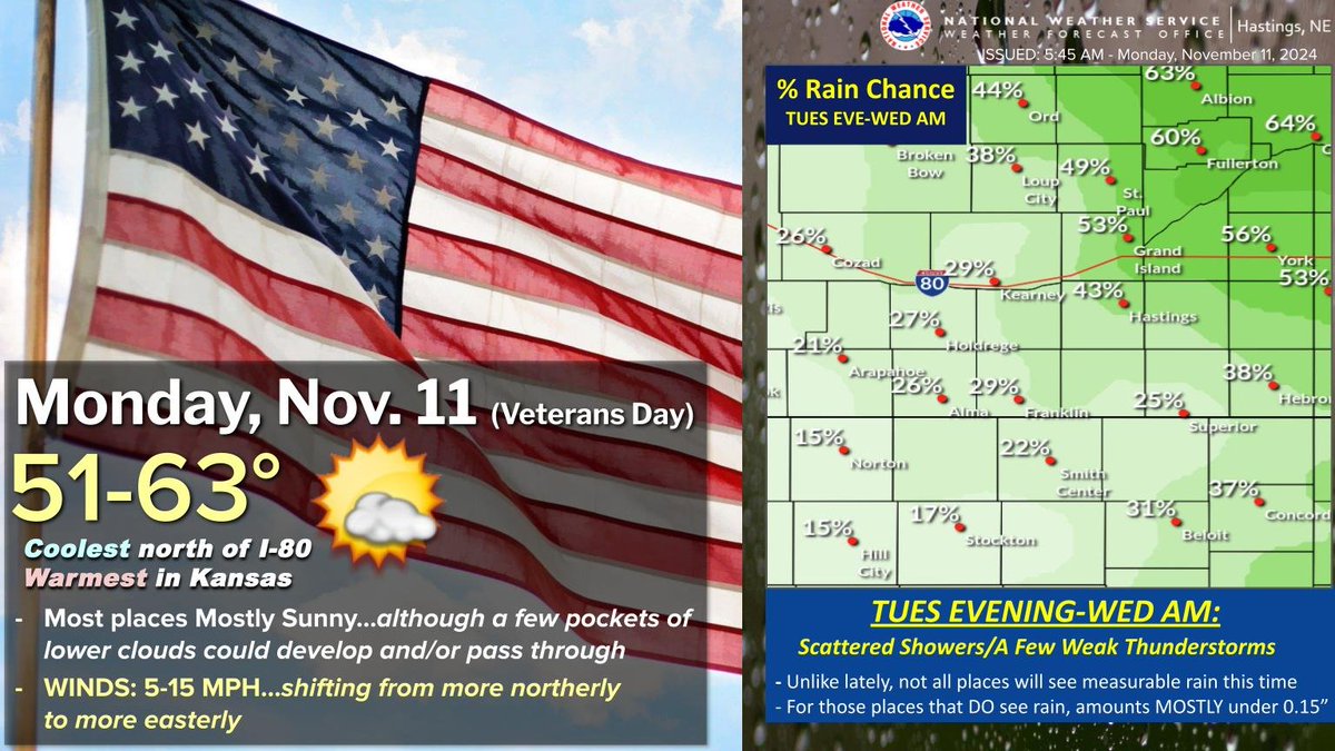
This Veterans Day will be dry with highs 51-63° (coolest north/warmest south) under generally mostly sunny skies. Things turn a bit more active Tues-Wed, with stronger winds (Tues from SE/Wed from NW), along with scattered showers+ a few weak storms Tues eve-Wed AM. #NEwx#KSwx
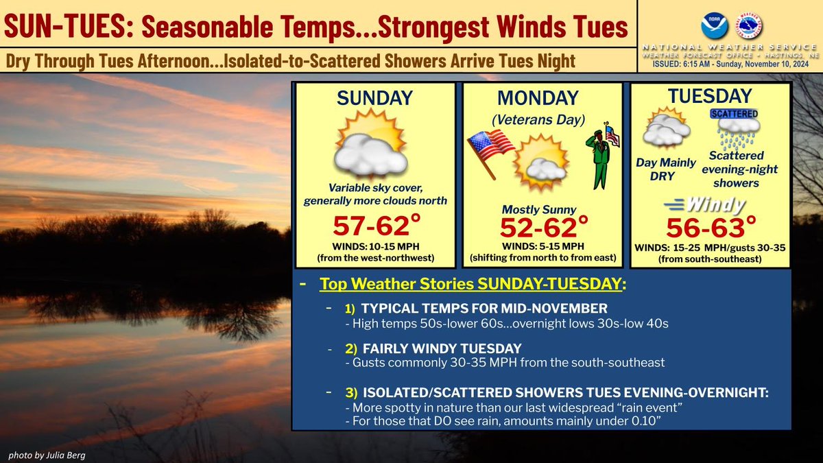
SUN-TUES Overview: 1) Seasonable high temps (50s-low 60s)...2) Becoming fairly windy Tuesday (gusts 25-35 MPH from south-southeast)...3) Next rain chances Tues evening-overnight, but more isolated/scattered in nature than our last "rain event" #NEwx#KSwx