Located in Paris TN, Henry County Emergency Management provides community warning info and coord of disaster response, preparedness, recovery, and mitigation.
🚨Attention Dyersburg, TN NOAA Weather Radio listeners! We have good news!
...NOAA Weather Radio broadcast for Dyersburg, TN has returned to service...
NOAA Weather Radio station WWH-30 operating on a frequency of 162.50 MHz in Dyersburg, TN, has returned to service.
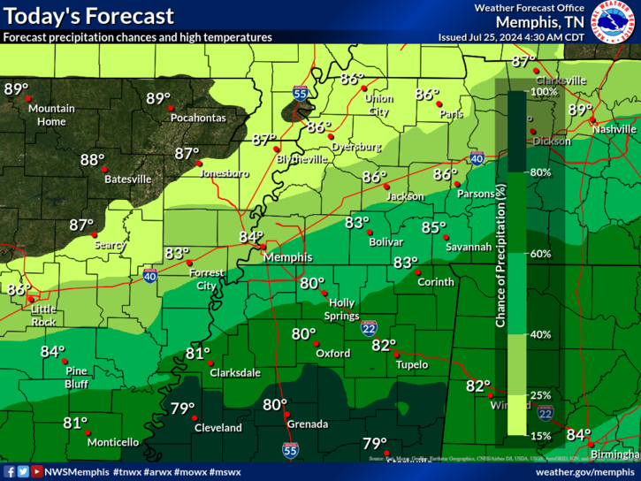
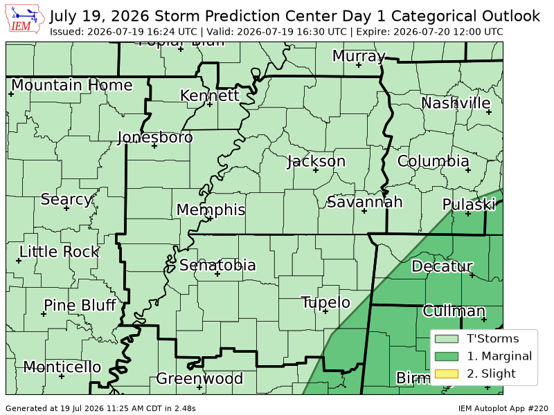
Here's a look at shower and thunderstorm coverage over the next ~48 hours. Highest coverage of storms will be overnight tonight through late Friday morning.
Here's an updated look at what we're expecting for storms tomorrow night. The first 3-4 hours of the event will be the peak intensity over eastern AR, though even that doesn't look too impressive. Storms will very quickly diminish in strength after about midnight. 🧵(1/2)
PLEASE SHARE: A Tornado Watch has been issued for Henry, Carroll, Benton, & Decatur Counties in TN & Trigg, Christian, Todd & Muhlenberg Counties until 3am Saturday. We expect the watch to be expanded east, so make sure you have a way to get the warnings!
10:30PM Storms to the south are weakening upon approach, indicating that they are still clinging to of a cap on the atmosphere! Please continue to stay aware, especially as more storms form and others move in from the west. /LG
Who else is enjoying these ✨below normal ✨temperatures?!🙋♀️
Sadly, these beautiful temperatures won't last much longer... We begin a warming trend this weekend. ☹️
Also... Don't forget those umbrellas when heading out the door today!☔️ #mowx#arwx#tnwx#mswx
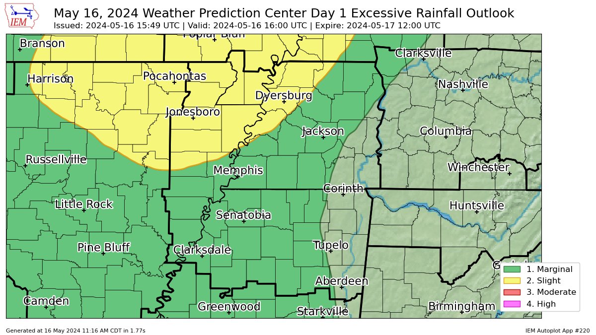
Radar estimates that nearly 8 inches of rain has fallen up around White House on the Highland Rim. Totals well into the 4 inch range inside Davidson Co. Additional rainfall tonight will make a bad situation worse. If you're N of I-40, please stay aware of your surroundings in case you need to evacuate.
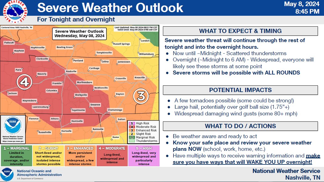
We are still expecting more severe weather to impact the state throughout the night.
👉Have multiple ways to receive warnings. Warning options should include ways that can wake you up if needed.
👉If you need shelter: https://t.co/PJCWPezC3b
PLEASE SHARE! We have multiple rounds of severe storms expected from now thru early Thu. am with tornadoes, damaging winds, heavy rain, and large hail! Please have a way to get the warnings as some rounds will be overnight! https://t.co/TzpIFd4Q5s
🚨4:09 Radar Update🚨 this storm cluster moving into eastern AR contains damaging wind gusts up to 70 MPH and ping pong ball sized hail! Take shelter now if you are not already. ⚠️⚠️⚠️⛈️
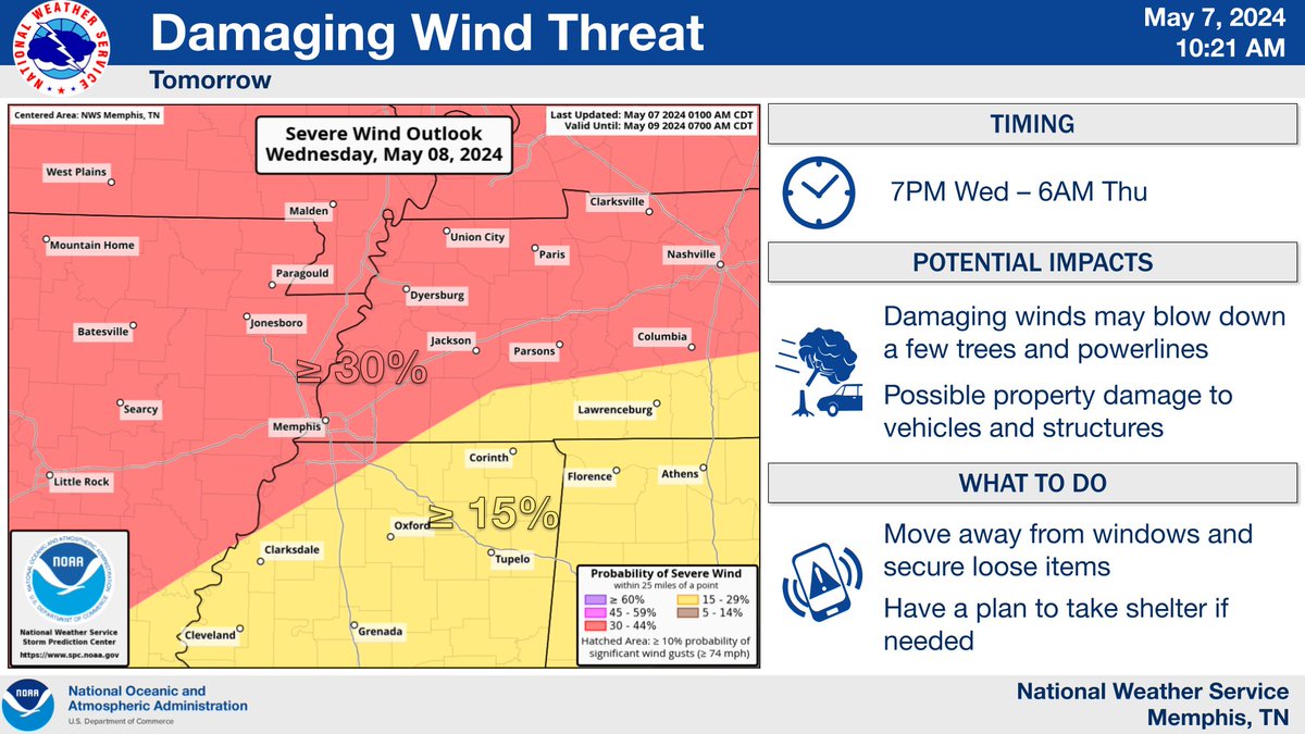
A potentially significant severe weather event is on tap Wednesday night, likely between 10pm-2am. A squall line will be capable of very strong wind, hail, and spin-up tornadoes. Have multiple ways of receiving weather alerts and prep for possible power outages. #memstorm
UPDATE:
View full severe weather briefing PDF here: https://t.co/U4nxyWh8n0
TOMORROW NIGHT: An Enhanced Risk (level 3/5) of severe weather is in effect for much of the area. All modes of severe weather will be possible; check out the individual wind/tornado/hail probabilities 👇
Henry County Govt offices will be closed on Friday Jan 19 due to ongoing winter weather and hazardous travel conditions. This includes Couthouse, Annex,Airport, Central Building, Health Dept, and Recycling Center. Offices to reopen on Monday Jan 22.