@mattluthier@KOB4 I think they’ll be mostly wet. Areas in the: foothills, Rio Rancho and East Mtns may have some icy roads. Otherwise we should start to melt nicely by Saturday.
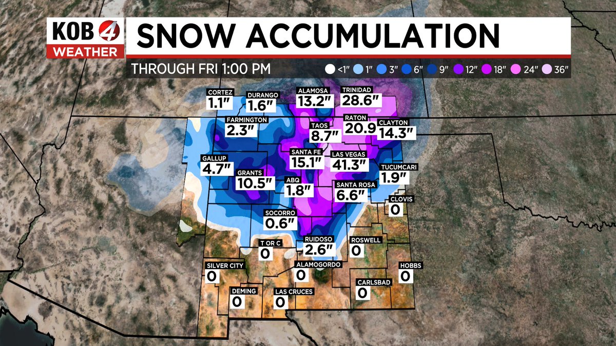
Up to 4+ FEET of snow is being expected, for the Mtns in northern #NM and many communities may be buried over the next few days. Here is the latest prediction for #snow accumulation. Major traffic impacts will focus on northern and central areas. #nmwx@KOB4
Blizzard Warning is in effect for the east slopes of the Sangre De Cristo mountains. Multiple car accidents have already been reported and some roads have been closed. Very dangerous driving conditions with low visibilities due to blowing snow. #nmwx
Heavy snow is coming down on I-25 & La Bajada. This is only the beginning - a lot more is on the way. Avoid north I-25 through Friday morning if possible! #nmwx
12:27 PM MST
Rain & high elevation (above 7,500 ft) snow will continue through the afternoon as a low pressure system shifts east across NM.
Expect a few hundredths of an inch to 0.4" of rain in lower elevations with another 1 to 3" of snow above 7,500 ft through 2PM. #NMwx
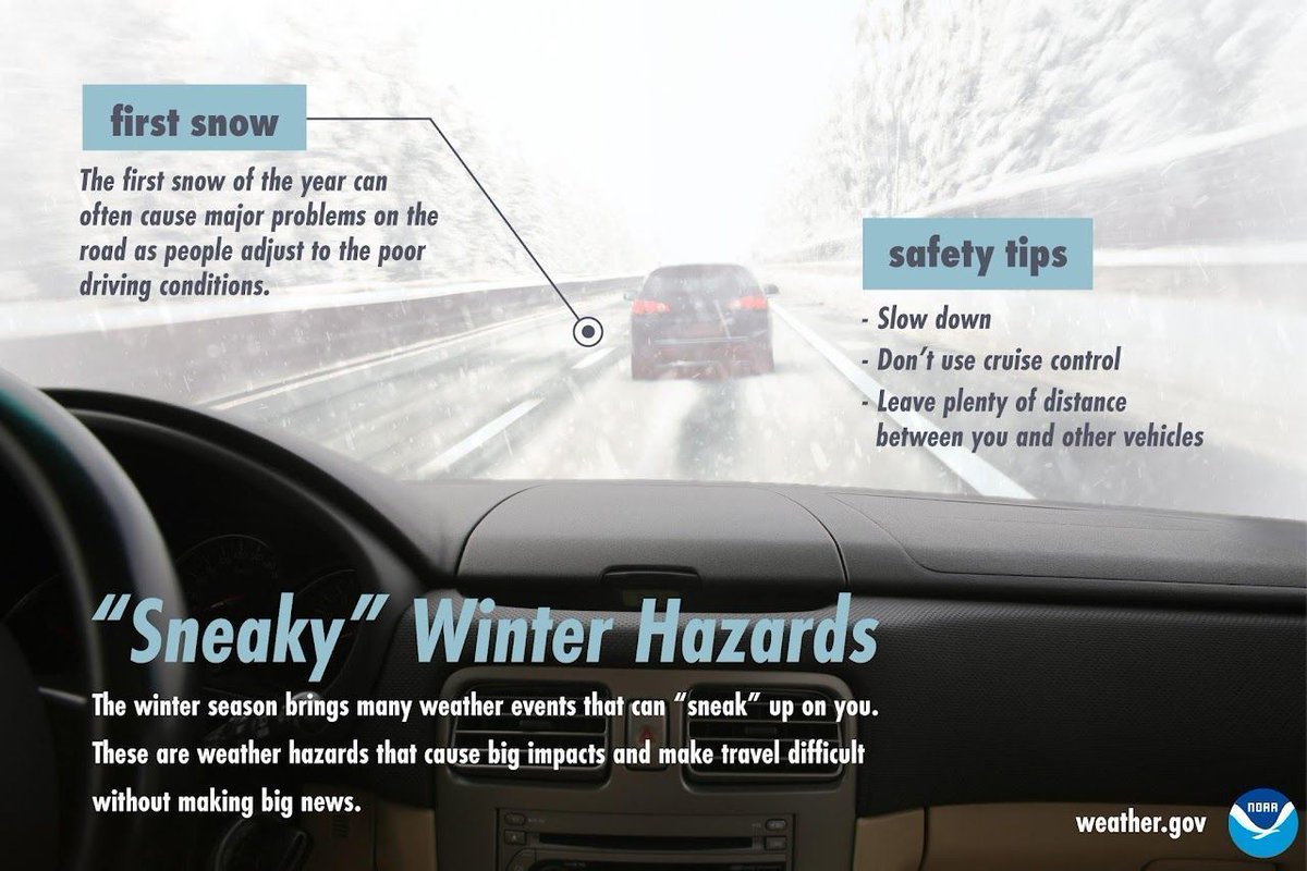
With snow forecast for portions of northern & central NM tonight & Monday, it's important to remember how sneaky those winter travel hazards can be.
✅ Slow down!
✅ Allow more time to reach your destination
✅ Consider delaying your travel to Tuesday
#NMwx
A line of strong thunderstorms is moving east and will affect areas from Taos to Santa Fe to Placitas. Gusty winds and small hail will likely accompany this line. #nmwx
A severe thunderstorm is about to cross Highway 285 at the intersection of Chaves, Lincoln, and De Baca County. Hail and damaging winds are possible in this storm. Drivers in this area should take caution. #nmwx
A very dangerous situation is ongoing in the Roswell area. Between 4 and 7 inches of rain has fallen, stranding many vehicles around town. Please stay off the roadways tonight!
The Aurora Borealis is visible in the #ABQ metro! From Corrales, to the South Valley, pictures are flying in to our @KOB4 social media! Thanks to Michelle and Meridee for these pics! #nmwx
Those waves that you see there, are actually gusty outflow boundaries from nearby thunderstorms. They not only bring gusts up to 60 mph, they can also spark new storms when they collide! Brace for high wind #ABQ metro! @KOB4 #nmwx


![iembot_abq's tweet photo. ABQ continues Tornado Warning [tornado: RADAR INDICATED, hail: 1.50 IN] for De Baca [NM] till 5:15 PM MDT https://t.co/IBHh8QZq9B https://t.co/a1YGMCVoMo](https://pbs.twimg.com/media/GaScy-eaoAAnnld.jpg)


