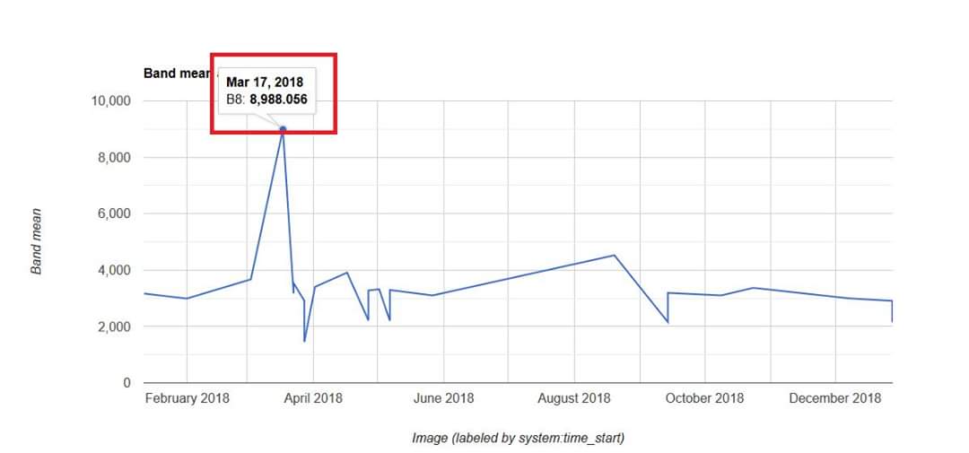
Análisis de series temporales de incendios con Google Earth Engine.
Incendio en la Reserva de Biosfera Indio Maíz, Río San Juan, Nicaragua.
@GIS_and_Beers @SIGgeek
Fyi do u have a fav place in the US? Download a DEM from USGS (The National Map), add it to QGIS, add some satellite data (Plugins>install Quick Map Services, then choose Bing Satellite), put it above the DEM, install Qgis2threejs plugin & use it to make a nice visual.
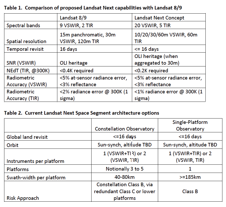
Beyond #Landsat 9
A Request for Information (RFI) for #LandsatNext has been released. NASA & USGS are requesting feedback on mission science requirements, instrument solutions & mission architecture.
Details: https://t.co/2788JgNj1O