Due to inclement weather and hazardous road conditions, Town Hall, Town Library and Municipal Court will be closed on Tuesday, Jan. 27 and municipal court cases originally scheduled for January 27 have been cancelled. All essential services remain fully operational.
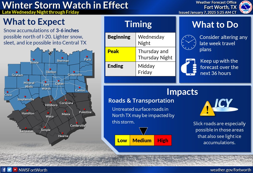
🚨A Winter Storm Watch is in effect for North Texas late Wednesday Night into Friday. 🚨
Untreated surface roads are likely to be impacted, with slick roads possible in any locations that see light icing. Consider altering travel plans & monitor the forecast! #dfwwx#ctxwx#txwx
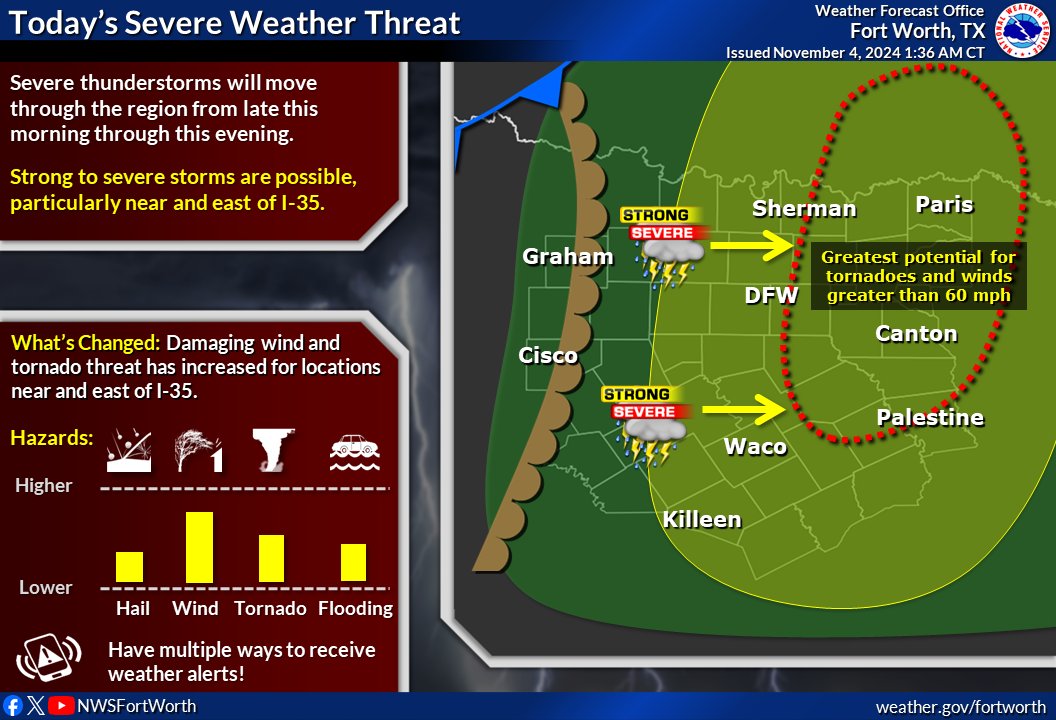
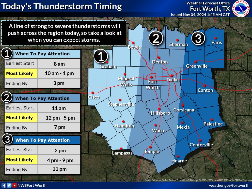
🚨Stay Weather Aware Today🚨
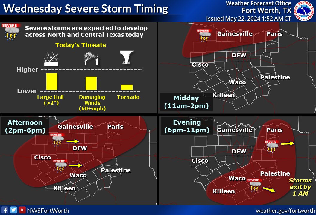
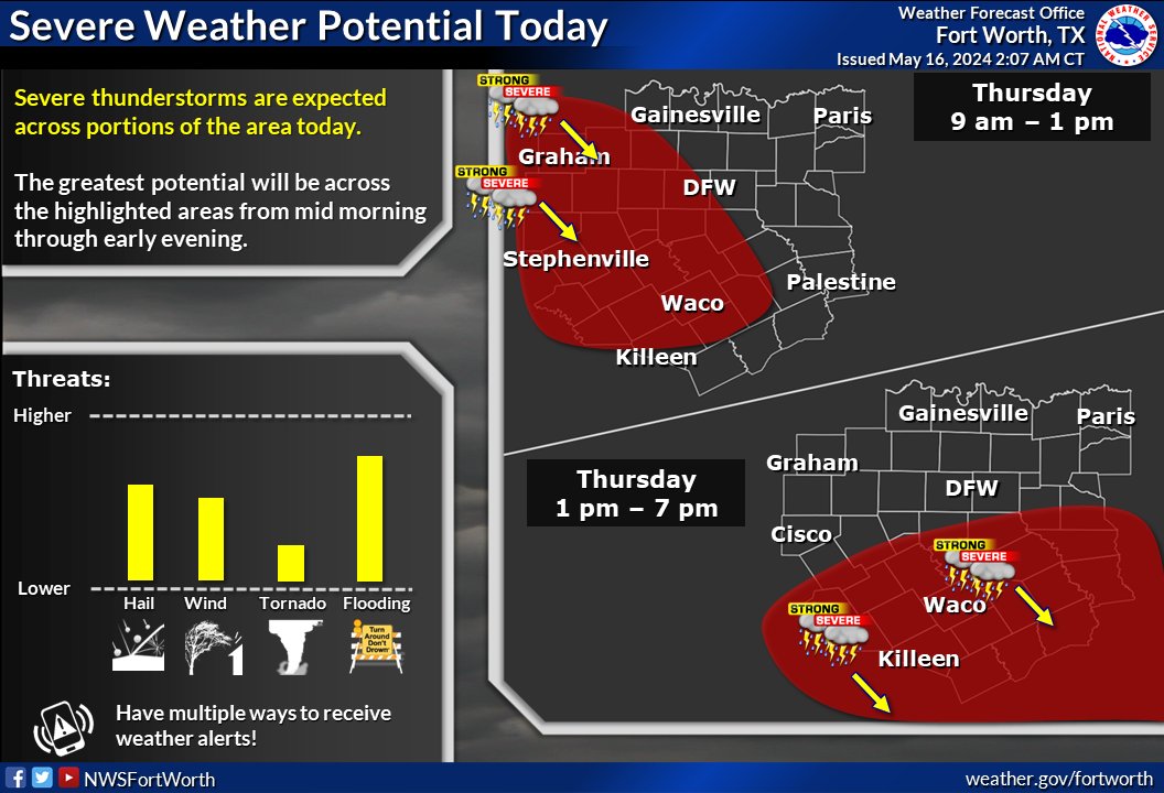
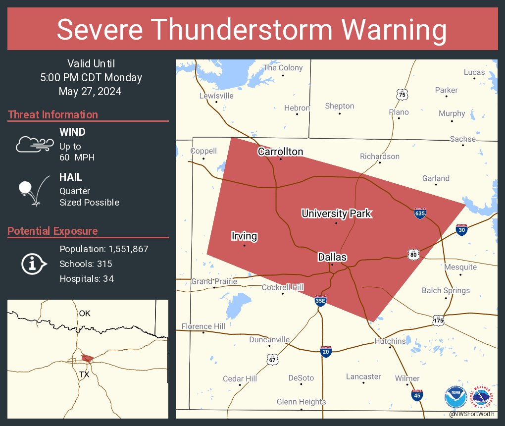
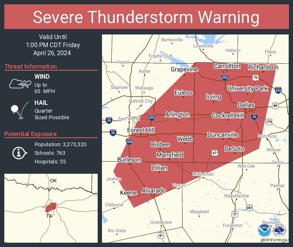
Severe storms capable of producing all hazards, including tornadoes and damaging wind gusts, are expected to develop across North and Central TX late this morning and into this afternoon.
Have multiple ways to receive warnings today! #dfwwx#ctxwx
Hitting the road? Use your library card to fuel your mind with books, e-Books, audiobooks, streaming content and more. There’s so much to discover, even on the go! www/hptx.org/library #LibraryCardSignUpMonth
September is Library Card Sign-Up Month! We all know that libraries are more than meets the eye. Roll out to the library and sign up for your card today. There is no charge for a library card if you are a resident of Highland Park. More info at https://t.co/oVhqk7z4GU
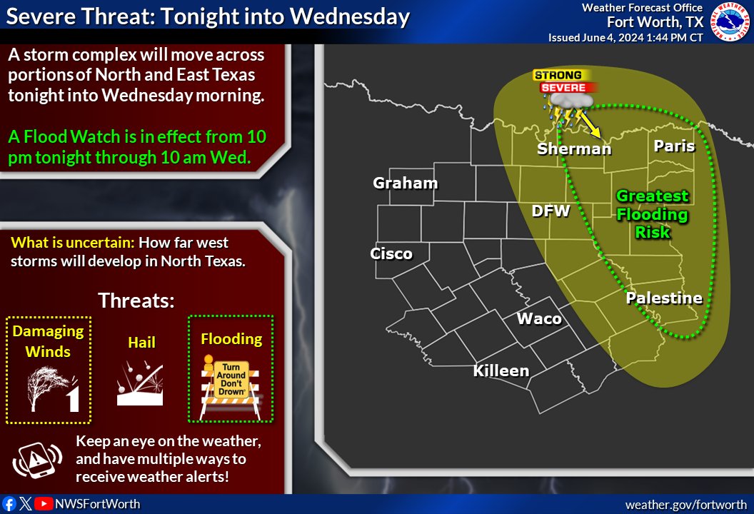
You're tired of hearing it, we're tired of saying it. 🫠 More storms are expected tonight into Wed. morning! Damaging winds & flooding are the main threats. Isolated large hail will also be possible. Have multiple ways to receive warnings, and don't drive through flooded roads!
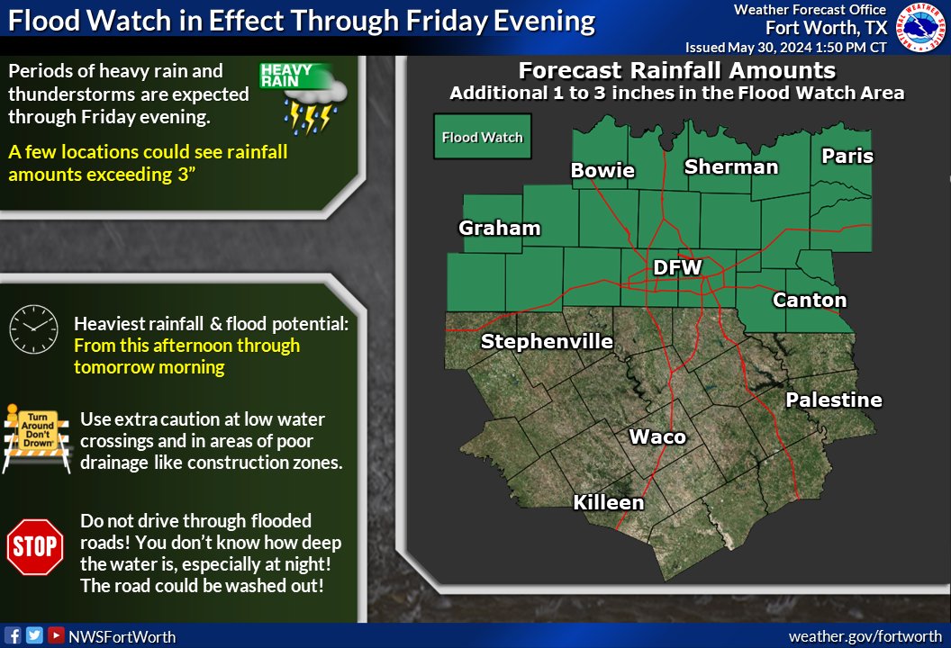
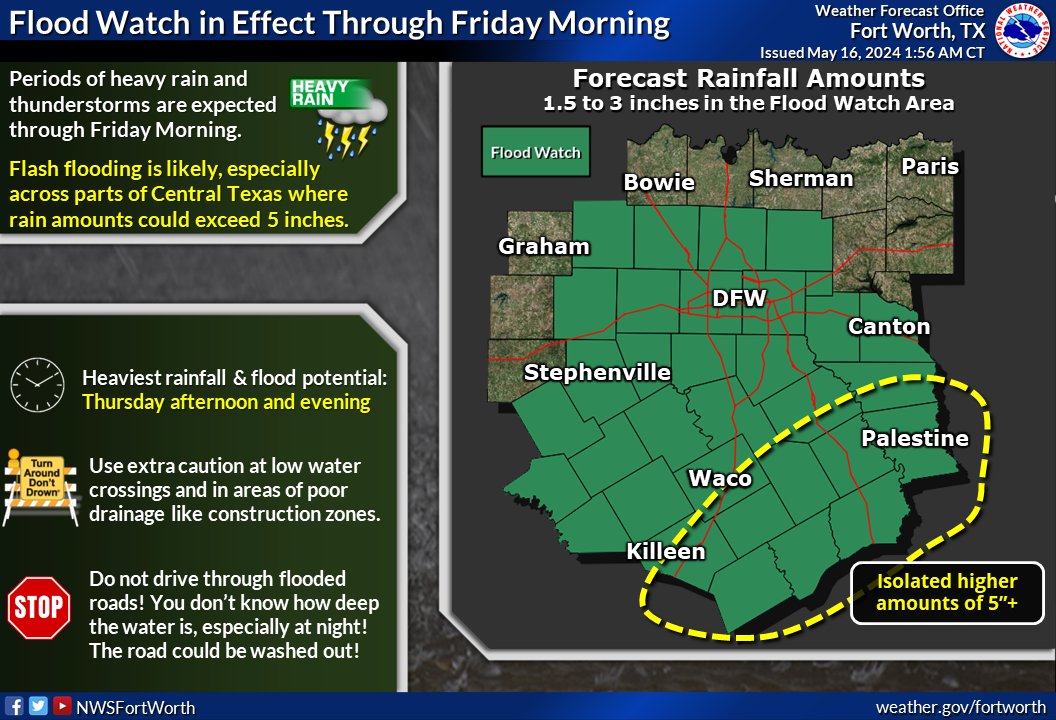
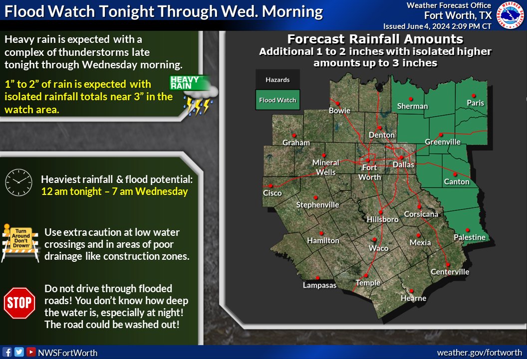
A Flood Watch is in effect for North Texas through Friday evening. Additional 1 to 3 inches of rain can be expected with the heaviest rainfall and flood potential today through tomorrow morning. ⚠️Use extra caution and never drive through flooded roads!🛑 #dfwwx#txwx
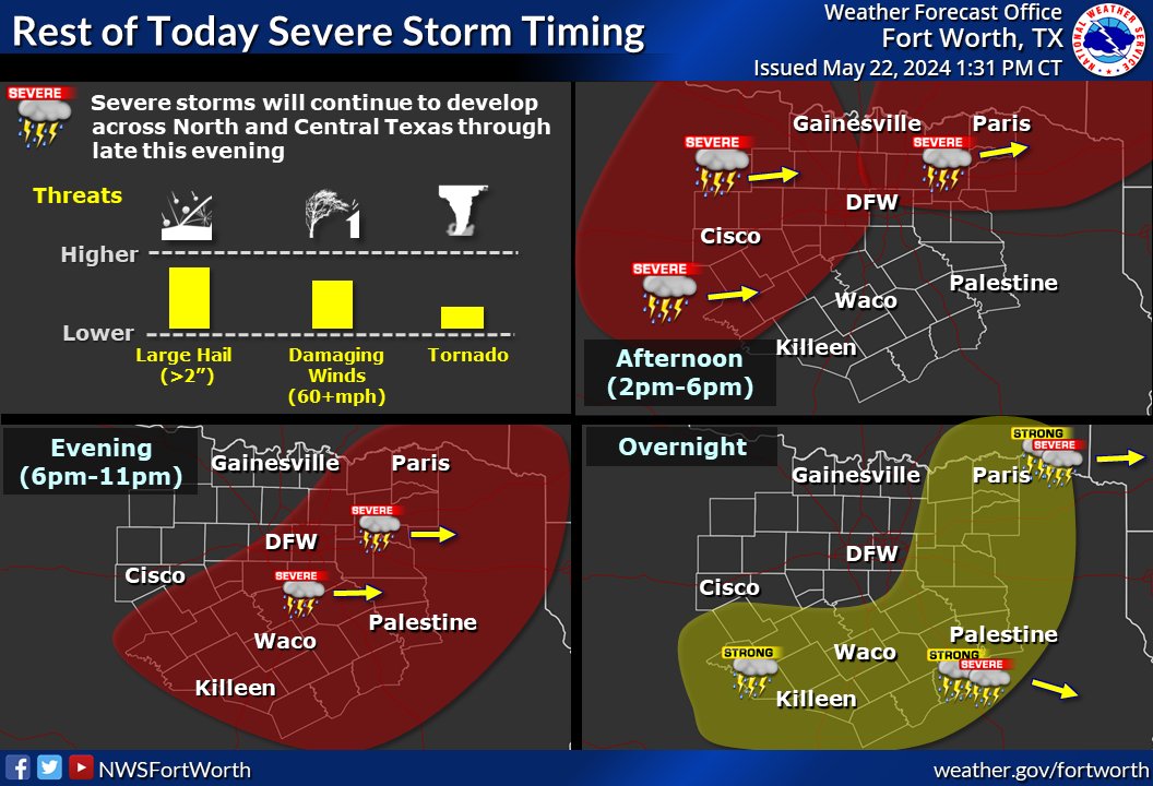
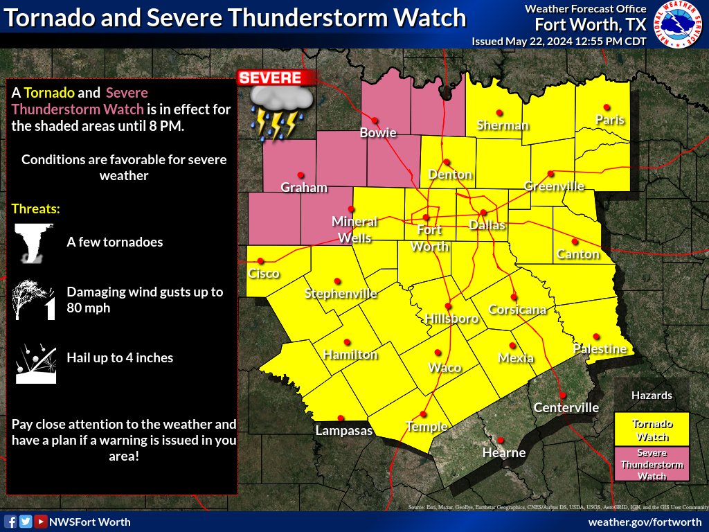
1:33pm - A Tornado and Severe Thunderstorm Watch are in effect for much of the area until 8pm. Storms will continue to gradually move east through the rest of today. Make sure you remain weather aware -- have a plan in case severe weather threatens you! #dfwwx#ctxwx
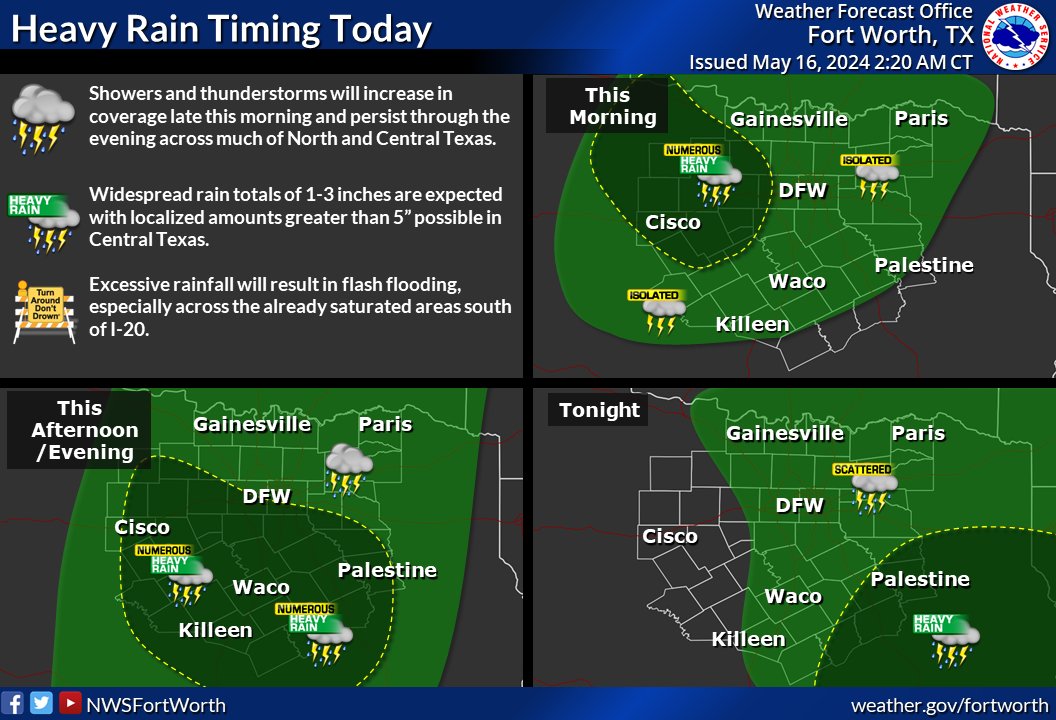
Severe thunderstorms are expected across much of North and Central Texas today. Large hail and damaging wind gusts will be the primary hazards with a lower threat for tornadoes. Locally heavy rainfall may also occur. #ctxwx#texomawx#dfwwx
Today is a day to stay weather-aware! The Flood Watch has been expanded. In addition to the flooding potential, all modes of severe weather are possible today. #dfwwx#ctxwx#texoma#txwx
Dallas County will hold public meetings to gather public input for updating the Hazard Mitigation Plan. Additional details for May 6 public meeting: https://t.co/E9CJyshdFo
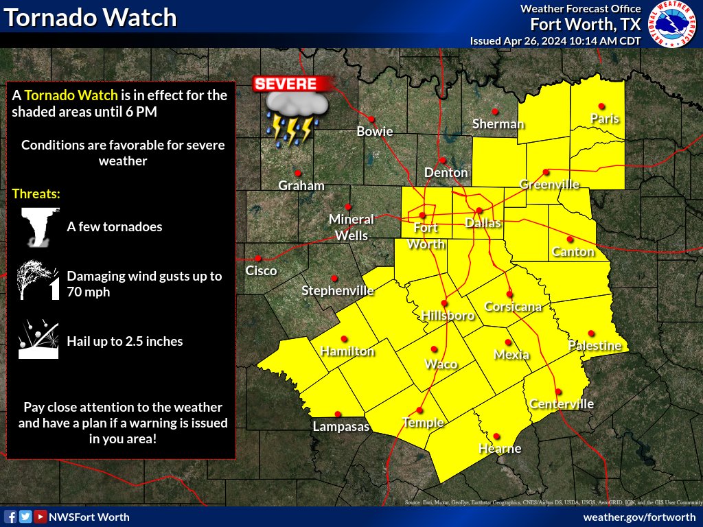
A Tornado Watch is in effect for the shaded areas until 6 PM. Main concerns will be large hail, damaging winds up to 70 mph, and a few tornadoes. Have multiple ways to receive warnings and be prepared to take shelter if a warning is issued for your location. #dfwwx#ctxwx
9 am: Another wave of heavy rain is moving across portions of Dallas County. This will cause urban flooding, especially over those areas with poor drainage, low lying and construction zones. Take it slow! A Flood Advisory is in effect until 10:45 am. #dfwwx
With our new mobile app, instant access to the Library is now easier than ever. Check your account details, reserve, browse the collections and so much more.
https://t.co/XNVQqUxjRw
@NationalLibraryWeek