Temperatures widely 16-17°c across the region today. Could see the first 20°c of the year. Remains warm tomorrow, unfortunately more cloud the weekend with some showery rain. Temps closer to average 10-12°c next week.
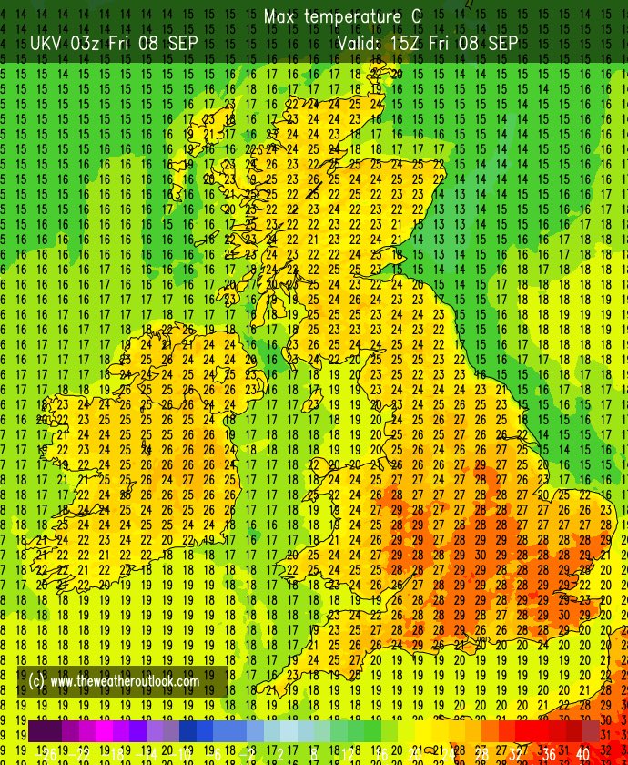
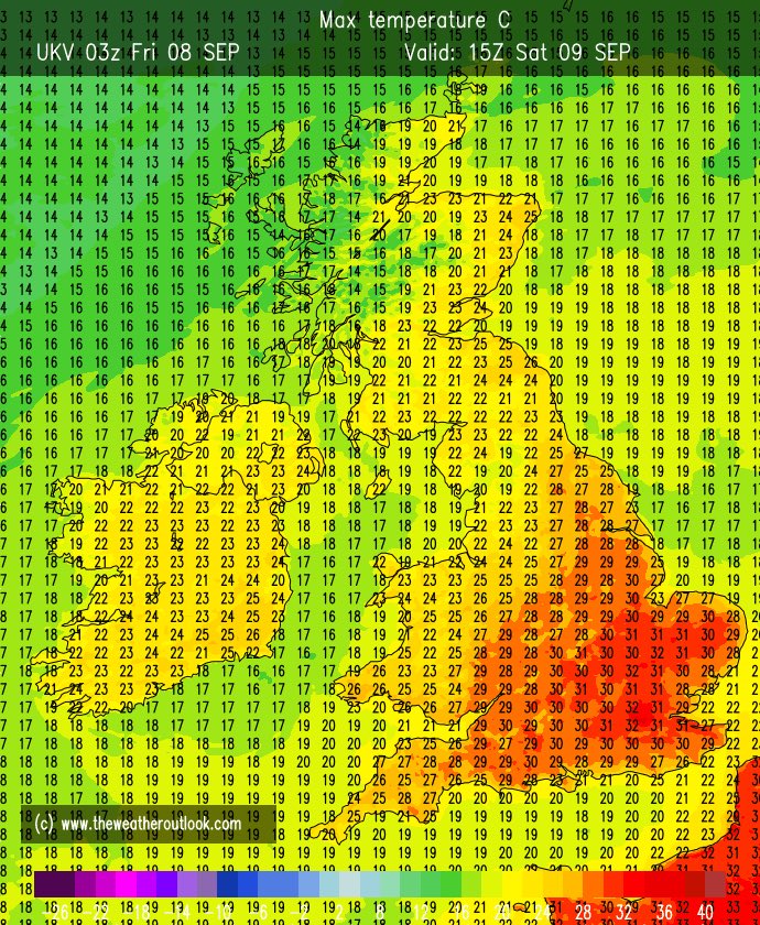
Latest UKV charts for max temps Thursday - Sunday, could be looking at temperatures of 25-27°c over the weekend. Highest temps on Sunday but as mentioned previously need to see cloud amounts closer to the time as low pressure starts to approach from the west.
A chilly start again, some sunny spells at first today but more cloud the further east you are. Cloud spreads west through the morning. Likely to be rather cloudy for most by mid afternoon. A chilly north wind. Highs 11-13°c but struggling to 9°c on exposed north/east coasts.
Heavy showery rain clearing east through this morning should see some sunshine this afternoon although it will remain windy. Gusts 40-50mph widely. Unfortunately more rain sweeps east through the middle of tomorrow. Mild highs around 12-13°c.
An exceptionally warm day today for the time of year could see temperatures up at around 26°c. Warmest across London, north Kent and Essex. Similar temperatures tomorrow but more cloud at times.
Along with the heavy bands of rain tomorrow likely to see the strongest winds since mid March in the afternoon. With gusts widely 40-45mph, a short spell of 50-55mph possible with the initial rain band. Winds quite quickly ease through the night.
As expected more cloud today compared to recent days, still hot with sunny spells highs upto 30°c. Hot, sunny tomorrow 32°c. Some uncertainty on cloud amounts Sunday, UKV less hot 28°c with heavy showers in the west but a few models show mid 30’s.
Saharan dust & some patches of mist/low cloud making for a murky start, another hot day highs 31°c. Remaining hot over the coming days, a little fresher in the east with a sea breeze. Sunday should see fresher air pushing in from the west but still hot in the east of the region.
A brighter but chilly start today after overnight lows of 9-11°c. Sunny spells with a scattering of showers this afternoon highs 20°c. Sunny spells to start tomorrow but areas of showery rain into the afternoon. 18°c. Early showers Friday, 21°c. Largely dry sunny spells the wknd.
After a glorious spell all change tomorrow with the risk of some heavy rain into the south perhaps thundery but very uncertain. Showers likely to develop into the afternoon a little further north some heavy again with the risk of thunder. Warmest in the north or the region 25°c.
BREAKING: Arsenal have reached an agreement to sign David Raya, here we go! Deal agreed with Brentford after personal terms last week 🚨🔴⚪️
Documents being prepared between the clubs, medical to be booked this week.
Raya only wanted #AFC move.
Much better day today, good sunny spells albeit breezy perhaps the odd shower into the west later. 20°c. Sunny spells Monday 21°c, some rain likely Tuesday, warm and sunny Wednesday 23°c. Hotter on Thursday 26-28°c. Fresher with showers likely Friday.
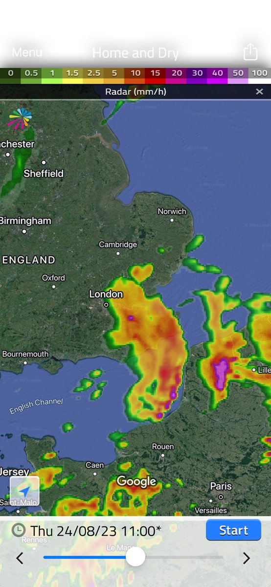
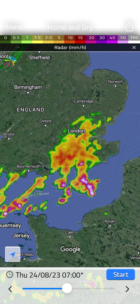
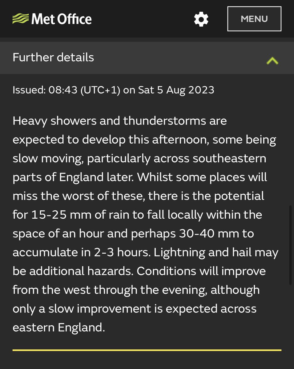
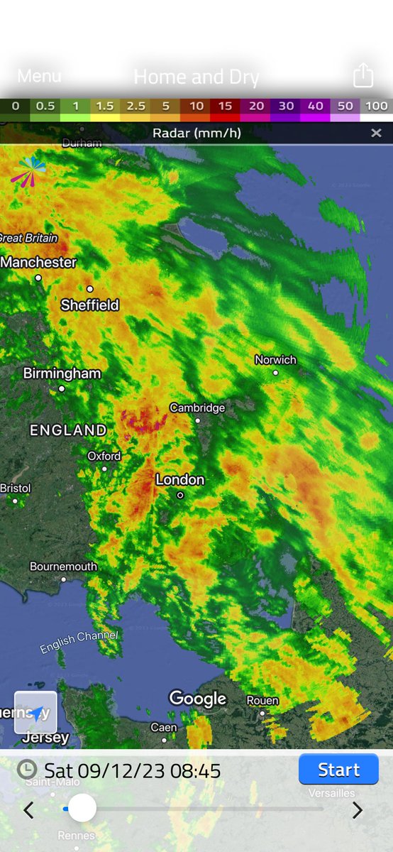
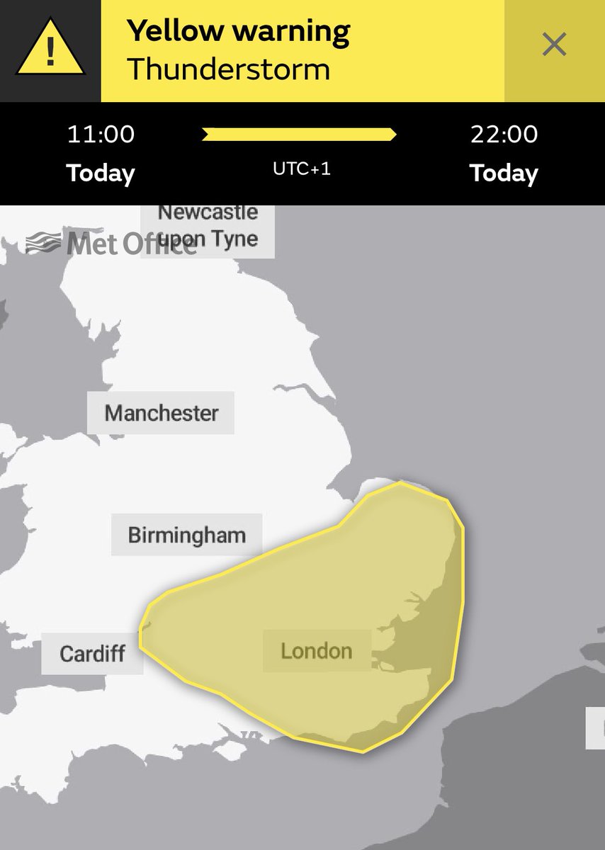
Similar to Wednesday, once the rain clears this morning could see heavy thundery downpours this afternoon as another low centre passes over the region. Met office warning issued this morning.