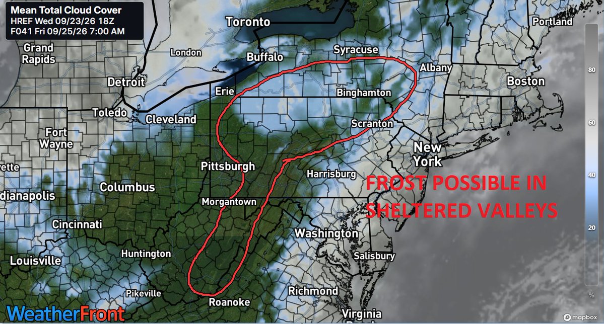
Frost Possible In The Sheltered Valleys of The Central Appalachians On Friday Morning!!!
Weather Update:
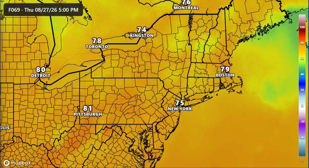
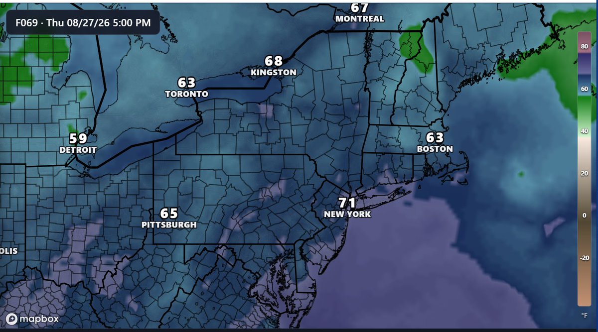
An area of low pressure will develop and intensify off the East Coast late this week. Counterclockwise flow around the strengthening cyclone will help to filter dry Canadian air into the region late this week. After a sunny, cool day on Thursday, a chilly night will unfold across the region. Clear skies, light winds, and low dew points will allow temperatures to drop off quickly after sunset. While widespread frost formation is not expected, some of the colder, sheltered valleys from eastern West Virginia through southern New York will have the potential to see some patchy frost early Friday morning. It is possible that some cloud cover may push into southern New York and northern Pennsylvania overnight, limiting the risk of frost in this area. Otherwise, the risk of isolated frost is expected in the highlighted area.
#PAwx #wvwx #mdwx #NYwx #WeatherUpdate
Fall-Like Weather Pattern Expected Across The Central Appalachians Through The Weekend!!!
Weather Highlights:
* Fall-Like Weather This Week
* Heavy Rain Possible Through Wednesday
* Sunny days and cool nights Thursday through Sunday
* Frost risk possible, especially in the colder valleys late this week
Weather Update:
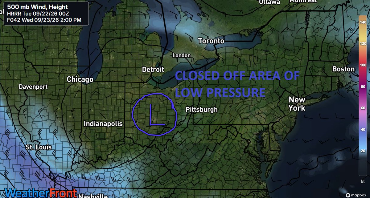
The official start to fall begins on Tuesday, and it will certainly feel like fall across the region. A frontal boundary will continue to meander through the region over the next couple of days. This frontal boundary will continue to produce a damp, chilly air mass across our area. A low-pressure system is expected to close off over the Ohio Valley and will provide persistent rain chances across much of the region through mid-week. Conditions will improve late in the week, as the system moves toward the Eastern Seaboard.
Much drier air will filter in behind this system, setting the stage for a beautiful fall weekend. Sunny days and chilly nights can be expected across the region Thursday through Sunday. The dry air and clear nights will likely provide optimal conditions for radiational cooling. It is possible that a frost risk may materialize late this week.
#PAwx #wvwx #ohwx #mdwx #NYwx #fall #fallweather
Weekend Weather Forecast For The Central Appalachians!!!
Summary:
The weekend will start off on a quiet and comfortable note for much of our region, but a frontal boundary will bring the risk of heavy rainfall and flash flooding from Saturday night into Sunday.
Friday:
A frontal boundary positioned from Central Ohio to northern Pennsylvania will gradually sink southward through the day. This will allow dew points to drop in northern portions of the area by late in the day, while southern regions will likely remain muggy. There will also be the chance for scattered showers or thunderstorms for mainly areas south and east of Pittsburgh this afternoon and evening.
Saturday:
The frontal boundary will stall out form the Midwest to the Mid-Atlantic region Saturday morning before returning northeastward as a warm front on Saturday. This will lead to an increase in dew points during the day, especially for areas south and west of Pittsburgh. Most other areas will experience a dry comfortable day before low-level moisture returns across much of the region Saturday night.
Sunday:
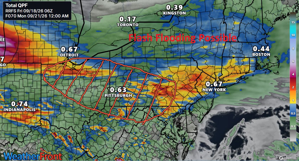
The frontal boundary will once again slow down or stall Sunday across northern Ohio and northern Pennsylvania on Sunday before returning south late in the day. A high amount of atmospheric moisture will be in place along and south of the boundary, setting the stage for the potential of heavy rainfall and flash flooding across the region. While the greatest risk may be in the highlighted area, all locations across our area should remain alert for the possibility of flash flooding.
#pawx #WVWX #ohwx #mdwx #NYwx #heavyrain #flashflooding #weatherforecast
Scientists have discovered a new species of cat for the first time in over a century.
Smaller than an average housecat and covered in leopard-like spots, the cat species — proposed name Leopardus tilcayo —lives in Bolivia’s Yungas forest ecoregion.
Why Haven't There Been Any Hurricanes in The Atlantic Yet This Year?
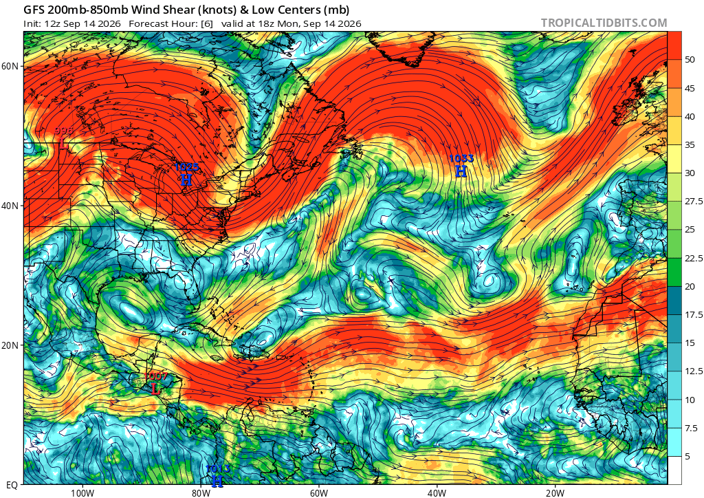
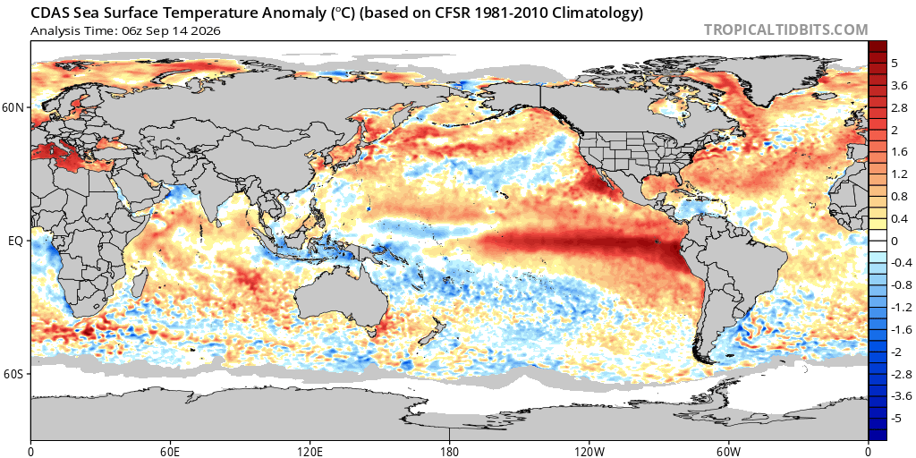
The primary reason why there has been a lack of tropical activity in the Atlantic Basin this season is because of high amounts of wind shear. The wind shear in the Atlantic Basin is particularly strong this season as a result of the strong El Nino that is developing in the equatorial Pacific Ocean. At this point, there have been only five named storms in the Atlantic Basin this season, and none of them have reached hurricane strength.
While most tropical waves that try to develop in the main development region of the Atlantic will struggle to organize, the Eastern U.S. will still need to remain alert for tropical activity that tries to develop in the Gulf, Caribbean, or southwest Atlantic as we enter the fall months. Any tropical activity that develops in this area will not have to travel across the entire Atlantic Ocean to reach the U.S., which could increase the chances of an impactful system.
At the moment, it does not appear that any tropical systems will pose a risk to the eastern U.S. over the next couple of weeks.
#tropical #HurricaneSeason #weather #ElNiño #atlanticocean
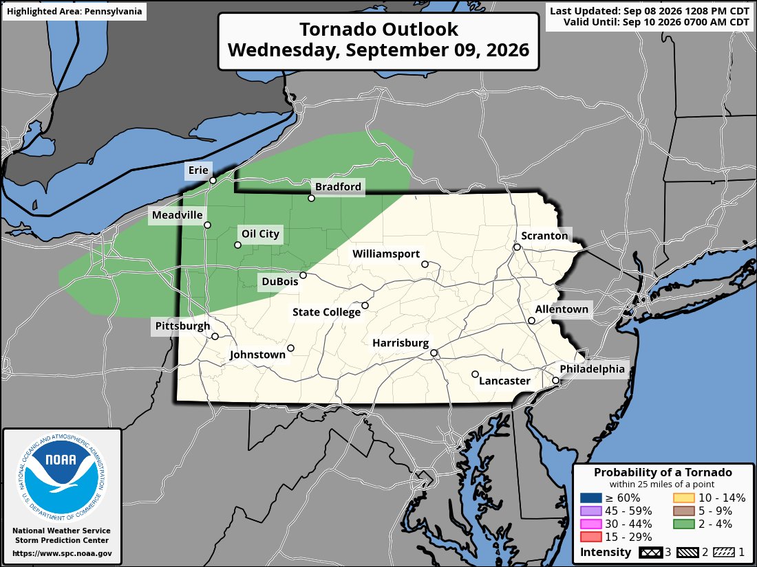
Severe Weather Possible On Wednesday Across The Upper Ohio Valley and Central Appalachians!!!
The Storm Prediction Center has highlighted parts of our region in a risk for severe weather on Wednesday.
* Location: Areas from Eastern Ohio to Southwestern New York under a Slight Risk (Level 2 out of 5) for severe weather on Wednesday. Nearby surrounding locations have been placed under a Marginal Risk (Level 1 out of 5).
* Hazards: The primary hazard with severe storms on Wednesday will be damaging winds, but isolated tornadoes are also possible.
Stay updated on the latest forecasts and outlooks from the Storm Prediction Center over the next 24 hours.
#nywx #OHwx #pawx #WVWX #SevereWeather
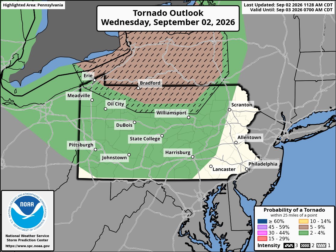
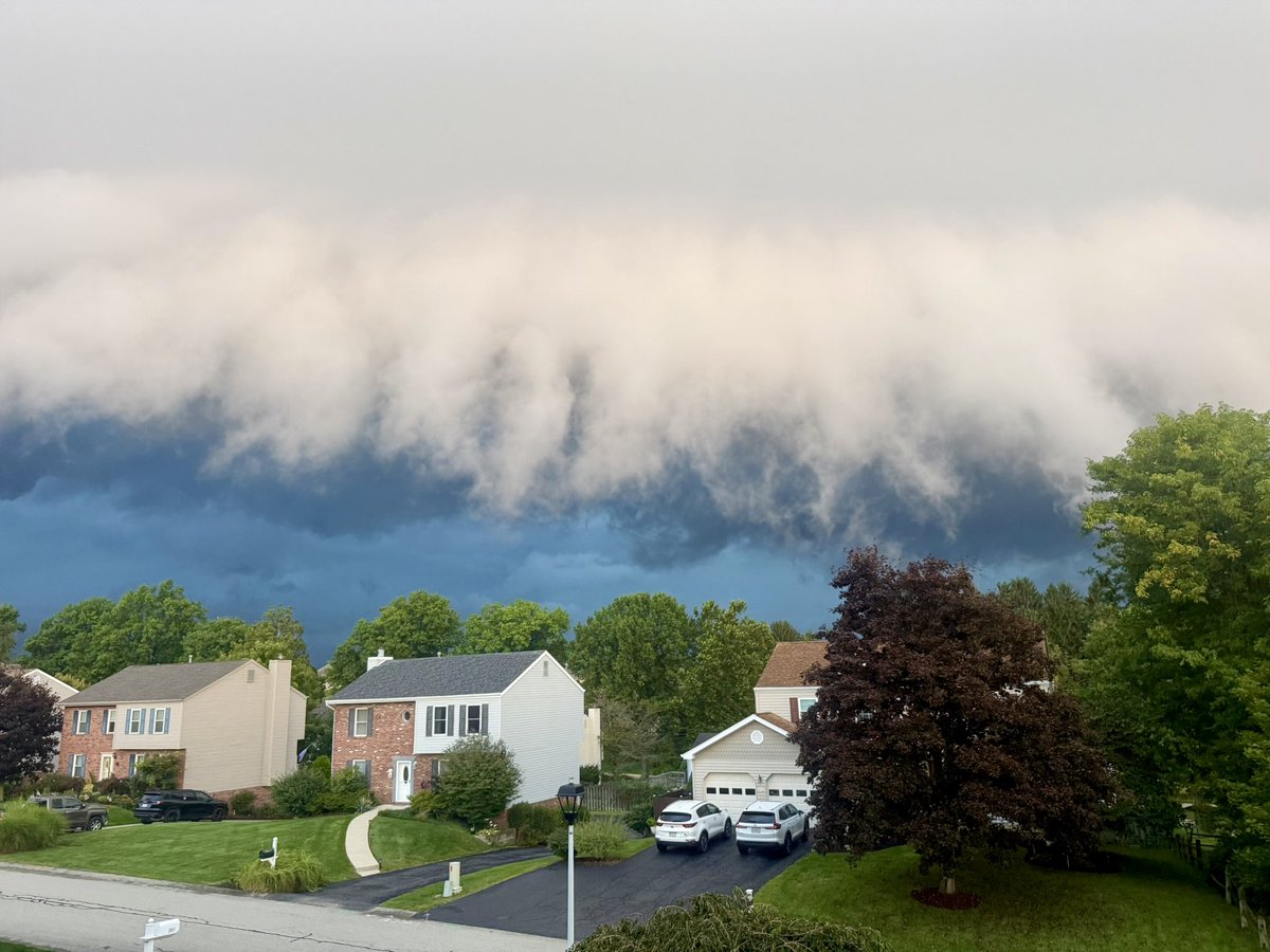
Enhanced Risk (3 of 5) is in effect today for eastern Ohio and western Pennsylvania, including our coverage area. The Storm Prediction Center is tracking scattered strong to severe thunderstorms through tonight, with the potential for organized clusters and a few supercells. Damaging wind and large hail are the main threats, with the highest probability across northern Ohio into Pennsylvania. A Slight Risk (2 of 5) extends from the Upper Midwest and Great Lakes into the Mid-Atlantic.
Multiple rounds of storms are possible from this afternoon into tonight. Make sure you have a reliable way to receive warnings, know where you'll shelter, and keep an eye on the sky as conditions develop. We'll keep you updated as this system evolves.
#OHwx #PAwx #SevereWeather #CAWA
Severe Weather Likely For Western New York Late This Afternoon And This Evening!!!
The Storm Prediction Center has highlight Western New York in an Enhanced Risk (Level 3 out of 5) for severe weather today.
There is also a Slight Risk (Level 2 out of 5) for severe weather across Pennsylvania, Maryland, northeast Ohio, and parts of northern West Virginia.
The storms later today will be capable of producing all severe weather hazards including: damaging winds, large hail, and tornadoes. Western New York will likely see the highest coverage of severe weather, and an elevated tornado risk is expected in this region as well.
While western New York is favored for the greatest severe weather risk, anyone that is in an area that is highlighted for severe weather should monitor the latest forecasts throughout the day. There is also some model disagreement on the location of the storms later today into tonight, and changes to the forecast could occur if model guidance converges on a different solution.
#SevereWeather #pawx #nywx #ohwx #mdwx #wvwx
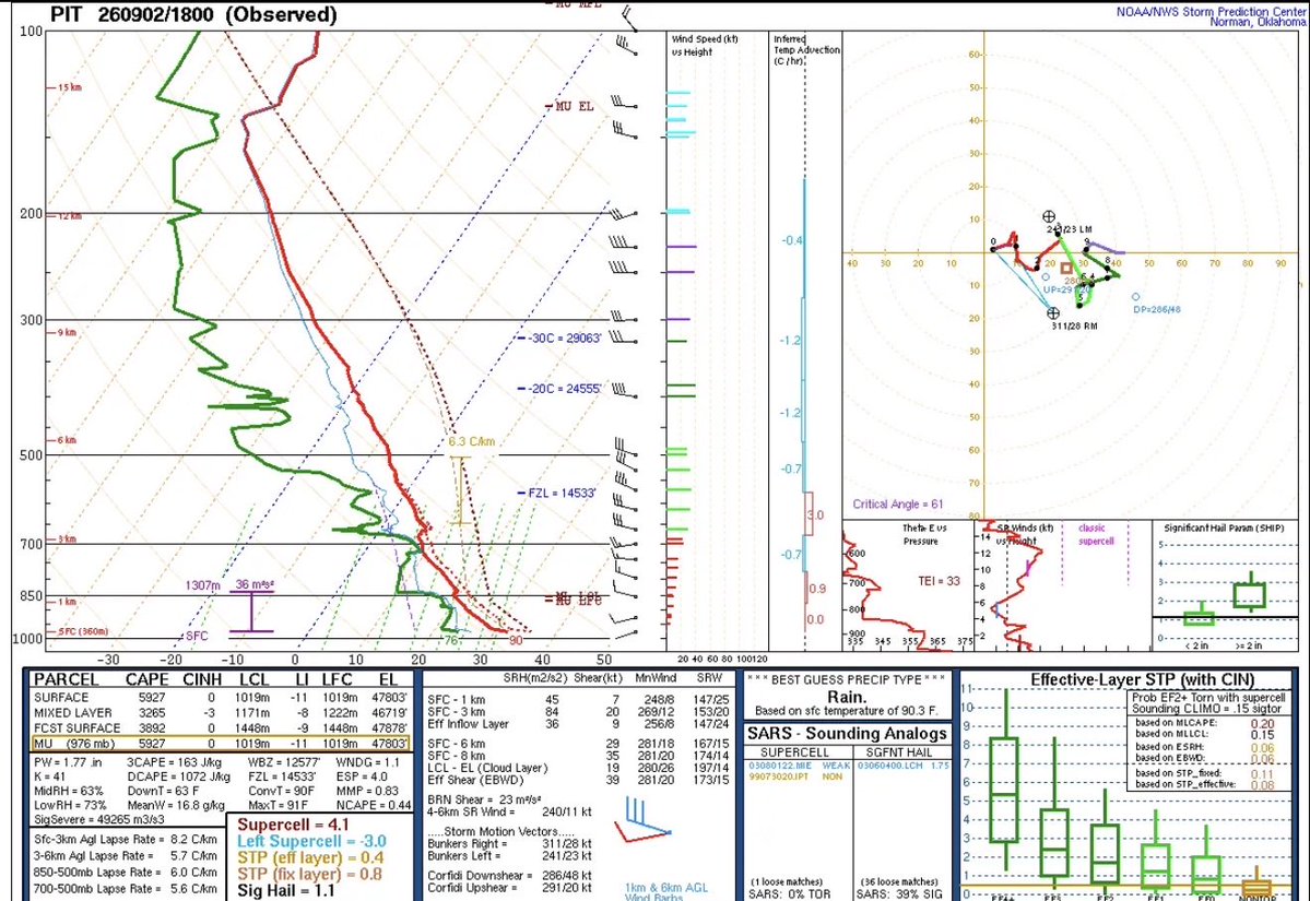
🤯 NWS Pittsburgh’s special balloon sounding recorded an SBCAPE value of 5,927 J/kg, the highest ever recorded in September at this NWS office.
#pawx#wxtwitter
Severe Weather Forecast Update!!!
The risk for severe weather continues across the Ohio Valley and Central Appalachians through the end of the week.
While there have not been many major changes to the forecast since yesterday, there has been some small adjustments to the severe weather risk areas highlighted by the Storm Prediction Center.
Hazards:
The primary hazards with severe thunderstorms over the next few days will be damaging winds and large hail; however, a few tornadoes will be possible as well.
Location:
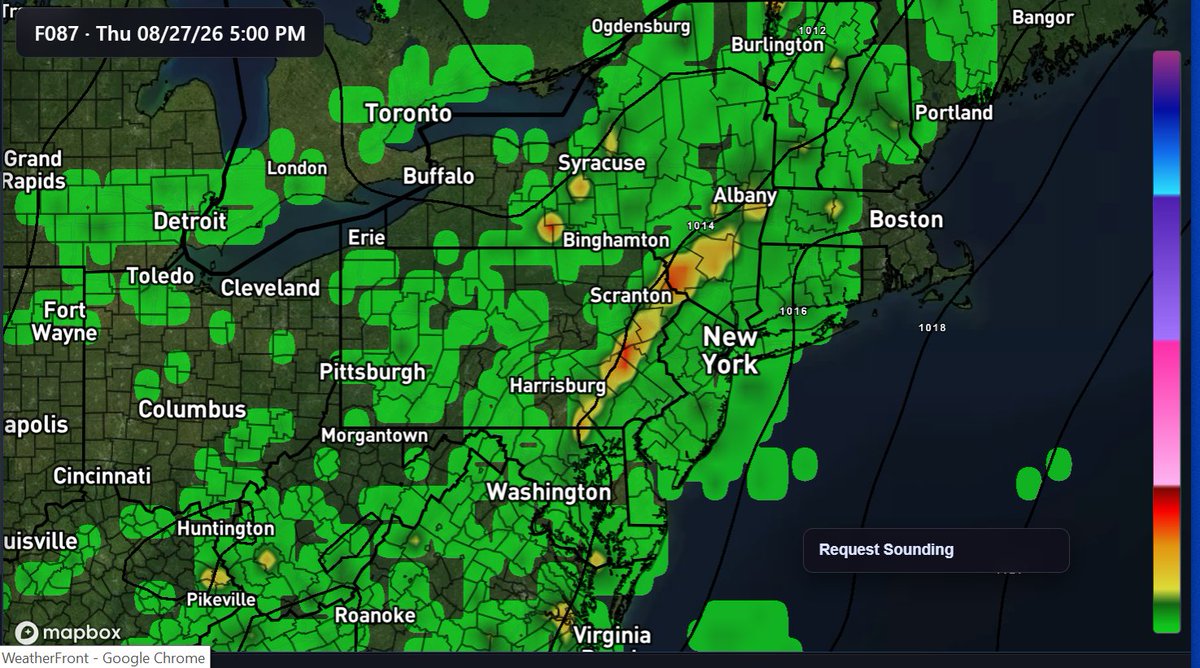
It appears that the northern and eastern parts of our region will have the greatest risk for severe weather today, with the risk of severe weather shifting further south and west as we head into the mid-late week timeframe.
Check back for more updates to the forecast over the next few days, and refer to the Storm Prediction Center for the latest severe weather information.
#pawx #wvwx #ohwx #mdwx #nywx #SevereWeather #thunderstorm
Ring of Fire Pattern Will Bring The Potential for Severe Weather And Flash Flooding Next Week!!!
The Storm Prediction Center has highlighted parts of the Northeast and Mid-Atlantic for the potential of severe next Wednesday.
Meteorological Discussion:
The strong ridge of high pressure that has been anchored over the southwestern Us for the last few weeks will begin to make some northeastward progress this weekend into early next week. As this transition occurs, the seasonably comfortable air mass over the Ohio Valley and Central Appalachians will be replaced by an increase in heat and humidity. Shortwaves riding the periphery of the building ridge will begin to move southeastward through the Great Lakes, Ohio Valley, Mid-Atlantic and Northeast.
Impacts:
This combination of rich moisture, shortwave driven wind shear, and high instability, will create the potential for severe weather next week. The risk for flash flooding will likely be elevated as well, due to the very moist air mass in place. Flash flooding will especially be a concern in areas that receive multiple storm clusters or training storms.
Location :
At this early stage, it appears that the greatest risk for severe weather and flash flooding next week may set up for areas across the Great Lakes, Ohio Valley, Central Appalachians, Mid-Atlantic, and Northeast. This could certainly change over the next few days as model guidance gets a better handle on the location of the ridge. A trend that should be monitored is the possibility for these thunderstorm clusters to track further southwest than what is currently forecast. There is a lot of moisture currently in the soil and vegetation over the Midwest and Ohio Valley regions. This could result in the high pressure ridge remaining anchored a bit further southwest across the drought-stricken Southern Plains, with the jet stream positioning itself closer to the Ohio Valley and Central Appalachians. This will certainly be something to watch over the coming days.
Uncertainty:
The potentially active weather pattern is still several days out, and the timing, location, and impacts from any severe weather or flash flooding is highly uncertainty at this point in time.
Source: https://t.co/w1os1bnkd9
#pawx #wvwx #ohwx #mdwx #nywx #VAwx #SevereWeather #ringoffire
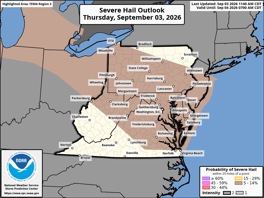
Severe Weather is Possible on Thursday Across The Central Appalachian Region!!!
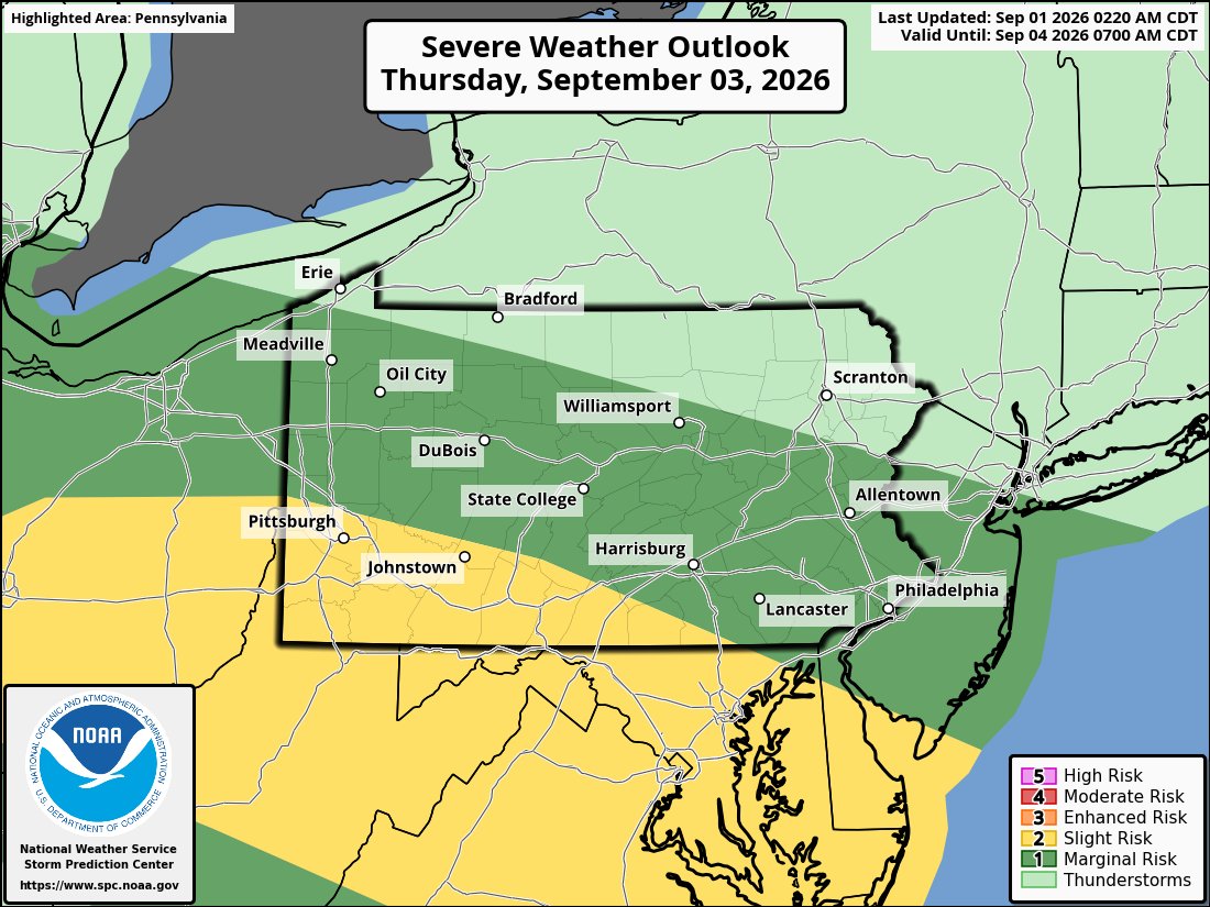
The Storm Prediction Center has highlighted parts of our region under Marginal Risk (Level 1 out of 5) for severe weather on Thursday.
Forecast Discussion:
* Meteorological Setup - After a few days of September-like weather across the region, severe weather will once again be possible on Thursday. A warm front will lift northward on Wednesday night into Thursday morning out ahead of a system moving out of the Upper Midwest. In the wake of this front, warm, moist air will build into the area at mid-week. As the system and its associated cold front push into the region on Thursday, atmospheric lift will overlap with sufficient moisture, and provide an opportunity for severe weather. One of the primary limiting factor for Thursday's severe weather setup is the lack of strong wind shear.
* Hazard Type - At this point, damaging winds appear to be the most likely risk with the storms on Thursday. The tornado risk appears to be quite low with large temperature dewpoint spreads and a lack of strong wind shear in place. If the forecast for surface moisture and wind shear increases, a low-end tornado risk could materialize as well.
* Location - At this point, it appears that northeast West Virginia, southern New York, Maryland, and much of Pennsylvania could be at risk for severe storms.
* Uncertainty - As usual, there is still some uncertainty in the forecast this far in advance. Changes to the timing of system and the ingredients necessary for severe weather will ultimately determine the timing, location, and hazards involved with any severe weather.
Source: https://t.co/Pi0TTD6aSr
#pawx #ohwx #wvwx #mdwx #nywx #SevereWeather
Weather Forecast Discussion!!!
Summary: A much more comfortable and stable weather pattern will take shape across the Ohio Valley and Central Appalachians this week, with the exception of a mid-week system that will bring the chance for showers and thunderstorms around mid-week.
* Early Week - After another weekend that featured severe weather and flash flooding for parts of the region, a much more comfortable and stable weather pattern is expected through much of this week. A drier air mass has moved in behind a cold front that pushed through the region overnight. This will bring sunny days, cool nights, and comfortable dewpoints to the area over the next couple of days.
* As we head into the mid-week timeframe, temperatures and dewpoints will begin to creep back up as the flow returns out of the southwest ahead of another weather system tracking from the Upper Midwest to the Northeast. This will also reintroduce the chance for showers and thunderstorms Wednesday into Thursday. It currently appears that the best chance for rainfall on Wednesday will be in the higher terrain of West Virginia, though rain chances will likely increase areawide on Thursday. The severe weather and flash flooding risk with this system appears to be rather low, but this will need to be monitored over the next couple of days.
* Late week - After the mid-week system departs Thursday night, a comfortable late summer day is expected on Friday, with drier air pushing in behind the system's cold front. There are still some uncertainties regarding how strong the push of dry, cool air will be late this week, as the cold front may begin to wash across the area.
Source: https://t.co/Pi0TTD6aSr
#pawx #wvwx #mdwx #nywx #ohwx #WeatherUpdate #weatherforecast
AMC Waterfront Event Friday Evening!!!
If you are planning to see @ReedTimmerUSA 's new film, stop by our table, and chat with us for a bit. We would love to answer any questions you have about weather, storm chasing, or the mission of our organization. The @PAStormTrackerz and @Trey_KDKAWx will also be at the event.
Extreme Rainfall Event Affects Parts of the Midwest!!!
While parts of the Central Appalachian region have been affected by heavy rainfall and flash flooding over the last few days, a much more extreme rainfall event occurred in the Midwest over the last couple of days. Rainfall totals of 6-10+ inches have been recorded across portions of eastern Indiana, based on radar estimates. Additional heavy rainfall is expected to move through the Midwest today and into tonight.
We will also be monitoring this next round of rainfall as it pushes eastward. Potions of eastern Ohio, southwestern Pennsylvania, West Virginia, and western Maryland will be most susceptible to flooding concerns. Not only have these locations received the highest rainfall totals over the last few days, but this will also be the area that will likely receive the highest rainfall amounts overnight and into the day on Friday. Keep in mind that there is still some uncertainty in the track of this next batch of rainfall, and this will ultimately affect the location of the highest rainfall totals.
Stay tuned to the National Weather Service to stay updated on the latest information.
Source: https://t.co/2qm0NlcSf5
#pawx #OHwx #mdwx #WVWX #FlashFlooding #heavyrain
72-Hour Rainfall Estimates: