An hour-by-hour look at thunderstorms late today into this evening as they approach from the north and west. Any of these storms could contain strong, gusty winds and hail.
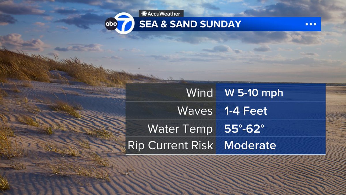
A summery Saturday will be followed by evening thunderstorms which could be strong to severe before we turn a little less humid tomorrow with perhaps a spotty storm, especially south and east. Seasonable sunshine to start next week will be followed by another warmup.
Summerlike heat still on tap through the first half of the weekend, to be interrupted by some storms and then a cooldown into early next week as the Knicks return home.
Tonight will be clear with 50s in most suburbs and 40s in a few of the coolest outlying spots. Expect sun to start tomorrow followed by patchy high clouds. It'll be quite warm with highs near 90 inland, but cooler again along the south shore of Long Island and the Jersey Shore.
Expect sun and a few clouds this afternoon. It'll be warmer and still pleasant with low humidity. A sea breeze will keep it cooler along the south shore of Long Island and at the Jersey Shore.
Expect patchy clouds tonight with 40s in some suburbs. Tomorrow will be sunny to partly cloudy and warmer, but still pleasant with low humidity. A sea breeze will keep it cooler along the south shore of Long Island and at the Jersey Shore.
Tonight will be partly to mostly cloudy with a slight chance of a shower north of the city and over eastern Long Island. Expect sun and more afternoon clouds for both tomorrow and Tuesday with just the chance of a spotty afternoon shower, but most places will stay dry.
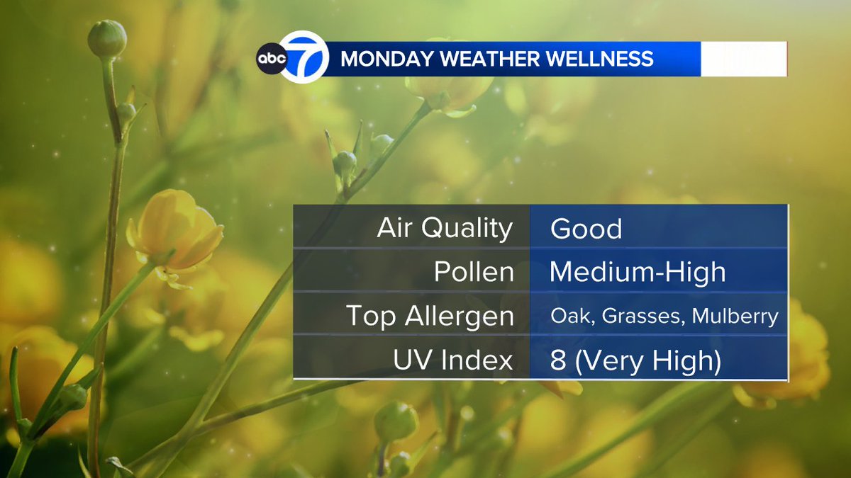
After a nice day tomorrow, expect some more clouds on Monday with a shower in spots in the afternoon and perhaps a couple of showers on Tuesday as well before warmer sunshine takes us into late week.