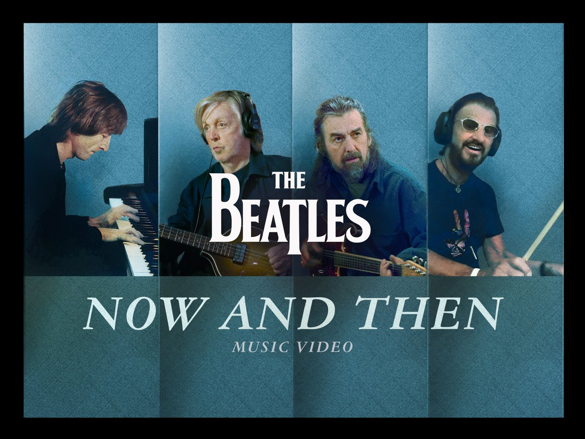
The official music video for ‘Now And Then’ is live on YouTube directed by Peter Jackson.
https://t.co/sNQz6t4n32
He describes finding “a collection of unseen outtakes in the vault, where the Beatles are relaxed, funny and rather candid. We wove humour into some footage shot in 2023. The result is pretty nutty and provided the video with much needed balance between the sad and the funny.
I realised we needed the imagination of every viewer to create their own personal moment of farewell to The Beatles"
Jackson concludes by saying he has “genuine pride” in the finished piece, his first ever music video “and I’ll cherish that for years to come”.
TODAY is the deadline! Submit an abstract for your presentation for a chance to be a presenter at #EsriUC2024.
🔹Get the details: https://t.co/rpqsleUvzD
Esri: This map shows six years of Columbia Glacier's retreat. 🏔️ Learn how to make it in #ArcGISPro: https://t.co/50C95zWYSU
🔸Data sourced from the Sentinel-2 Land Cover Explorer.
Esri: @TheGISDiva@0mgould We are happy your access is working again Jami. Our teams continue to monitor these site issues. Looking forward to seeing you at UC, virtually or in San Diego!
Esri: RT @natureserve: Happy #BiodiversityDay! 🌎🌳 Learn about the biodiversity of the #UnitedStates—what species exist, where they live, & which are most threatened below!
➡️ https://t.co/YUdD1r2xwR
Visit the link in our bio to start exploring! @Es…
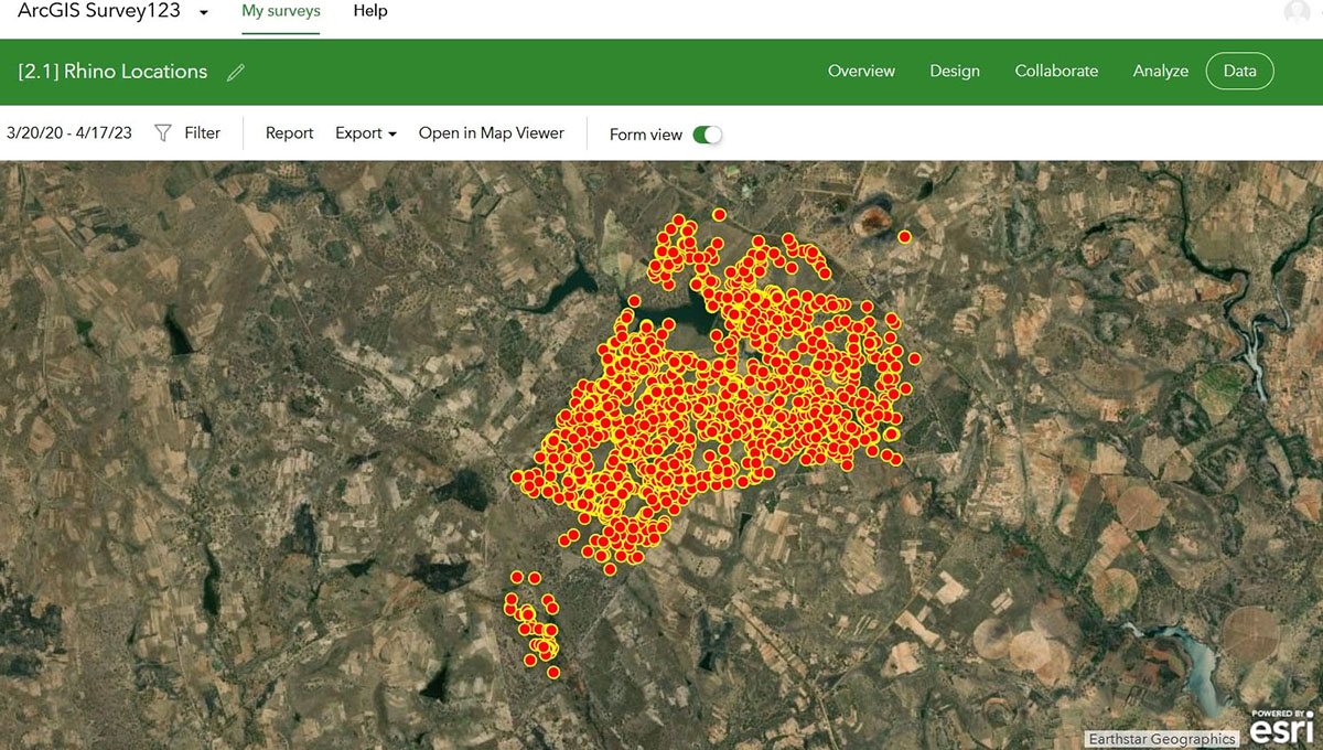
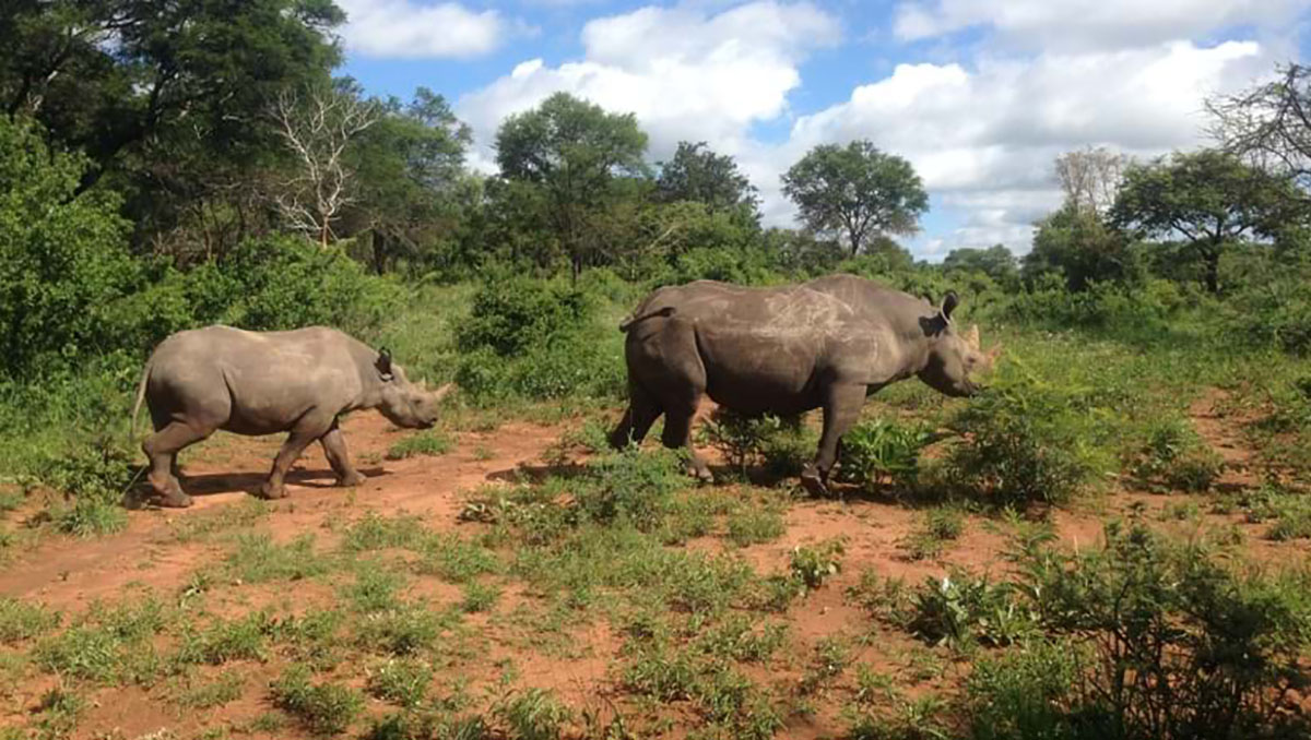
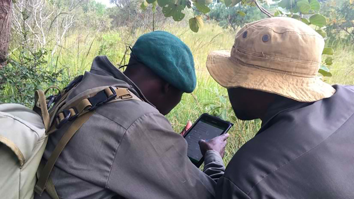
Esri: How do you help rhinos thrive in the wild? 🦏 Give rangers a data collection app. Discover how geospatial apps provide a framework for black rhino conservation management at @Imire_Zimbabwe. https://t.co/TaU1XmZ2b6
#EndangeredSpeciesDay
Esri: Did you know #AI can be used alongside satellite data to map ground collapses from permafrost thaw? Dr. Sue Natali from @WoodwellClimate explains.
🔹Watch the full video: https://t.co/KjqpU9lbF4
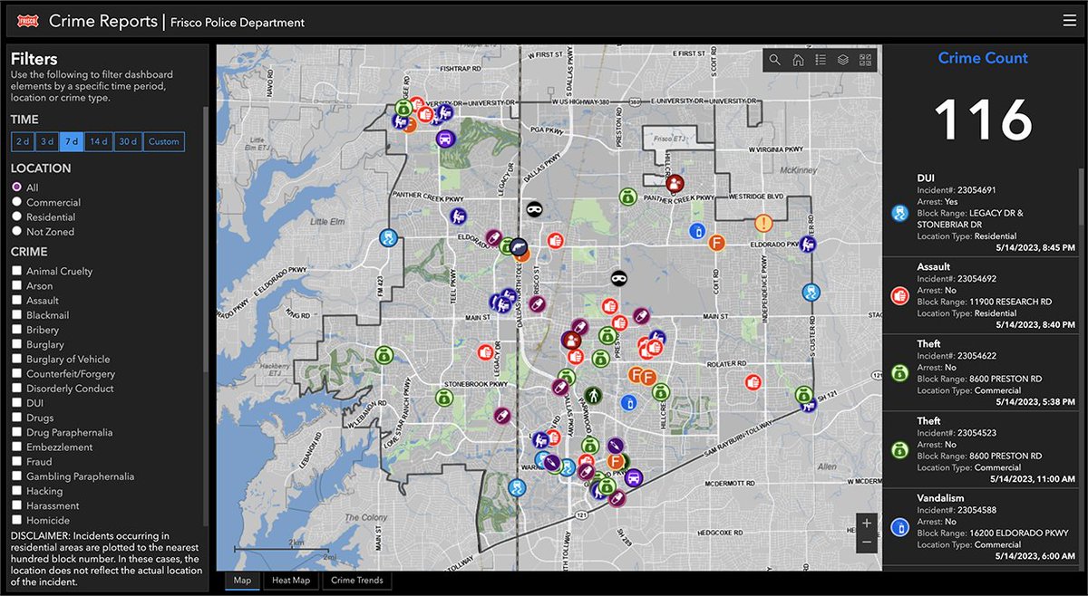
Esri: How does the safest city in the US become safer? Find out how Frisco, Texas, Situational Awareness for Emergency Response (SAFER) platform lives up to its name. https://t.co/sqPequjOaz
#DigitalTwin#PublicSafety
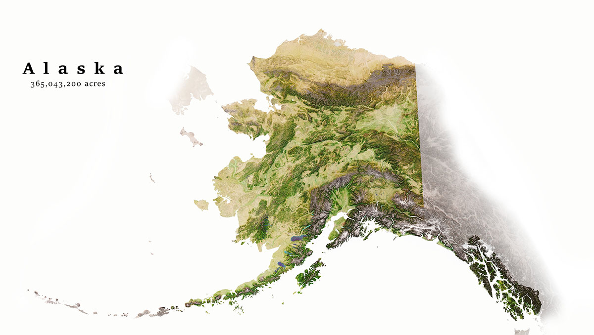
Esri: How was this beautiful map of Alaska made? 😍 Created by @g_fiske from @WoodwellClimate, he uses various cartographic techniques to achieve stunning results.
See his process here: https://t.co/8bKiRncEba
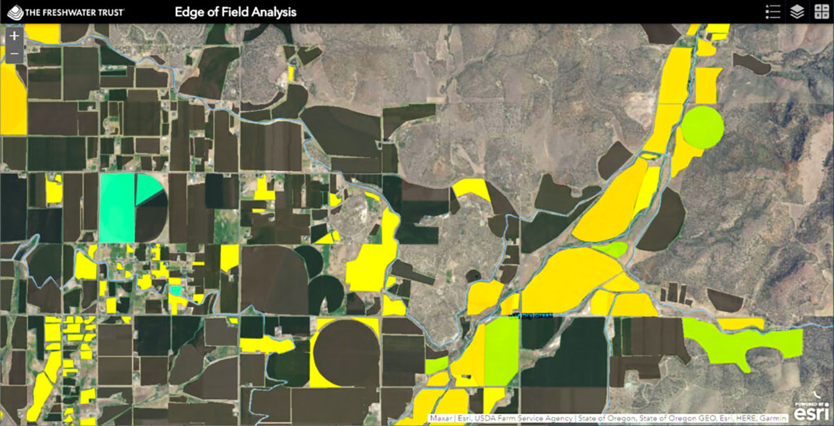
Esri: Using #ArcGIS and a community-based approach to digitizing fields, the Freshwater Trust (@fresH2Otrust) is increasing the pace and scale of #conservation.
🔸Here's their story: https://t.co/daBNdEin80
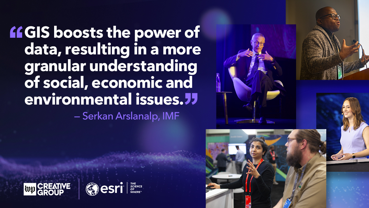
Esri: What can real-time vessel traffic tell us about the future? Listen to Serkan Arslanalp, an economist with the IMF who’s using location data to forecast economic trends in the Pacific islands. https://t.co/cWYxecXiQB
@IMFNews#GIS
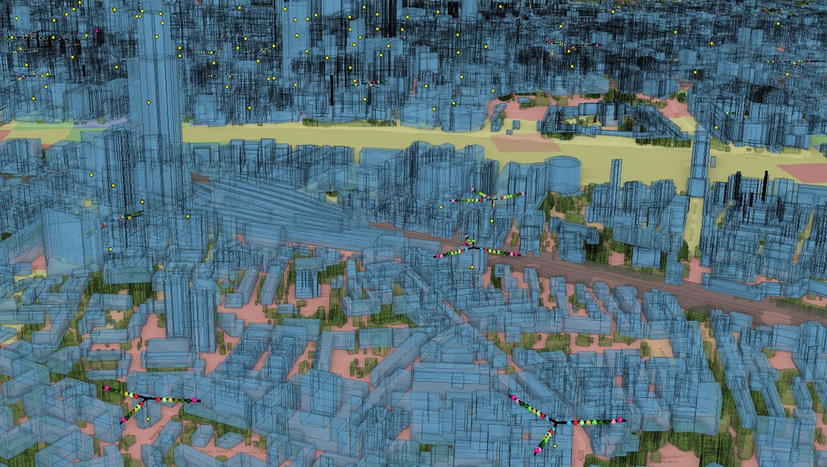
Esri: See how @VodafoneGroup and the busiest seaport in Europe are demonstrating that location technology is a critical foundation for a successful digital twin. https://t.co/OuZL6ZJos6 via @Forbes#DigitalTwins#AEC
Esri: RT @ArcGISStoryMaps: Ready to join the rebellion against the limits of human knowledge?
Embark on a journey to galaxies far, far away with this interactive exploration of images captured by the James Webb Space Telescope. #MayThe4thBeWithYou …
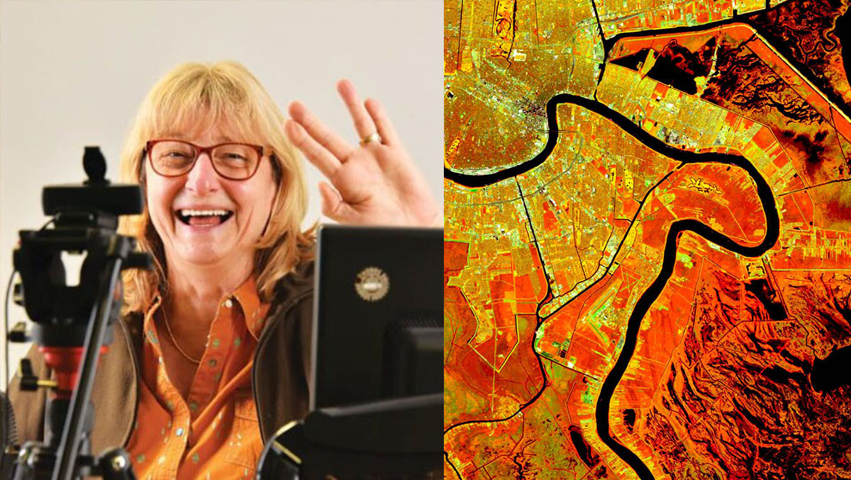
Esri: Meet our GIS hero, Dr. Christiane Schmullius! 🙌 Discover how she uses radar remote sensing to explore land surface changes around the world. https://t.co/KaFCqjtX6p
#GIS#RemoteSensing
Esri: The Smithsonian @NMNH will soon feature a reality-based digital experience. To achieve a deeper connection, Director Kirk Johnson believes in the integrative power of maps.
🔸Learn more: https://t.co/JdVCzZ2CBs #GIS