Good Thursday morning!
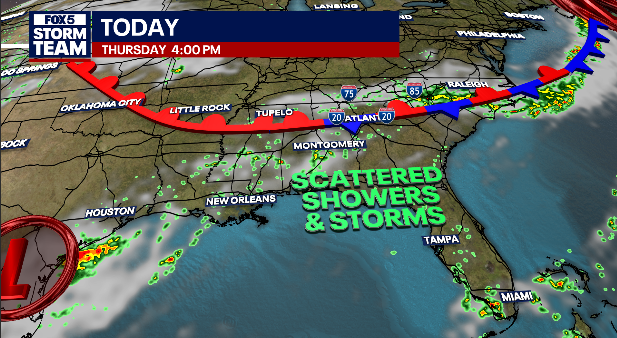
A front fueled with tropical moisture brings occasionally heavy rain for the next couple of days
Storms are widely scattered today with cooler high temperatures over far north Ga
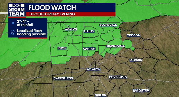
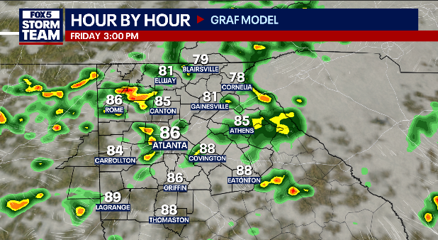
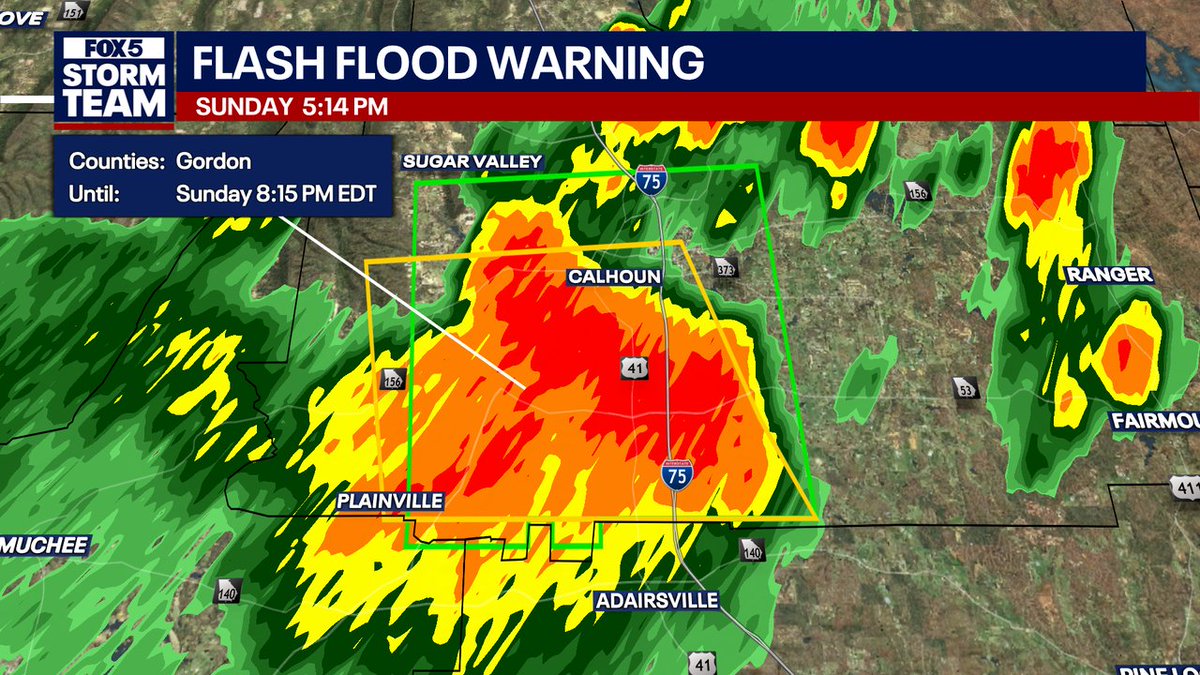
Storms are more numerous for Friday with localized flash flooding possible
NEW: A Flood Watch has been issued until 7/25 12:00AM EDT for parts of North and Central Georgia. More updates to come on FOX 5 and streaming on FOX Local.
While Tropical Storm Bertha does not directly impact our weather, our chance of scattered rain/storms increases each day for the rest of the week. But this also means it won’t be quite as hot! @GoodDayAtlanta
WEDNESDAY 5AM TROPICAL STORM BERTHA UPDATE:
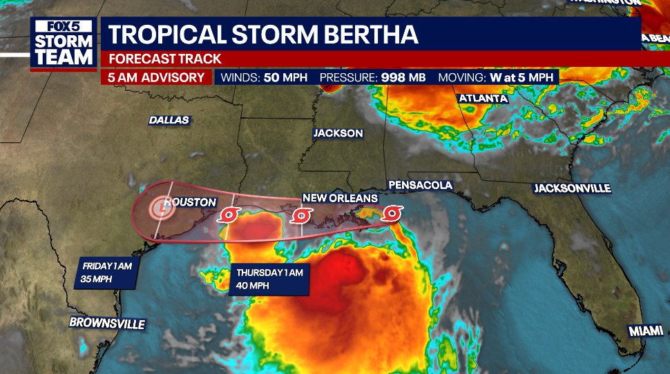
Still very much a lopsided storm that is keeping most of the rain offshore, Bertha is still bringing tropical storm force winds, 1-4 ft of coastal storm surge, and generally 1"-4" of rain along its path @GoodDayAtlanta
Another seasonably hot and humid day with only a couple afternoon storms expected.
As rain chances increase tomorrow, thanks to an approaching cold front, we have a higher risk of excessive rain than coastal areas in the path of Tropical Storm Bertha! @GoodDayAtlanta
TUESDAY 5AM ADVISORY - TROPICAL STORM BERTHA
After strengthening overnight, the max winds are holding at 50 mph. Tropical Storm Warnings in place from the FL/AL line to SE Louisiana for locally high rainfall totals 4"+, storm surge from 1-4 feet, and tropical storm force winds
MONDAY 5AM UPDATED TRACK:
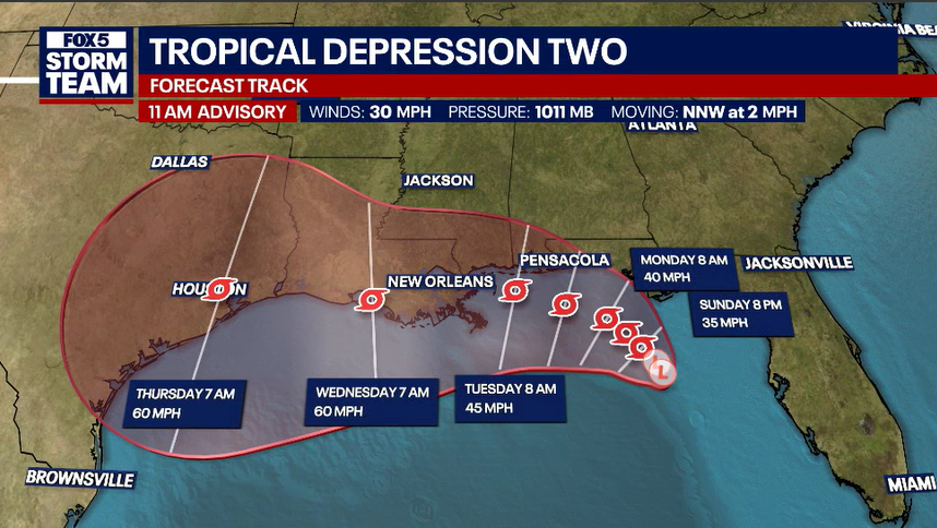
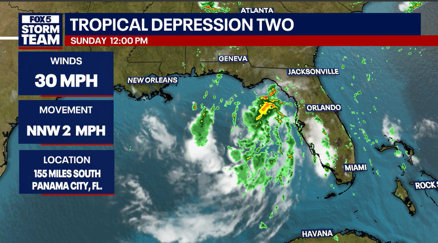
Tropical Depression Two isn't quite to tropical storm strength yet, but is forecast to reach that later today. The slow drift to the west over the next several days means no direct impact on north Georgia's weather. Join us on @GoodDayAtlanta for details
Tropical Depression Two has formed in the Gulf and is moving slowly. Forecast to become #Bertha by tonight or Monday and drift westward along the Gulf Coast. Areas from western Florida to Louisiana expected to be most impacted by highest rain totals. @FOX5Atlanta