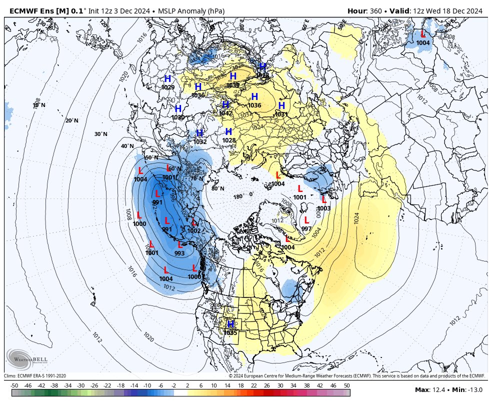
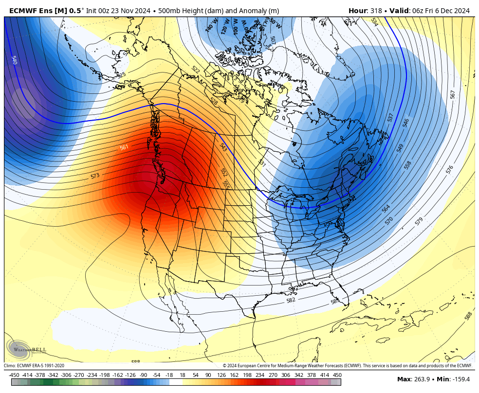
A huge ridge looks like it will try up over the PNW. This means drier and possibly warmer than normal temperatures will invade the area for at least all of December. This may be the end of winter,folks, expect a possible early spring! #bcwx#bcstorm#wawx@ensembleator@vlad_rad
A huge ridge looks like it will try up over the PNW. This means drier and possibly warmer than normal temperatures will invade the area for at least all of December. This may be the end of winter,folks, expect a possible early spring! #bcwx#bcstorm#wawx@ensembleator@vlad_rad
My last post said that PNW will be under ridge keeping it mild and dry. This likely will be the pattern this winter as a ridge sets up here while cold goes east and it should persist through the winter. #bcwx#wawx#bcstorm@vlad_rad https://t.co/QZZm2daMz3
@webberweather Sounds cool for the east. I'm in the western part but I enjoy the more mild and don't like the cold. I was hoping it to stay mild like this for a bit and it's looking like my wish is coming true. This should persist all winter and should expect early spring?
@RyanVoutilainen And we thought winter would come in full force this season 🤔
This winter has been more mild compared to strong el lino last winter season.
When yet, been wrong again.
Maybe I was onto something.All long range models showing this warm west pattern continuing till January.Don't expect much winter this year,east is getting it all.Maybe really late winter a chance but not much
https://t.co/vwDeFL25i9
#bcstorm#bcwx#wawx@vlad_rad@cwaughweather
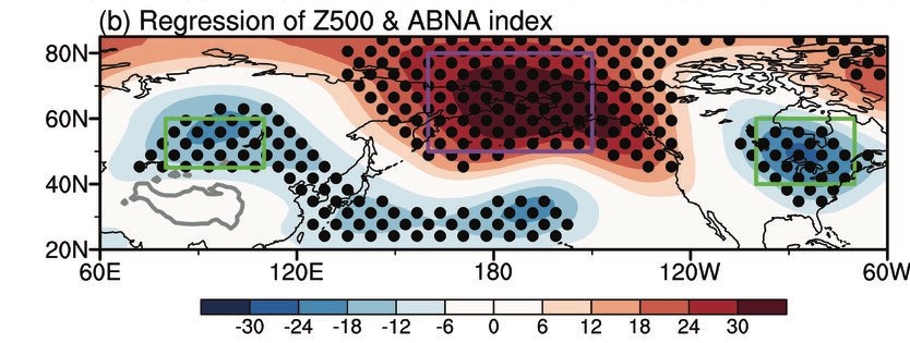
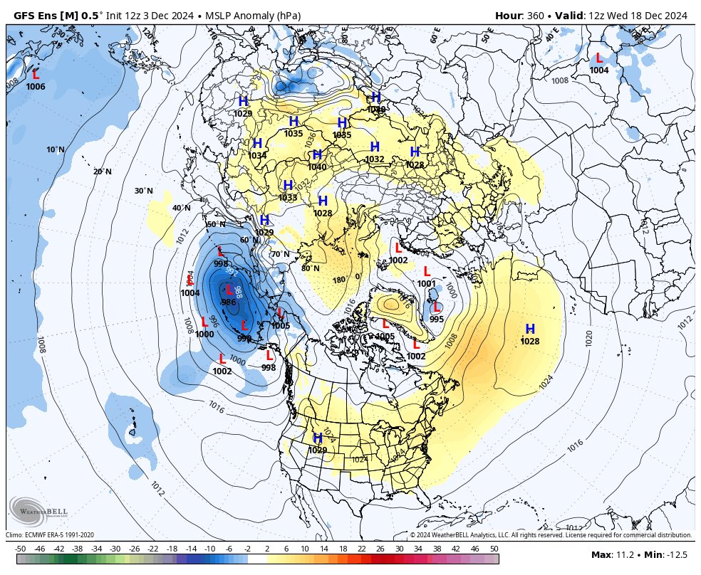
We're going full throttle +TNH/-EPO (Hudson Bay Vortex - Alaskan ridge) pattern for the foreseeable future.
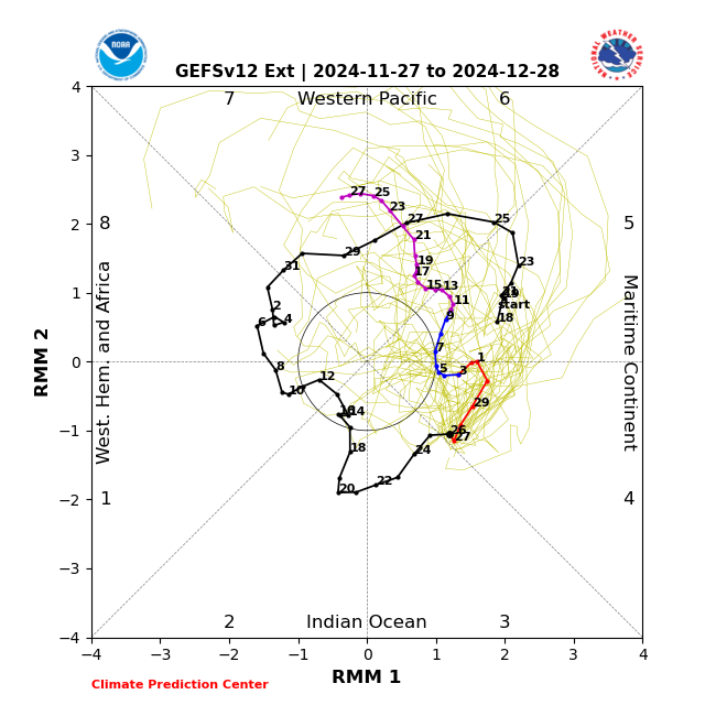
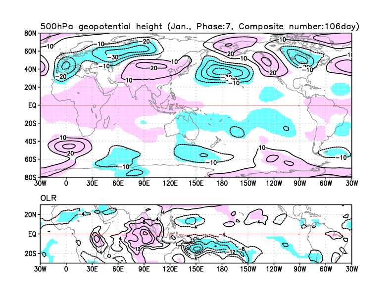
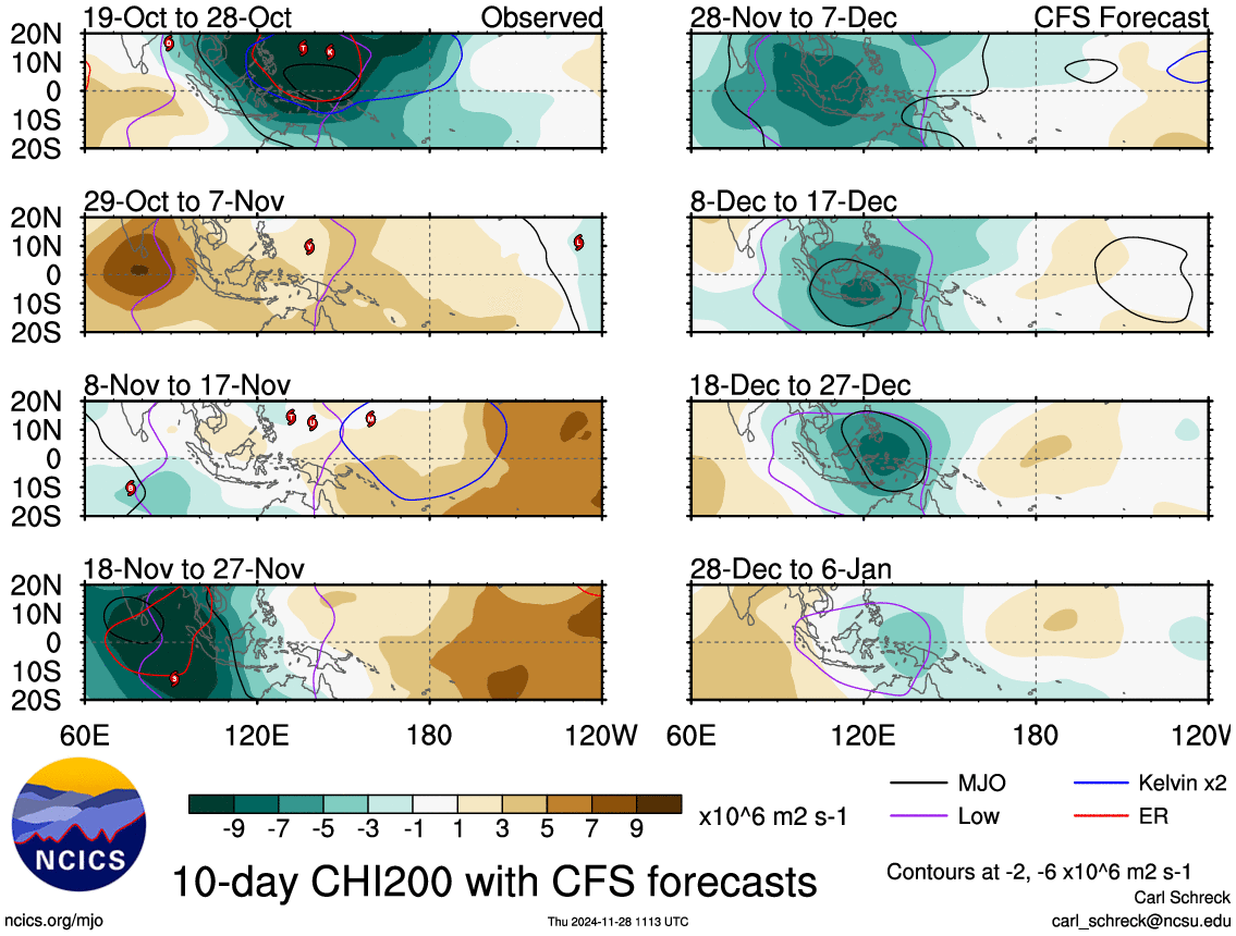
Subseasonal boost from a slow-moving MJO event coupling to low-frequency forcing over the Maritime Continent & West Pacific will likely make this pattern even stronger near the end of December into January.
🥶☃️
This is the kind of large-scale pattern change that probably favors a focus for more wintry weather over the Rockies & Upper Midwest/Great Plains as we get to the middle of the month.
After some arctic cold shots the next week - 10 days or so over the Eastern US, generally much milder weather is potentially around the corner by roughly the middle of December.
This is the kind of large-scale pattern change that probably favors a focus for more wintry weather over the Rockies & Upper Midwest/Great Plains as we get to the middle of the month.
After some arctic cold shots the next week - 10 days or so over the Eastern US, generally much milder weather is potentially around the corner by roughly the middle of December.