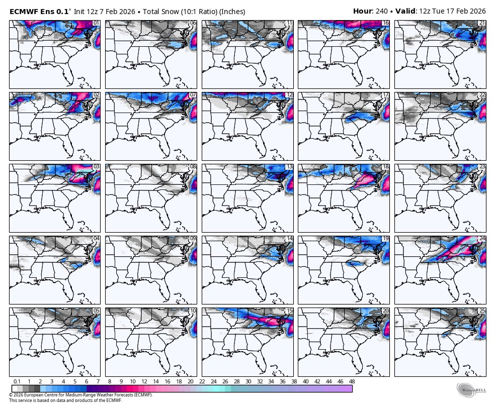
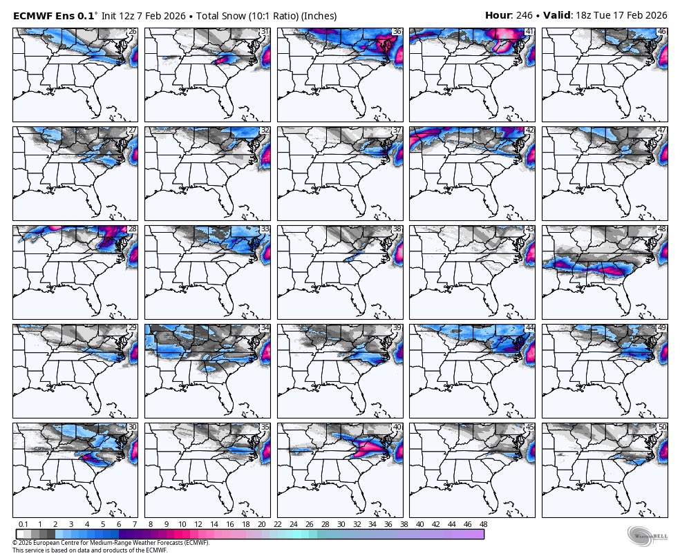
Yes, we are aware the latest Euro run shows snow in GA beyond our 7 day forecast next weekend.
It’s 1 run of 1 model. Of its 50 ensemble members only 2 show snow like the operational run or 4%. For now, it’s an anomaly. We wait for a trend before getting excited
Beautiful snowflakes observed just across the GA/TN border in Cleveland, TN!❄️
Could certainly see something similar early Saturday as the temperature & moisture conditions we will experience are ideal for snowflake structures like the ones seen below.
Photos by: Maddie L.
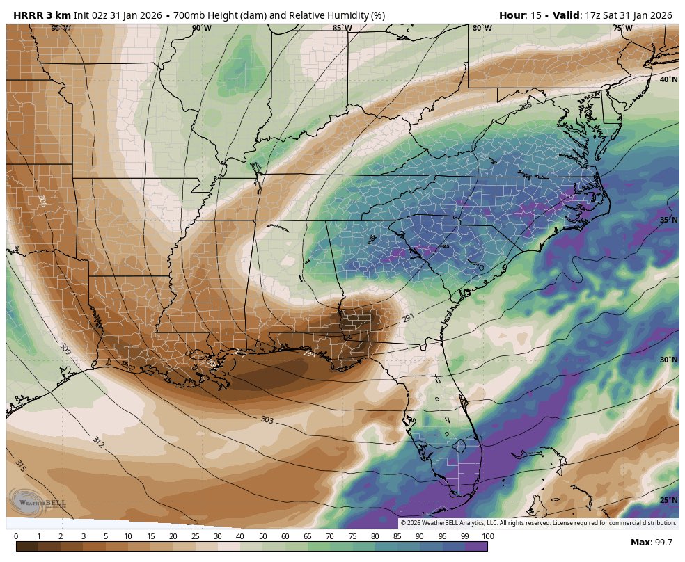
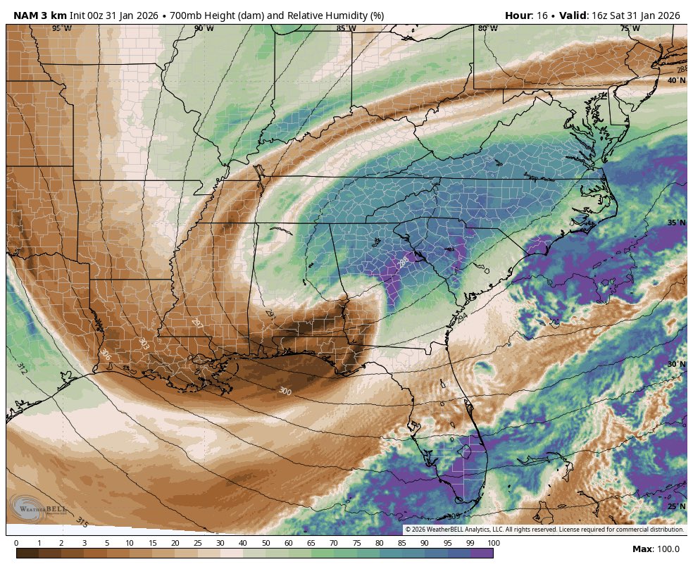
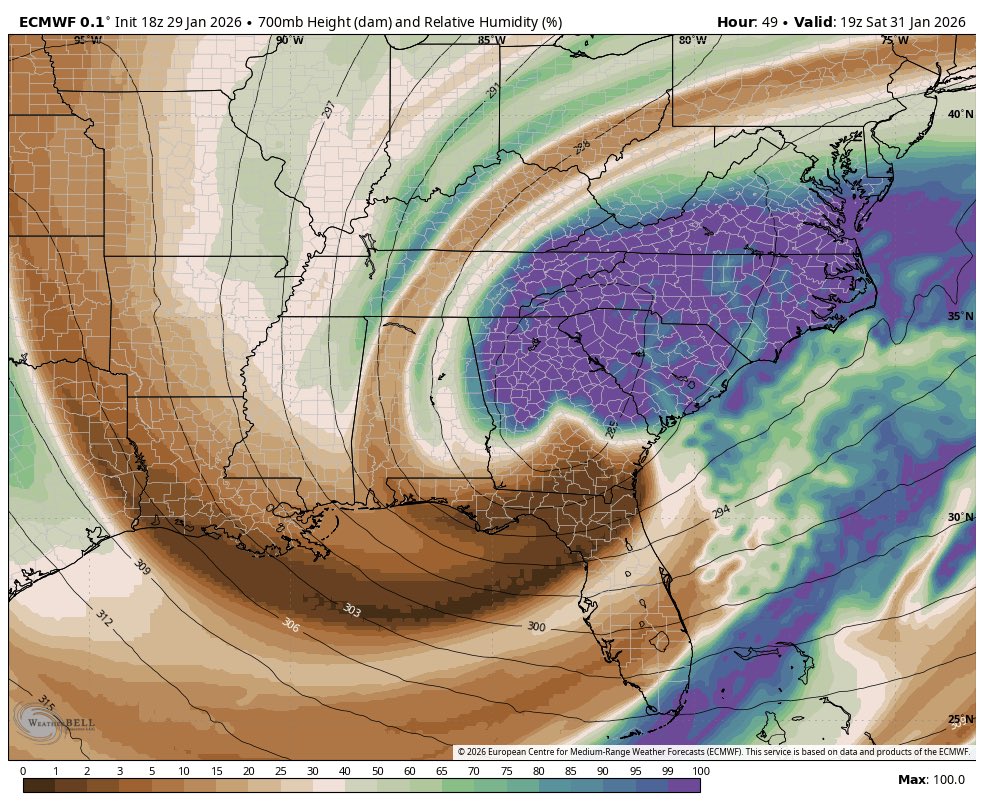
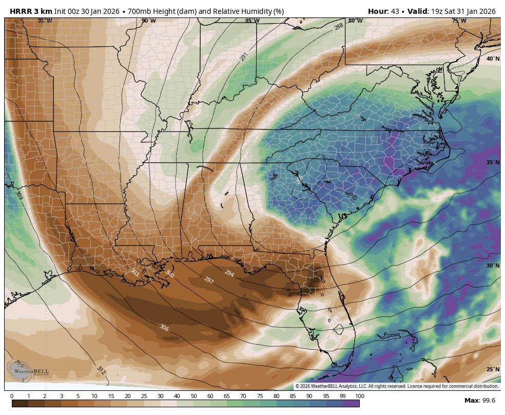
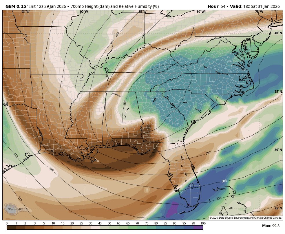
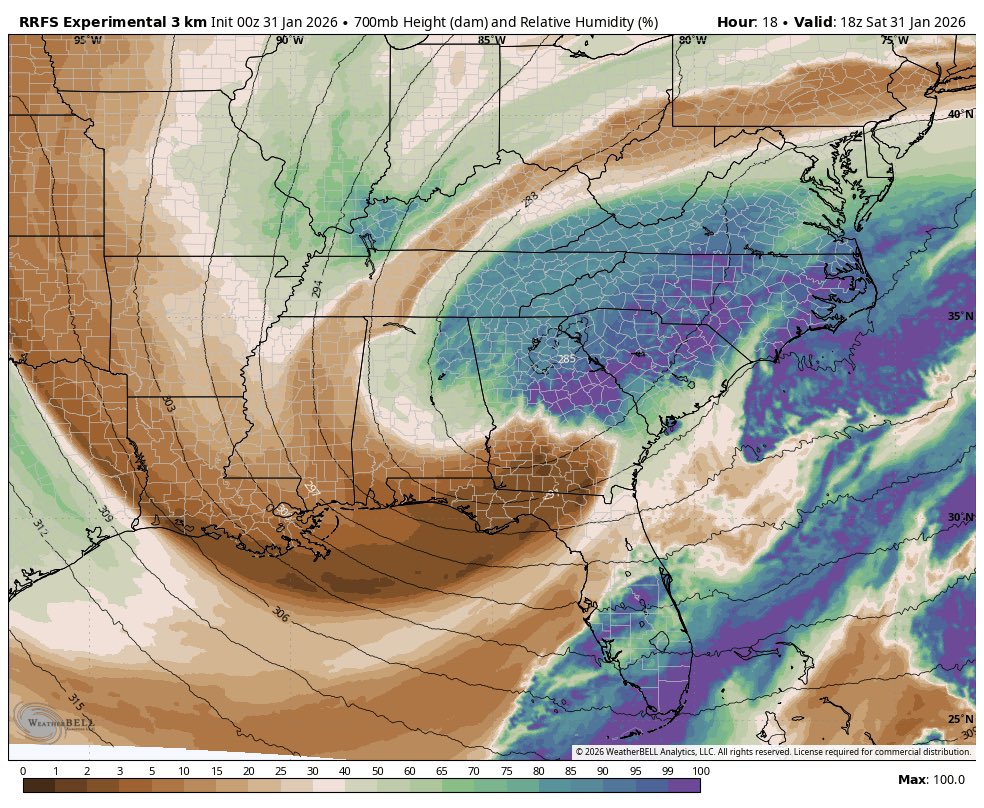
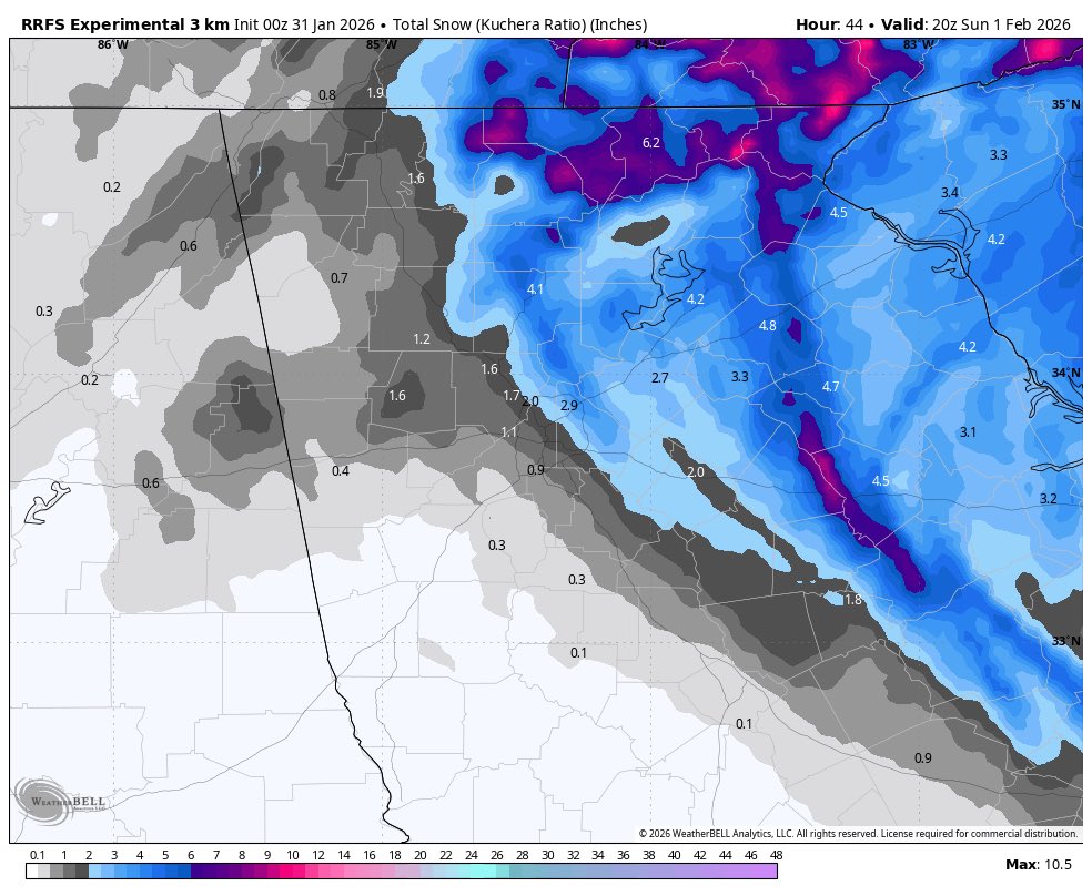
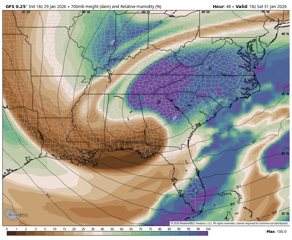
3 models 3 similar 700mb patterns and RH picture. The result is finally some consistency in the QPF and resultant snow pattern. Short of some curveball, ie strong mesoscale features which concentrate snow totals, we should be able to hone in on the picture now.
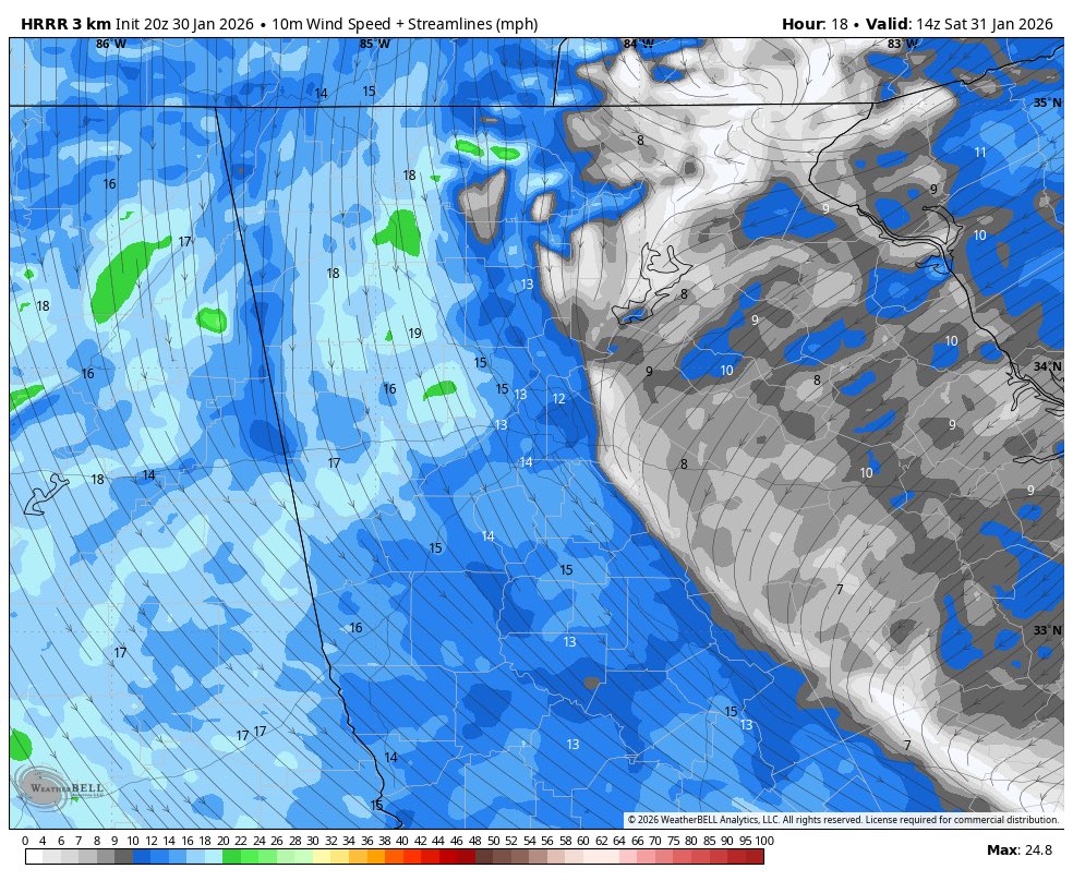
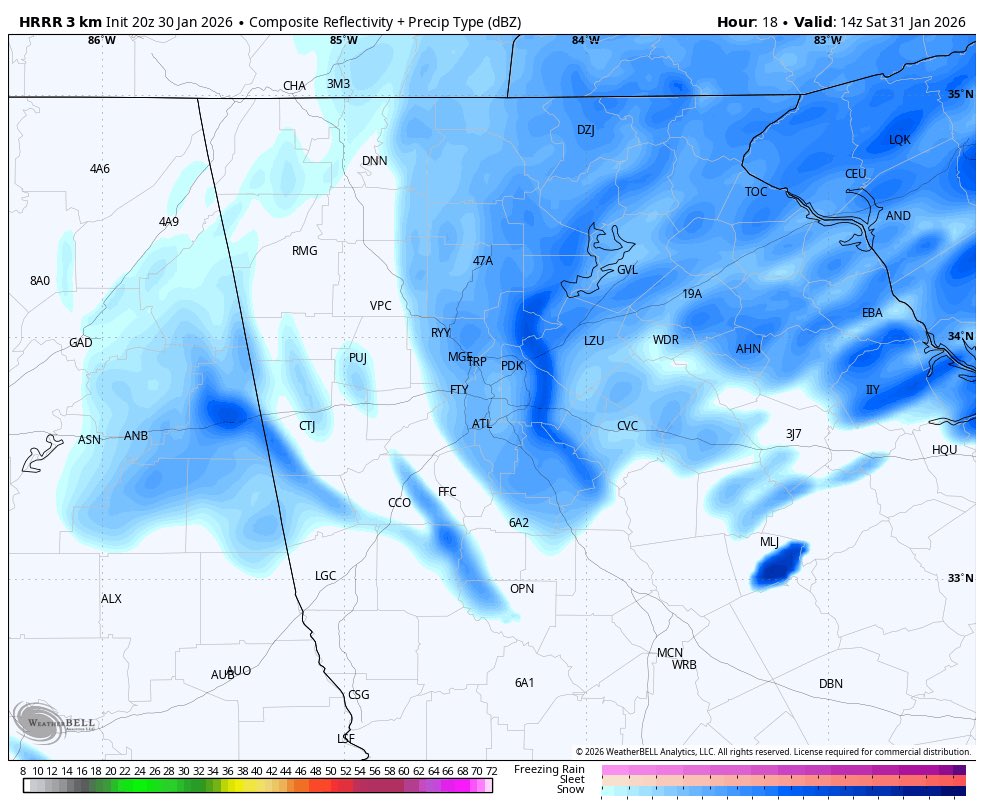
Latest 20z HRRR run laying the groundwork for a serious snow band to start the day in Atlanta 7-10am. Low level winds clearly showing the convergence which has the mid and upper support. Origins of the convergent band NE metro appear terrain induced
Snow in GA will come down to the precise route the 700mb low takes. Shown here are the big 4 at 18z sat: note not only the subtle differences in the center of the low, but also the differences in moisture. The corresponding snow totals are tied to this.
Tricky fcst on tap for GA this weekend, but the Euro ENS mean showing a deeper and further west trof over the past 4 runs. Would equate to more snow potential further west and a possible frontogenetic band. Time wil tell.
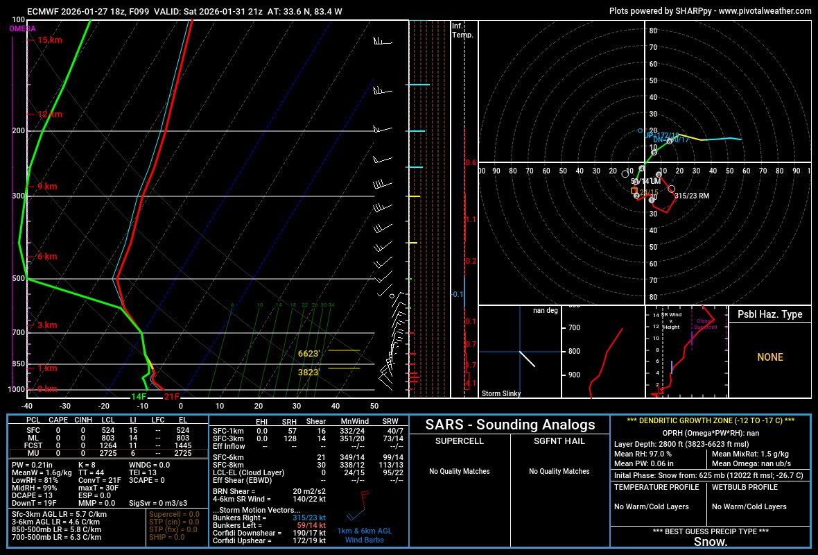
Profiles suggest 15:1 or more possible..if it snows
@MatthewCappucci Mmmm I’d want to see the details behind the dewpoint sensor used here. We see errors in them all the time, particularly amongst a certain class sensors.