⚠️⚠️🔴 Red weather warning now in force 🔴⚠️⚠️
Storm Goretti will bring exceptionally strong winds to the Isles of Scilly and parts of Cornwall, with peak gusts of 80-100 mph or more in exposed areas
Winds will increase rapidly with violent gusts that may persist for 2-3 hours
⚠️⚠️🔴 Red weather warning issued 🔴⚠️⚠️
Very strong winds across the Isles of Scilly and parts of Cornwall
Thursday 16:00 – 23:00
Latest info 👉 https://t.co/QwDLMfRBfs
Stay #WeatherAware ⚠️
5 pm EDT - Extremely powerful Hurricane #Melissa beginning to pull away from Jamaica and headed toward eastern Cuba. Here are the Key Messages. Visit https://t.co/tW4KeGe9uJ for updates.
Hurricane #Melissa Advisory 29: Extremely Dangerous Category 5 Melissa About to Make Landfall In Jamaica. Catastrophic Winds, Flash Flooding, and Storm Surge Occurring On The Island. https://t.co/tW4KeGdBFb
10AM #Melissa Update: @53rdWRS and @NOAA_HurrHunter Hurricane Hunter aircraft find that Melissa continues to strengthen. Catastrophic winds are moving onshore southern Jamaica. THIS IS THE LAST CHANCE TO PROTECT YOUR LIFE! For more updates visit https://t.co/tW4KeGe9uJ
Hurricane #Melissa 9AM EDT Update: @53rdWRS find Melissa stronger as the northern eyewall is approaching the southern coast of Jamaica. For the latest visit https://t.co/tW4KeGe9uJ
Hurricane #Melissa Advisory 28A: Eye of Extremely Dangerous Category 5 Melissa Approaching Western Jamaica. Catastrophic Winds, Flash Flooding, and Storm Surge Expected On The Island Today. https://t.co/tW4KeGdBFb
10/27 5am EDT: #Melissa has strengthened to a Category 5 hurricane with 160 mph winds and a 917 mb central pressure, confirmed by the Air Force Reserve Hurricane Hunters. Conditions in #Jamaica will rapidly deteriorate later today and tonight. Here are the key messages:
See https://t.co/Wq6ZtKfHp9 for the latest details.
Hurricane #Melissa Advisory 24: Melissa Now a Category 5 Hurricane. Destructive Winds and Storm Surge and Catastrophic Flooding Will Worsen On Jamaica Through the Day and Into Tonight. https://t.co/tW4KeGdBFb
This is not the time to wait it out.
I’m urging all residents, especially in flood-prone areas, to take Hurricane Melissa seriously.
Move to higher ground, stay alert, and keep your important documents safe and dry. 🇯🇲
#HurricaneMelissa#StaySafeJamaica#MLSSJA
10/26 5am EDT: #Melissa is now a Category 4 Hurricane with 140 mph winds. Parts of #Jamaica may already be experiencing tropical storm force winds & heavy rains- conditions will get much worse there through Monday and Tuesday. For southern portions of Hispaniola, additional heavy rain will cause flooding to get even worse over the next couple days. A Hurricane Watch is in effect for eastern #Cuba. Melissa should steer toward the Southeastern #Bahamas and #TurksandCaicos after eastern Cuba Tuesday night and Wednesday. Monitor https://t.co/Wq6ZtKfHp9 for the latest info.
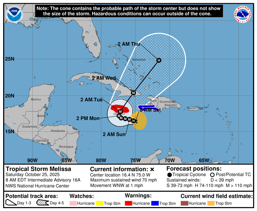
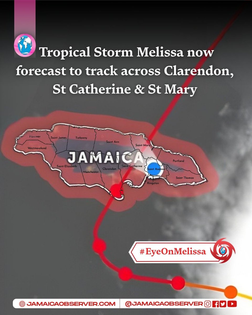
The 7:00 a.m. update from the U.S. National Hurricane Center shows Tropical Storm Melissa still aiming for Jamaica, with a projected path that may take it across three major parishes:
📍 Landfall possible near Clarendon
📍 Moving inland through St Catherine
📍 Exiting the island near St Mary
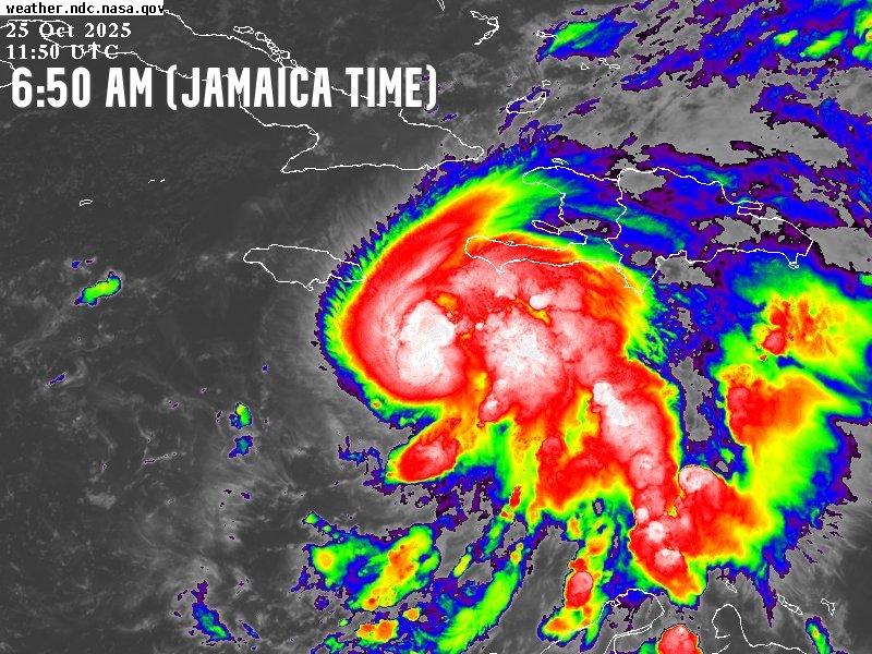
Melissa is moving west-northwest at 1 mph, with maximum sustained winds of 70 mph (110 km/h). Jamaica remains under a Hurricane Warning as the system is expected to strengthen further.
⚠️ Residents in Clarendon, St Catherine, St Mary and surrounding parishes are urged to:
Finalize preparations
Stay off flooded roads and low-lying areas
Monitor official updates throughout the day
📲 If it’s safe to do so, send your storm photos/videos via WhatsApp to (876) 894-2555.
#TropicalStormMelissa #Clarendon #StCatherine #StMary #JamaicaObserver
The 7 AM update from the U.S. National Hurricane Center shows that Tropical Storm Melissa is now moving towards the west-northwest at 1 mph, still packing 70 mph winds. We are still under a hurricane warning as she strengthens and continuous threaten to make landfall here.
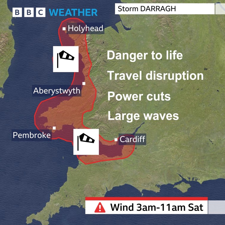
Western parts of Wales and the Bristol Channel are at most risk of seeing damaging wind gusts on Saturday #StormDarragh
Keep up to date with your weather here: https://t.co/vMJEViJPsf
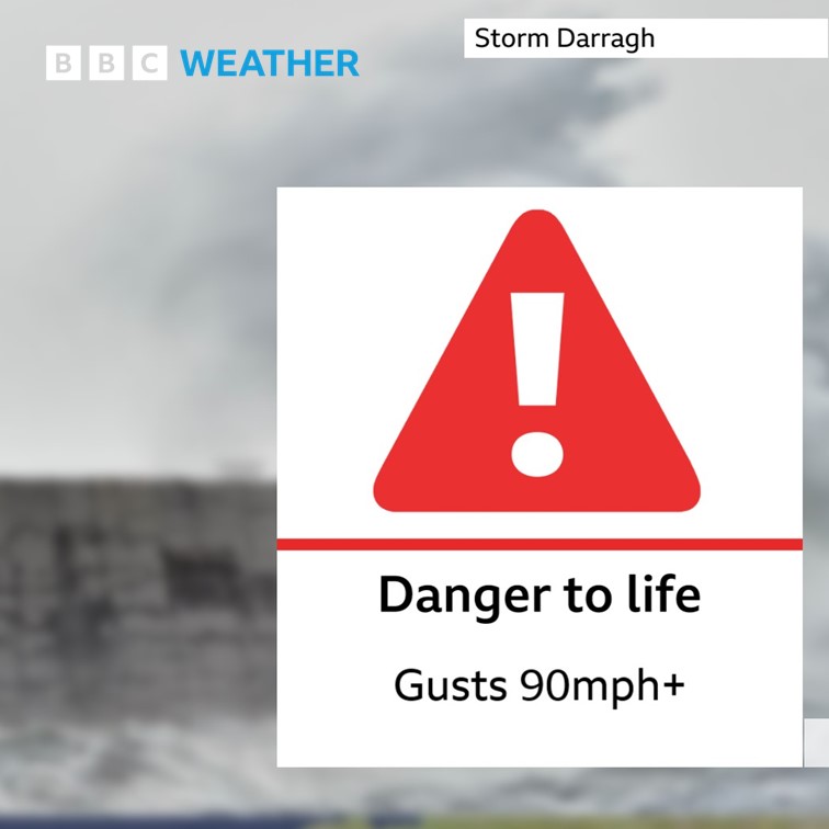
A rare RED wind warning has now been issued for parts of Wales and SW England valid from 3am until 11am Saturday.
Damaging winds pose a danger to life and are likely to cause significant disruption. See warning details here: https://t.co/kCBpCsDpQQ
Hurricane #Beryl Advisory 19: Core of Dangerous Hurricane Beryl Expected to Impact Jamaica Midday Bringing Life-Threatening Winds and Storm Surge. Expected to Approach the Cayman Islands Tonight Into Thursday. https://t.co/tW4KeGe9uJ
Hurricane #Beryl Advisory 14A: Category 5 Beryl Still Intensifying in the Southeastern Caribbean. Expected to Bring Life-Threatening Winds and Storm Surge To Jamaica Later This Week. https://t.co/tW4KeGe9uJ
Beryl is an extremely dangerous record-breaking Category 5 hurricane. In this video, @weatherjamaica gives us the late Monday night update on this system. On another note, rain is in the forecast for parts of southern Jamaica on the afternoon of Tuesday, July 02, 2024. Apologies for the late video post. Today was hectic. Please support my YouTube channel by watching these videos. Keep in mind that these posts are not always made here on our Twitter/Instagram/Facebook/Tik-Tok page but they are posted on our YouTube channel all the time. So search for @weatherjamaica on YouTube or on Google and support this page there or click/tap the link in our bio. I thank you in advance. https://t.co/dBuir5lwOM