🚨 Siren Test Today at 1:00 PM! 🚨
Little Elm will conduct its monthly Outdoor Warning Siren Test at 1 PM (weather permitting).
✅ This is only a test
⚠️ No action needed
📲 Sign up for alerts: https://t.co/wXF713iLEP
#LittleElmOEM#SirenTest#BePrepared
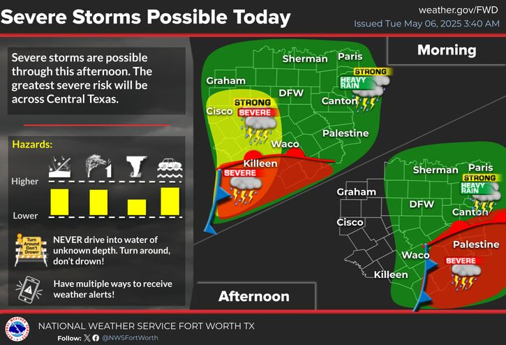
Heads up, Denton County! We’re under a Severe Thunderstorm Warning currently and a Flood Watch until tonight. The storms moving through our area have the potential to bring heavy rain, strong winds, hail, and even localized flooding.
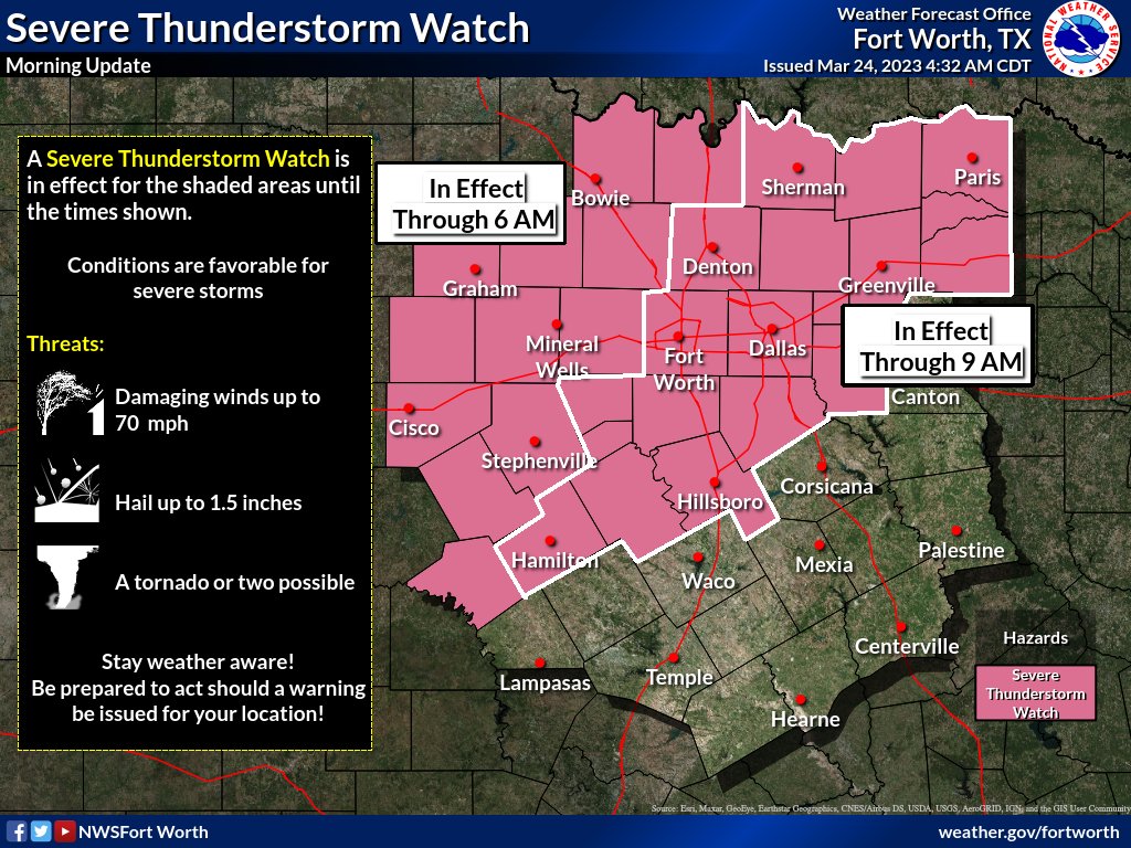
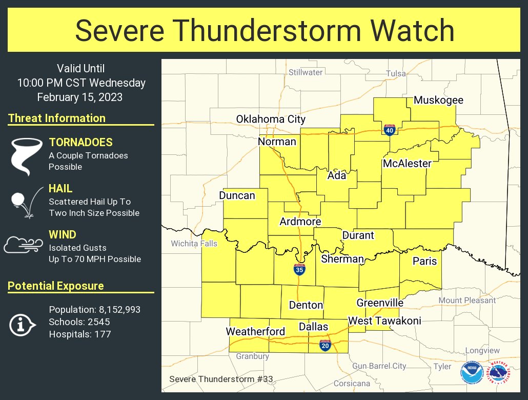
4:40 AM Update: A new Severe Thunderstorm Watch has been issued for portions of North and Central Texas, including the DFW Metroplex, until 9 AM this morning. The Watch issued earlier for areas west of the Metroplex remains in effect through 6 AM this morning. #dfwwx#ctxwx#txwx
A Tornado Watch is in effect for most of North Texas until 8 PM this evening. Large hail, damaging wind gusts up to 70 mph, and a few tornadoes will all be possible through the remainder of the afternoon and into the evening. #dfwwx#ctxwx#txwx
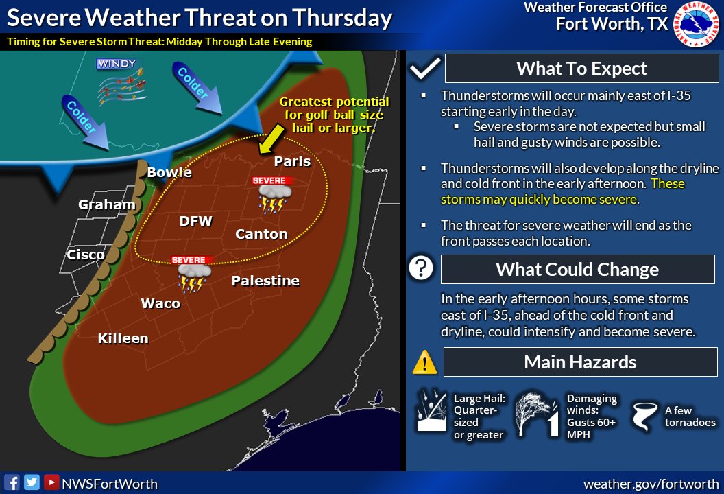
THURSDAY STORM UPDATE! We will be watching 2 areas for a severe wx threat: east of I-35 and then to the northwest along the front/dryline. *Large hail is the main threat*. Have a plan to stay safe and multiple ways to get warning information. #dfwwx#ctxwx#texomawx
The greatest severe weather threat will be tomorrow late afternoon/early evening. Main threats: Large hail, damaging winds, & a few tornadoes.
✔️ Ensure you have multiple ways to receive watches & warnings
✔️ Know your shelter locations at home, work, & school
1/
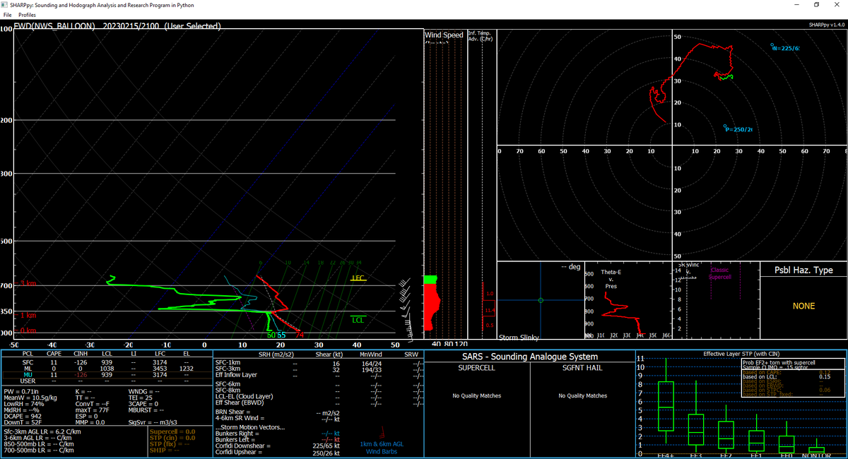
255PM: We released a 21Z special sounding to assess the strength of the cap. The balloon has made it through the cap, and it is still holding strong at this time. It is weaker than it was earlier, but still out there. #txwx@NWSSPC
Heads up, Denton County!
There is the potential for a few strong/severe storms later this afternoon & evening, so remain weather aware!
The greatest severe risk is N of I-20 & E of I-35, w/ hail as the main threat. Expected timeline is between 4pm - 12am.⛈️
1/
3:33 PM: Current radar is showing rain across the region with temperatures in the upper 20s… not great. Freezing is 32F. The sun sets at 6:02 PM tonight. Road conditions will be AWFUL after sunset and overnight. The freezing rain will continue. DO NOT BE ON THE ROADS. #dfwwx
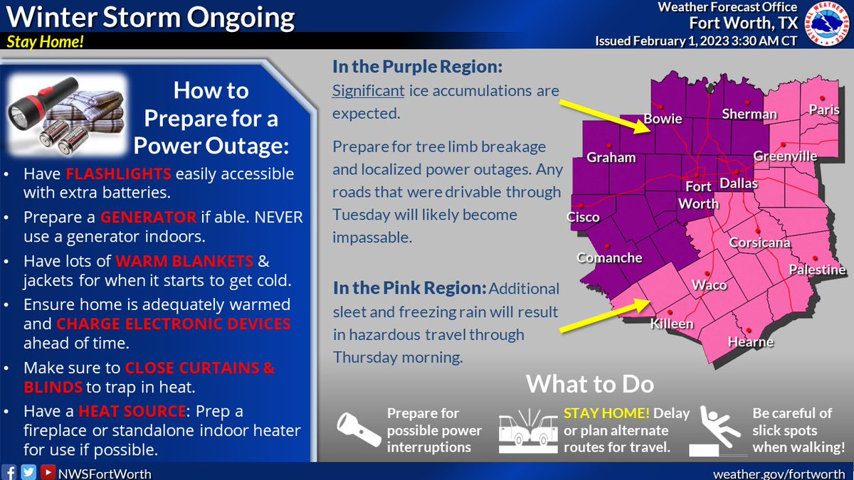
Freezing rain is occurring across much of North TX. Ice is building up on trees and powerlines and will result in sporadic power outages especially in the Ice Storm Warning area by tonight. While most shouldn't lose power, there are things you can do now to prepare! #dfwwx#ctxwx
Texas faces winter weather conditions this week.❄️🥶
Icy conditions are hazardous for drivers! Avoid travel if possible.
🚗Check road conditions: https://t.co/uUBMpOEsWh
🎒Keep emergency supplies in your vehicle
🗣️Let someone know your destination & route
Stay Weather Aware!
Local officials have opened more than 60 warming centers in response to #WinterStormMara.🥶
To find a warming center near you, visit: https://t.co/e3Aj1WneLS
#txwx
What to do if there is a power outage? Always make sure your phones stay charged & report it to your electric company via phone call/website.
Prepare for power outages by bundling up, making sure you have flashlights, batteries, & an indoor safe heat source if possible!
(1/2)