Leavenworth County Emergency Management is responsible for the development and implementation of a Comprehensive Emergency Plan for Leavenworth County.
Cooler, scattered showers today. An isolated storm is possible, but chances are less than 15% at any given location. No severe weather is expected. Today: Sprinkles & slight chance of showers. Cloudy, then becoming sunny, high 79. Wind 3-7mph. Tonight: Clear low 59. Wind 5mph.
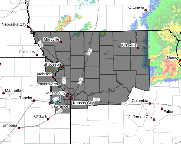
THE NATIONAL WEATHER SERVICE HAS ISSUED SEVERE THUNDERSTORM WATCH 343 IN EFFECT UNTIL 10 PM THIS EVENING.
Continue to monitor by watching the local news channels, tuning into National Weather Service, and/or your mobile apps.
WIND ADVISORY IN EFFECT FROM 7 AM TO 1 PM WEDNESDAY. Southwest winds 20 to 25 mph with gusts up to 50 mph expected. Gusty winds will blow around unsecured objects. Tree limbs could be blown down and a few power outages may result.
🚧ROAD CLOSURE🚧
Jamison Road, 0.44-Mile East of 187th St beginning Monday 6/22/26 will be closed for a bridge replacement. Full road closure barricades will occur at the bridge replacement, located on Jamison Road, 0.44-Mile East of 187th St. Anticipated until August 31, 2026.
Dry weather to start. Shower & storm chances return early Tue morning. Severe storms possible Wed. Capable of severe hazards. Chances for showers & t-storms this weekend. Today: Sunny, high 80. Wind 6 mph. Tonight: Showers & t-storms chance. Low 63. Wind 5-10mph. Gust 20 mph.
**ROAD CLOSURE** June 22, 2026, Spruce (K-92 Highway) at 20th St will be closed for construction. Project expected to last until October 2026 time frame. 20th St will have one lane open north & south bound traffic. East & west bound traffic from Spruce will be completely closed.
FLOOD WATCH LATE TONIGHT THRU SUN MORNING. Flash flooding caused by excessive rainfall possible. Excessive runoff may result in flooding of rivers, creeks, streams, and other low-lying and flood-prone locations. Heavy rain & t-storms. 2-4" rainfall possible tonight.
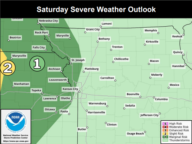
Complicated t-storm on Sat. Early morning storms across E-SE KS to W-SW MO has potential for heavy rainfall. Cold front moves in. All hazards possible, damaging winds, damaging hail, & potential for a tornado(s). Today: Sunny, high 84. Tonight: Increase cloud, low 65. Wind 6 mph.
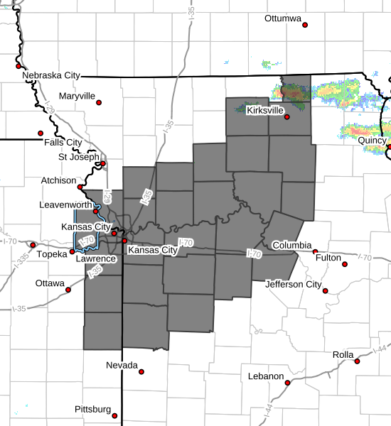
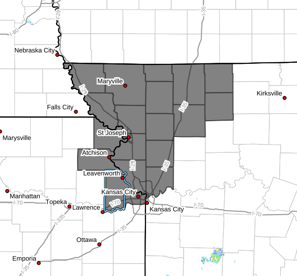
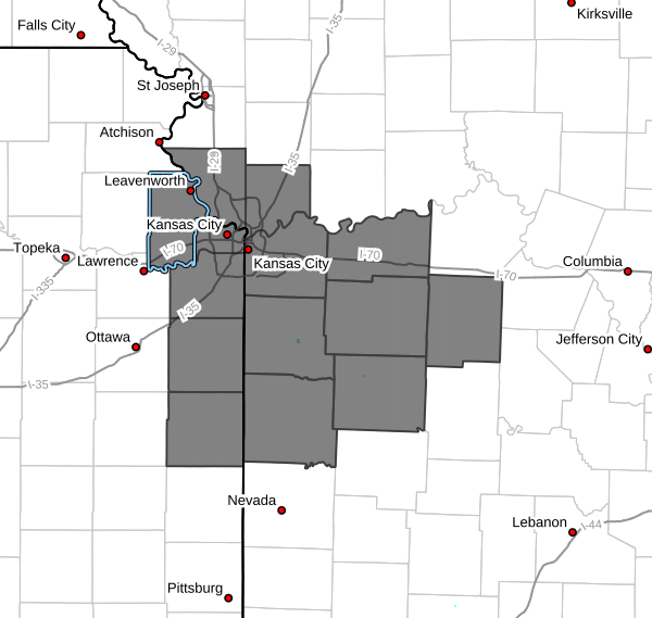
THE NATIONAL WEATHER SERVICE HAS ISSUED TORNADO WATCH 303 IN EFFECT UNTIL 9 PM THIS EVENING FOR THE FOLLOWING AREAS
IN KANSAS INCLUDES: JOHNSON NORTHEAST KANSAS ATCHISON DONIPHAN LEAVENWORTH WYANDOTTE
TO INCLUDE COUNTIES IN MISSOURI
HAVE A PLAN AND BE PREPARED!!! BE SAFE!!
FLOOD WARNING IS CANCELLED...
The Flood Warning is cancelled for the Stranger Creek near Tonganoxie.
* ADDITIONAL DETAILS...
- At 7:30 AM CDT Tuesday the stage was 15.6 feet.
- The river is expected to rise to a crest of 16.4 feet this afternoon.
Storms, some strong/severe, possible overnight. Probability 60-70% in Eastern KS & Western/Central MO late tonite into early Tue morning. Hazards: Heavy rainfall (1"+), damaging winds (70-85mph), hail (up to 1/4") & isolated tornado threat. Isolate storms possible (20% chance).
NWS issued Flood Warning for Stranger Creek near Tonganoxie. FLOOD WARNING IN EFFECT FROM TUE AFTERNOON TO THURSDAY EVENING. At 12:30pm, stage was 7.6 feet. Creek is expected to rise above flood stage early tomorrow afternoon to a crest of 25.9 feet early Wed morning then fall.
HEAT ADVISORY NOON TO 10 PM TUE. Heat index 105 degrees expected. Hot temps & high humidity may cause heat illnesses. Drink plenty of fluids, stay in the ac room, out of the sun, & check up on relatives/neighbors. Wear lightweight/loose fitting clothing. Limit activities outside.
NWS issued Flood Warning for Stranger Creek (Easton) until late Tues night. Moderate flooding forecast. At 8:30 AM Monday stage is 14.8 ft. Creek expected to rise above flood stage late this morning. Crest 18.9 ft this evening. Fall below flood stage (17.0 ft)after midnight.