Makepath is a custom software solutions firm that helps driven innovators at private companies. We specialize in GIS, visualizations and full-stack development.
Technology is great, AI is cool...but how do you build a user-centric satellite imagery application? Check out our case study with ORBO Systems and Planet. #eo#satellite#ai#geospatial#usercentricdesign
https://t.co/64QcUTKCti
Have you used Meta's SAM (Segment Anything) model in a geospatial context? Here is how to get started with samgeo, an Open Source effort led by @giswqs at University of Tennessee, Knoxville. #geospatial#ai#sam#samgeo
https://t.co/0tUclaIEDG
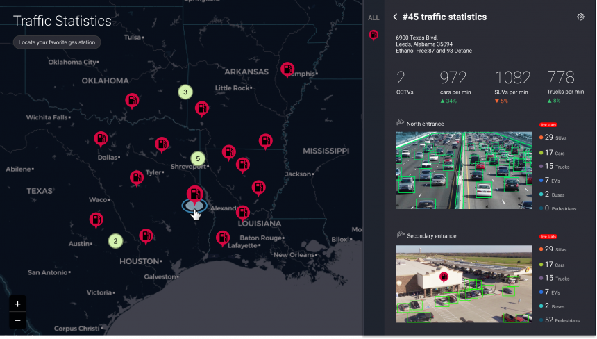
A lot of geospatial software is cluttered. So. Many. Layers. How can we use the 10 Principles of Good Design to make beautiful, usable software? #gis#geospatial#design#dieterrams
https://t.co/WR1aARkRT8
We recently published a post with our insights from the React US Summit. How are you using React in your applications? #react#redux#zustand#tanstackquery#reduxtoolkit https://t.co/DtdRxObEeo
🚀 Modernizing React Applications: A Deep Dive into Zustand, TanStack Query, and Redux Toolkit
We break down how to modernize your React apps with Zustand, TanStack Query, and the Redux Toolkit.
#ReactJS#WebDevelopment#StateManagement#Makepath
https://t.co/DtdRxObEeo
What can 1950's radio design teach us about making uncluttered geospatial software? Whether you have heard of Dieter Rams or not, here are a few ideas you can use when designing your product. #geospatial#software#design#dieterrams
https://t.co/WR1aARkRT8
Have you ever felt like geospatial software is cluttered, confusing, and not aesthetic? What can we learn from Dieter Rams when building geospatial software? What is your favorite simple and beautiful geospatial product? #geospatial#software#design https://t.co/WR1aARkRT8
Unlocking Value is a Contact Sport
We humans are bad at estimating.
Software compounds the problem because you can only estimate planned complexity.
You win by doing.
Learn more about optimizing your returns!
https://t.co/Mac56CMd5B
#Software#AI#Innovation
At Makepath, we help data-rich companies solve hard problems and unearth strategic opportunities hidden within their data.
Learn more about using your data to your advantage below!
https://t.co/gS5kkV7V4U
hashtag#Software, hashtag#innovation, hashtag#ai
Excited to announce @makepathGIS as our official Geospatial Services Provider! With their expertise, customers can now get custom GIS solutions built using SkyFi data.
This partnership offers endless possibilities, from tackling complex problems to unlocking new markets with innovative applications.
Read about our #partnership: https://t.co/WQUZ2KCCnt
What is the status of my supply chain?
We work with companies to build internal products that lead to sound operational decisions.
Learn more about how we can help your business!
https://t.co/gS5kkV8sUs
How do you turn the product vision that you see when you squint into the horizon into a specific and actionable plan?
90% of new clients who engage with Makepath start with a Discovery Package.
https://t.co/HET1rudL8r
Unlocking Value is a Contact Sport. We humans are bad at estimating.
Software compounds the problem because you can only estimate planned complexity. You win by doing.
Learn more!
https://t.co/Mac56CMd5B
#Software#AI#Innovation
At Makepath, we help data-rich companies solve hard problems and unearth strategic opportunities hidden within their data. We worked on a retail prototype that combines open-source GIS (Geographic Information Systems) and AI/ML applications.
https://t.co/gS5kkV8sUs
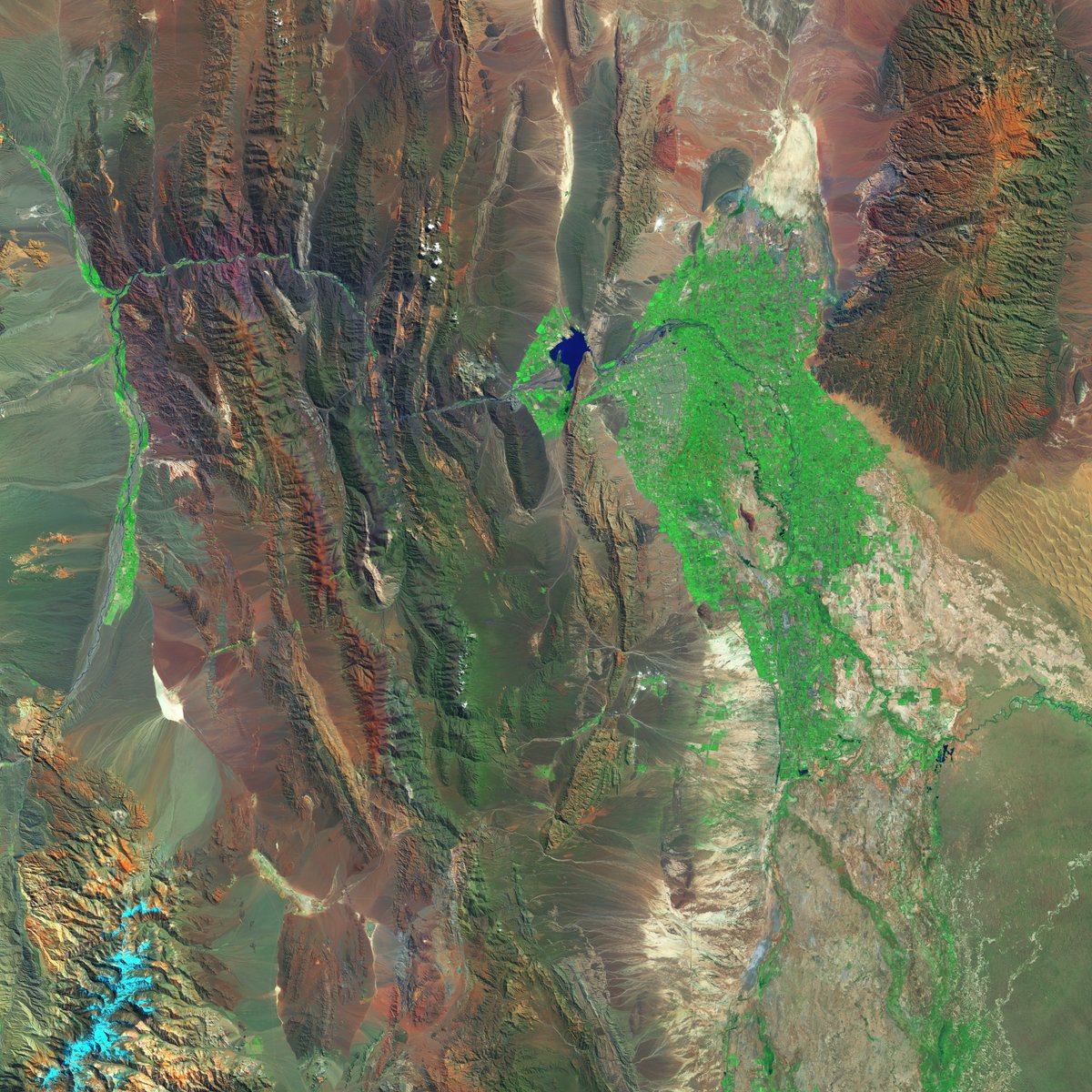
Natural Resources Conservancy (NRC) partnered with Makepath to create Orbo, a tool to monitor conservation easements.
Orbo uses Planet satellite imagery and AI to help make sure that only permitted uses are occurring.
Read more below!
https://t.co/64QcUTLaiQ
#Software,