With its source in the Futa Jalon Highlands in Guinea, the River Gambia runs east to west for nearly 1,000 miles through Guinea, Senegal and the Gambia. The total area of the River Gambia and its tributaries, locally called Bolon in Mandinka is 947 square km.
#30DayMapChallenge
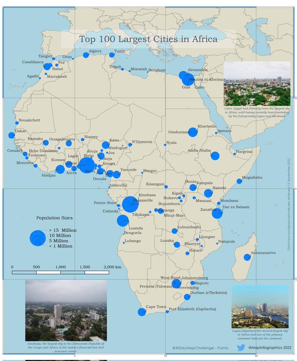
A map of the 100 largest cities in Africa by city proper population using the most recent official estimate. This reflects only cities located geographically in Africa including nearby islands.
📍🗺️Kinshasa (D.R.C.) tops the list.
#30DayMapChallenge day 1: Points.
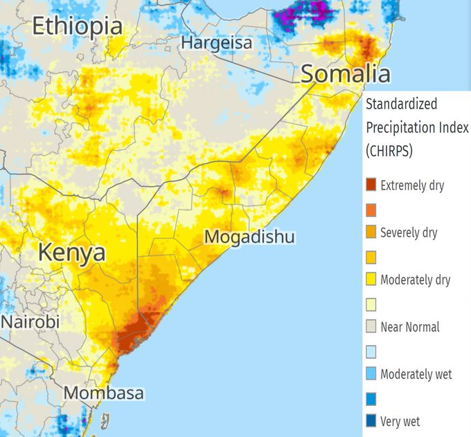
🚨ALERT:
1) An exceptional three-season drought sequence has struck the Eastern Horn of Africa
2) The food security situation is likely to deteriorate rapidly
3) Scaled-up humanitarian responses are needed.
MORE➡️https://t.co/ND57sxq4cZ
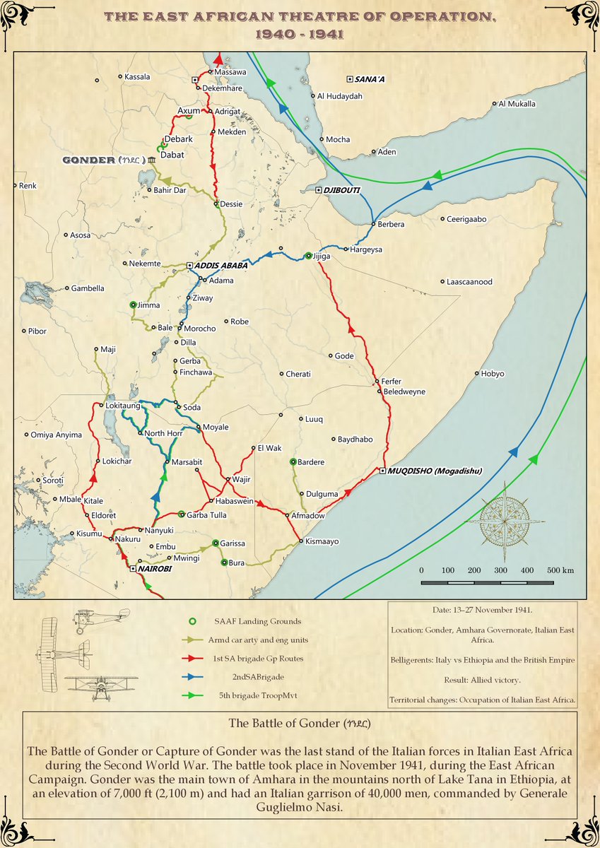
November 13-27, 1941:
The Battle of Gonder (ጎንደር) was the last stand of the Italian forces in Italian East Africa during the Second World War. The battle took place in November 1941, during the East African Campaign.
#30DayMapChallenge. Day 24 - Historical Map.
Gonder was the main town of Amhara in the mountains north of Lake Tana in Ethiopia, at an elevation of 7,000 ft (2,100 m) and had an Italian garrison of 40,000 men, commanded by Generale Guglielmo Nasi.
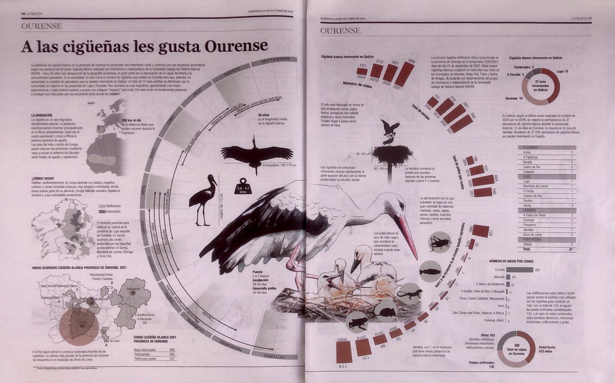
Actualización de la infografia que @MapInfographics ha preparado con tanto esmero con los datos del III Censo de Cigüeña blanca de la provincia de Ourense coordinado por @AmigosCegonas para @SGHN_Galicia (trataremos de publicar un archivo descargable para que se pueda imprimir)
We developed a consumer spending power dataset for every country in #Africa at a 2km x 2km resolution dating back from 2003 to 2020 to show how much people spend on goods and services. (2/3)
https://t.co/clQqfYzcvH
#research#kenya