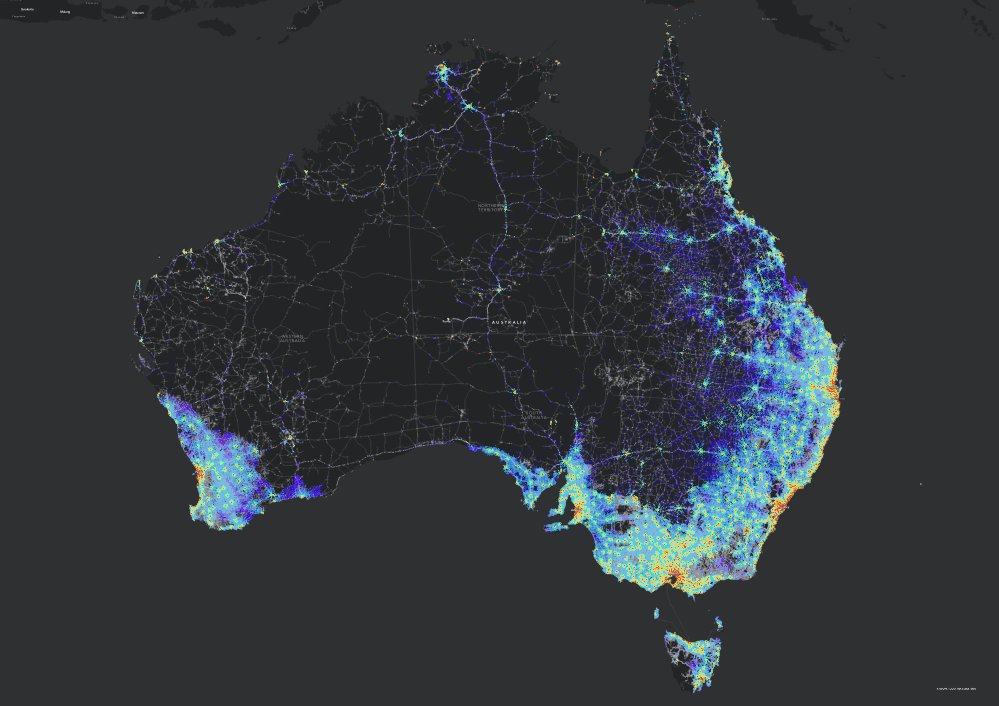
@abcnewsradio One of the problems with a the lack of social infrastructure in suburbs is the lack of good data. The Centre for Australian in to Access is trying to combat this. https://t.co/DVWML2YWWO
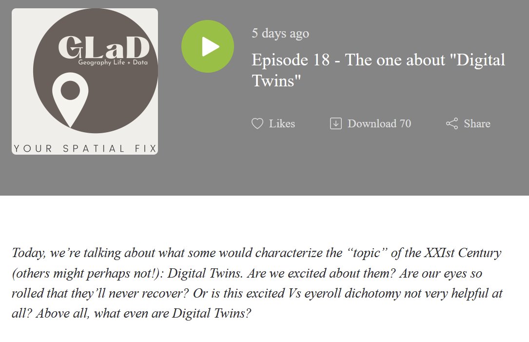
On the theme of spooky 👻 @levijohnwolf, @rsfrankl and myself have a brand new episode of #theGLaDpodcast🎧🎧🎧This one, no less, on Digital Twins. You love them, you hate them, you can't ignore them...
📢https://t.co/5r8H8zAQbN
Achieving #HealthForAll requires concrete changes in economic policy.
My latest article with @DrTedros on the cover of the @TheLancet outlines next
steps on how to align health, economic, and environmental priorities at national
and international levels.
Read it here ➡️ https://t.co/xWj3mFUtUF
and more on the underpinning Council @Economy4Health recommendations here ➡️ https://t.co/Ke2wnor4SU
An unexpected diversion in this talk; Ian spoke very positively about @WalthamstowAcad which he had recently visited; I'm proud to be a school governor there
#Postgres dump files, #geoparquet files in AWS S3 & #Docker containers for the August 2024 Geoscape #GNAF & admin boundaries release are up, for both GDA94 & GDA2020:
https://t.co/TDqIBqpX8Q
https://t.co/N9FJdnUtwC
Given SEIFA is going on 40 years old, perhaps
@ABSStats should look at some more nuanced approaches. For example, the Alkire-Foster (AF) Method.
Technical introduction to the AF Method | OPHI https://t.co/Ym0vNXQEE1.
the new PySAL is out today! This release introduces the new Graph class and includes a *ton* of new stuff all across the metapackage
https://t.co/Ih1ILB12j5
Overture Maps launched the Address Theme with over 200M addresses from 14 countries. 🌍
Our goal is to build a single, conflated, global address dataset and we invite our community to provide feedback on the schema.
Read our blog for details: https://t.co/wV0AdnhapU
I've been taking a look at the @NUSingapore@fbiljecki Global StreetScapes dataset this morning for my city. Fascinating stuff. 🧵
https://t.co/tGiBN44a9O
Overture Maps Foundation Releases General Availability of its Open Maps Datasets https://t.co/qfVBztSukb from @OvertureMaps
Download process https://t.co/ni48XkNR80 + release notes https://t.co/QhFS55gywo (no persistent link)
#geospatial#osm#opendata
1/2
The most important geospatial concept?
The Modifiable Areal Unit Problem.
It can be the difference between reliable and deceptive results.
Here’s what you need to know about it:
The most important geospatial concept?
Spatial Autocorrelation.
It can make the difference between spurious and accurate results.
Here’s what you need to know about it: