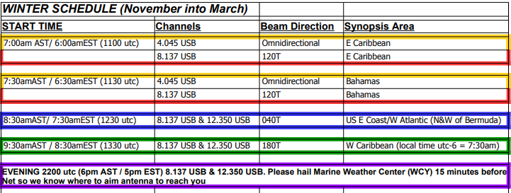
This is a friendly reminder that with the time change in the US tonight, we will be moving into our "Winter Schedule" for SSB nets and Webcasts beginning on Sunday, November 5.
If you have any questions about the schedule, reach out to us!
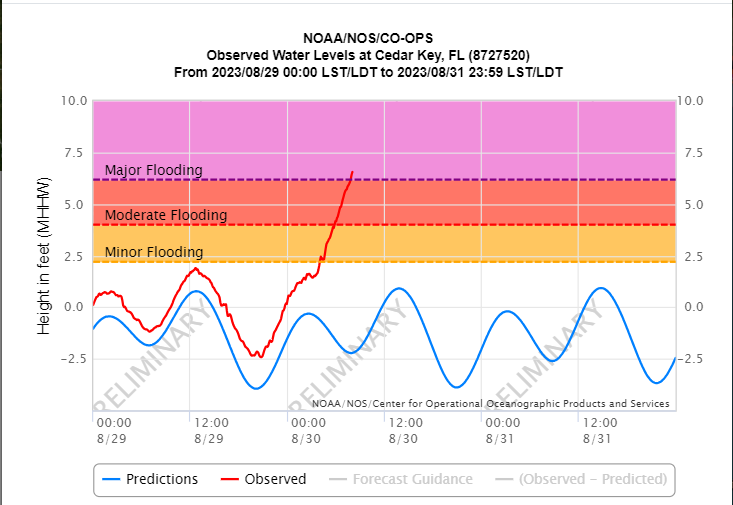
Water levels continue to rise in FL from Tampa Bay- Panama City as Hurricane #Idalia makes landfall. The NOAA tide station at Cedar Key is at 6' above normal high tide and rising. Get the real-time data: https://t.co/xeMuNhlWrw
All of NOAA's #Idalia info: https://t.co/qBK4fxJo51
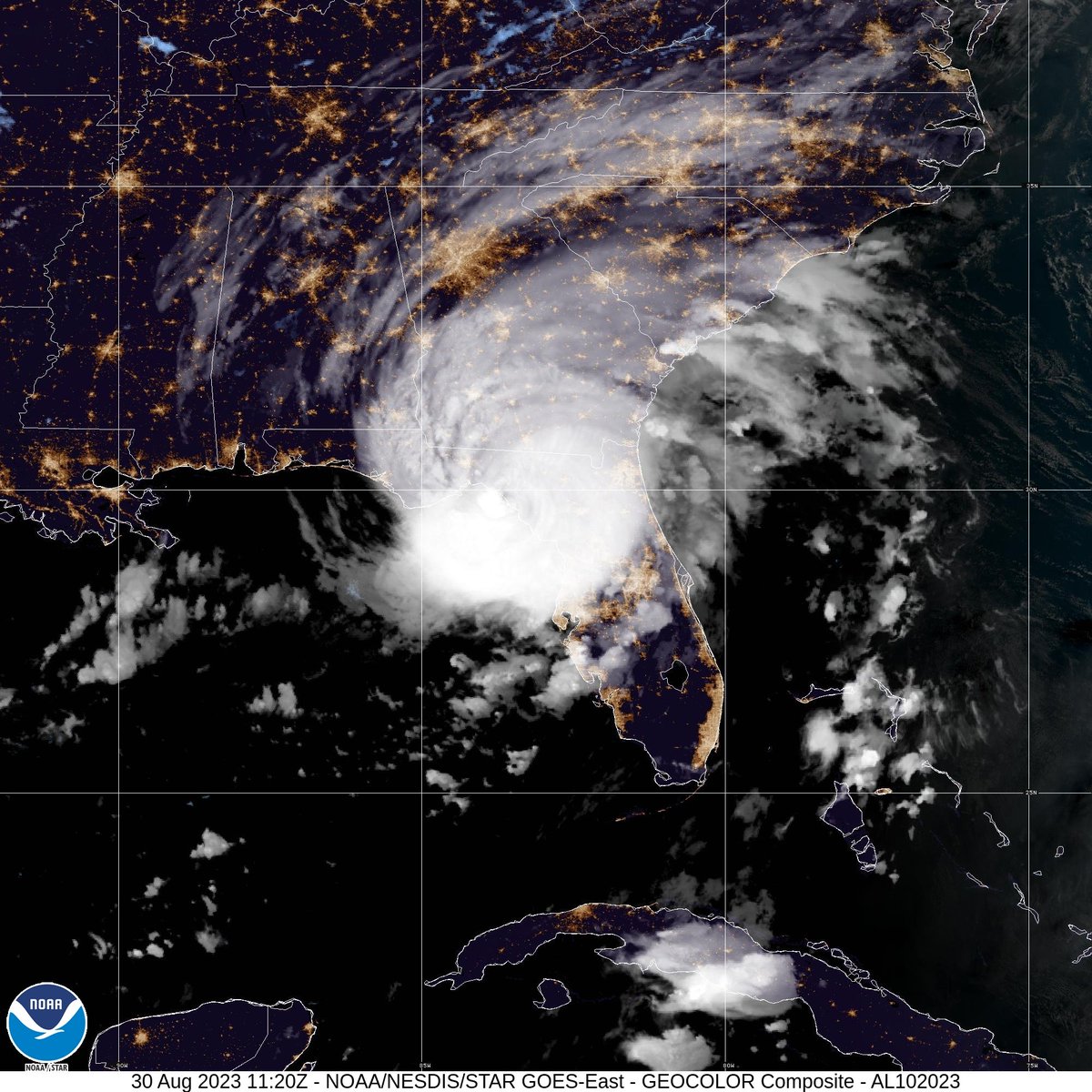
7:45 AM EDT update: Extremely dangerous Category 3 Hurricane #Idalia makes landfall in the Florida Big Bend. Maximum sustained winds were estimated to be 125 mph. Catastrophic storm surge and damaging winds ongoing.
Despite a slow start to the typical tropical wave activity in the Caribbean this summer, there are signs of a strong tropical wave exiting Africa later today and approaching the East Caribbean mid to late next week. We'll need to watch this one closely!
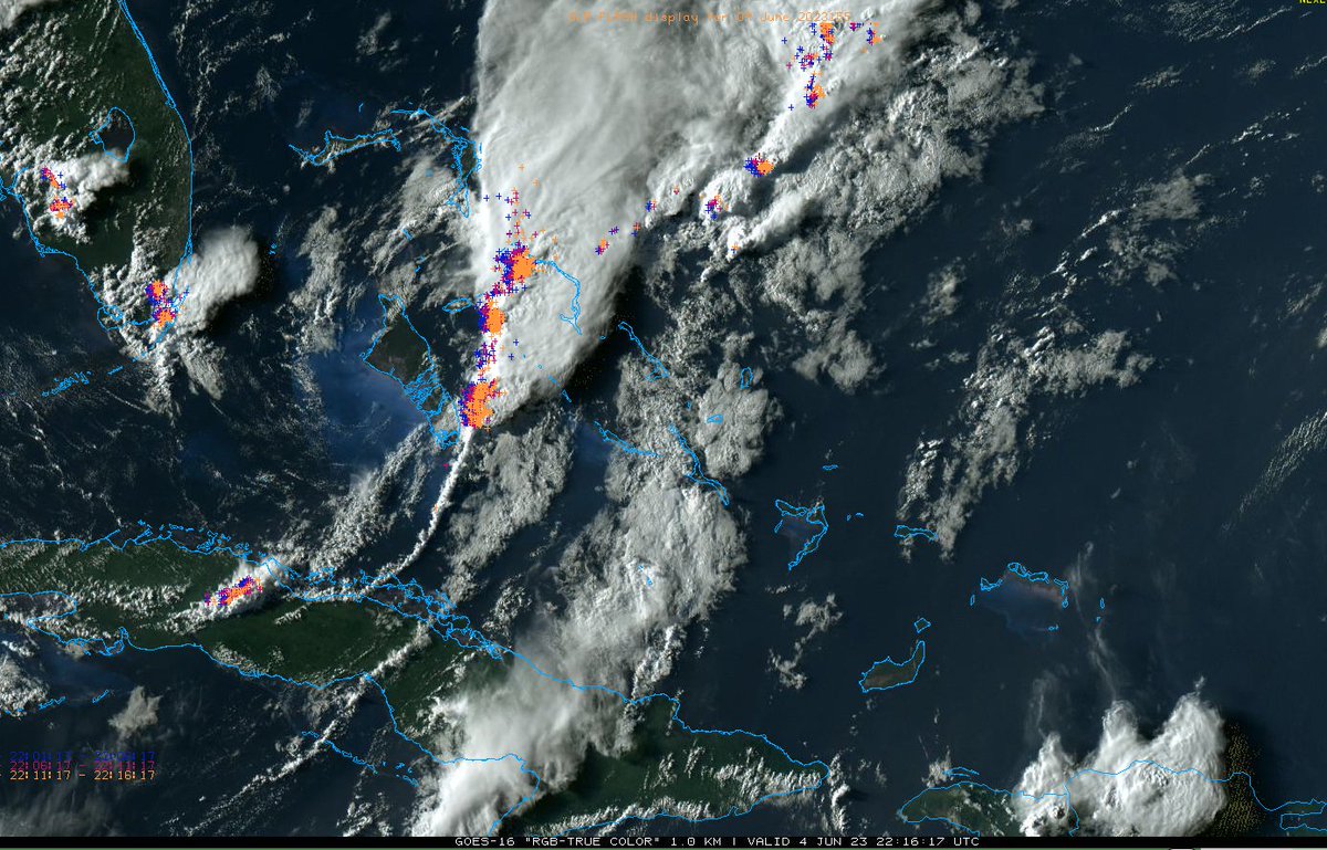
Strong to severe thunderstorms are moving east across the Central Bahamas this evening. We hope everyone is staying safe! If you have reports or pictures, please share!
Image Source: College of Dupage
SSB / Webcast schedule:
A reminder to subscribers of SSB/Webcasts that the schedule has changed due to the arrival of Daylight Savings Time in the US. The attached image contains the start times, channels and beam direction/area for the summer schedule of SSB/Webcasts.
An apparent MCV has formed this morning about 100mi ESE of Canaveral. An MCV (Mesoscale Convective Vortex) is a small low pressure center associated with a cluster of squalls/thunderstorms that pulls wind into a circular pattern.
This MCV will continue to drift slowly ESE today.
A reminder that Marine Weather Center will be presenting at TrawlerFest 2023 in Stuart, FL, next week!
Chris Parker will host presentations on Tuesday, February 28, and Wednesday, March 1.
See the website or FB Events for more info!
https://t.co/VZ5CmG2z97
We'd love to see your weather photos! Send them to [email protected] for a chance to have your photo reposted! We love all types of weather photos and you might even learn something about the phenomenon you captured. Below is the Marine Layer in San Francisco Bay, by Shawn Rosenthal
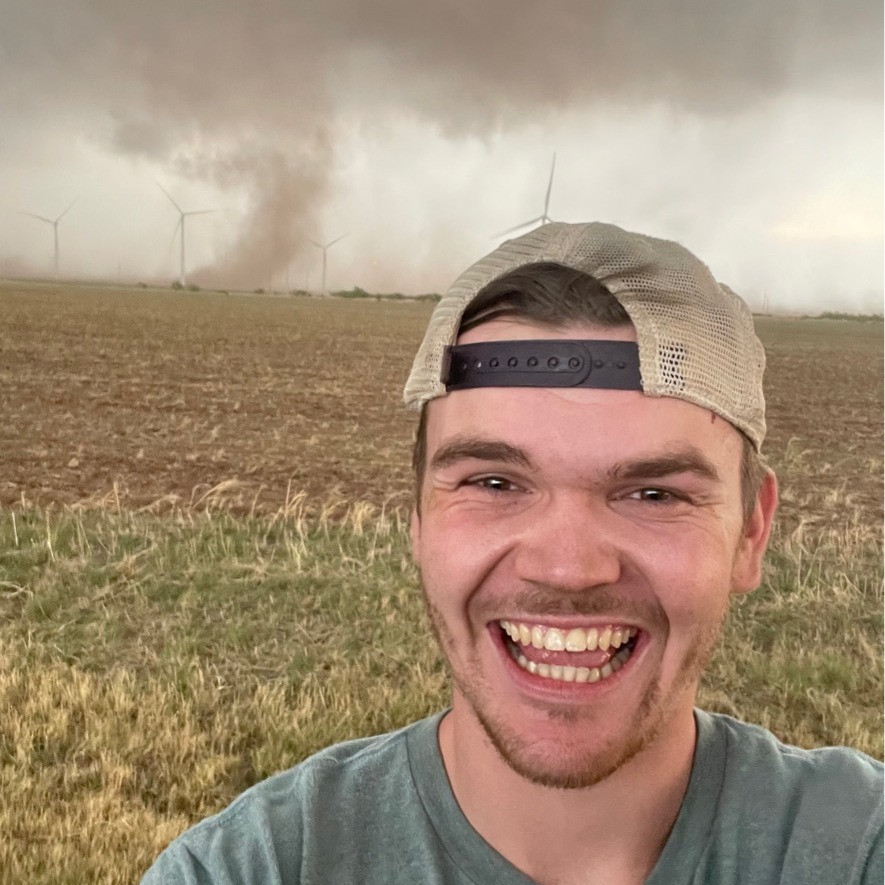
from winter storms to hurricanes. He’s always had a passion for weather but Hurricane Irma encouraged Matthew to pursue a career in forecasting. He’s been actively growing in various aspects of forecasting, most recently storm chasing across the plains to learn about supercells!
The next meteorologist to introduce is Matthew Bostrom.
Matthew is the newest addition to the team. He graduated from Mississippi State University with a B.S. in Meteorology. Originally from Michigan and now living in Florida, Matthew grew up experiencing all sorts of weather...
intense and exciting weather (130mph wind!) Her love of meteorology stems from a wide range of seasons in MA and learning to sail a small daysailer that has been in her family for over 50 years. She loves gardening & working at a farm stand & always enjoys a summer thunderstorm.
The next member of our team is Laura Kee!
Laura joined MWXC in March 2022. After graduating with a B.S in Atmospheric Science from Cornell University in 2019, she interned at the "Home of the World's Worst Weather" on the Mt. Washington Observatory in NH where she experienced...
including a sailing trip from New England to the Chesapeake and a storm chase in the Great Plains. Shawn has always had a keen interest in severe weather, especially winter storms and tropical cyclones, but never complains about a sunny 70 degree day.
The next member of our team is Shawn Rosenthal!
Shawn joined MWXC during the summer of 2018. He graduated with a B.S. in Meteorology from Virginia Tech, where he excelled in forecasting. He has a variety of meteorological and marine experiences...
This includes presentations by Chris Parker.
Chris will be presenting on Tuesday, February 28, from 1:00pm-3:00pm and again on Wednesday, March 1, from 9:00am-11:00am.
Topics are wide-ranging from basics like wind flags to forecasting "secrets" garnered from years of experience.
Have you signed up for 2023 Trawlerfest in Stuart, FL?
Trawlerfest starts in one month with a boat show, many great seminars, social activities and more.
Stormy sailed from Norfolk to the Virgin Islands over two weeks during the fall of 2015. While Stormy prefers tropical weather, he has been storm chasing in the Great Plains and came face-to-face with a historic tornado in Simla, Colorado in 2015!
The next member of our team is Chris "Stormy" Stickle!
Stormy joined the operation during the fall of 2015. He graduated from Virginia Tech in the spring of 2015 with a B.S. in Meteorology and also holds a B.A. in Geography from Old Dominion University.