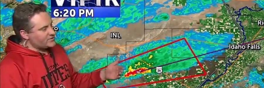
Warning until 4:30PM:L Severe thunderstorms were located along a line extending from near Northwest Inl to near Southeast Inl to near Taber, moving northeast at 20 mph.
Ping pong ball size hail and 60 mph wind gusts.
12/1/25: A round of light snow is moving into the region tonight and will continue into Tuesday evening, marking the start of a wintry stretch of weather. The heaviest snowfall is expected across the Island Park and the Snake Highlands. https://t.co/DRVUhvyDU1
11/5/25: A cold front arrives late Wednesday with spotty rain and mountain snow. Another front arrives late Thursday, with another shot at wet weather with gusty winds. https://t.co/KECVE4uC5T
10/23/25: We're still on track to see the winds crank up Saturday afternoon with scattered rain and snow on the way for Sunday. https://t.co/pjjbbAlSoF
10/20/25: After a windy Sunday, we have a chilly start to the workweek. We'll see a marginal warming trend this week thanks to high pressure. https://t.co/zKblie7aMB