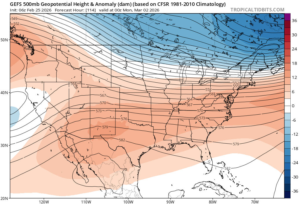
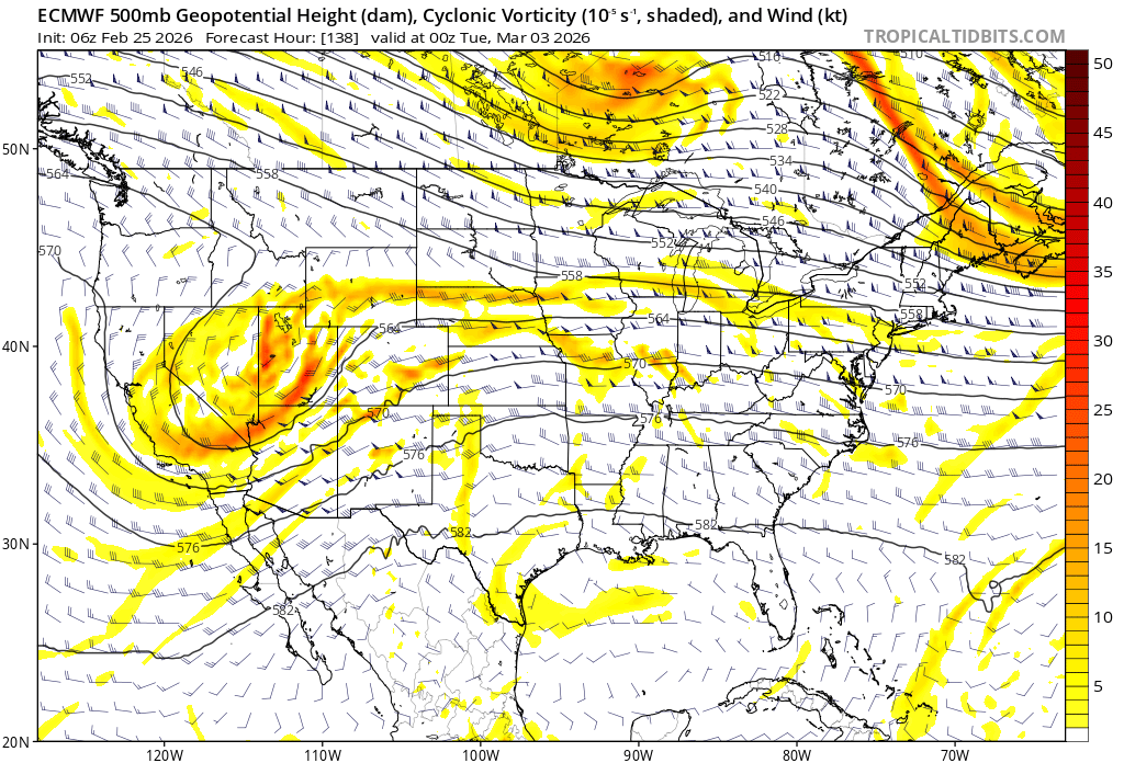
Let's see how this is looking in a day or two. These waves can be tricky to forecast, particularly in the medium range as they ride along a relatively zonal flow. Once in mesoscale guidance range, the picture should become clearer, if not a bit before that.
For early next week, we have a wave(s) ejecting out of the SW, traversing the CONUS, running into strong CAD courtesy of a strong HP to the N. ? is, can it/they hold together enough? (& possibly interact w/a northern stream disturbance?) I'm a bit skeptical, but it's intriguing
Each event is a learning opportunity & this historic one will be no exception. Thank you to all who follow me, I appreciate the support! After a light snow event tomorrow & a low-confidence, possible light event Thurs/Fri, eyes turn to next week to see what it may have in store.
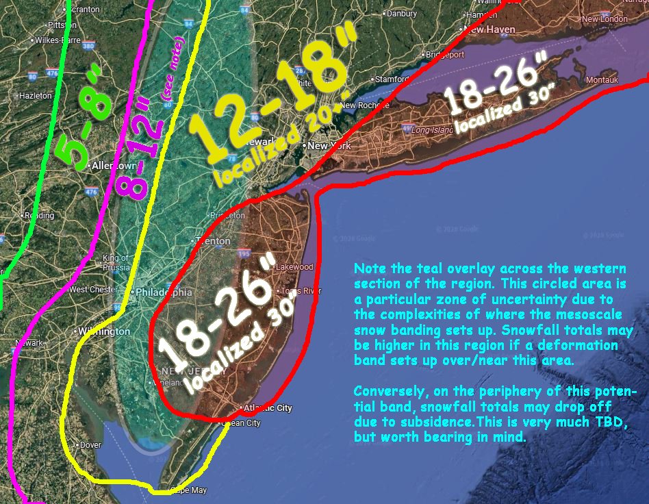
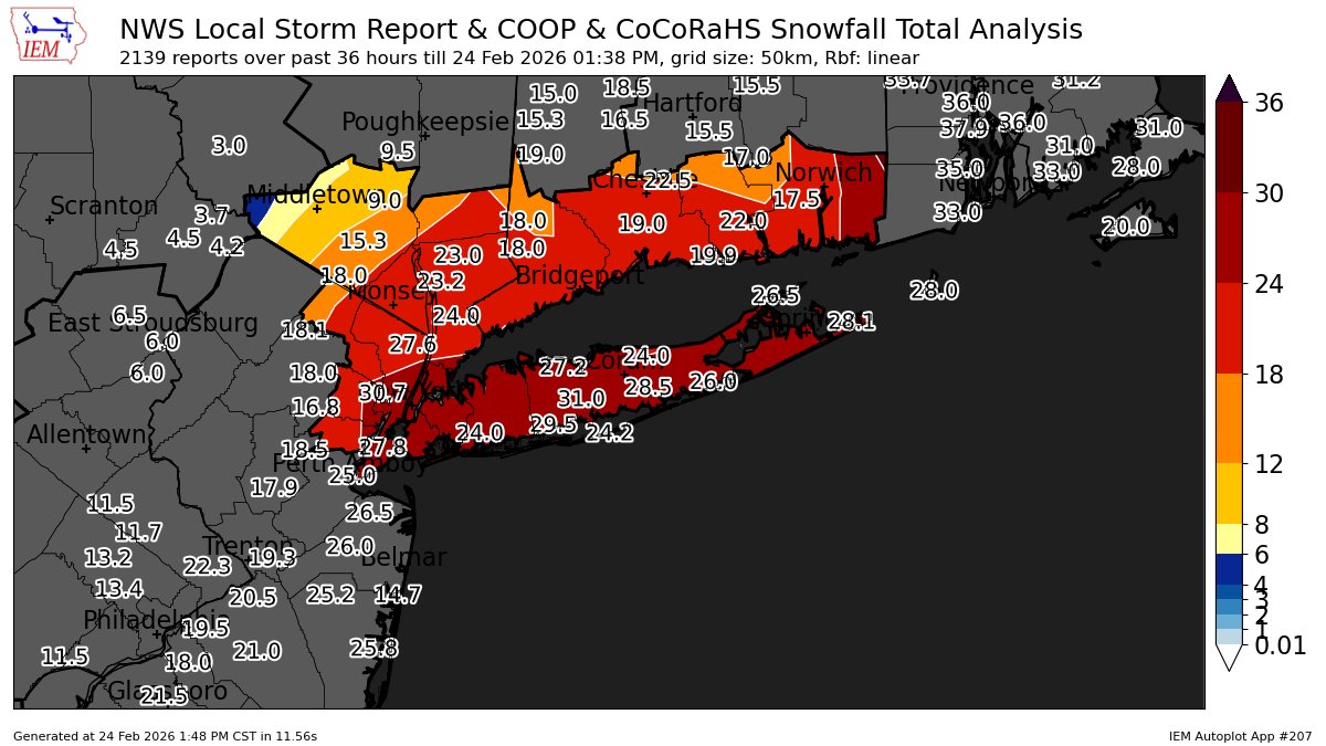
In the end, the extreme totals worked out well across ENJ/LI/SECT. Issue was, the zone wasn't expansive enough south into DE/MD or N into C&NENJ/NYC/SNY/SWCT. The steep gradient idea was correct, but was still a bit too far W w/the cutoff. The contour bend idea in SEPA was decent
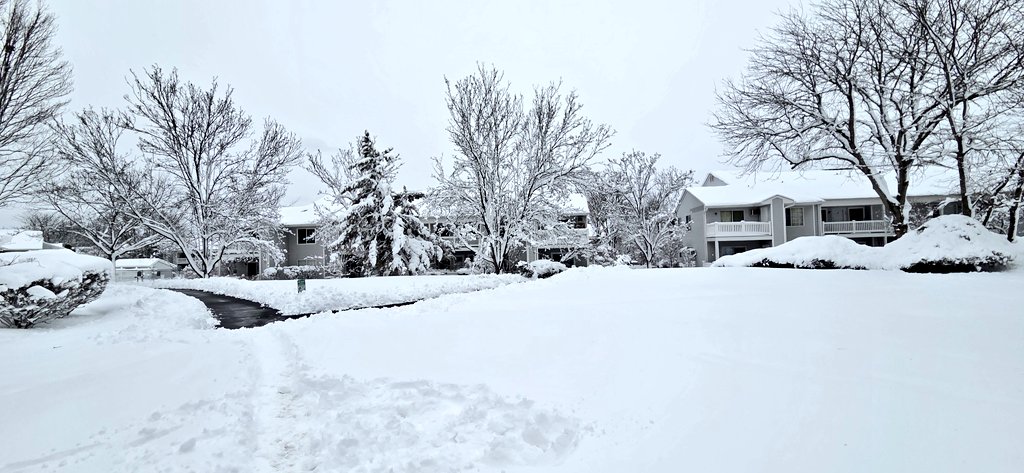
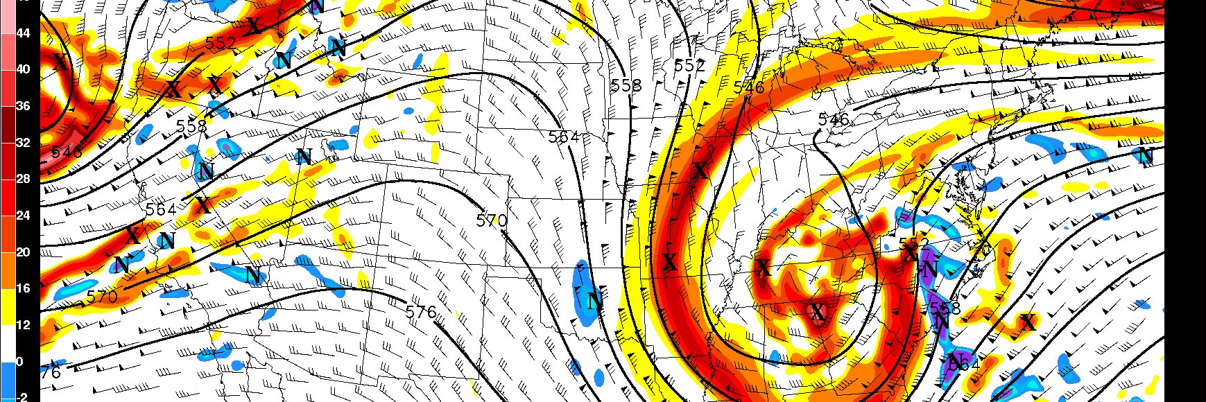
This storm is still ripping over the eastern half of the area, but early interpolated reports would lead me to believe this map will have fallen short of my expectations, a C+ perhaps😑-Too low in DE, too high in NW NJ & not extending the max & 12-18 zone further N & to the SW.
All in all, I'd give it a C+; Maybe a B-. My main disappointment was failing to miss the extent of the obvious deform N/S band that was inevitable to develop, which should have guided that longitudinal maxima more accurately. That was a fundamental human error, not a model one.
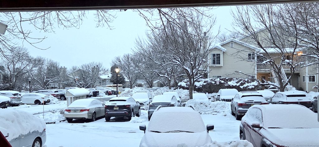
Tomorrow morning will feature a light snowfall across the region. Considering that this will be occurring during the morning rush & temps will be quite cold at the onset, it's worth mentioning to use caution & plan accordingly in case you need extra time. #njwx#nycwx#nywx#pawx
There is bust potential for the city to exceed the 20" mark should a deformation band pivot on top of the metro and become quasi-stationary. But too soon to tell in that regard.
@WxRiskGrains It's really just the first part I'm touching on. I'm not looking at any of the fine details like snowfall output, or even weighting QPF too much for that matter in the medium range. Just noting it had the general phased system idea and held onto it moving up in time.
Rare medium-range performance win from the GFS, outperforming the ECMWF, its classic comparator.
Wise forecasters of course don't play this age-old game; Using NWP for its strengths & weaknesses requires nuance. Nevertheless, for the wx nerds, this was quite the aberration!
The GFS doesn't often win many prizes, but in terms of catching onto the synoptics, it has done an admirable job here. I suspect this is partially due to its propensity to be more progressive w/northern stream branches than its counterparts, which are still catching up IMO.
This storm is still ripping over the eastern half of the area, but early interpolated reports would lead me to believe this map will have fallen short of my expectations, a C+ perhaps😑-Too low in DE, too high in NW NJ & not extending the max & 12-18 zone further N & to the SW.
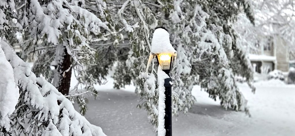
❄️Blizzard of 2026 Final Snowfall Forecast❄️- Scattered to widespread power outages possible. Coastal flooding, dangerous travel conditions expected. Please be safe out there, folks! #njwx#pawx#nywx#nycwx#ctwx
@RKarHol Yeahhhh, for NNJ it was like Deja Vu! Though all of central and SNJ cashed in big this time vs in BDB where they were also shortchanged to the west.
Where are you situated?