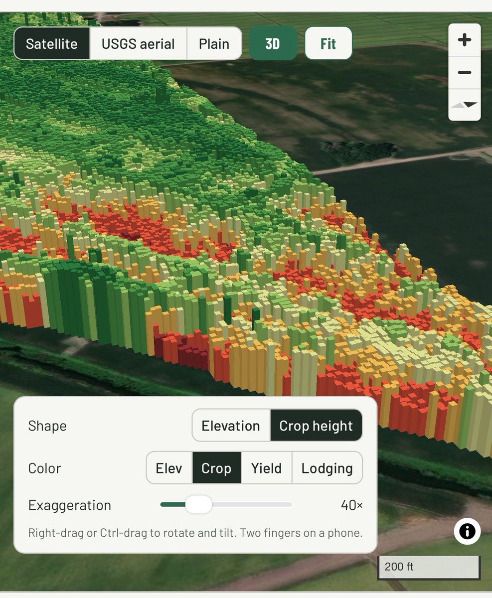
Using the dual 3D cameras from the @JohnDeere S7/X9 Combines you can use that crop height data to create high-res yield maps. That 40foot swath can now be 1 foot resolution! 🤯
Getting that grain loss data is great too.
@traviss22 I don’t think anyone knows the significance of taking yield data point from 40’ down to 1’ resolution. Super impressive! I could see the sprayer tracks in the yield data now!
Wild to be able to visualize the X9/S7 Harvest Automation 3D camera dataset. I can visualize lodged/down crop (rice) and overlay yield data or fuel data.
Late-night planter adjustments from 3 hours away. Monitoring planter performance, I noticed the planting rate wasn’t changing quickly enough on the VR zones & made an Rx look-ahead adjustment. Tractor pulls into the field, & the AB line, Rx, variety, are auto-populated.
AgriCapture’s carbon program continues to deliver for farmers🌾
Our latest 14,000-credit sale shows growing demand for verified carbon credits and proves regenerative agriculture creates real financial value.
Read more➡️ https://t.co/qDRcCCfPeZ
Finally we have Remote Display Control! Saves time by allowing us to work on displays remotely during troubleshooting or task setup while operator can continue to operate machine or, if parked, they can be doing other things out of cab. More uptime=more productivity! @JohnDeere
@lukemacfadden Yes but it’s a coverage map & not a true as-applied rate map(at least the controllers the last couple years could only do that). As Richard said, you export from Chem-man or other software as a shapefile. After that, there is a fair amount of editing with ArcGIS & other software.
Six Years of Using Drones for Collecting Elevation in Agriculture!!!
A lot of hard lessons learned but one thing is for sure:
Drone Technology is the most efficient, precise, and accurate tool in collecting elevation for irrigation, drainage, and land-forming purposes in Agriculture.
#Drones #precisionag @Wingtra @AgEagleUAVS @DJIEnterprise@DJIAgriculture
Another round of carbon credits for rice methane reduction issued for our farmers. Not only are they the only company in the world to have done this once, but they have done it twice!
We’re proud to announce our third carbon credit issuance from the largest rice methane project in the U.S.!
🥇 First 2024 vintage agricultural carbon credits to hit the market
🌾 926 fields across 5 states
💧 21 billion gallons of water saved
🌍 Over 70,000 tonnes issued to date
✅ Credits verified under the Climate Action Reserve’s SEP protocol
When the economics work, farmers respond. AgriCapture is scaling a fast, credible system that rewards producers for cutting emissions and conserving water—now expanding from the U.S. to Brazil.
Read the announcement here: https://t.co/dhBNxax2Mw
I am fortunate to work with progressive farmers with open minds that are putting data to work on their farms. I am also thankful for productive lunch meetings…..and BBQ. @AgriCaptureInc@PumpTrakr
Been working on this year's new corn maze design for a farm. Thought I'd share what it looked like during last year's planting process. We converted the planting Rx into a field boundary and used section control to not plant the walking paths. 🌽 🎃
We plant a half rate in one direction then plant a half rate in perpendicular direction to prevent seeing down the row and making the planted area more dense.