14,179 feet (4321.8 m) tall active stratovolcano in the Cascade range of northern California. 🗻☁️(they/them, she/her) Not-seacretly married to MarianaTrench0
Mount Shasta has some of the best drinking water in the state! We do not need a data center! Tell Siskiyou County to place a county wide moratorium or ban on data centers. Also contact your supervisor.
More @ https://t.co/eXavNZD98E
#nodatacenters#waterprotectors@IENearth
Check out Mount Shasta earlier today with her fresh coating of snow from the storms over the weekend. It’s going to be a pretty quiet week to finish October in Northern California. 🏔️
📸: Steve Huckabone
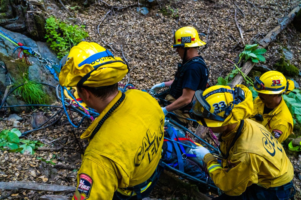
🚑 Ready to be a part of the team that saves lives on the frontlines?
CAL FIRE is now accepting applications for the Firefighter II (Paramedic) examination year-round! 🚨🚨
Bring your paramedic license to the frontlines—no firefighting experience required. CAL FIRE has updated its minimum qualifications, making this the perfect time to submit an application.
From medical calls to wildfire response, your skills can make a difference where it matters most.
➡ Apply today: https://t.co/O5i9vQDbh1
#CALFIRE #Paramedics #Firefighters #JoinCALFIRE #FireService
The Weed Police Department has issued the following EVACUATION Warning for Zones WED - 5420 SIS- 5310 WED -5408 in the WED 5411 AND WED 5414 area of WEED due to A STRUCTURE FIRE IN THE AREA.
https://t.co/XVQZGfkbr6 for more information!
My glaciers are small but immaculate, my cones are complex and varied, my lava is plenty thicc, you just can’t handle a volcano who knows how to party hard.
But sure, go after those super wide basaltic kings and queens! No shame in preferring (boring) consistency & frequency.
@MountShastaCA You’re unclean. Disgusting. Your cone is misshapen. Your fluid is the wrong thickness. Do not come into my mentions again with your nasty, malformed geometries. I find solace only in the soft, tender (possibly lethal) embrace of the supple shield and her seductive curves. 😤
Turn off your lights! Half a BILLION birds will be migrating southwards each night through late September, and shutting your lights between 11 p.m. and 6 p.m. can help with the migration! 🕊️
Too much light pollution can interfere with their navigation and foster collisions with structures or objects.
The birds take to the skies a few hours after dark and fly through the night. We can estimate how many of them by using WEATHER RADAR. Yes, really!
Radar “sees” whenever there is “stuff” in the sky. Usually, that’s precipitation. But in September, when large amounts of biomass (living objects) are present in the sky, signals get bounced back to the radar and plotted.
Researchers at Cornell have found a way to estimate the exact “flux” of birds, or how many birds are flying through a unit of area. At any given point, up to 500,000,000 may be in the air simultaneously over the eastern half of the country!
On radar, we can tell they’re birds because the objects have “low correlation,” meaning they are more spikey and jagged than precipitation particles like rain, hail or snow. And they move southwards each night — regardless of which way the wind is blowing.
Weather radars have also sensed other crazy things, like butterflies, ladybugs, spotted lantern flies, bats, meteors and even tornado debris.
Remember to shut your exterior lights!