⛈️ #Delhi, brace for a dramatic change in weather! Rain and thunderstorms accompanied by strong, gusty winds are on the cards. 🌧️💨 The possibility of hailstorms cannot be ruled out.
🌡️ Much-needed relief from the prevailing heat is finally in sight!
@SkymetWeather@JATINSKYMET
Delhi enjoyed a sharp drop in temperatures on Sep 28 due to clouds and light rain. Safdarjung recorded a maximum of 28.7°C—6°C below normal. But, dry weather is now set to return and temperature to rise to the capital. 🌦️➡️☀️ #DelhiWeather#DelhiRain@SkymetWeather@JATINSKYMET
The former Bay depression has finally dissipated after crossing 6 Indian states. Its remnant surface system now lies over Uttar Pradesh, with the upper-air circulation still persisting. However, the widespread heavy-rain phase is now coming to an end. @SkymetWeather@JATINSKYMET
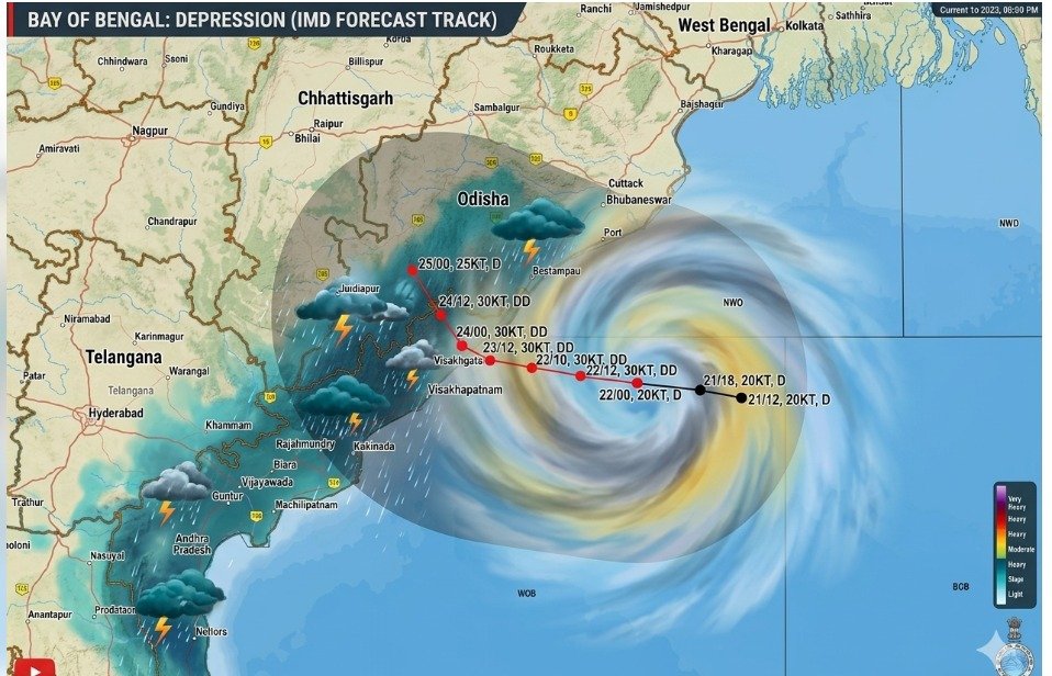
Visakhapatnam recorded a staggering 28 cm of rain in 24 hours during the deep-depression episode, Several other AP stations received 12–20 cm. The depression is now moving northwestward, and relief from intense rainfall is finally in sight. 🌧️ @SkymetWeather@JATINSKYMET
South Odisha & North Coastal Andhra Pradesh face a serious weather threat on 23–24 September. Extreme rainfall may trigger flash floods, waterlogging and landslides. Coastal and hilly districts must remain on high alert. #weatheralert#Heavyrain@SkymetWeather@JATINSKYMET
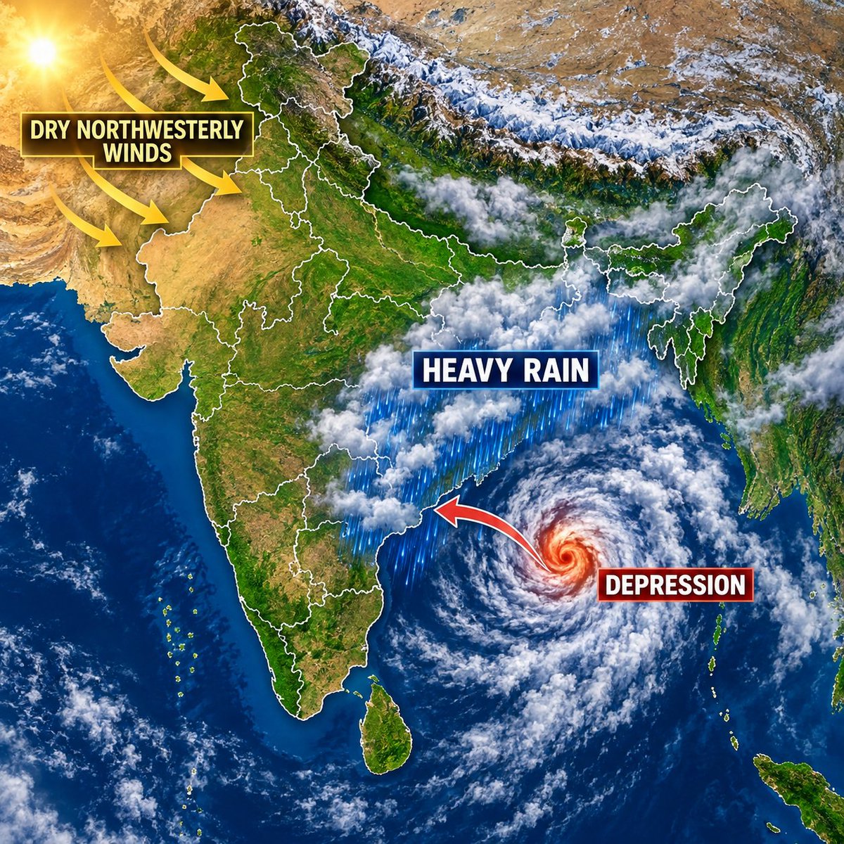
The depression over the Bay of Bengal may intensify into a DD and cross the North Andhra Pradesh–South Odisha coast on the evening/night of September 23. Winds may reach 60–70 kmph, accompanied by heavy rain, rough seas and a possible storm surge. @SkymetWeather@JATINSKYMET
The LPA over the BOB is becoming better organised and may intensify into a depression today. It is likely to move towards the North AP–South Odisha coast. Coastal areas should remain alert & closely monitor further updates. #WeatherUpdate#BayOfBengal@SkymetWeather@JATINSKYMET
Dry winds over NW india indicates the withdrawal of monsoon. Depression in BOB to move towards South Odisha and north AP coast by September 23rd. Take care. @SkymetWeather@JATINSKYMET
⚠️ Severe Weather Alert: South Odisha and North Coastal Andhra Pradesh face a significant threat on 23–24 September. Isolated extremely heavy rain may trigger flash flooding and severe waterlogging, while squally winds could disrupt normal life. @SkymetWeather@JATINSKYMET
June saw a 40% rainfall deficit, followed by a sharp recovery in July before the shortfall widened again in Aug & Sep. Why has the monsoon failed to sustain the July recovery?
Gargi Shetty speaks to Mahesh Palawat of Skymet Weather Services in Profit 360.
@Mpalawat#GargiShetty
India’s monsoon rainfall remains 15% below normal through 16 September. While Central India recorded a wet week, large deficits persist across the South Peninsula and East & Northeast India—highlighting a sharply uneven monsoon season. #Monsoon2026@SkymetWeather@JATINSKYMET
A circulation near Thailand may enter the North Andaman Sea today and develop into a low-pressure area by Saturday. South Odisha and North Andhra Pradesh should closely monitor its west-northwestward movement. 🌧️🌀 @SkymetWeather@JATINSKYMET
India’s monsoon withdrawal signal is getting stronger. West Rajasthan may begin drying out around 19 Sept, while Delhi is likely to turn largely dry from Friday setting the stage for the seasonal retreat. #MonsoonWithdrawal#RajasthanWeather@SkymetWeather@JATINSKYMET
Conditions may become favourable for monsoon withdrawal from parts of West Rajasthan around 19 Sep. Humid easterly winds are expected to give way to dry westerlies an important signal of the monsoon’s retreat. #MonsoonWithdrawal#RajasthanWeather@SkymetWeather@JATINSKYMET