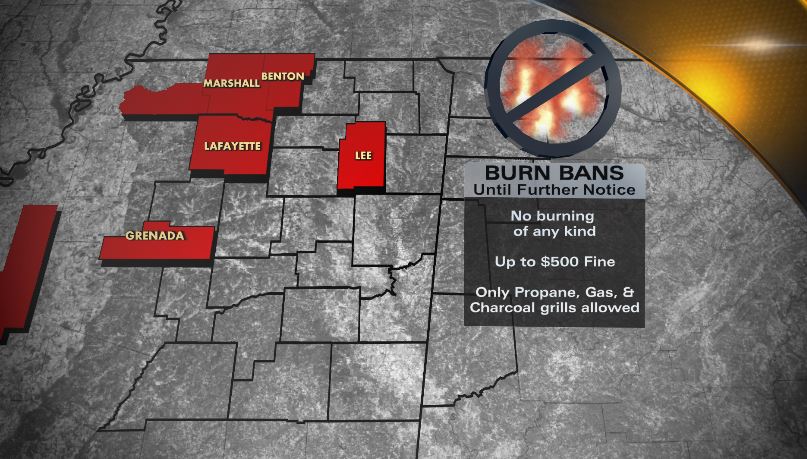
BURN BANS🔥: Benton, Lee, Marshall, and Tate counties join Lafayette, Grenada, and Sunflower counties in a burn ban. Burning of any kind is prohibited during the ban which includes campfires, fireworks, burn barrels, debris burning and more. https://t.co/pXwspiaLTo
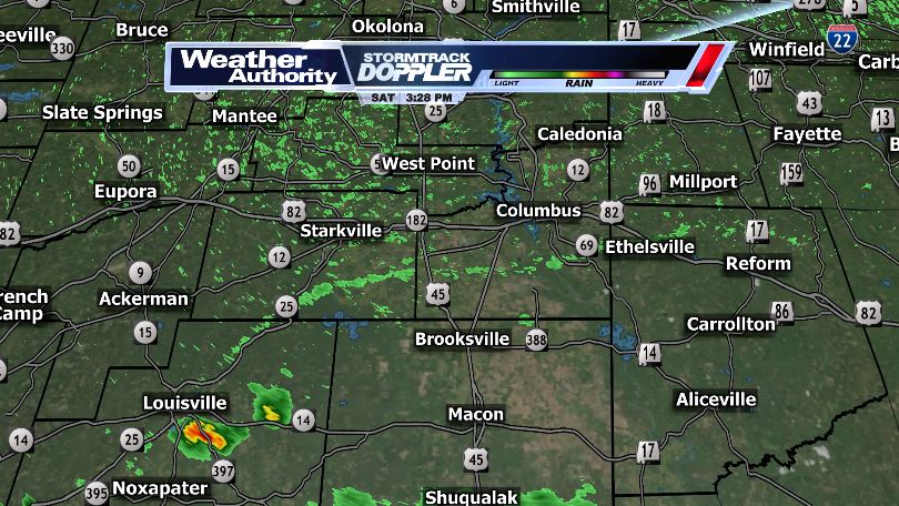
Some rain is on the way! While it looks to be more scattered than widespread, we will take it. Best chances come Friday afternoon and Saturday afternoon.
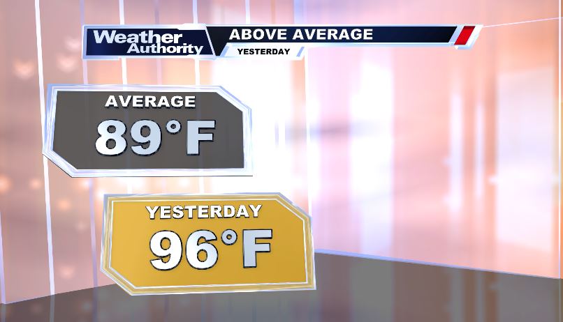
We are off to our second hottest start to September on record! Temperatures have consistently been 8-11 degrees above average and won't dip down anytime soon. Our hottest start for September came back in 1990 where temperatures were above 100 for 5 straight days!
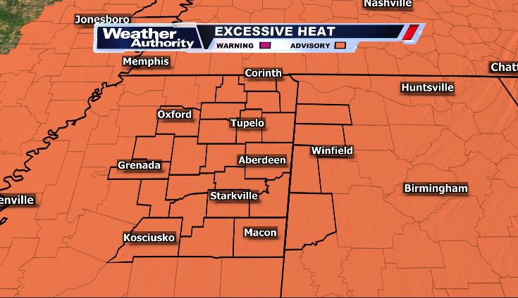
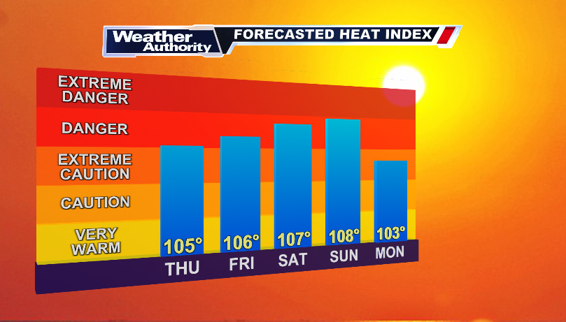
That heat just won't go away. Heat advisories are in place for Lafayette & Yalobusha counties this afternoon. Heat Indexes will be above 100 for many of us so drink plenty of water, take frequent breaks if you're working outside, and stay cool!
WTVA ALERT: A Severe Thunderstorm Warning is in effect. Damaging wind and large hail are possible.
More info on our website and in the @WTVAweather App. #mswx
New severe thunderstorm warning for Marion and Lamar counties until 3 PM. Some weak signs that there could be a microburst in this storm, so gusty winds are very likely.
WTVA ALERT: A Severe Thunderstorm Warning is in effect. Damaging wind and large hail are possible.
More info on our website and in the @WTVAweather App. #mswx
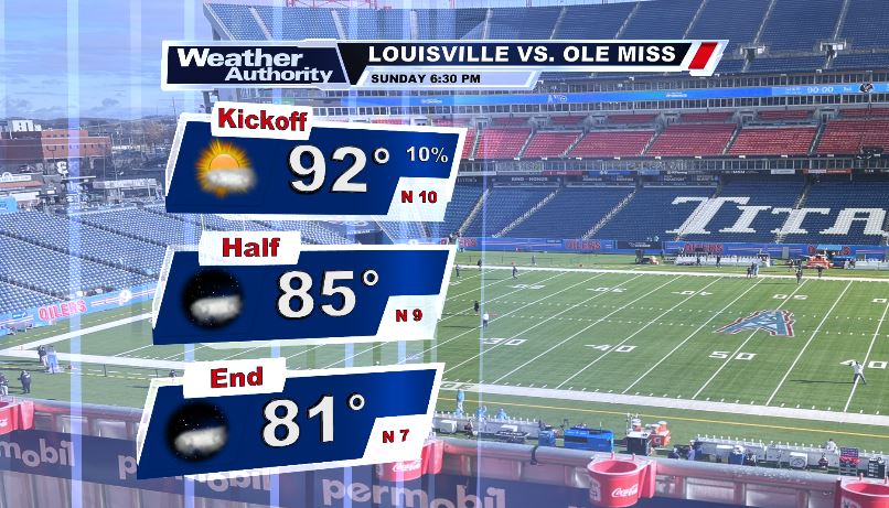
Labor Day Weekend Sunday will be very hot with highs in the lowm100's. We are tracking a severe weather risk in the mid afternoon and evening hours with damaging winds being the main threat. Rebel fans, it will be sunny but very hot in Nashville.
Heads up Bulldogs fans! An outflow boundary with strong winds (and potentially cooler temperatures) is moving towards Starkville. Things will be windy for a few minutes and we could see some thunderstorms begin to pop up! Still stay cool though!
As predicted, the latest drought monitor shows some significant changes across our area. Our drought will continue to get worse over the next 2 weeks with hot temperatures and little to no rainfall.
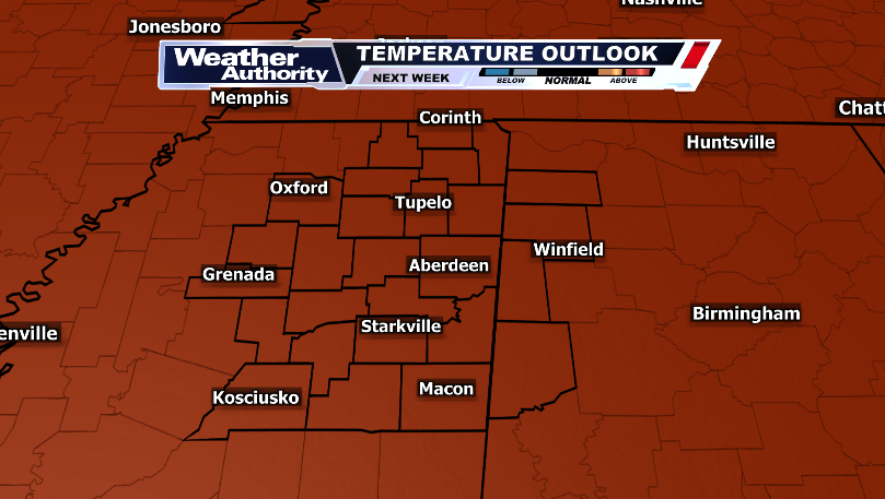
Another day, another round of heat advisories for our area. These will expire Saturday (at the moment),but temperatures stay well above average all of next week too.
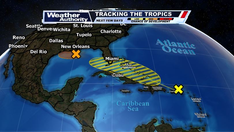
🌀SUNDAY TROPICS UPDATE🌀 The remnants of tropical storm Dolly will try to reform over the Greater Antilles. Another wave off the Louisiana coast now has a 50% chance of formation and could bring a ton of rain to Texas. These storms won't be a threat to Mississippi.
Good news for my fellow Nascar fans: most of the rain to the south is letting up and barring a few pop up storms (it's Florida ya never know), tonight's race should be good!
🌀TROPICS UPDATE🌀 We're monitoring two areas of possible development. The one just off of the Lesser Antilles has just a 10% chance of formation. The one off of the Mobile bay has a 20% chance and could bring some storms and rough surf to any beach goers.
WTVA ALERT: A Severe Thunderstorm Warning is in effect. Damaging wind and large hail are possible.
More info at https://t.co/3NgDpLxZoC and in the @WTVAweather App. #mswx