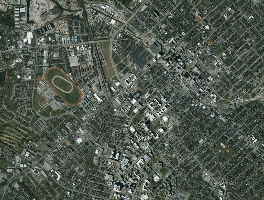
Formerly Quantum Spatial, we are the geospatial pioneer: Delivering data + analytics, providing geospatial insights to government and corporate organizations.
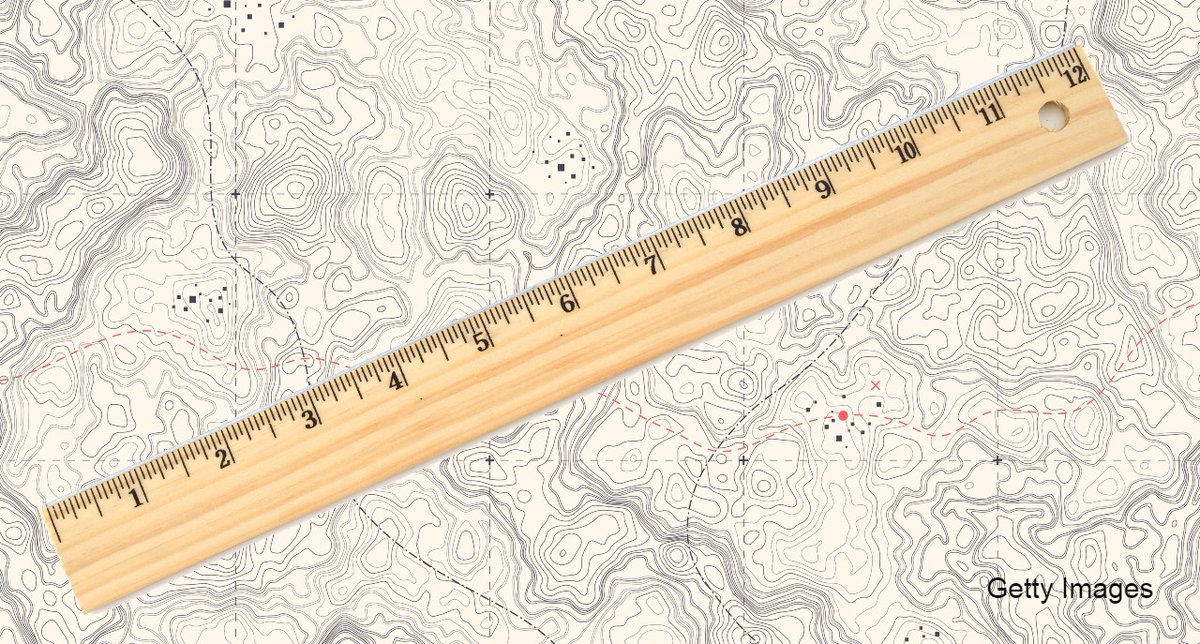
We're starting the new year off on "the right foot"!
On NYE, NOAA & @NIST will officially retire the use of 1 of 2 measuring feet.
The change will reduce surveying errors & increase accurate positioning for mapping & more.
Details: https://t.co/pxB73zyYzU
@noaaocean
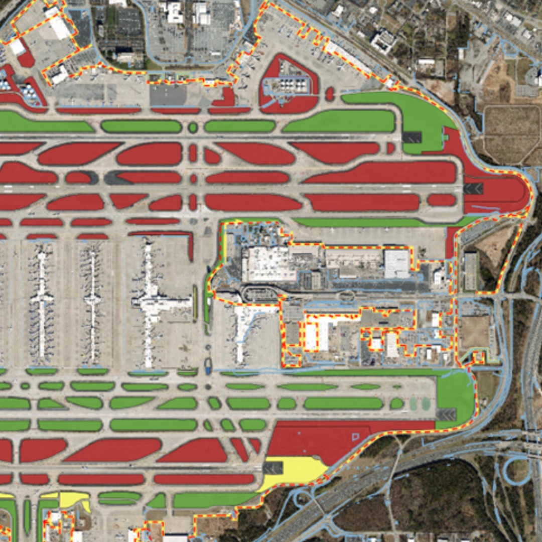
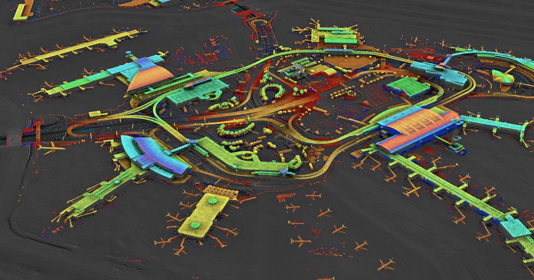
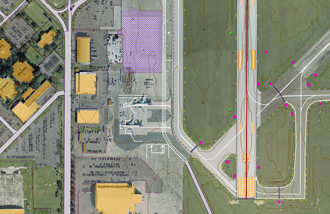
NV5 Geospatial's engineering-grade imagery and geospatial data allow Airport Planners to utilize high-quality information when creating ALPs, reporting to the FAA, and managing assets. Follow the link to learn more! https://t.co/o0YlL8HgFT #Airport#ALP#FAA#AssetManagement#GIS
GPS World recently featured Aviation Program Director David Grigg in a recent article discussing our turnkey airport solutions and how we support our airport clients. Follow the link to read the article!
https://t.co/Km1PFAC4dk
#Airport#GIS#ALP#FAA#Geospatial
Rapid Reporting provides quality data in as short as 2-3 weeks post acquisition! Get your year-end geospatial analysis, reduce risk, improve efficiency, and maximize reliability. To learn more, follow the link below.
https://t.co/jYJhlUfKSP
#Utilities#UtilityManagement#GIS
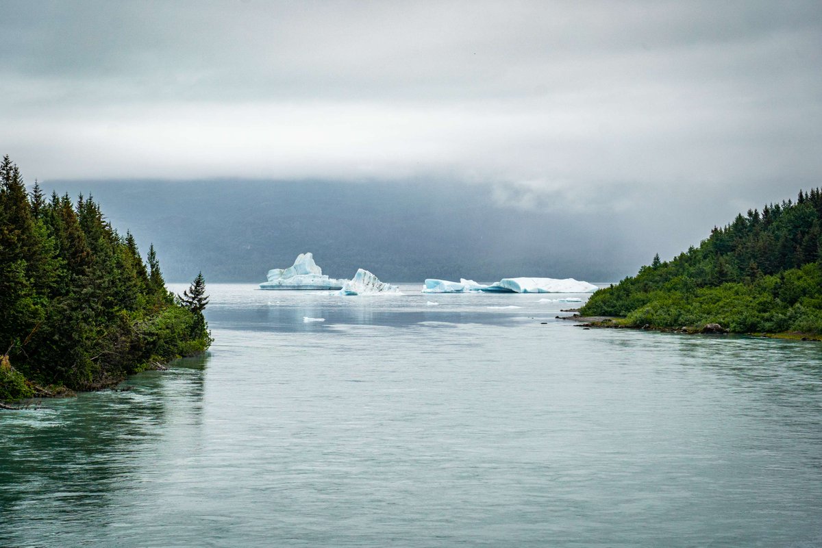
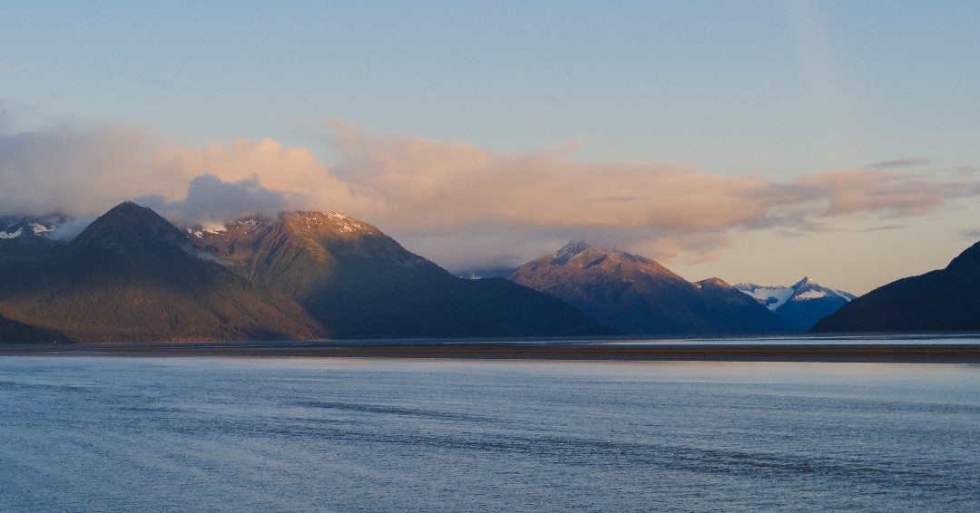
#FieldPhotoFriday Seward Highway, AK. This 127-mile bypass stretches from Seward to Anchorage and is triple designated as a USDA Forest Service Scenic Byway, Alaska Scenic Byway, and All-American Road.
📸: Josh Noble
#Alaska#SewardHighway#GIS#Geospatial
On this Veterans Day, NV5 Geospatial extends heartfelt gratitude to the brave men and women who have served and sacrificed for our country. Your courage, dedication, and selflessness inspire us every day.
#VeteransDay#USA#Veterans#GIS#Geospatial
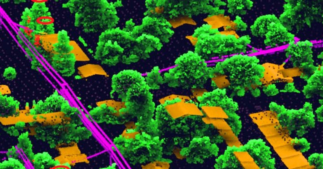
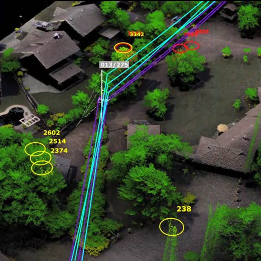
Trees got you down? NV5 Geospatial's Rapid Reporting provides quality, affordable vegetation management in an unmatched turnaround time. To learn more, follow the link!
https://t.co/KAYs0ybGHf
#VegetationManagement#Lidar#Power#Utility#Distribution#Data#GIS
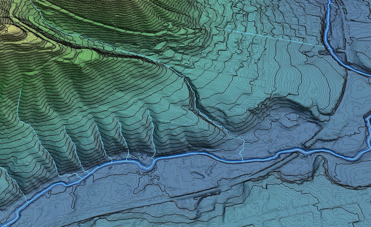
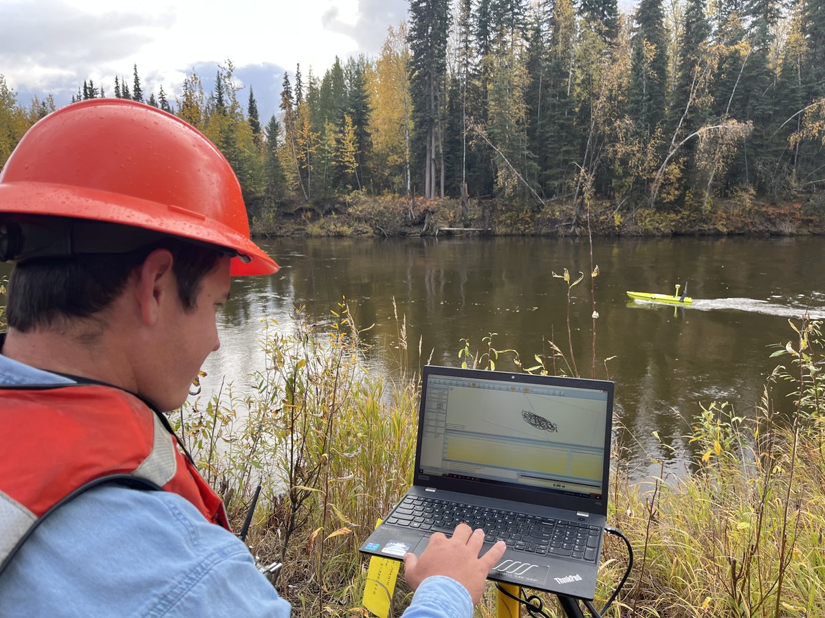
Elevation Derived Hydrography takes expertise and collaboration at all levels. NV5 Geospatial works side-by-side with you to balance your specific requirements with the USGS standards. Follow the link to learn more! https://t.co/VGiKxPjTt8 #EDH#USGS#GIS#Geospatial
Measure right. Measure once. An engineer-grade survey from NV5 Geospatial provides value from the outset of onshore renewables site evaluation that lasts over the lifetime of the project. Follow the link to learn more!
https://t.co/qFkvqhz76n #SitePlanning#OnshoreRenewables#GIS
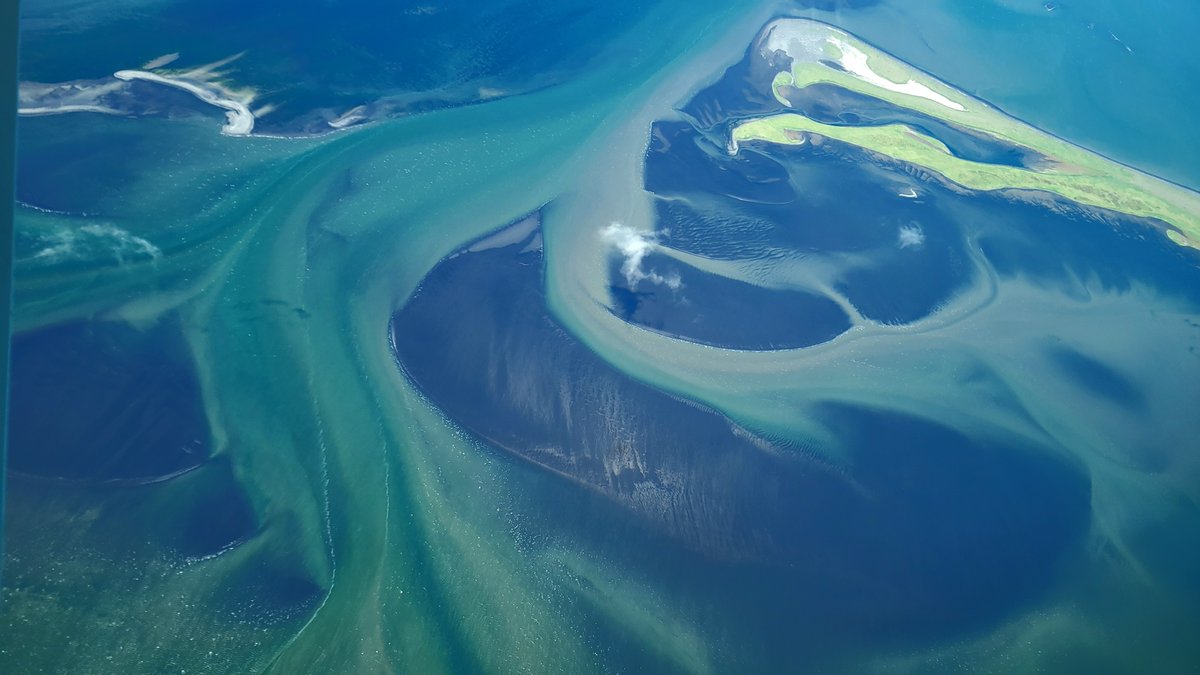
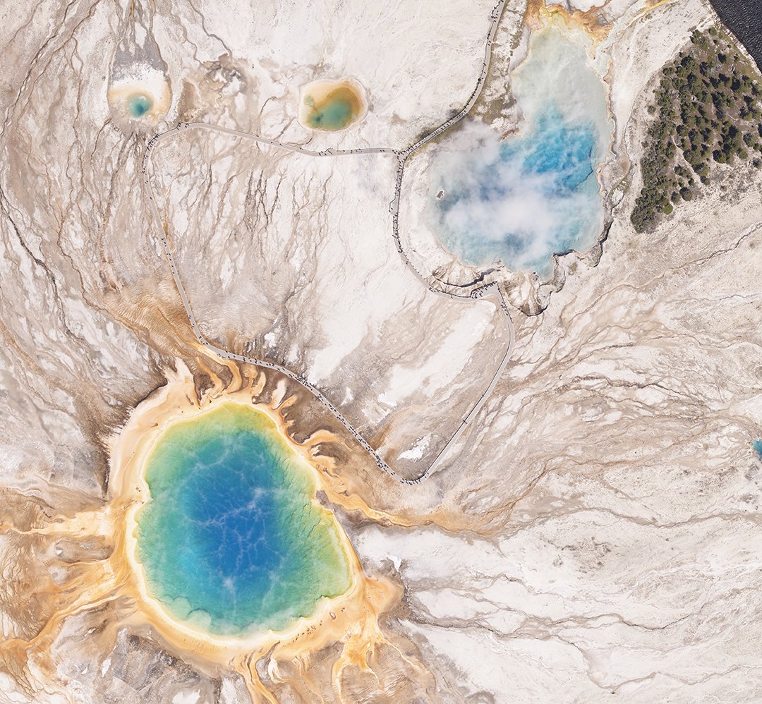
Data Dive: RGB Aerial Imagery of Grand Prismatic Spring and Excelsior Geyser Crater in Yellowstone National Park. If you look closely, you can see the visitors walking on the path!
📸: Christopher Haglund
#Yellowstone#ExcelsiorGeyser#AerialImagery#GIS
Our remote sensing and eGIS solutions help Airport Planners and A&E firms see airports from a new perspective through engineering-grade imagery and custom interfaces, easing asset management, creating ALPs, and so much more. Click the link for more! https://t.co/o0YlL8HgFT #GIS
Recently NV5G's Andrew Brenner, Phd was featured in GeoWeek News' article "How 3D Hydrography can set the rivers straight". NV5G's Elevation Derived Hydrography Program offers unique, nationwide capabilities and expertise for the development of EDH. Read-> https://t.co/6TiBHUA6FB
Happy National Kentucky Day! We are proud to work closely with the Commonwealth and are currently collecting statewide imagery. To learn more about the project, follow the link below.
https://t.co/UrIVU6hVmk
#Kentucky#NationalKentuckyDay#Imagery#RemoteSensing#GIS