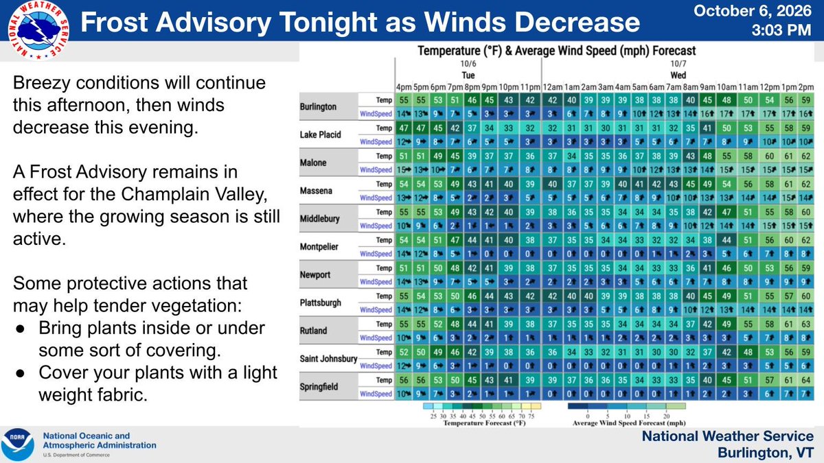
Breezy conditions will continue this afternoon, then winds decrease this evening. A Frost Advisory remains in effect for the Champlain Valley, where the growing season is still active. Bring sensitive plants inside or cover with light weight fabric.
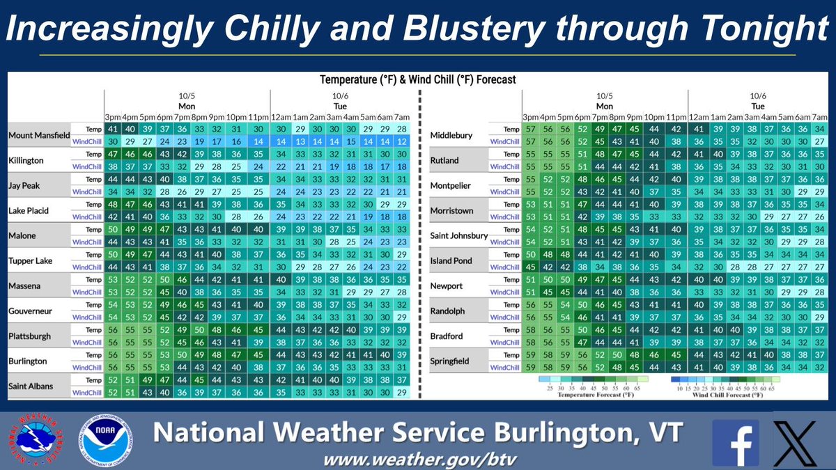
Brrr! Chillier dry air is filtering in on gusty winds. Wind chills are beginning to resemble early winter, especially in the mountains where observed wind chills in the Adirondack high peaks have fallen into the teens. Bundle up if you're spending time outdoors tonight.
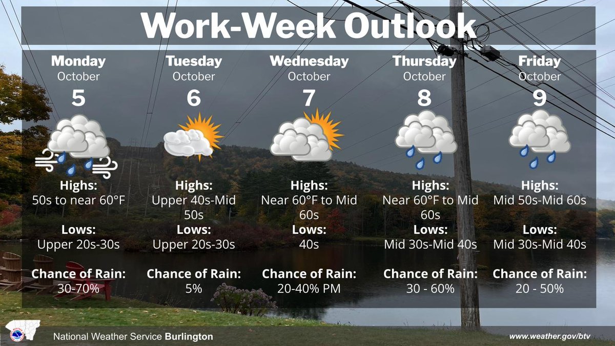
As of 4 AM, Oct 5th - A cold front is shifting east across the area. Brisk winds will develop behind it, with scattered showers possible today. After a stretch of quiet and cool conditions, daily rain chances exist with several weak weather systems passing through.
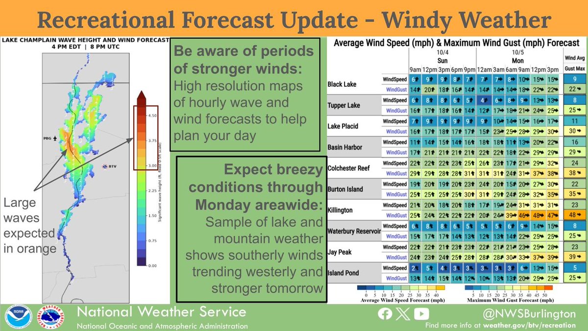
The next couple of days will become increasingly breezy which will impact recreational activities on area lakes and mountains. To plan ahead, visit https://t.co/oNO01CnPp7, where you'll also find a link to a new dashboard that provides a one-stop-shop for our forecasts.
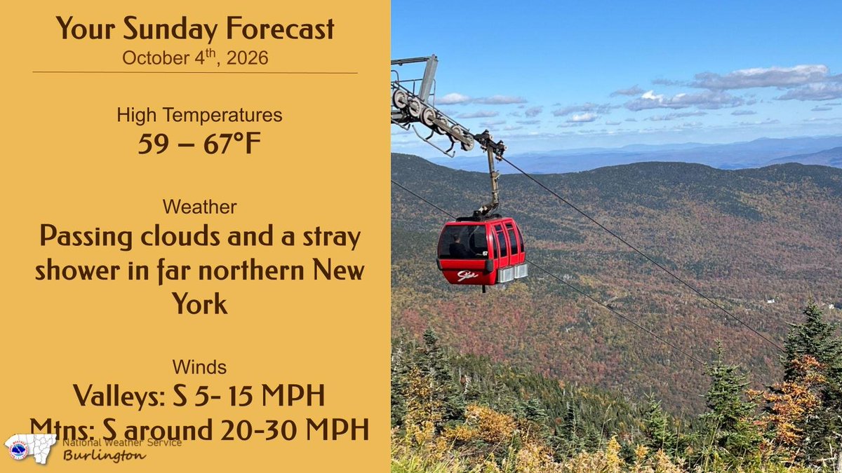
Temperatures near seasonal norms in the upper 50s to mid 60s are expected today. A stray rain shower is possible in far northern New York, but most areas will be dry with passing clouds. Winds will pick up today, and they will be brisk near Lake Champlain and over summits.
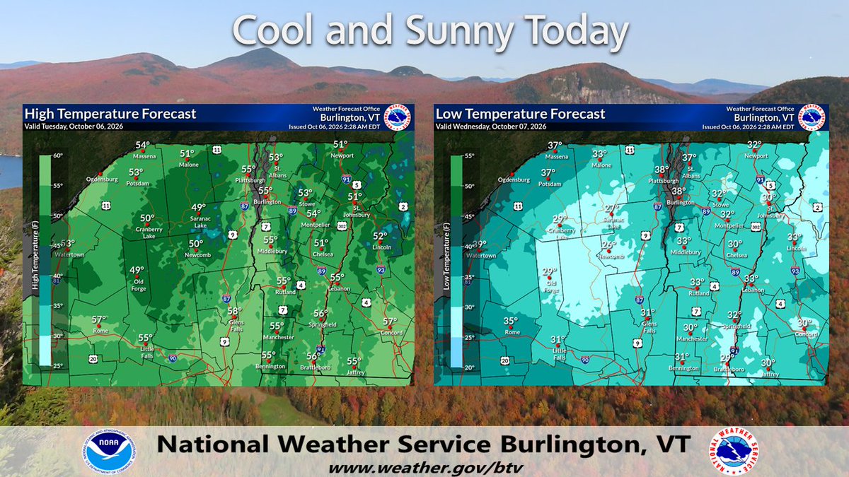
Clear skies and cool temperatures prevail across the region today, making for a pretty perfect fall day .
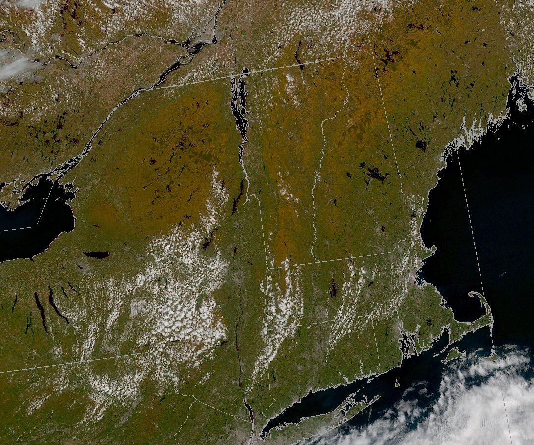
Looking at satellite, you can see the progression of the fall foliage 🍂 across the region, with many places in the mountains reaching peak this weekend.
It was quite a sunset over Lake Champlain this evening as showers departed and a mix of low and high altitude clouds remained to scatter the light. Hope you enjoyed this, but if you missed it, plenty of sunshine is coming over the weekend.
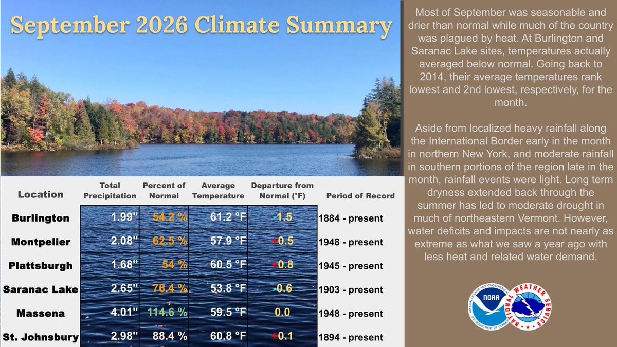
Based on the 1991-2020 temperature normals, Burlington and Saranac Lake were below average, but overall it was a seasonable month. So far in 2026, temperatures in Burlington were below normal 5 out of 9 months. With some exceptions, it was a drier than normal month in the region.
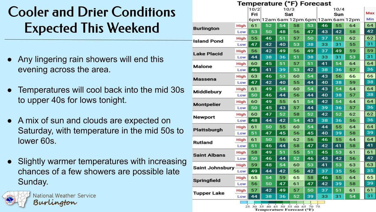
Lingering rain showers will end this evening across the area. Temps will cool back into the mid 30s to upper 40s for lows tonight. A mix of sun and clouds are expected on Sat, with temps in the mid 50s to lower 60s. Slightly warmer temps with increasing chances of showers late.
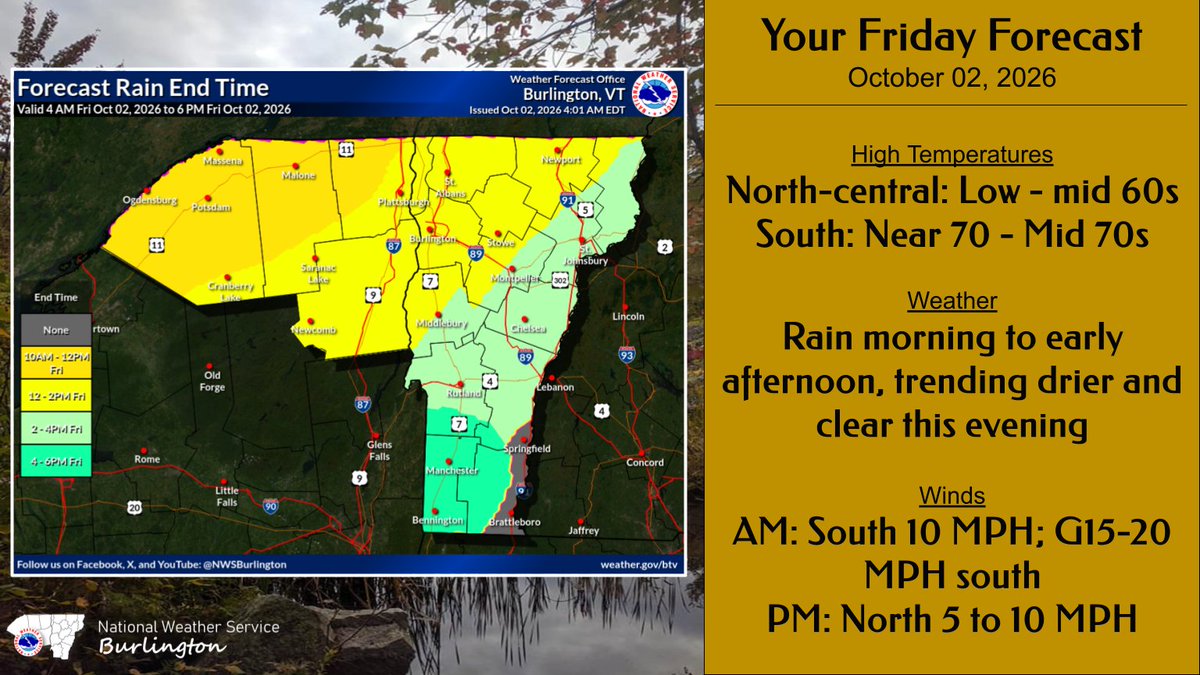
A cold front will sweep across the region this morning into the early afternoon. Light to locally moderate rain is expected. Showers will taper off by this afternoon, trending drier and clearer by this evening.
Looking back at this year so far, temperatures have averaged relatively close to the standard 1991-2020 climate normals here. However, looking at the long-term data back to 1895, it comes out a few degrees above normal/average.
A cold front will come through tomorrow morning so temperatures will gradually decrease during the day, except in far southern areas. It will also feel a bit humid early tomorrow morning, but that will go away quickly.
South channeled winds today will lead to locally gusty winds, between 20-30 MPH, in the Champlain and St. Lawrence Valleys, peaking this afternoon. Showers should hold off until after sunset for most locations. Winds will weaken with the onset of showers tonight.
When a Frost or Freeze is expected during the “Growing Season”, the NWS will issue a Frost Advisory or Freeze Warning.
As of today, the only location in VT and northern NY that is in the growing season is the Champlain Valley. #vtwx#nywx#frost#freeze
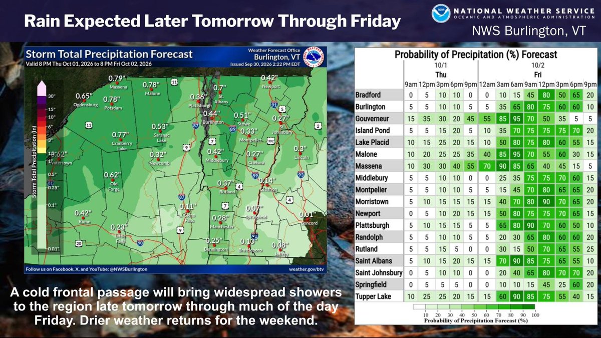
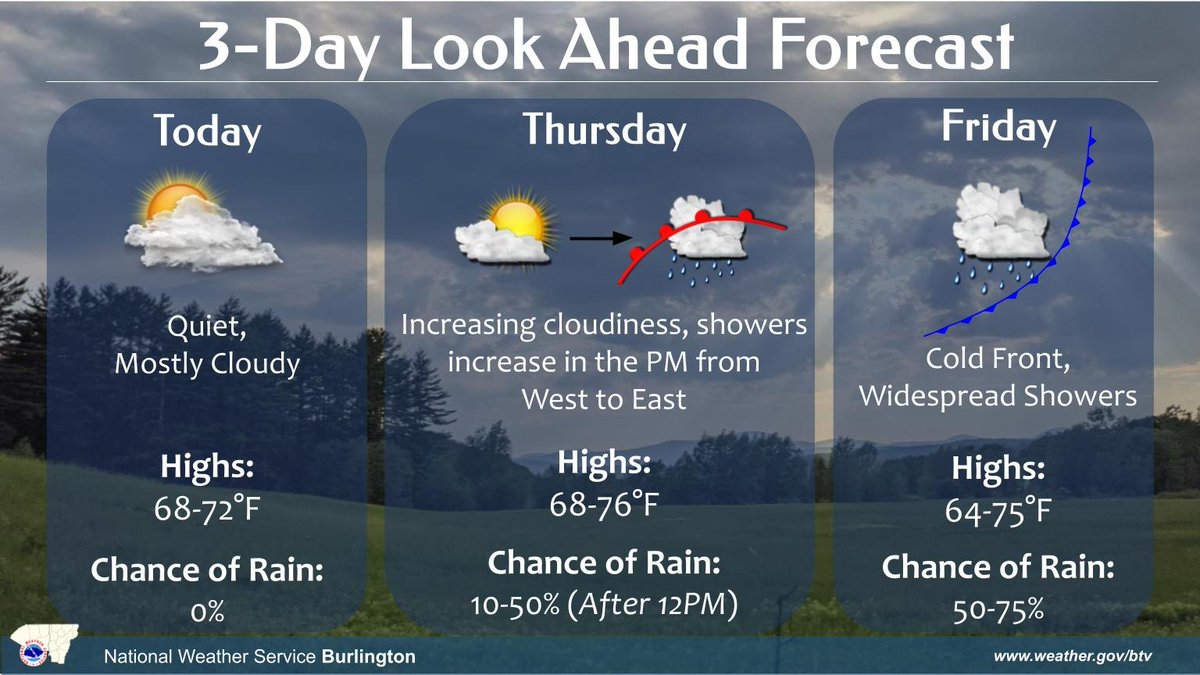
Shower chances will increase late tomorrow, continuing thru Fri as a cold front crosses the region. The rain will be light to moderate at times, with the highest rainfall amounts in the northern mountains. Showers taper to an end Fri eve, giving way to dry weather for the weekend
Low clouds will finally break today with calm and drying conditions. Temps will increase towards Friday into the 70s ahead of a frontal system that will bring showers Thursday afternoon to northern NY. Shower coverage increases Friday as a cold front passes through the region.
We're at the season when low cloud ceilings linger and reduce visibilities across higher elevations. Areas in yellow are the most likely to get socked in clouds, tonight. If traveling across the hills, you'll likely drive into clouds. Take it slow over roads in high terrain.