Potential for thunderstorms to move into portions of southeast Michigan Sunday night. Isolated storms will be capable of producing damaging winds and large hail, mainly south of I-96. In addition heavier rainfall may occur resulting in a localized flash flooding threat. #miwx
Scattered showers with a chance of non-severe thunderstorms this afternoon and early evening. An isolated storm will be capable of producing wind gusts to 45 mph. Drier and less humid conditions will briefly arrive tonight and Sunday, Rain chances return Sun night. #miwx
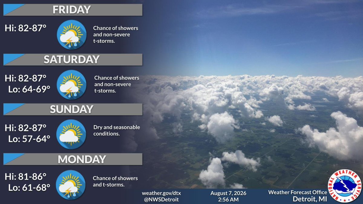
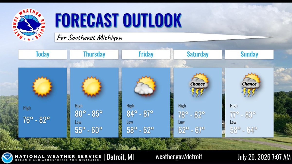
Typical summer conditions will exist today into the upcoming weekend. High temperatures will peak in the middle 80s. A chance of showers and non-severe thunderstorms both Friday and Saturday mainly during the afternoon and evening. #miwx
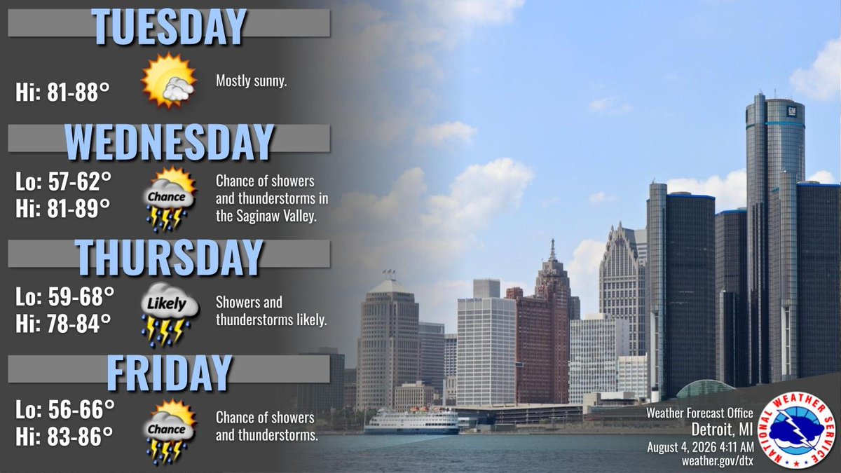
Another sunny and warm day today. The next chance for showers and thunderstorms arrives over the Saginaw Valley on Wednesday, then spreads across the rest of SE MI Wednesday night into Thursday. #miwx
Lots of sunshine and seasonable August temperatures to start the week. Chances for showers and thunderstorms increase by late Wednesday into Thursday. #miwx
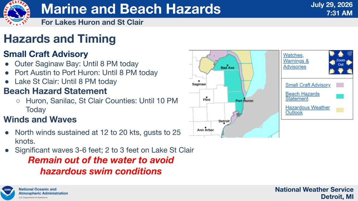
A Small Craft Advisory is in effect for all nearshore waters today. A Beach Hazards Statement is also in effect for Huron County - remain out of the water to avoid hazardous swim conditions. #miwx
A Flood Watch is in effect for parts of Southeast Michigan today including Metro Detroit, Ann Arbor, Adrian, Monroe, and Port Huron. A slow moving band of showers will bring heavy rain at times. Be alert for possible flooding, especially in urban areas. #miwx
@nuxi There is a comms issue at KARB & restoration time is unknown. For the closest observations, see Willow Run/Ypsilanti: https://t.co/jXSlCv4guG