Fog continues to expand in coverage as sunrise this Sunday approaches. The fog will burn off 8-10 am. But until then you may encounter areas of low visibilities across eastern North Dakota and northwest Minnesota. #NDwx#MNwx
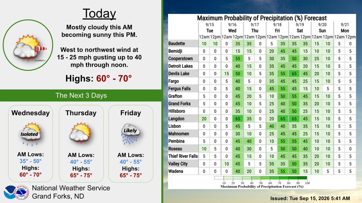
Outside of Wednesday night into early Thursday, a dry period ahead. Highs mostly in the 60s, until late week when temperatures begin to rise into the 70s. Light winds and clear sky Monday night/early Tuesday will bring the risk of frost to northwest MN. #NDwx#MNwx
Patchy fog and low clouds are developing over parts of northwest Minnesota this early Sunday, mainly around Bemidji west to Fosston then to the Mahnomen, Osage and Park Rapids areas. Patchy fog may develop in other locations before sunrise as well. #MNwx
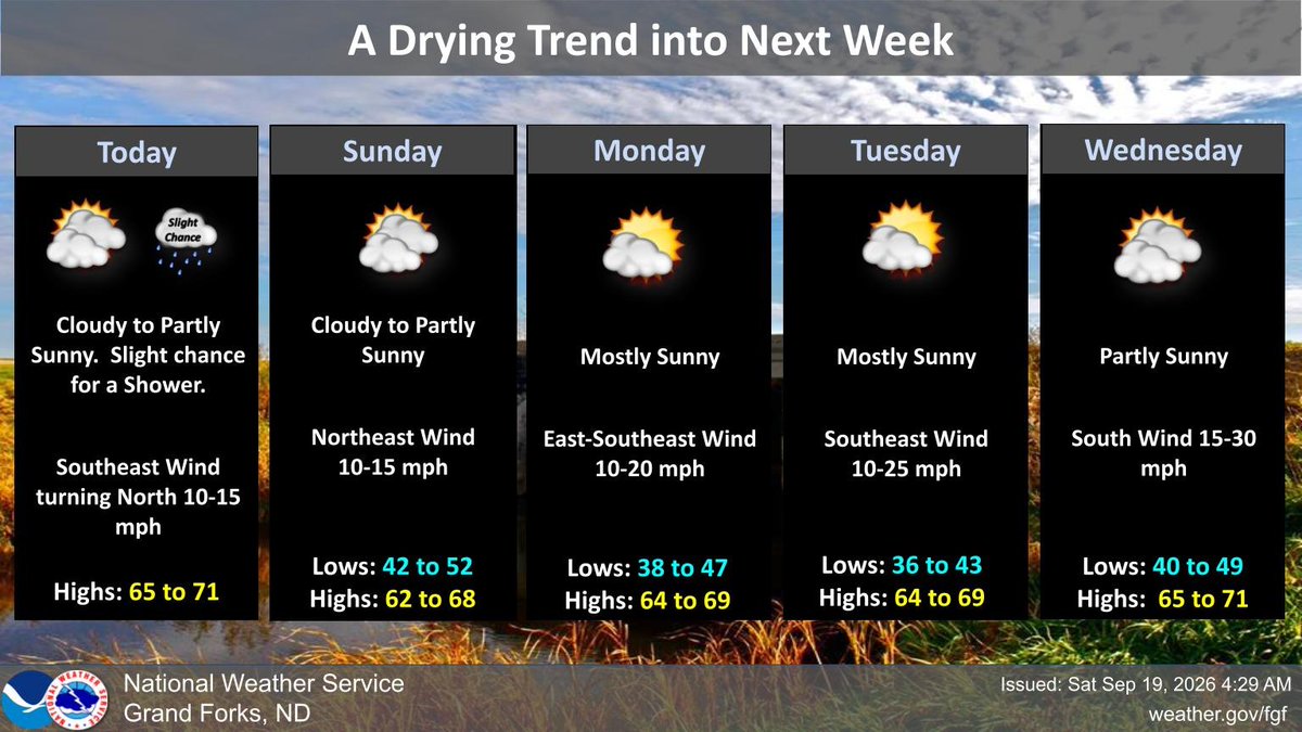
Cloudy to partly sunny today as a weak cold front drops south. Slight chance of showers. Cloudy to partly sunny again on Sunday. Highs both days in the 60s to around 70. Sunnier conditions Monday & Tuesday and dry conditions. #NDwx#MNwx
After today, dry conditions this weekend into early next week. Clouds and some sunny breaks this weekend and winds northeast up to 15 mph. Lows in the mid 40s to low 50s and highs in the mid 60s to around 70. #NDwx#MNwx
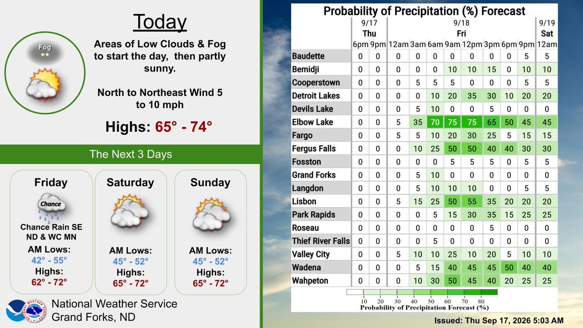
The north edge of an area of rain will affect far SE ND & parts of WC MN today. The graphic shown shows that the chance for getting 0.50 inch or more is over 70% in Elbow Lake MN but drops quickly as you head north. Chances for rain are highest between 6 am & 3 pm. #NDwx#MNwx
Areas of morning low clouds and fog, then partly sunny. Light winds today with highs in the mid 60s to low 70s. Friday will see rain spread into far southeast ND and parts of west central MN. Rainfall 0.10 to 0.60 inch. Weekend looks dry but partly sunny to cloudy. #NDwx#MNwx
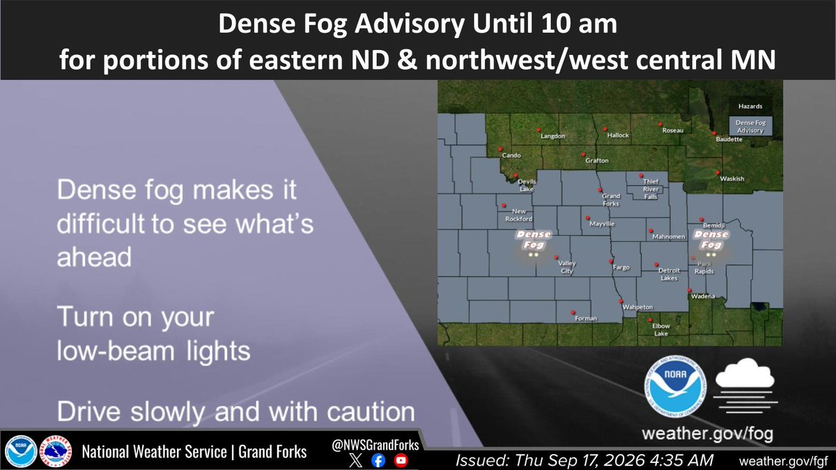
Light winds early this morning is allowing for areas of dense fog to form. Widespread dense fog with visibilities less than one-half was over parts of eastern ND along with parts of northwest and west central MN. Drive with caution and with low beams. #NDwx#MNwx
PATCHY DENSE FOG ACROSS EASTERN NORTH DAKOTA AND PARTS OF NORTHWEST AND WEST CENTRAL MINNESOTA for Clay, East Becker, East Otter Tail, East Polk, Hubbard, Mahnomen, Norman, North Beltrami, North Clearwater, Red Lake, South Beltrami, ... till 5:00 AM CDT https://t.co/afD4yobGsX
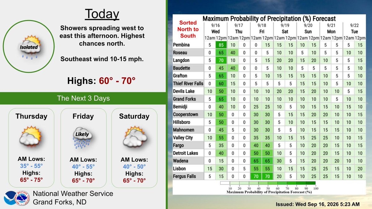
Rain will spread from west to east this afternoon with a few hundredths to a tenth of an inch (highest near the the international border). Another chance for a some frost Thursday morning before attention turns to a potential soaker Friday. #NDwx#MNwx
Winds diminishing through the day with mostly clear skies by the late afternoon. A mix of partly to mostly sunny skies the next 2 days with shower chances tomorrow and a more widespread rain Friday into the weekend. #NDwx#MNwx
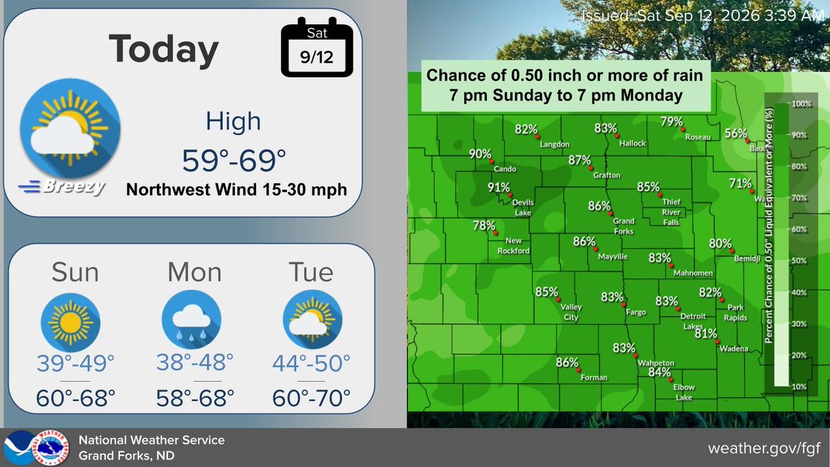
Rain will overspread the area on Monday with isolated thunderstorms. Widespread 0.25 to 0.75" with pockets up to 1 inch. Windy as well with S/SE winds increasing to 15 to 35 mph. Winds turning west with gusts of 40 to 50 mph in NE ND Monday night into Tuesday morning. #NDwx#MNwx
The system bringing widespread rainfall will also bring gusty winds. Two rounds of gusty winds: first on Monday, then another Monday night into Tuesday. Minor wind impacts forecast in northeast ND Monday night into Tuesday. #ndwx#mnwx
Today is a nice day, with mostly sunny sky and winds 10 mph or less. Highs in the 60s. Clear this evening then increasing clouds late tonight. Lows tonight in the 40s, with some 30s over NW MN. Rain showers Monday then clearing Tuesday. Chc showers Wednesday. #NDwx#MNwx
Rain showers Monday. Isolated t-storms. Average rain amounts 0.50 inch, range from 0.25 to 1 inch. Windy as well with SSE winds increasing to 15-35 mph Monday all areas, with winds turning west with gusts over 40 mph in northeast ND by Tuesday morning. #NDwx#MNwx
Cooler with a NW wind today 15 to 30 mph. Mainly sunny with lighter winds on Sunday. Highs both days in the 60s. Our next system arrives Sunday night with rain late Sunday night into Monday. Unlike past systems, rainfall will be widespread. #NDwx#MNwx