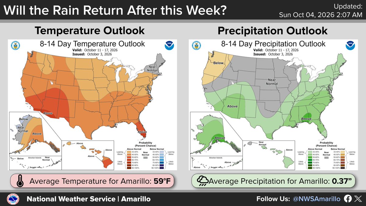
With a dry 7-day forecast ahead, the 8-14 day outlook (Oct 11-17) offers a small glimmer of hope. The Panhandles have a ~68% chance for near- or above-normal rainfall (and 32% for below-normal). Rain chances could finally start creeping back after this week! #phwx#okwx#txwx
This recent rain event was beneficial in many ways. water levels in Lake Meredith rose by 2 feet. From the beginning of September to the rain event, water levels dropped by 1 foot. However, water levels are still around 3 feet lower than where they were last year at this time.
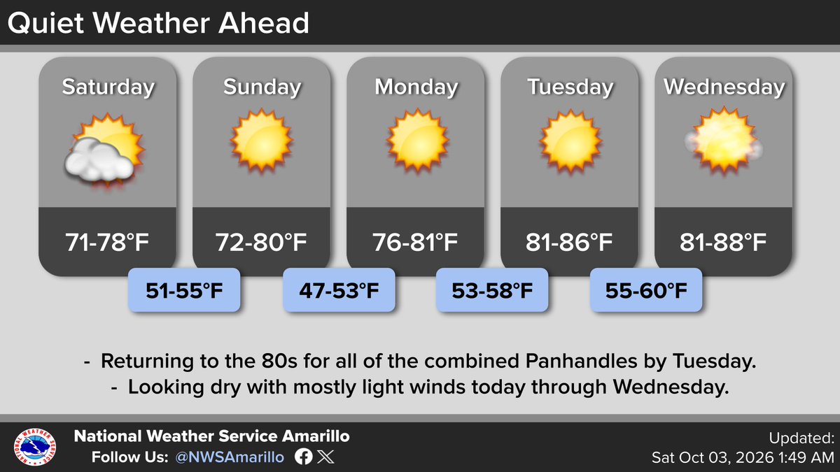
Nothing exciting in the forecast over the next 5 Days. Temperatures to warm back into the 80s across the board on Tuesday. Winds should stay relatively light over the next several days as well. #phwx#txwx#okwx
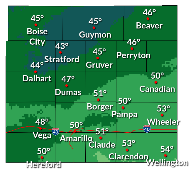
Good Evening Panhandles. It is a bit chillier across the panhandles today with all the clouds and drizzle. This is the first showing of Autumn after what seems like an eternity of summer heat. This does beg the question, "when will it finally freeze?". Well, mostly in October.
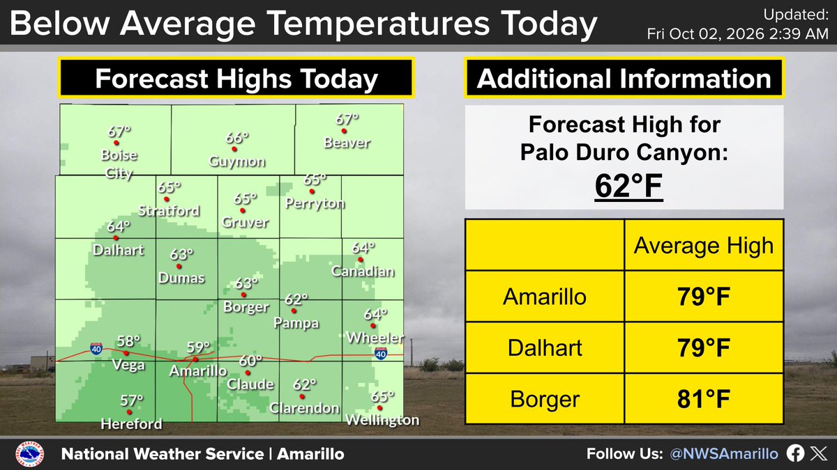
A cloudy, cool, and dreary day is expected especially for the central to southern TX Panhandle today. The northern combined Panhandles are expected to see the sun sneak out of the clouds later this afternoon and warm a few degrees warmer than the southern Panhandles. #phwx
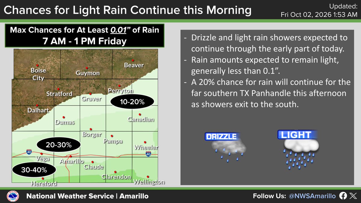
Light rain, drizzle, and 20-30 mph wind gusts are blowing across the Panhandles this morning. Expect wet roads and visibility under 3 miles at times. Drive with extra caution during your morning commute, especially while it is still dark out. #phwx#txwx#okwx
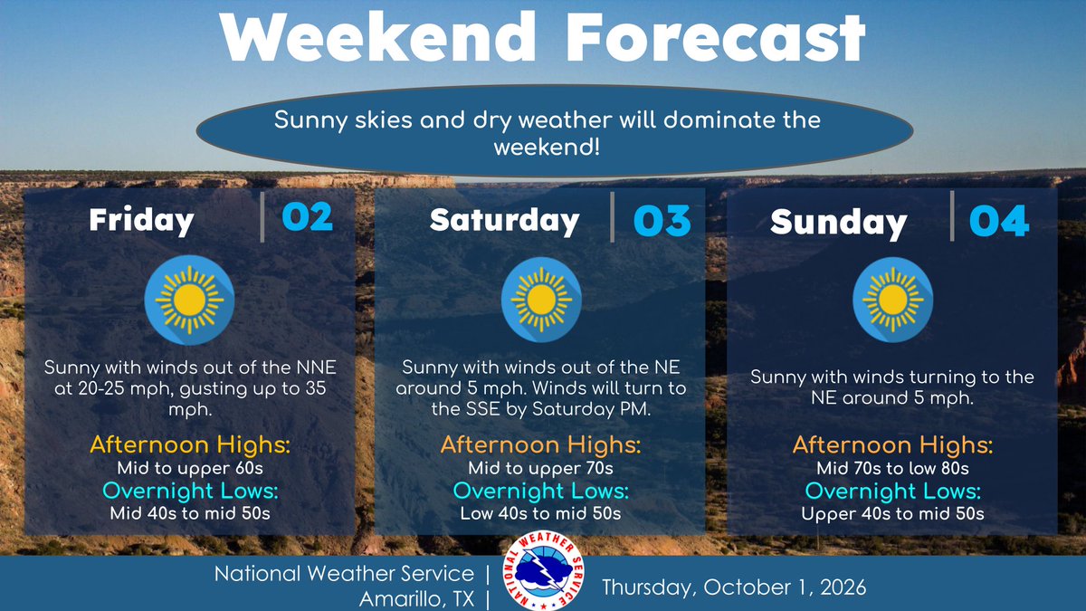
Sunny and dry weather is expected this weekend. Winds will be around 20-25 mph with gusts up to 35 mph Friday, and they will calm down for Saturday and Sunday. Overnight lows for the weekend are expected to be in the 40s and 50s. #txwx#okwx#phwx
Friday night should feature some of our coolest low temperatures so far this Fall season. As low as the lower 40's for some locations in the northern combined Panhandles. Anyone else happy to see these low temperatures! ✋#phwx#TXwx#OKwx
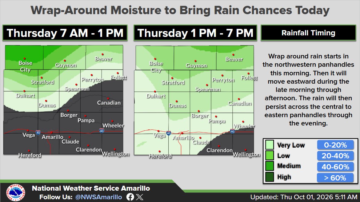
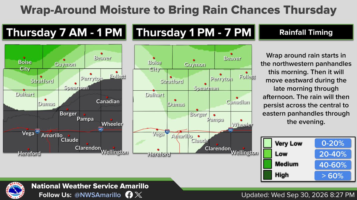
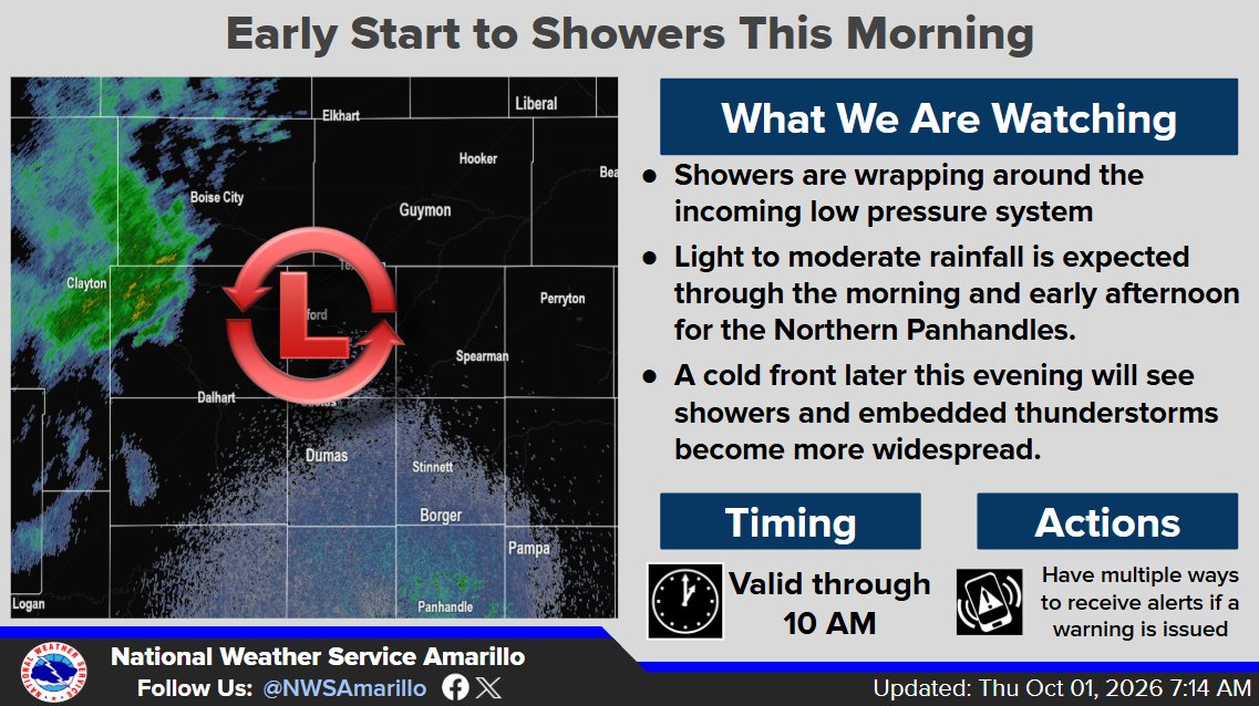
Showers are off to an early start this morning as we see moisture wrap around the still present low pressure system. At this time these showers are mostly looking to hold in the N Panhandles, but a cold front later this evening could see storms become more widespread. #phwx
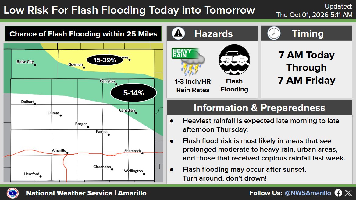
As moisture wraps around the still present system today, rain chances will return this morning into late this evening. While the threat of severe storms is low, the threat of flooding is still present, especially areas that received higher amounts from Tuesday.#phwx#txwx#okwx
Rain chances return tomorrow with rates up to 1-3"/hr. On the plus side, a cold front will sweep through the area late tomorrow afternoon, which will bring our temperatures down to the mid 60s - upper 70s. We are expected to be dry Friday through Sunday. #txwx#okwx#phwx
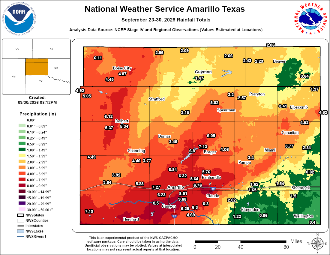
Check out our 7-day rainfall totals map. Most of the Panhandles received several inches of rain, with the highest totals nearing 10 inches around Lake Tanglewood and Canyon. Amarillo's climate data shows just under 2 inches for the year now. Big improvemnt. #phwx#TXwx#OKwx