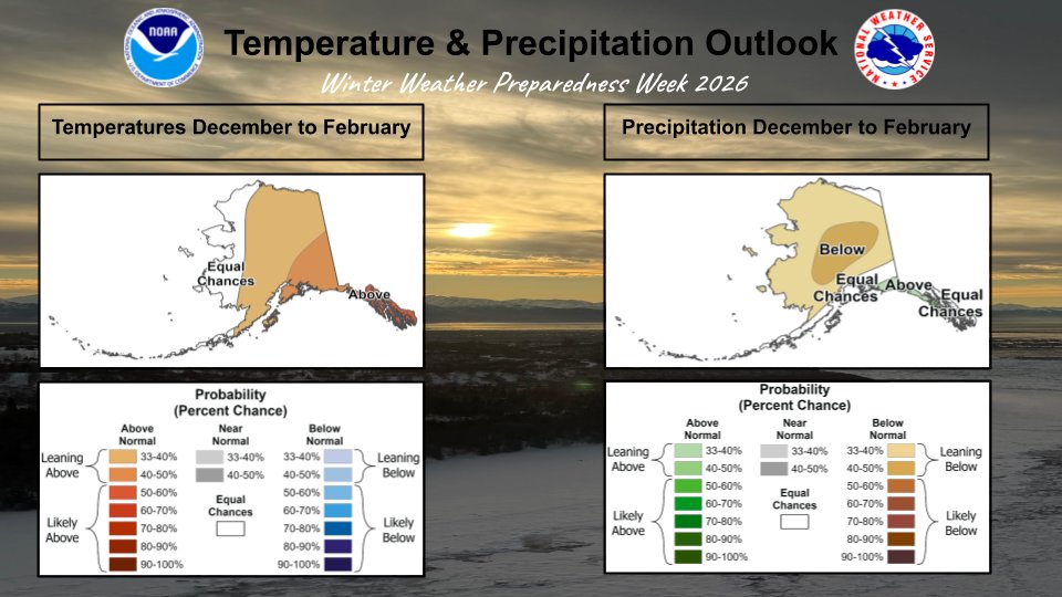
What does winter have in store for us this year? Check out the seasonal Temperature & Precipitation Outlook for December through February as Winter Weather Preparedness Week 2026 continues! #WinterWx#WeatherOutlook#WinterSafety#AKwx
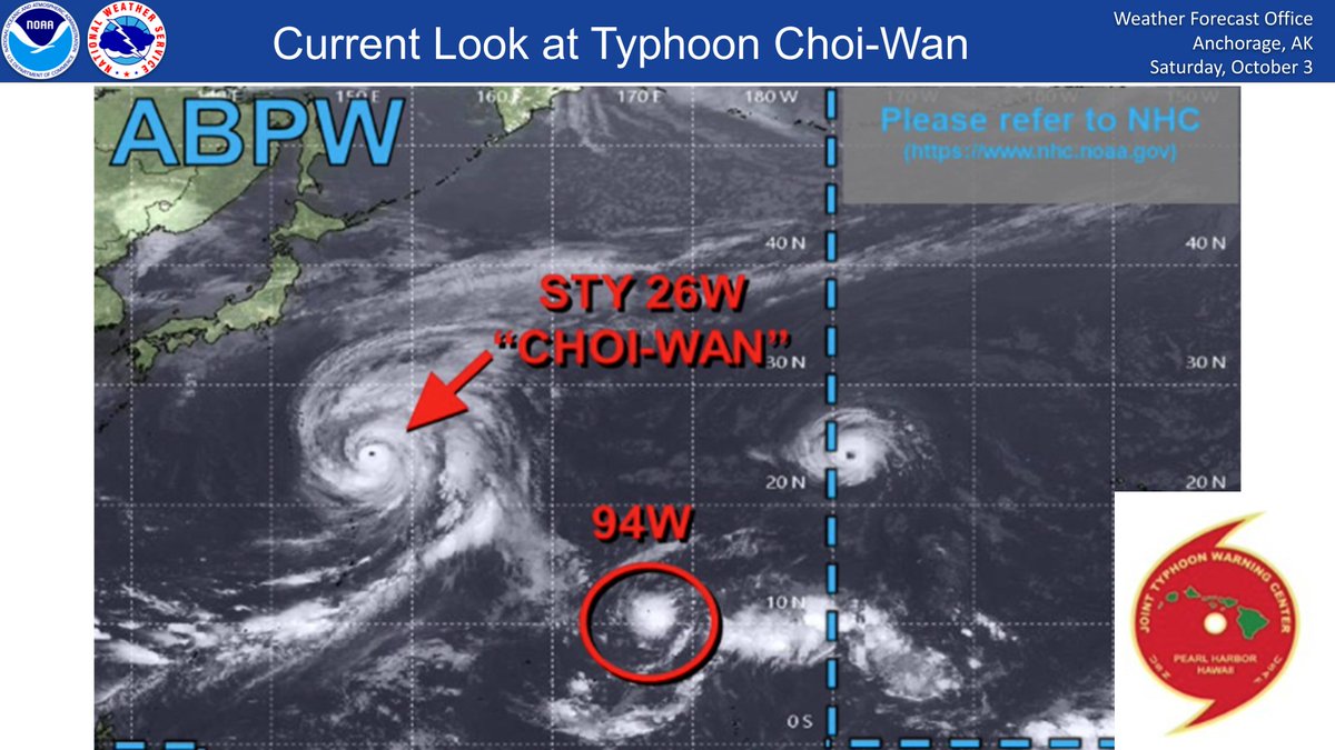
We're tracking Typhoon Choi-Wan as it phases with a complex low near Kamchatka. Expect storm-force winds (>55mph) across the Bering Sea, with a 60%+ chance of hurricane-force gusts (>74mph) over the W Bering. 40-60 mph winds hit the E. Aleutians, AK Pen. & Y-K Delta on Thursday.
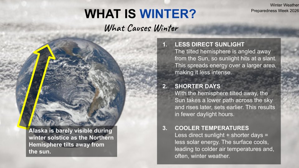
Ever wonder why days get shorter and temps plummet? Check out the science behind seasonal change and what causes winter weather as we kick off Winter Weather Preparedness Week 2026! #WinterWx#ScienceFacts#WeatherReady#AKwx
Ready or not, winter is on the way! ❄️ We're kicking off Winter Weather Preparedness Week 2026 to help keep you safe & warm all season long. Check out the full schedule below! #WinterWx#SafetyFirst#WeatherReady#AKwx
Snow will continue across the southern Copper River Basin through early Sunday morning. The snow may briefly change to a wintry mix of snow, sleet, and freezing rain Sunday morning before southerly winds develop, changing any mix to rain. #akwx
Snow and gusty winds will continue at Thompson Pass through late this evening. Temperatures are expected to warm into the mid 30s around midnight, allowing for rain to start to mix in. This will bring an end to any potential blowing snow. #akwx
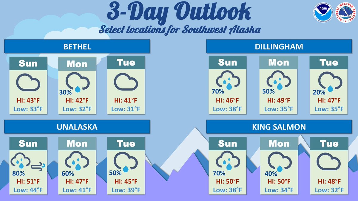
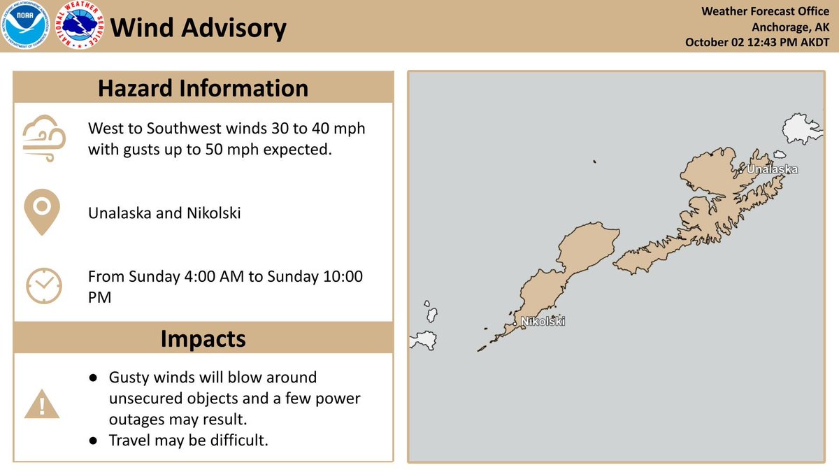
The weather becomes more active for SW AK through early next week, with periods of steady rain likely through Mon morning and showery weather lingering through early next week. Strong winds along the Aleutian Chain move into Unalaska for Sun, with gusts up to 50 mph possible.
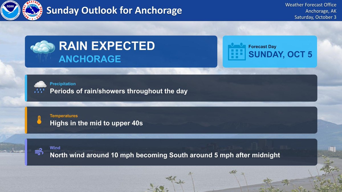
Sunday Weather Outlook for Anchorage 🌧️
Expect rainy conditions across Anchorage tomorrow, Sunday, October 5! Grab your rain jacket.
For the latest updates, visit https://t.co/sscIiVLNEv.
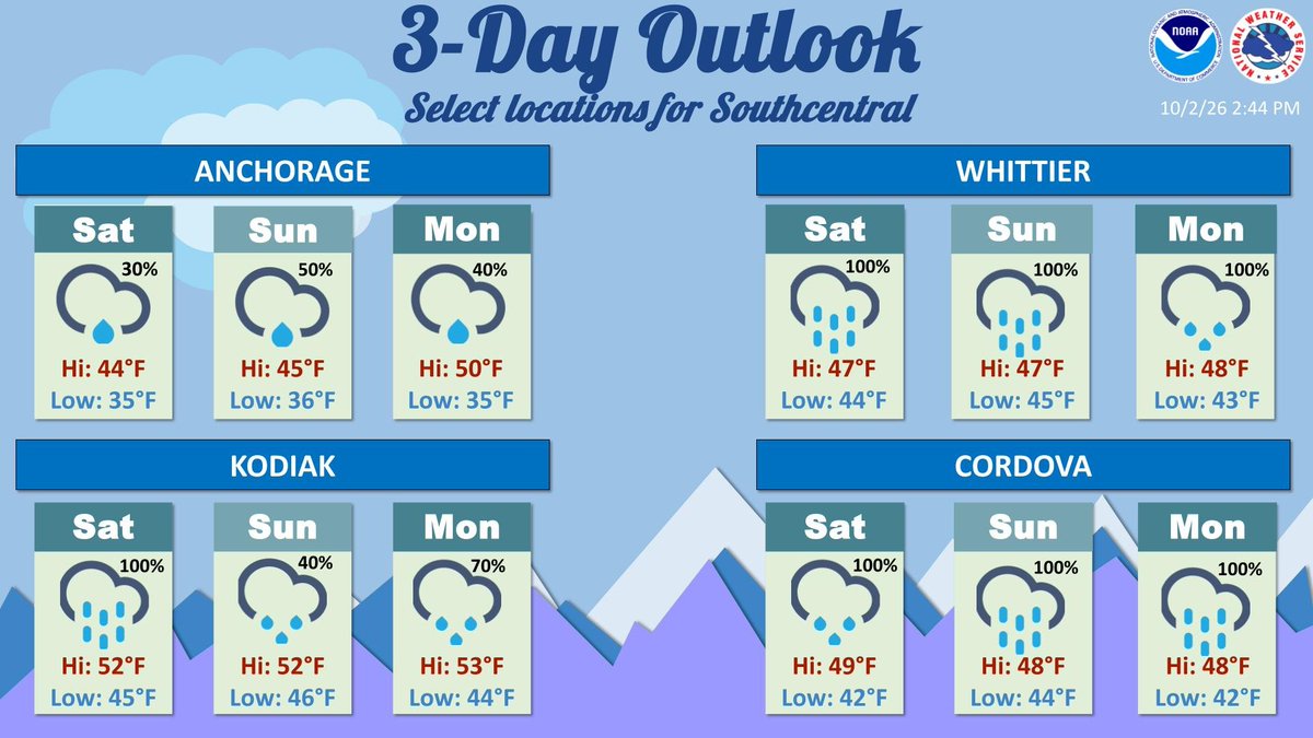
Heavy to moderate rain and gusty wind for Kodiak and the northern Gulf through Wednesday. Lower chances for light rain for the Anchorage bowl and MatSu starting Saturday afternoon through Wednesday.
🌬️ Wind Advisory for Nikolski & Unalaska: 4 AM–10 PM AKDT Sunday. A low pressure system will bring strong W–SW winds, with intermittent gusts up to 50 mph. Peak gusts: early–late Sun. morning in Nikolski; early Sun. afternoon–Sun. evening in Unalaska. Winds diminish Sun. night.
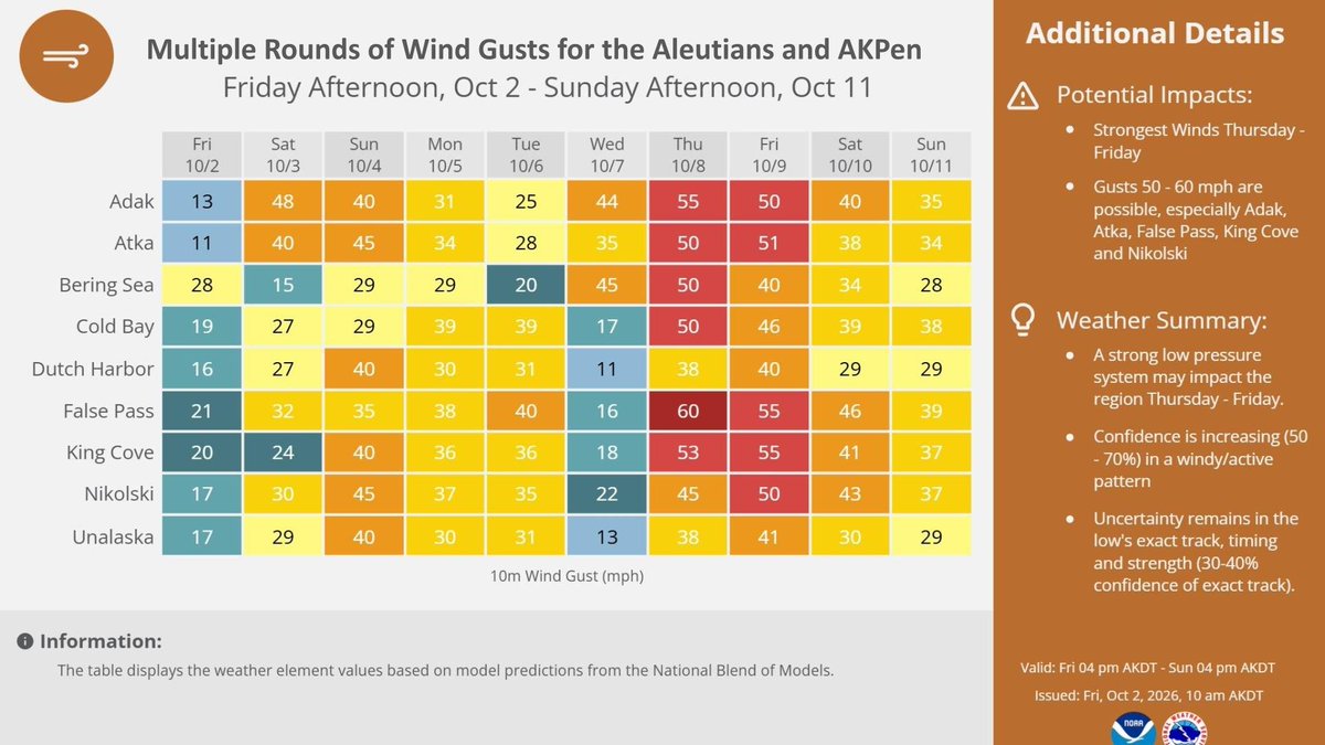
ALEUTIANS & AKPEN WEATHER ALERT
Multiple rounds of strong wind gusts are expected across the Aleutians and Alaska Peninsula through Sunday, Oct 11!
Strongest Winds: Thu–Fri (Oct 8–9) with gusts up to 50–60 mph.
As our current system moves eastward overnight, clearing skies and light winds will allow for temperatures to drop into the 20s and for most population centers to see the first hard freeze of the season. Watch for patchy black ice for your Friday morning commute. #akwx
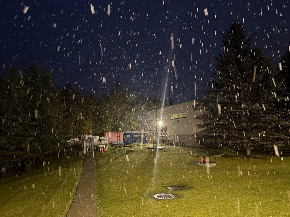
❄🌧 Portions of the Anchorage Bowl is reporting snow, other areas are reporting rain still. Some of this snow is sticking to colder surfaces. 🚙 Conditions may change along your commute. Be safe out there!
We would be happy to take reports! #AKwx#snow
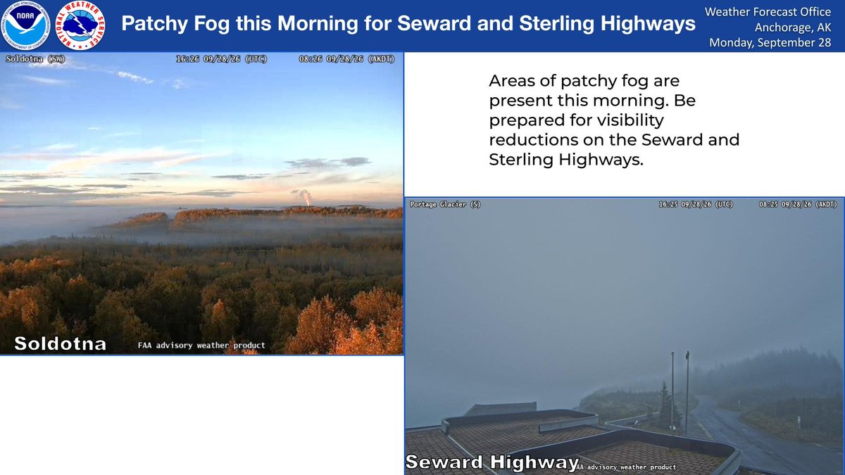
A Dense Fog Advisory is in effect until 10:00 AM Thursday for the Lower Matanuska & Southern Susitna Valleys (including Palmer, Wasilla, Willow, and Big Lake). Visibility may drop as low as ¼ mile, so please drive slow, use headlights, and leave extra space on the roads! #akwx
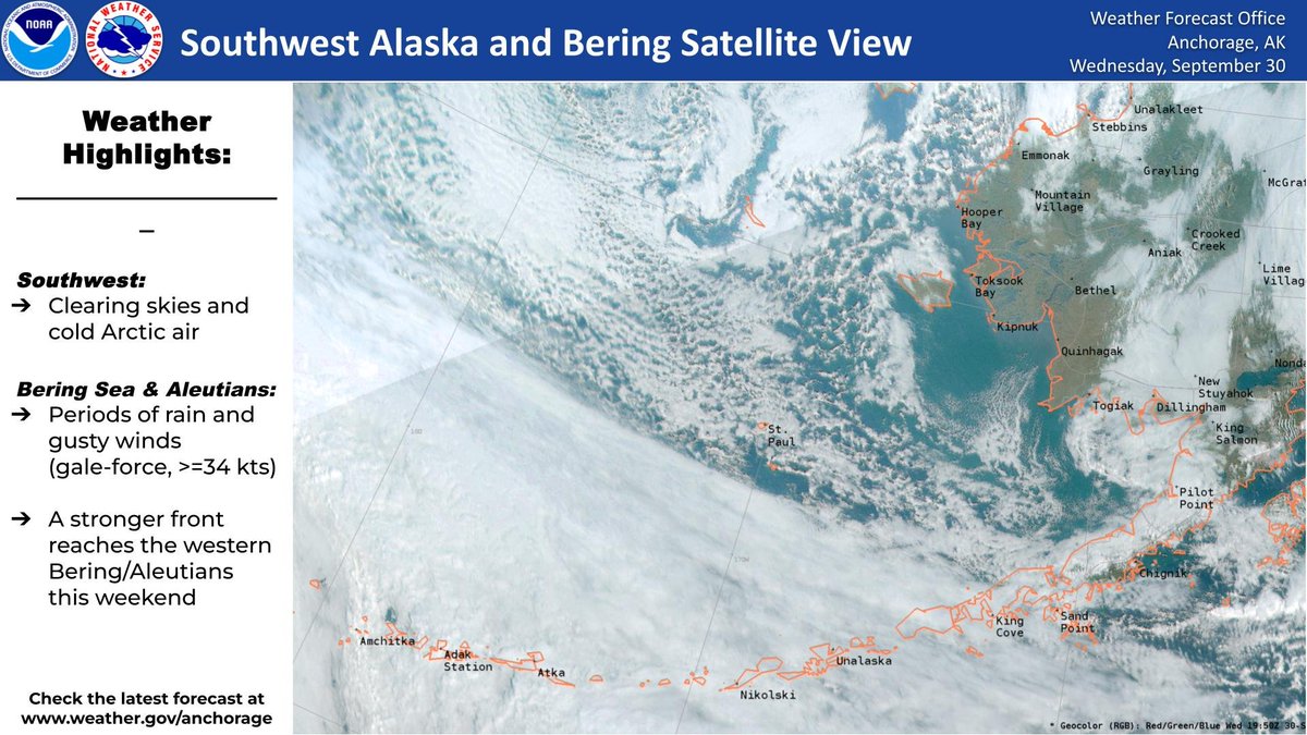
👀 Take a peek at satellite for the Bering, Aleutians & Southwest Alaska! We’re seeing periods of rain and gusty winds for the Bering & Aleutians, while clearing skies with #ArcticAir move into Southwest, bringing cold temps! A slightly stronger low arrives by this weekend. #AKwx
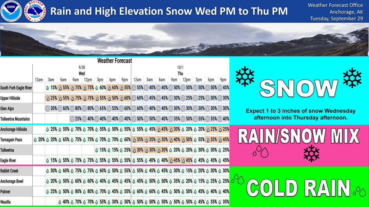
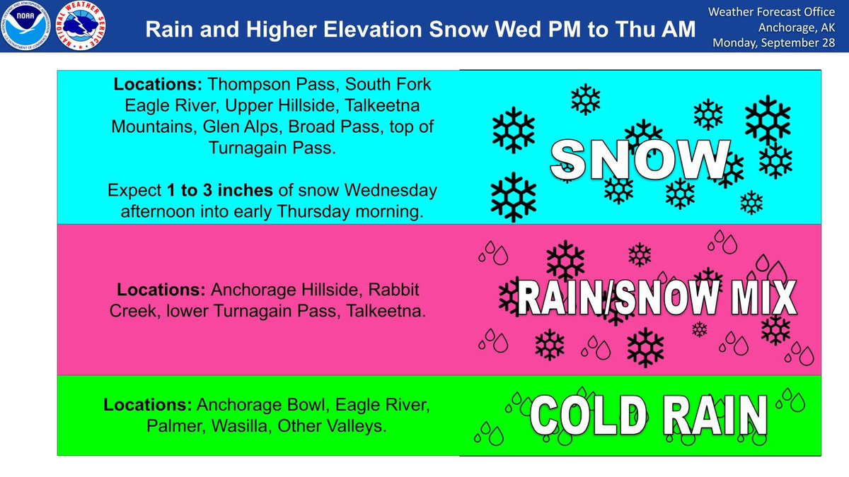
Rain, a rain/snow mix and snow at high elevations arrive Wednesday night through Thursday night as cold air from the north meet a frontal system moving across Southcentral. #akwx
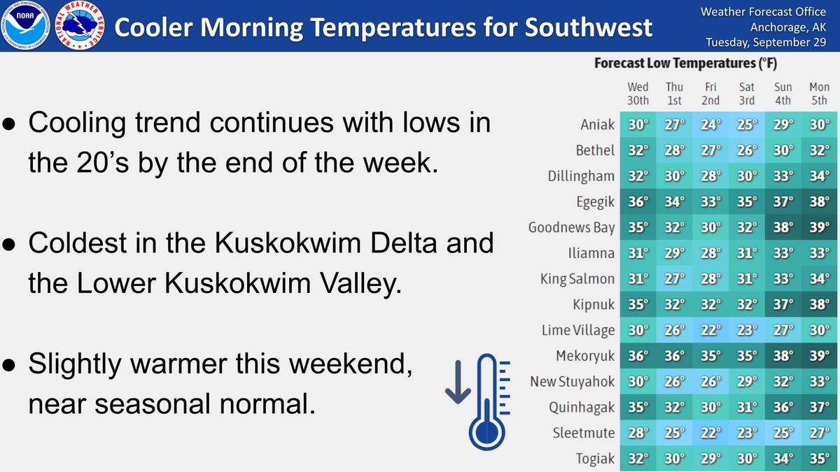
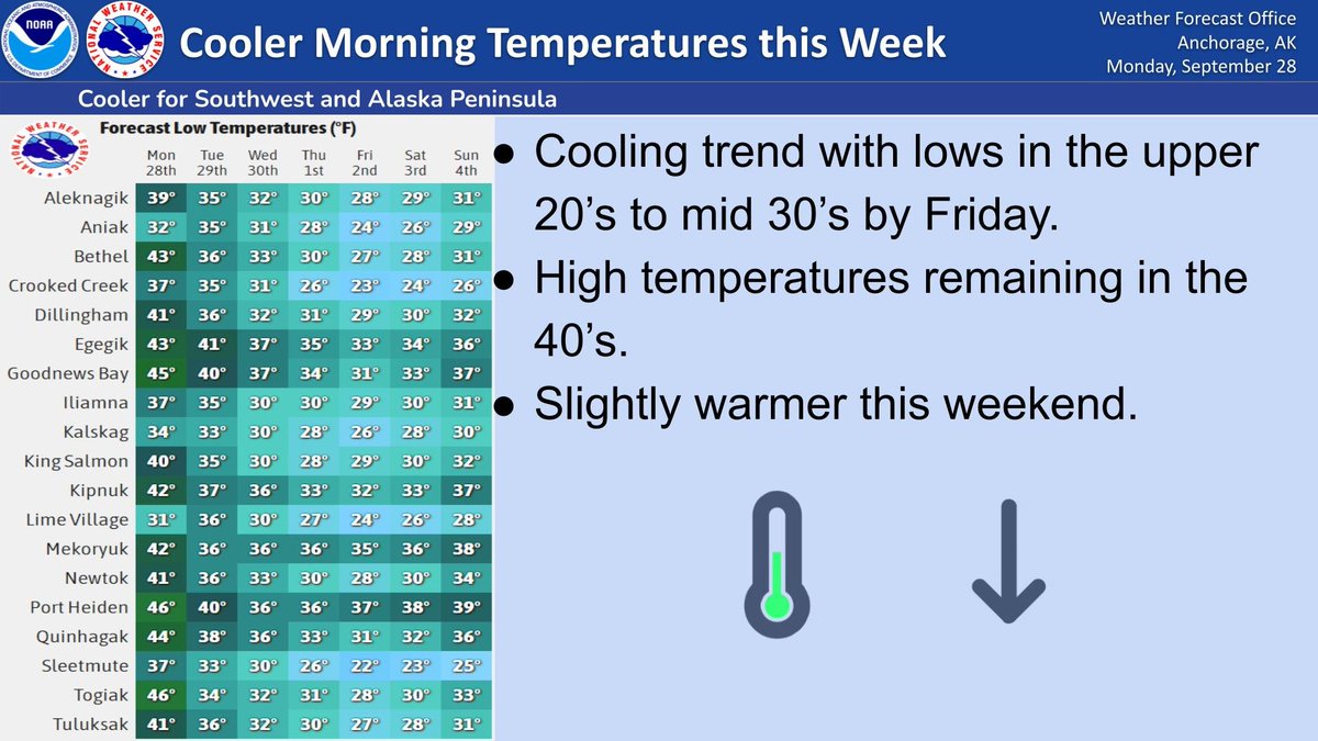
Update to the forecast for Southwest Alaska. Temperatures will drop to the 20s late this week as as a cold front from the Arctic moves into Southwest Alaska. Coldest conditions will be in the Kuskokwim Delta and the Lower Kuskokwim Valley #akwx
Colder air moving in from the north and a frontal system will cause cold rain for lower elevations and 1 to 3 inches of snow for higher elevations in Southcentral Alaska Wednesday evening into Thursday morning. #akwx