🔥Elevated fire weather concerns emerge across the higher elevations tonight through the weekend as pulses of offshore flow cause low humidities overnight. Remember: one less spark, one less fire! https://t.co/YsuF8z4kKc #CAwx
Clear skies have returned across the Bay Area and north Central Coast! ☀️
Expect a gradual warming trend through Tuesday, with more robust warming expected Thursday and Friday as high pressure builds over the eastern Pacific. #CAwx#BayAreaWX
🛰️Satellite imagery shows a broad upper level circulation incorporating remnant moisture from Rachel over the Great Basin. Mostly clear conditions expected over the SF Bay Area and Central Coast tonight, another cold night is likely across the inland valleys. #CAwx
ICYMI: We have a Coastal Flood Advisory in effect. We're asking for your help...
1) Have you seen any coastal flooding the last few days?
2) If yes, do you have a picture of it? 📷
3) If you share a pic, when & where was it taken?
Thanks in advance. #cawx#coastalflooding
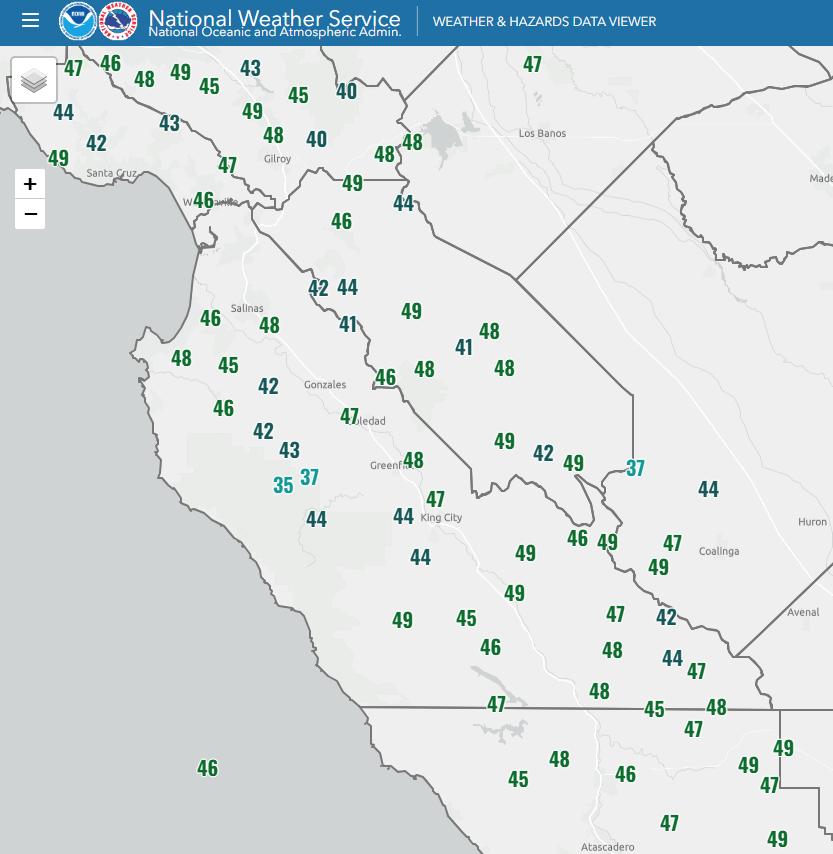
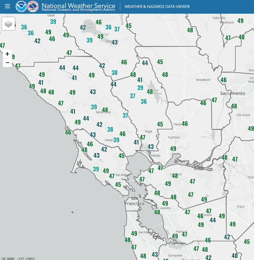
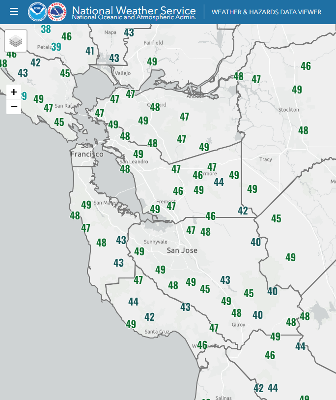
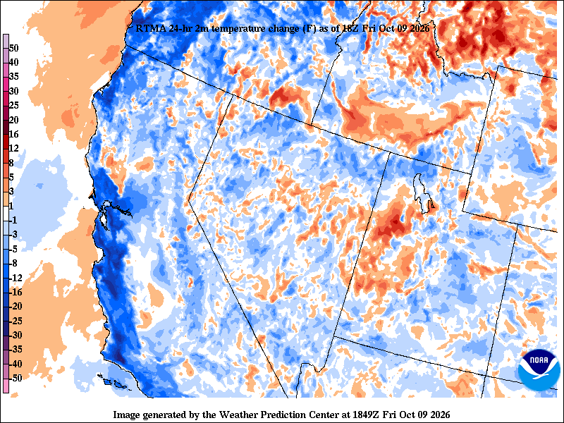
🍂Taste of Fall this morning...here's a look at temps that were less than 50°F since midnight. Notice a few 30s in there. Cozy up with your favorite pumpkin spice ☕ this morning. #chilly#cawx#pumpkinspicefan
Tropical Storm Rachel made landfall in Baja California last night, dissipating soon after as it moved inland.
The remnants of Rachel are currently bringing heavy rainfall and flash flooding to the Western U.S.
Just a little wet over SoCal this morning as precip moves through - left overs from former TS Rachel. Check @NWSLosAngeles and @NWSSanDiego for the latest info. #cawx
Talk about "crispy dry" higher up! 🍂 The 5 AM Oakland 🎈balloon launch measured an astonishing 2% RH, while mountain spots like the Santa Lucia Range (Chews Ridge) hit 3% RH with gusts up to 20 mph overnight. 🔥Fire danger is elevated in higher terrain, one less spark today!
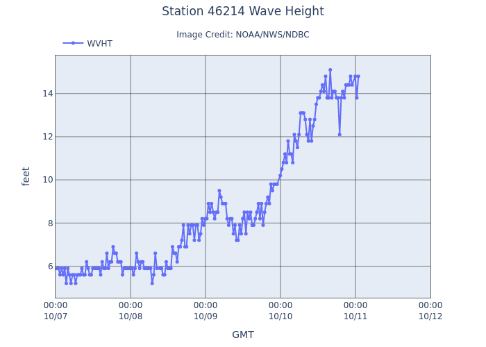
@Scripps_Ocean CDIP buoy at Point Reyes observed wave heights build above 14 ft in the past 24 hours :o Other buoys along our coastline are reporting similar wave heights around 10-15 ft with 30-40 mph wind gusts. Hazardous marine & beach conditions continue through Monday. #CAwx
⛵⚠️Heads up along the CA coast! 🌊 Hazardous marine conditions are in effect through at least Sun PM. Expect 13-16 ft waves, dangerous rip currents, and strong winds. Harbor entrances and bars can be more energetic with moderate to longer pd swells. #CAwx
🚨🚨We want to reiterate how dangerous it's going to be along our Pacific coastline this weekend. Rip currents & sneaker waves will pull the most experienced and capable swimmers and surfers out to sea. Never turn your back on the water & stay off jetties and rocks. CAwx
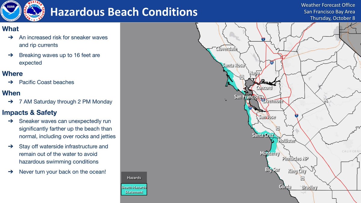
Increased risk of rip currents and sneaker waves expected with breaking waves up to 16 feet. Dangerous conditions are forecast along the shoreline. Stay off jetties, piers, rocks and other waterside infrastructure. NEVER turn your back on the ocean. #CAwx
Increased risk of rip currents and sneaker waves expected with breaking waves up to 16 feet. Dangerous conditions are forecast along the shoreline. Stay off jetties, piers, rocks and other waterside infrastructure. NEVER turn your back on the ocean. #CAwx
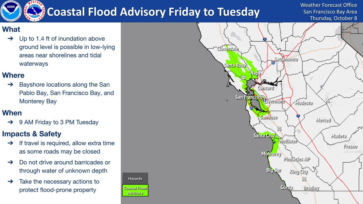
A Coastal Flood Advisory has been issued for 9 AM Friday to 3 PM Tuesday for bayshore locations along the San Pablo Bay, San Francisco Bay, and Monterey Bay. Minor coastal flooding is expected during the highest high tide - do not venture around barricades or through water. #CAwx
Increased risk of rip currents and sneaker waves expected with breaking waves up to 16 feet. Dangerous conditions are forecast along the shoreline. Stay off jetties, piers, rocks and other waterside infrastructure. NEVER turn your back on the ocean.