Lake effect snow continues to fall over far north-central WI & Door Co. early this morning. Snow has struggled to stick on the ground overnight, however, as temps continues to cool this morning a quick 0.5-2" of snow may accumulate in parts of Door & Kewanee counties. #wiwx
A little taste of winter to end the week for some, with rain/snow showers changing to snow showers near Lake Michigan & the Northwoods. Snow accumulation up to 2”, locally higher if a heavier snow band materializes. Temps will remain a little chilly into Fri. #wiwx
Accumulating snow for parts of northern/eastern WI tonight into Fri AM. While most will not see much snow, localized areas under the heaviest lake effect bands do have a 20-40% chance to see 2"+. Some roads/surfaces could be slippery overnight into the Fri AM commute. #wiwx
Confidence is increasing that areas across far northern Wisconsin as well as along Lake Michigan will see a round of accumulating snow this evening into Friday morning. While most will miss out on the snow these areas do have a 20-30% chance to see +2" of snow by Friday AM #wiwx
A little taste of winter to end the week, with rain/snow showers expected at times tonight/Thu, lingering into Fri near Lake MI & Northwoods. Snow accums up to 1" in north-central WI tonight with additional accumulation in Door & Vilas Co Thu night. Chilly temps into Fri. #wiwx
🌧️Rain showers today, otherwise fairly uneventful weather. Looking back at Veterans Day weather history in northeast Wisconsin, 12 years ago there was record-setting snow in some places.
Find more historical data at: https://t.co/z4GeAjDqys
Thank you veterans!
#wiwx
Scattered light rain spreads across northeast Wisconsin this Veterans Day with highs in the 40s to lower 50s. A few snowflakes may mix in over north-central areas late tonight as cooler air filters in behind the system. #wiwx
Clouds return tonight with a few showers arriving from the west. Scattered showers will roam the area on Veterans Day, with amounts around 0.10" or less for most, up to 0.25" in north-central WI, where some snowflakes will also mix in Wednesday night.
#wiwx
At this time 51 years ago (1975) the Edmund Fitzgerald was over eastern Lake Superior. It would sink later that evening near Whitefish Point, MI. @NWSMarquette has a great story map on the Fitzgerald and the storm. https://t.co/9j2VDRGu8d
Virtual winter spotter training is here! While these sessions will be hosted by a different NWS Offices, the training content will be similar across all talks—meaning you can sign up for whichever session works best for you. https://t.co/43yvovqIEC #WIwx
Quiet weather continues through Tuesday with the next chance for rain coming Wednesday. Behind the front cold northwest winds will kick of periods of light lake effect rain and snow across the typical lake effect regions of north-central and far eastern Wisconsin. #wiwx
Warm conditions with a mix of sun and clouds will continue across central and northeast Wisconsin through Tuesday. A midweek cold front brings rain showers Wednesday, mixing with light snow north on Thursday and Friday as highs drop into the upper 30s and 40s. #wiwx
Breezy northwest winds this afternoon will begin to diminish this evening leaving quiet and dry conditions tonight. The quiet weather will continue into the beginning of the work week before the next chance of precipitation arrives Wednesday along with some cooler temps. #wiwx
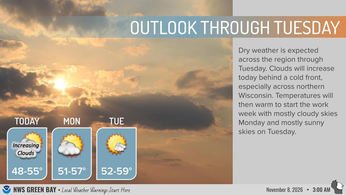
A cold front brings increasing clouds and cooler weather today, followed by high pressure keeping the area dry. Temperatures gradually warm into the 50s through Tuesday under partly to mostly cloudy skies. #wiwx
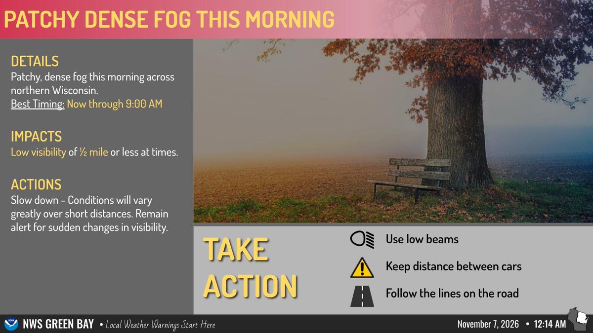
Patchy dense fog across northern Wisconsin through 9:00 AM will drop visibility to one half mile or less at times. If traveling, slow down, use low beam headlights, leave extra space between vehicles, and stay alert for rapidly changing road conditions. #wiwx
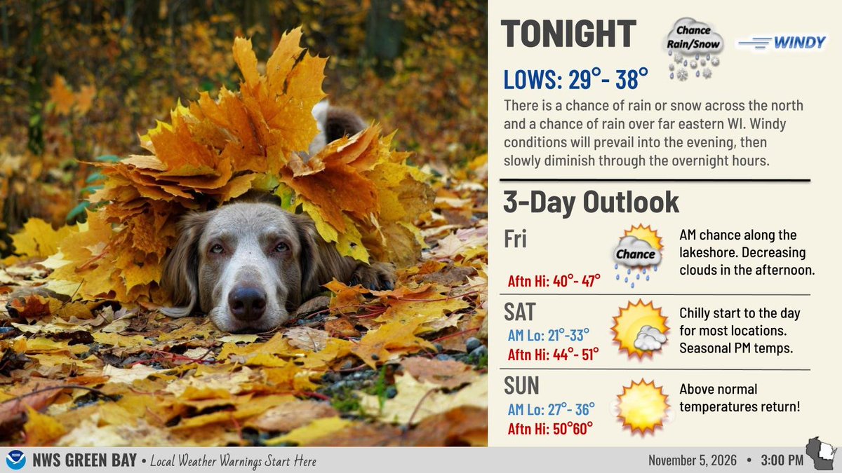
Tonight will be one of the coldest nights of the fall to this point with most inland areas falling into the low to mid 20s and those near Lake Michigan cooling into the low 30s. Seasonal temperatures and plenty of sunshine return for this weekend. #wiwx
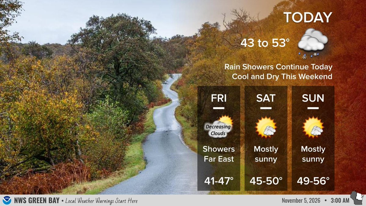
After a morning chance of showers along the lakeshore, high pressure will bring quiet, dry weather to northeast Wisconsin through early next week. Expect cool conditions today with seasonal temperatures this weekend. A warming trend arrives early next week. #wiwx
For tonight, there is a chance of rain or snow across the north, and a chance of rain across portions northeast Wisconsin where the chances linger into early Friday morning. Otherwise, near normal temps expected Friday and Saturday with above normal temperatures next week. #wiwx
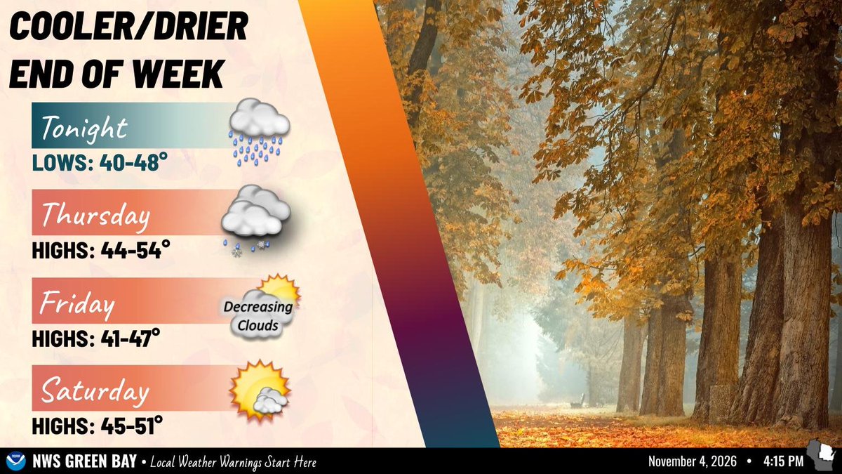
Another period of rain showers will move into the area today. A few flakes are possible over far northern WI tonight as the precipitation comes to an end. Conditions dry out Friday into the weekend as Temps cool off back to near seasonal readings. #wiwx
After a lull in the rain for much of today, another period of rain showers will move into the area later tonight into Thu. A few flakes are possible in northern WI Thu night. We dry out on Friday/Sat. Temps will cool off to near seasonal readings Thu into Sat. #wiwx