At 11:00 PM, Tropical Storm Bertha was centered over the northeastern Gulf, about 140 miles south of Panama City, FL. The system is stationary. Maximum sustained winds are 40 mph. The minimum central pressure was 999 mb or 29.50 inches. This system poses no threat to the Keys.
At 8:00 PM, Tropical Storm Bertha was over the northeastern Gulf of America, ~110 miles S of Panama City, Florida. The system is moving WNW at 3 mph. Maximum sustained winds are 40 mph. The central pressure was 1004 mb or 29.65 inches. This system poses no threat to the Keys.
At 5:00 PM, Tropical Depression 2 was over the northeastern Gulf, about 105 mi south of Panama City, Florida, and moving northwestward at 3 mph. Maximum sustained winds are 35 mph. The minimum central pressure was 1005 mb or 29.68 inches. This system poses no threat to the Keys.
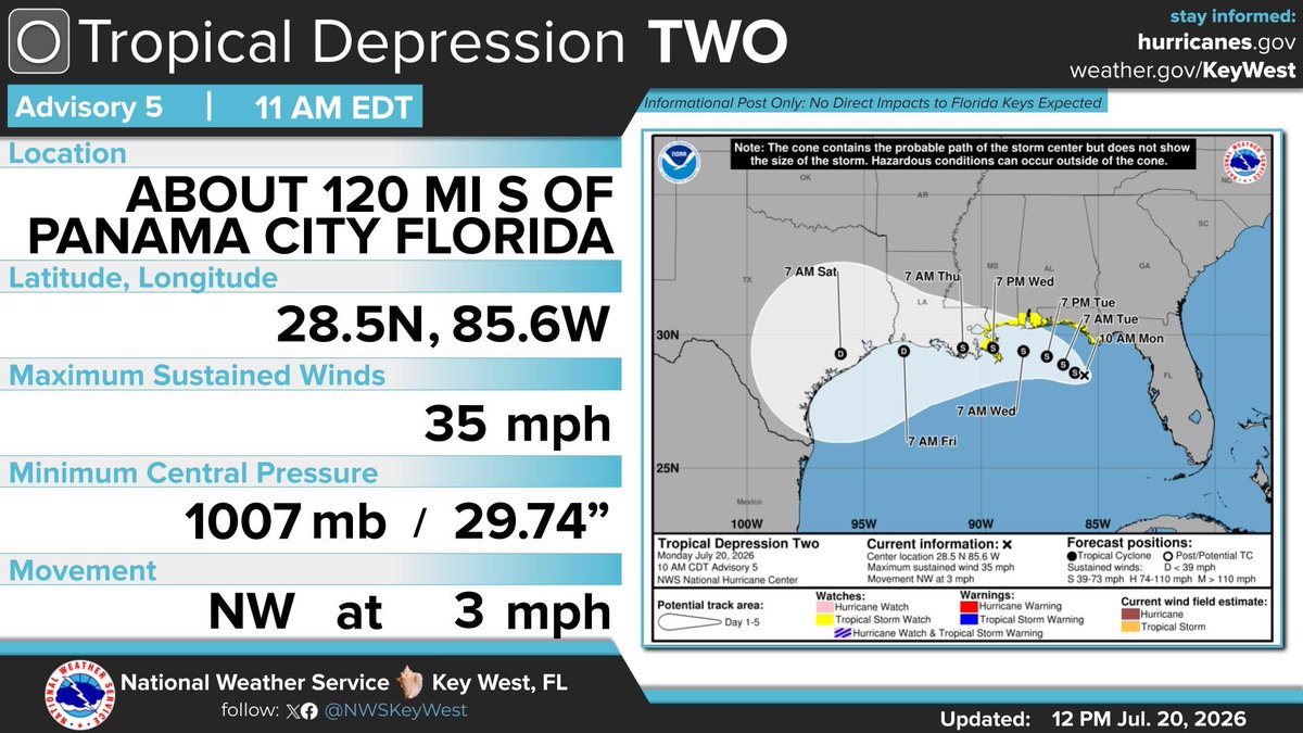
At 11:00 AM, Tropical Depression Two was centered over the northeast Gulf of America. The system is moving NNW at 3 mph. Maximum sustained winds has stayed at 35 mph. The minimum central pressure was 1007 mb or 29.74 inches. This system poses no threat to the Florida Keys.
At 5:00 AM, Tropical Depression Two was centered over the northeast Gulf of America. The system is moving NNW at 3 mph. Maximum sustained winds have increased to 35 mph. The minimum central pressure was 1006 mb or 29.70 inches. This system poses no threat to the Florida Keys.
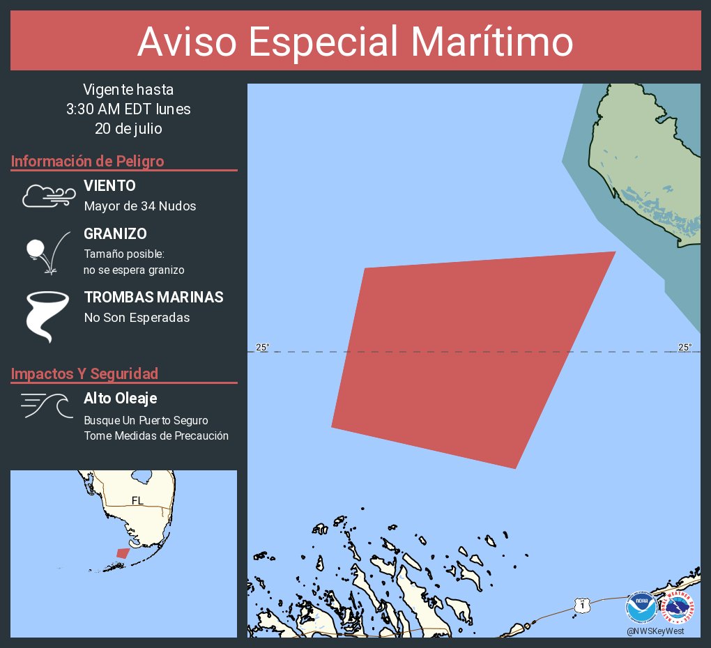
Aviso Especial Marítimo incluye Lado de Bahía y lado del Golfo desde Craig Key hasta el Final Oeste del Puente Seven Mile y Golfo de América desde el Final Oeste del Puente Seven Mile a Halfmoon Shoal más allá de 5 Fathoms hasta las 3:30 AM EDT
Special Marine Warning including the Bayside and Gulfside from Craig Key to West End of Seven Mile Bridge and Gulf of America from West End of Seven Mile Bridge to Halfmoon Shoal out to 5 Fathoms until 3:30 AM EDT
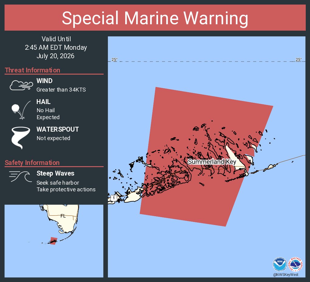
Aviso Especial Marítimo incluye Aguas del Golfo desde el Este de Cabo Sable a Chokoloskee 20 a 60 MN hacia afuera y pasando 5 Fathoms y Estrecho de Florida desde el final oeste del Puente Seven Mile hasta el sur de Halfmoon Shoal hacia afuera 20 MN hasta las 2:45 AM EDT
Special Marine Warning including the Gulf of America from East Cape Sable to Chokoloskee 20 to 60 NM out and beyond 5 fathoms and Straits of Florida from west end of Seven Mile Bridge to south of Halfmoon Shoal out 20 NM until 2:45 AM EDT
Aviso Especial Marítimo incluye Estrecho de Florida desde el final oeste del Puente Seven Mile hasta el sur de Halfmoon Shoal hacia afuera 20 MN y Golfo de América desde el Final Oeste del Puente Seven Mile a Halfmoon Shoal más allá de 5 Fathoms hasta las 2:00 AM EDT
Special Marine Warning including the Straits of Florida from west end of Seven Mile Bridge to south of Halfmoon Shoal out 20 NM and Gulf of America from West End of Seven Mile Bridge to Halfmoon Shoal out to 5 Fathoms until 2:00 AM EDT
At 11:00 PM, Tropical Depression Two was centered over the northeastern Gulf of America. The system is moving NNW at 3 mph. Maximum sustained winds are 30 mph. The minimum central pressure was 1008 mb or 29.77 inches. This system poses no threat to the Florida Keys.
At 5:00 PM, Tropical Depression Two was centered over the northeastern Gulf of America, about 284 miles northwest of Key West. The system is stationary. Maximum sustained winds are 30 mph. The minimum central pressure was 1010 mb. This system poses no threat to the Keys.
#FloridaKeys
At 11:00 a.m. EDT, newly formed Tropical Depression TWO was centered over the northeastern Gulf of America about 320 miles northwest of Key West, Florida. This system poses no threat to the #FloridaKeys.
#flwx
#FloridaKeys
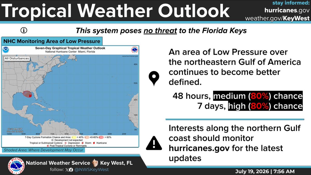
The National Hurricane Center (NHC) is monitoring an area of low pressure over the northeastern Gulf. Development chances have increased to 80% over the next 48 hours. This system poses no threat to the #FloridaKeys.
#flwx
#FloridaKeys
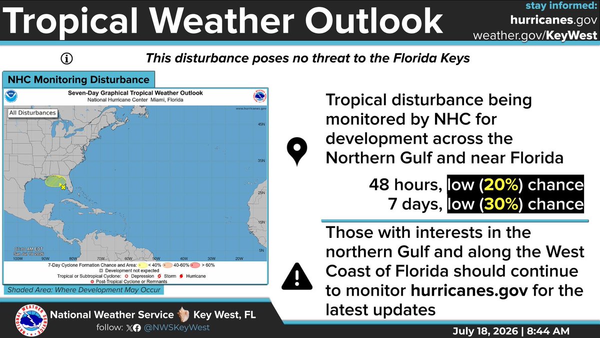
The National Hurricane Center (NHC) is monitoring a broad low-pressure area over the eastern Gulf. Currently it has a 30% chance of development over 48 hours and 40% chance through 7 days. This system poses no threat to the Keys.
#flwx
#FloridaKeys
The National Hurricane Center (NHC) is monitoring a broad low-pressure area over the eastern Gulf. Currently it has a 30% chance of development over 48 hours and 40% chance through 7 days. This system poses no threat to the Keys.
#flwx
#FloridaKeys
The National Hurricane Center (NHC) is monitoring a broad low-pressure area over the eastern Gulf. Currently it has a 30% chance of development over 48 hours and 40% chance through 7 days. This system poses no threat to the Keys.
#flwx