#BREAKING: 4.1 magnitude earthquake has struck off the coast of Maine around 40 minutes ago, with light-moderate tremors reported in nearby regions.
No tsunami risk is anticipated given the nature and magnitude of the quake.
#MEwx#earthquake#Maine
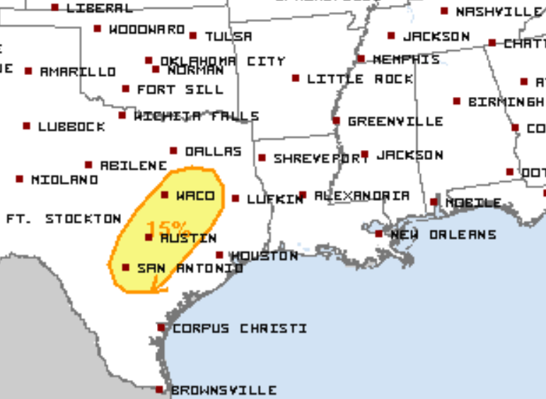
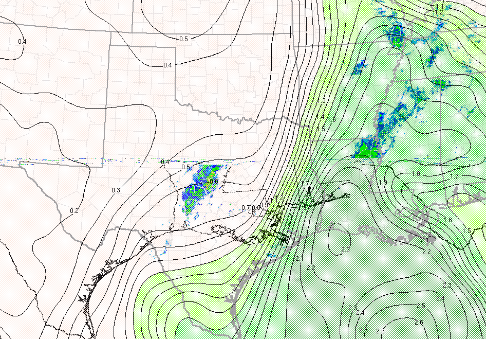
Severe weather is expected to return to portions of the Southern Plains towards the middle of this week (Wed. and Thurs.). Ensemble guidance is keen on a shortwave trough impinging into the region, bringing a potential of an all-hazards risk to portions of Texas.
#TXwx#weather
A return to increased severe weather activity is anticipated towards the middle of this week across portions of the Southern Plains, especially across portions of Central to Eastern Texas (Wed. & Thurs.), with all severe hazards possible.
#TXwx#weather#severewx
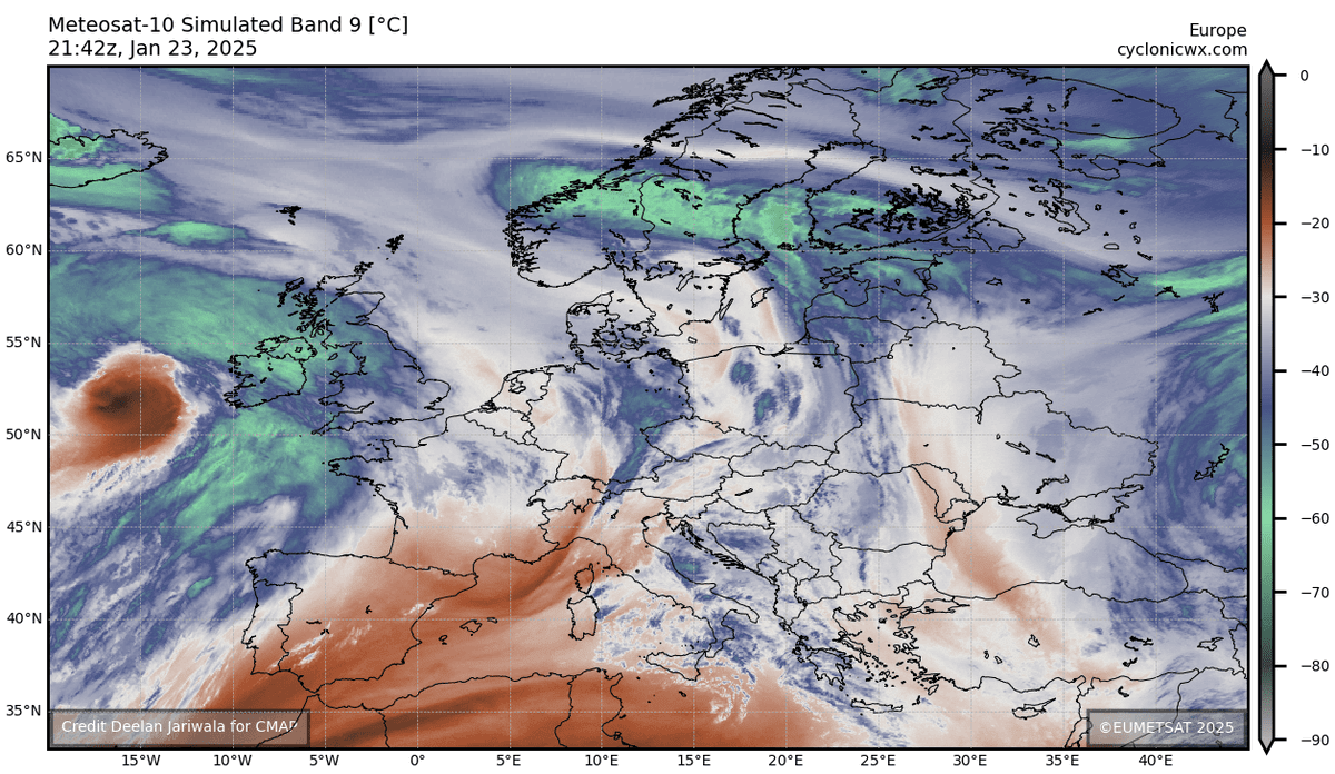
A pretty incredible look off of WV/IR imagery this afternoon (EST) of #StormÉowyn , with quite the robust cyclone continuing to deepen and bomb out as a classic comma head feature persists. Signs of a very dangerous wind event setting up for #Ireland beginning tomorrow.
@ZoomCenter Yes, thankfully there is going to be some relief coming in the form of rain towards the beginning of this weekend.
Much needed relief for the constant plague/pattern of these terrible conditions.
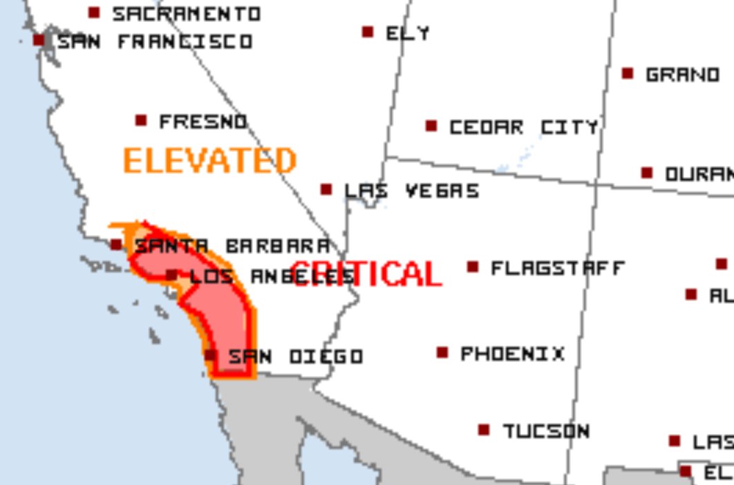
Another, high-end critical fire weather risk is in place across SoCal, especially across the LA County Mountains/Coastline to San Diego County Mountains/Coastline Vicinities...
#CAwx#wildfire#fire
, before winds will tend to calm down towards the mid-late afternoon and evening. Regardless, a multi-hour long window of high-end critical, to locally extremely critical fire weather conditions will once again persist across Southern California today. (3/3)
#CAwx#wildfire
Extremely low relatively humidity values coupled with a bone-dry airmass, in association with these strong wind gusts, will lead to fuels capable of fostering the spread and development of large, potentially considerable wildfires throughout the day... (2/n) #CAwx
What’s up y’all…
After a relatively long hiatus from this page, I’ve decided that I will finally return back to consistent and daily posting/uploads.
Primarily going to be meteorology/weather based tweets, so yeah, that’s the scoop.
#wxtwitter#weather
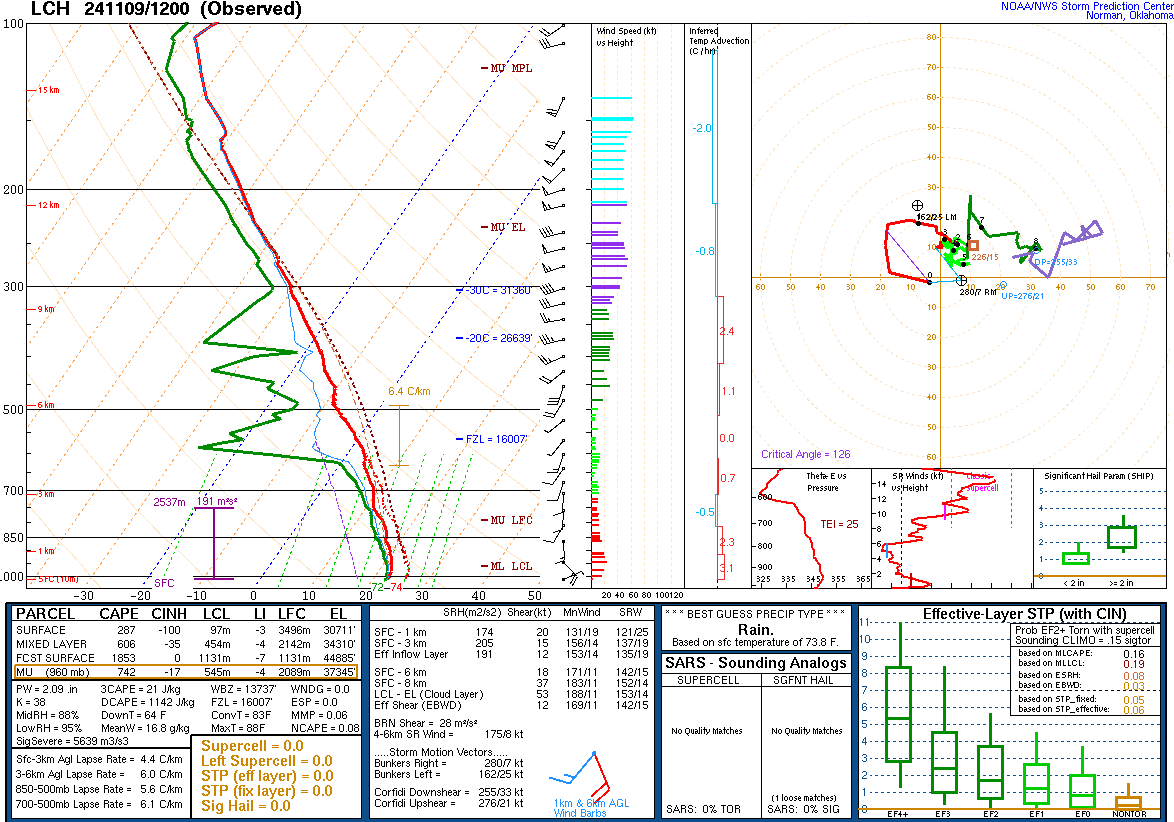
very high PWATs and significantly saturated environmental profiles will lead to the risk of widespread heavy rainfall across much of the state and elsewhere across the Lower MS/TN Valley, with the greatest totals anticipated in Louisiana (widespread 2-4, isolated 7-8+")
#LAwx
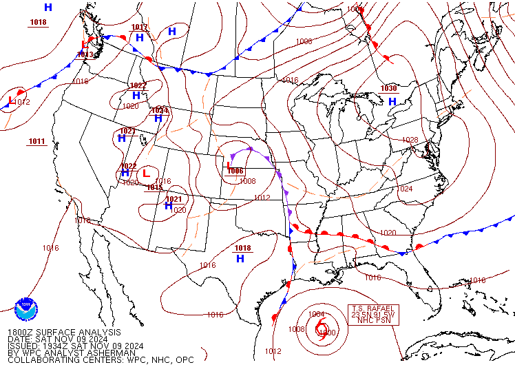
A dangerous flash-flooding threat is forecasted to exist today across portions of Central/SW #Louisiana as an influx of strong, rich GOM moisture in association with the outer influences of TS #Rafael and a strong frontal system situated over the South Central US, coupled with...
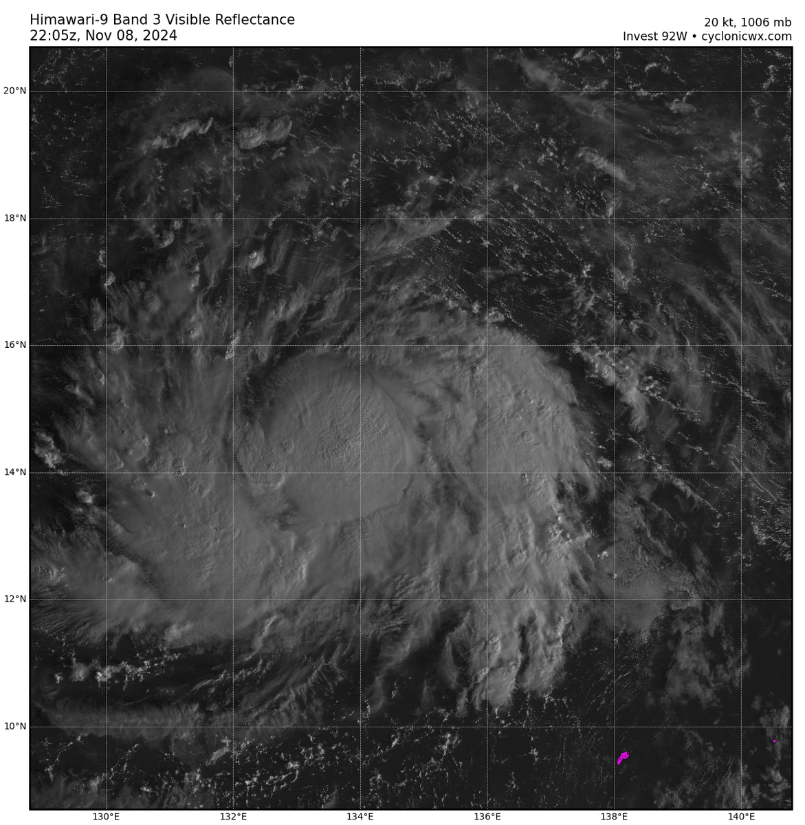
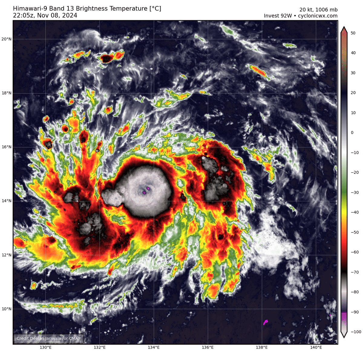
Sunrise over Invest #92W brings a quite obvious "TC" look. Well defined curved banding noted to the West along with very intense, cold central CB activity pushing -85C+ over an evidently tight LLC. Not sure why JTWC has budged from a "medium chance" marking.
#tropics#wxtwitter
BREAKING: The Minnesota Timberwolves are nearing a trade to send All-Star Karl-Anthony Towns to the New York Knicks, sources tell me and @JonKrawczynski.
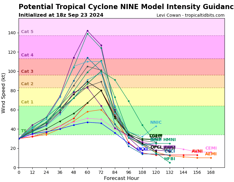
Furthermore, given the latest intensity guidance suite from 18z, and accounting for other reliable model intensity data, I wouldn't be shocked to see NHC start explicitly forecasting a major for PTC #09L / future #Helene.
A majority of the FL gulf coast should be on high alert.
A recent RECON pass into PTC #09L has indicated the presence of a small, and somewhat present RMW with associated >~40KT FL winds well to the East+ a corresponding pressure drop (down to ~1006mb XTRP), supporting at least 35kts.
09L (future #Helene) could be a TC at this time.