We submitted our paper on: "Analytical solutions for gravity changes caused by triaxial volumetric sources". Check out the preprint, Matlab codes will follow after acceptance https://t.co/8FwFokIKr6
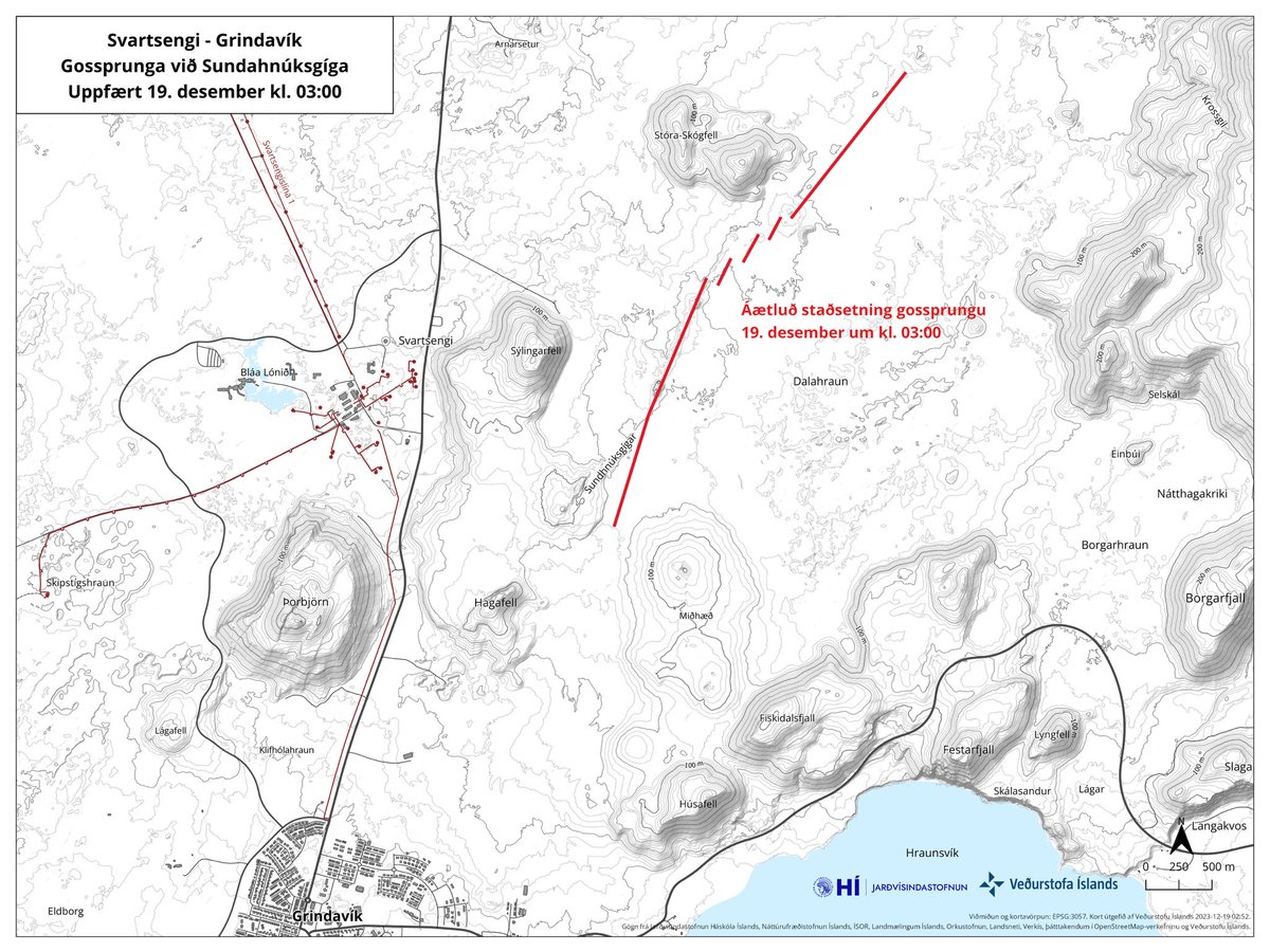
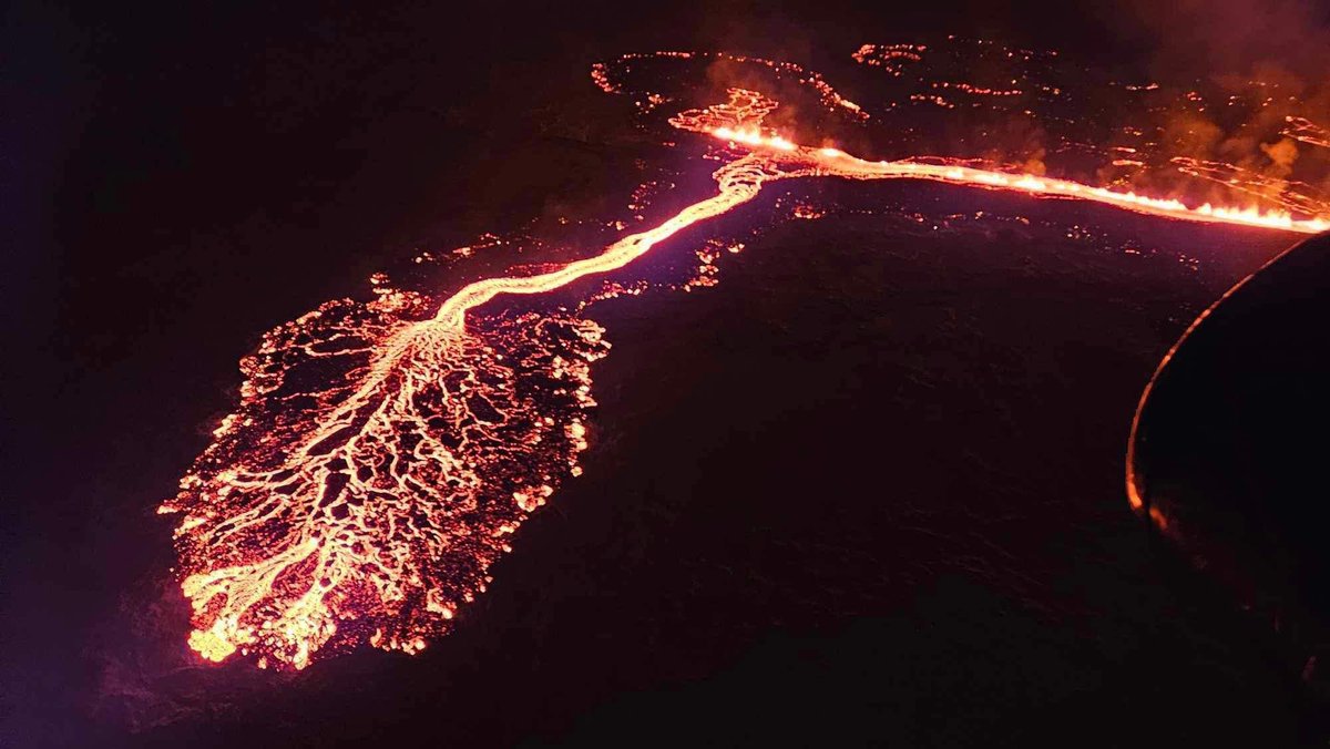
Eruption fissure still ~4km long but effusion rate has decreased, as expected. Fissure end 3km north of Grindavik but lava not going towards it or the power plant. So far, eruption is as non-threatening as could have been hoped for. Images @Vedurstofan@almannavarnir#Reykjanes
Approximate length and location of the fissure eruption on the #Reykjanes Peninsula. Reported to be 3.5 km long and potentially growing towards the North, with estimated output volumes of 150 m³/s, 3 to 4 times greater than the three previous eruptions at Fagradalsfjall.
JUST IN: First aerial footage captured just minutes ago of the newly opened volcanic fissure near Grindavík, Iceland.
It is estimated to be about 3 km long!
Jobs on Friday! 😱
2 funded positions in the "Geodynamic Modelling Section" at GFZ German Research Centre for Geosciences in Potsdam, Germany
(1) Postdoctoral researcher: https://t.co/Qva8txSowB
(2) Research software engineer / Postdoctoral researcher: https://t.co/6OU2HksU2r
Volcanic unrest is still occurring beneath the Reykjanes-Svartsengi volcanic system in Iceland 🌋 GNS Scientist Sigrún Hreinsdóttir is working with the Icelandic Meteorological Office and University of Iceland. Read more 👇
https://t.co/oZuqtvKLIY
As of 9am GMT, Nov 14, there has been NO volcanic #eruption across #Reykjanes - any footage you see on social media of an eruption is old, and maybe not even from Iceland. If an eruption happens it will be reported by RÚV and other reputable outlets immediately. #Grindavik
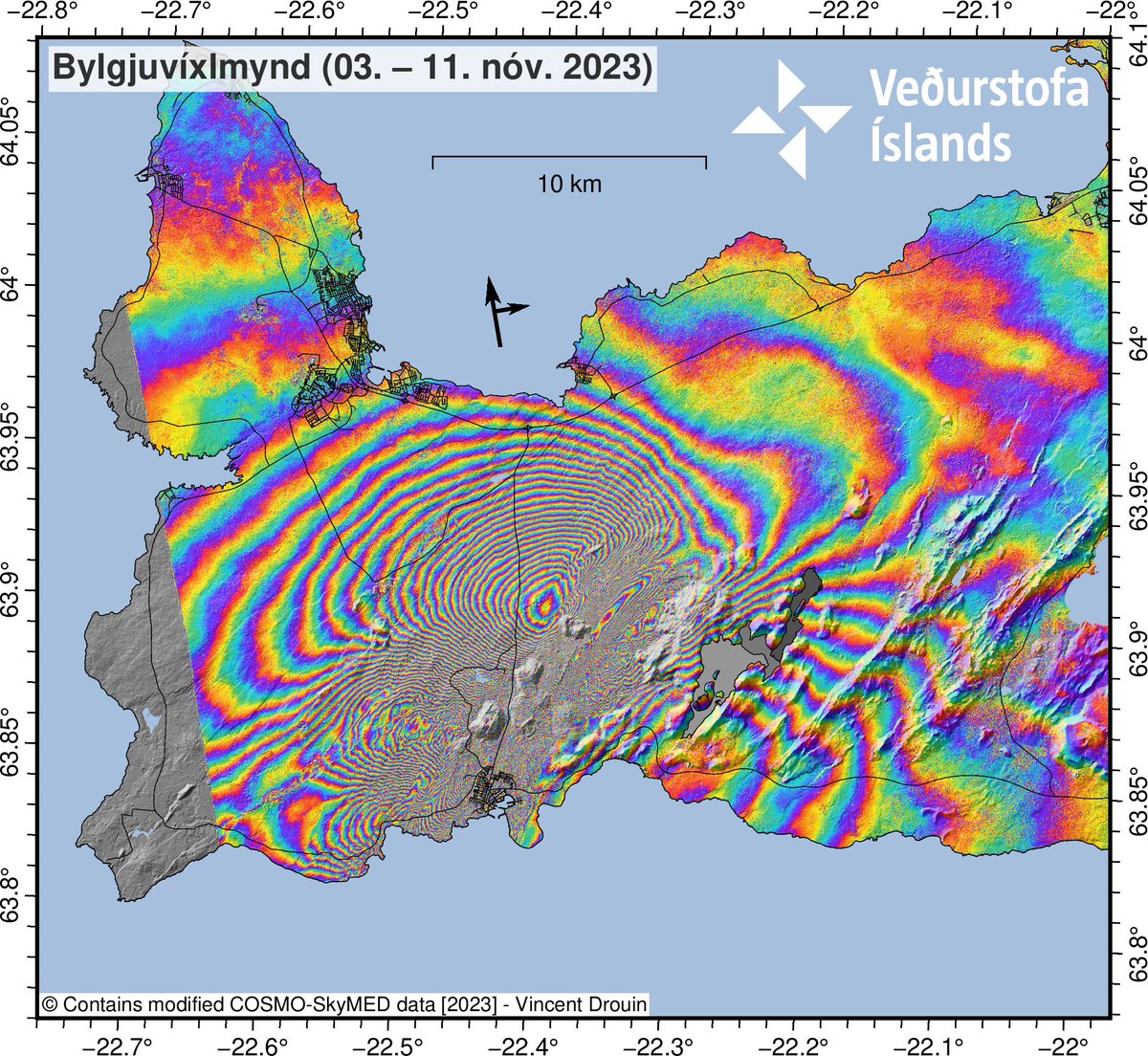
I satelliti radar della costellazione COSMO-SkyMed, sviluppato dall’Agenzia Spaziale Italiana in cooperazione con il @MinisteroDifesa aiutano a monitorare l’eruzione che sta avvenendo nella regione sud-ovest dell’Islanda
https://t.co/qpg7pwPIB9
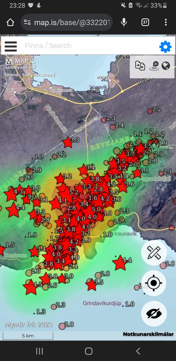
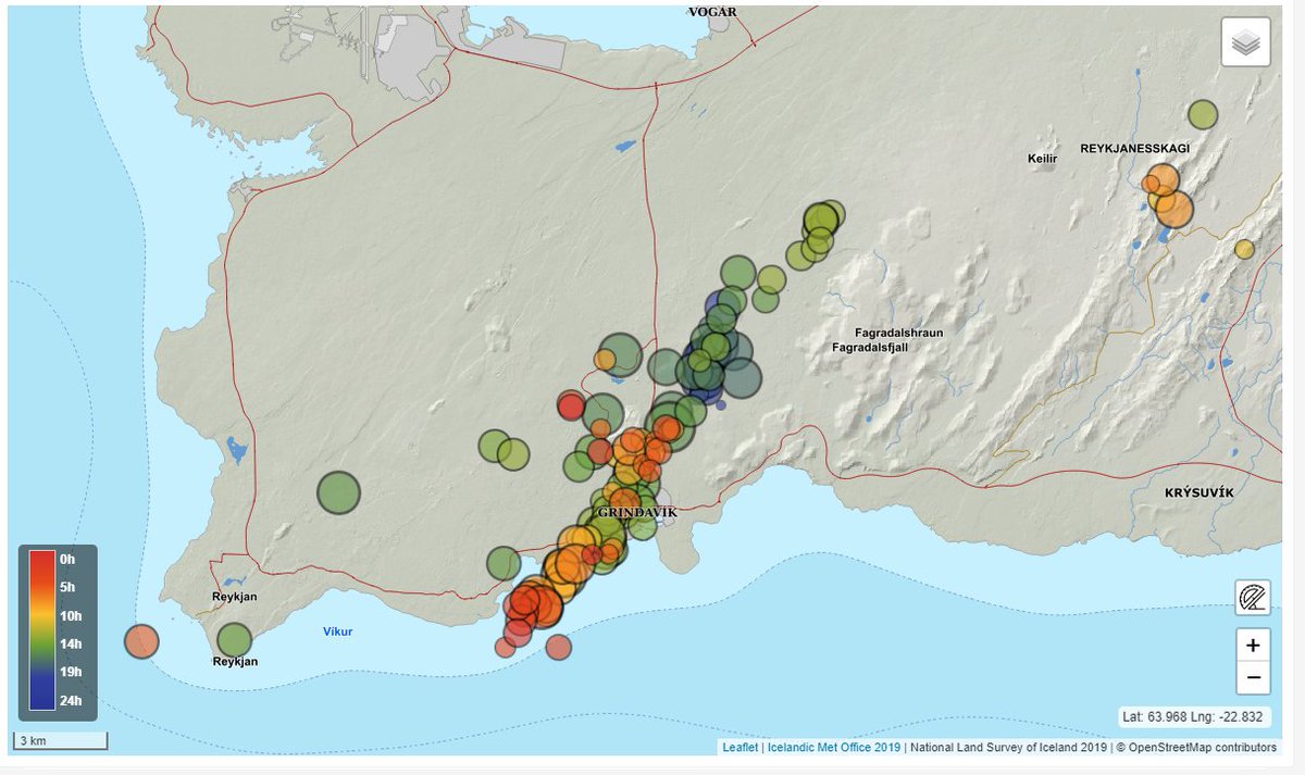
Visualizing the dike intrusion on Reykjanes Peninsula. The seismicity illuminates the dike's growth, starting NNW of Grindavik, and its rapid propagation in both directions.
If you are interested in the unrest and possible 🌋 in Iceland, start with the official information: https://t.co/DRIj2GnyCx via @Vedurstofan .
There is also a live blog from the @RuvEnglish (Icelandic Broadcasting service in English) https://t.co/62nRfA2nF5
For those asking what a phreatomagmatic submarine eruption at #Reykjanes would look like, probably quite a lot like this. Worth noting though that according to the Icelandic scientists, a submarine eruption is considered the *least* likely of all the possible outcomes.
Quick display of IMO's earthquake locations the last 6hrs using https://t.co/fsAt8MbJd1. A good,free tool to play with. It certainly looks like a dyke intrusion propagating both SW and NE from Svartsengi. Note that seismicity indicates that the dyke reaches under Grindavík town
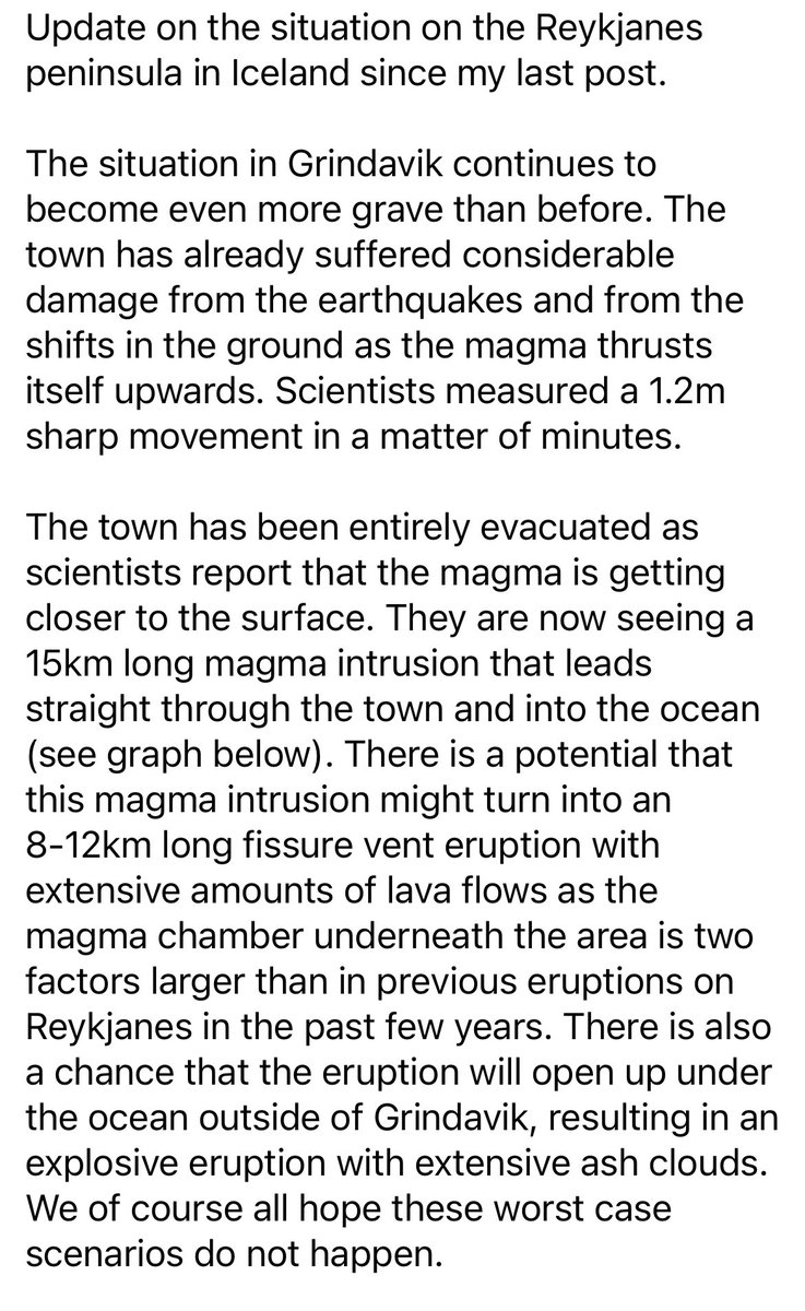
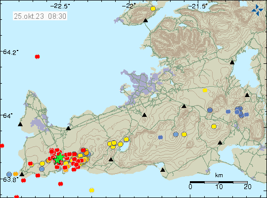
The rate of ground deformation is much higher than has been measured previously on the Reykjanes Peninsula. Around 800 earthquakes have been detected since midnight. The likelihood of a volcanic eruption occurring in the near future is deemed considerable. https://t.co/9vYBBjNcX9
Reykjanes peninsula experiencing new earthquake swarm. Over 600 quakes since midnight, with two moderate ones measuring in at 3.9 and 4.5 respectively (initial estimates from @Vedurstofan). GPS measurements have shown that the land is rising as magma is collecting.