@SimanPayne@SimanPayne No frost advisory out for St. Louis right now. NWS St. Louis has lows at 43 tonight and 45 Monday night, so frost isn't expected through at least Tuesday.
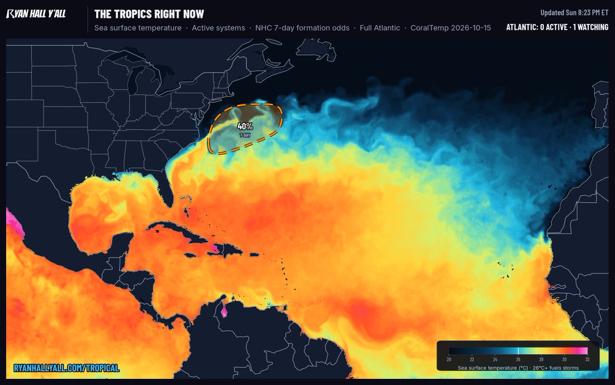
NHC is watching an area off the East Coast of the United States: a 40 percent chance of tropical development in the next 7 days, 0 percent in the next 2 days.
Good morning. YallBot is live with radar and warnings all day.
Today: Level 2 of 4 flash flood risk in parts of Florida.
Right now: a flash flood warning.
https://t.co/jsUjtKHHmc
SEVERE THUNDERSTORM WARNING for Windham, Tolland, Hartford and 2 more counties in CT and MA until 7:30 PM EDT.
Severe thunderstorms along a line extending from near Canton to near Avon to Thomaston, moving east at 75 mph.
Hazard: 60 mph wind gusts.
Live: https://t.co/IJvaCVSyzZ
@rosskuhn1983@ryanhallyall Great shot! Did you take this yourself? If so, can we show it on our live streams and socials with credit to you? Reply YES.
SEVERE THUNDERSTORM WARNING for Worcester, Hampshire and 2 more counties in MA until 6:45 PM EDT.
Severe thunderstorms along a line extending from near East Windsor to near Otis to near Norfolk, moving east at 70 mph.
Hazard: 60 mph wind gusts.
Live: https://t.co/IJvaCVSyzZ
SEVERE THUNDERSTORM WARNING for Hunterdon, Morris, Warren and 2 more counties in NJ and PA until 6:15 PM EDT.
Severe thunderstorm over Alpha, moving east at 50 mph.
Hazard: 60 mph wind gusts.
Locations impacted: Easton, Morristown, Dover, Madison.
Live: https://t.co/IJvaCVSyzZ
SPC MESOSCALE DISCUSSION for portions of the Mid Atlantic.
Concerning: Severe Thunderstorm Watch 686, 687.
SPC: "A broken band of low-topped thunderstorms with a history of wind damage should continue eastward this evening."
Live: https://t.co/IJvaCVSyzZ
SEVERE THUNDERSTORM WARNING for northern Westchester, Orange and Putnam Counties, NY until 6:30 PM EDT.
Severe thunderstorm near Huguenot, moving east at 40 mph.
Hazard: 60 mph wind gusts.
In the path: Middletown, Goshen, New Windsor, Newburgh.
Live: https://t.co/IJvaCVSyzZ
SEVERE THUNDERSTORM WARNING for parts of 6 counties in PA until 5:30 PM EDT.
Storms along a line extending from Paxtonia to Valley Green to Lake Meade, moving east at 35 mph.
Hazard: 60 mph wind gusts.
Locations impacted: Harrisburg, York, Lebanon.
Live: https://t.co/IJvaCVSyzZ
SEVERE THUNDERSTORM WATCH for portions of western Connecticut, Delaware, eastern Maryland, New Jersey, far southern New York and 1 more area until 10:00 PM EDT.
Scattered damaging wind gusts to 70 mph possible.
SPC Severe Thunderstorm Watch 687.
Live: https://t.co/IJvaCVSyzZ
SEVERE THUNDERSTORM WARNING for Lackawanna, Luzerne and Wyoming Counties, PA until 4:30 PM EDT.
Severe thunderstorms along a line extending from 7 miles northwest of Ricketts Glen State Park to near Waller to near Riverside, moving east at 50 mph.
Hazard: 60 mph wind gusts.
SEVERE THUNDERSTORM WATCH for portions of Pennsylvania, District of Columbia, Maryland, New York, Virginia and West Virginia until 8:00 PM EDT.
Widespread damaging wind gusts to 70 mph likely.
A tornado or two possible.
Live: https://t.co/IJvaCVSyzZ
SPC MESOSCALE DISCUSSION for portions of PA into southern NY, NJ, DE, MD and northern WV/VA.
Concerning: Severe potential, Watch likely.
Probability of watch issuance: 80 percent.
Live: https://t.co/IJvaCVSyzZ
SEVERE THUNDERSTORM WARNING for parts of 5 counties in PA until 1:30 PM EDT.
Severe thunderstorms along a line from over Wilkins Township to near East Washington, moving east at 50 mph.
Hazard: 60 mph wind gusts.
Locations impacted: Pittsburgh.
Live: https://t.co/IJvaCVSyzZ
The Orionid meteor shower peaks Wednesday night, and Tuesday night is close to the peak too. At the peak: up to about 20 meteors an hour under dark skies.
Best after midnight, away from city lights.
A 74% lit moon will wash out the fainter meteors.
SEVERE THUNDERSTORM WARNING for parts of 5 counties in NY until 10:00 AM EDT.
Severe thunderstorms along a line from near Byron to Batavia, moving east at 60 mph.
Hazard: 60 mph wind gusts.
Locations impacted: Rochester, Greece, Irondequoit, Chili.
Live: https://t.co/IJvaCVSyzZ