We have added multiple new custom topographic maps of Minnesota lakes to our store, including Lake Lida, Star Lake and Big Cormorant Lake, with more maps on the way! #oldmaps#topographicmap#minnesota#lakes https://t.co/b0nd6ja80Z
Cattaraugus County New York Just acquired and edited from Library of Congress . A huge map 5' square. 1000s of Homeowner Names. see https://t.co/FqmLVamKIk or ETSY: https://t.co/sJeJaNwSzM. #cattaraugus#olean#newyorkhistory#wallart#salamancany#oldmap
A circa 1860 map of Spotsylvania County Virginia. Shows homeowner names. Perhaps made for the Civil War. Many old map prints on https://t.co/FqmLVamKIk and my #etsy shop https://t.co/mpOiG08dWf #spotsylvania#chancellorsville#civilwarmap#virginiahistory
Orrs Island and Bailey Island Maine 1872. Closeup from my custom map made from a larger nautical chart. Property lines. Old roads . Prints on https://t.co/FqmLVamKIk & my #etsy shop: https://t.co/8MRFLdi73U #orrsisland#baileyisland#baileyislandmaine#orrsislandmaine
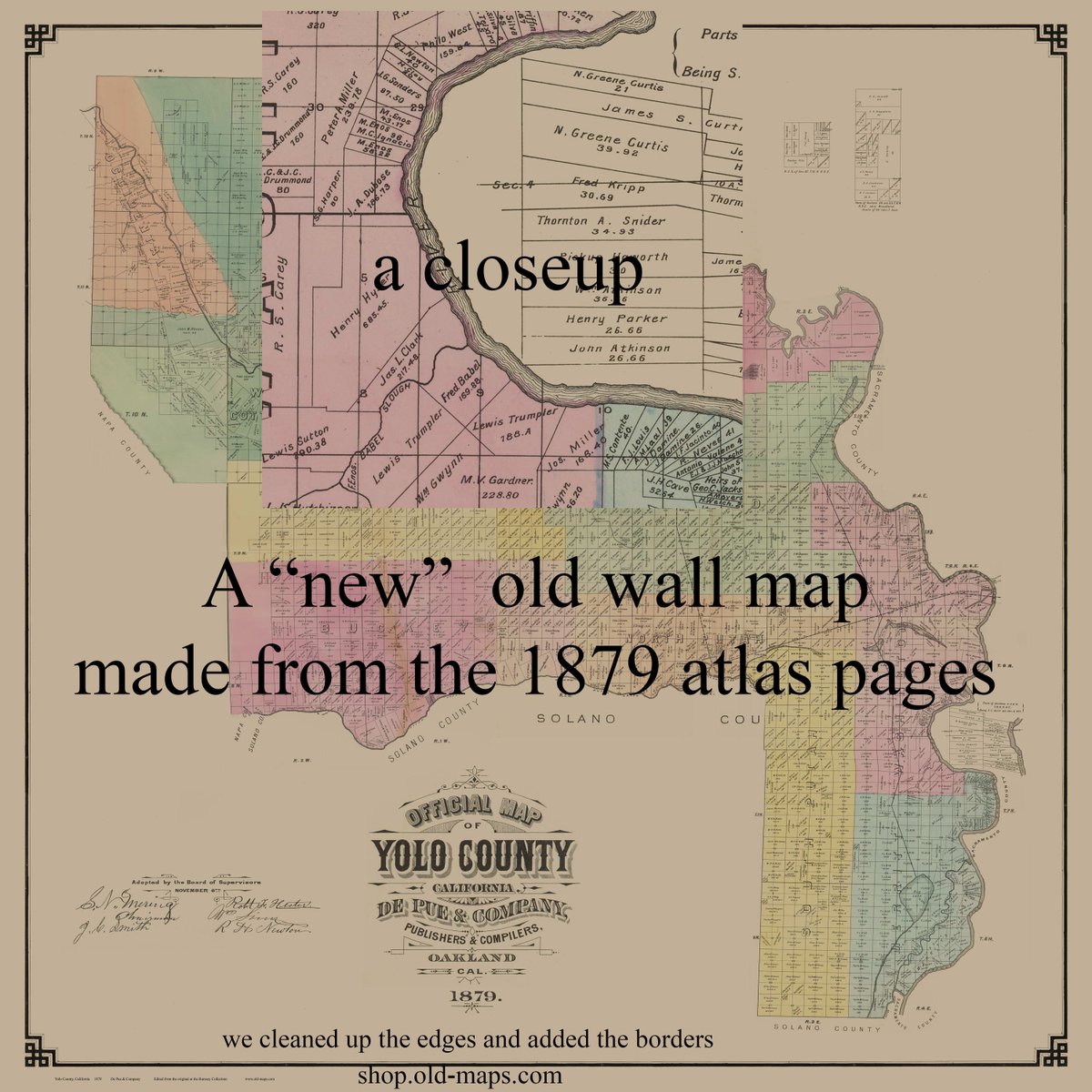
Yolo County in 1879. We edited the images from the David Rumsey site's atlas to make a "New" county wall map. Farm lines. Owners names. Prints at https://t.co/FqmLVamKIk & #etsy shop: https://t.co/4wkHiOoqUu #yolocounty#sacramentohistory#californiahistory#davisca
Milwaukee Nautical chart 1957 A different time. Lots of railroads. See 100s of Great Lakes chart reprints at https://t.co/FqmLVamKIk & #etsy shop: https://t.co/SID5cZz7Vl #milwaukee#milwaukeehistory#wisconsin#lakemichigan