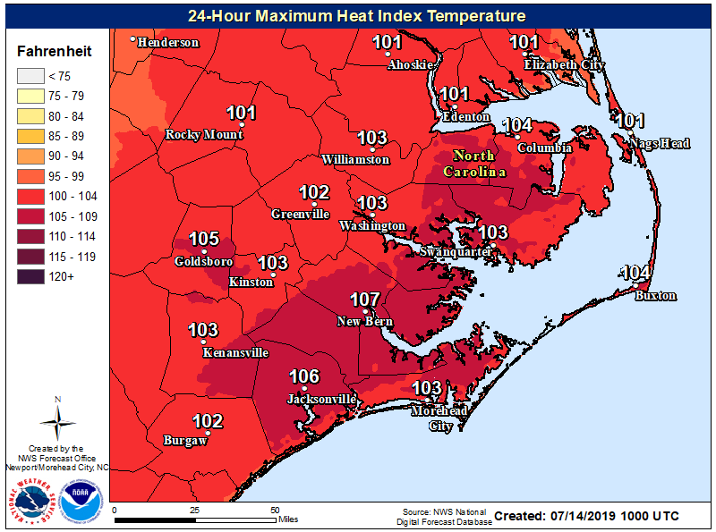
Hot and humid conditions will lead to heat indices of 100F - 105F. Know the signs and symptoms of heat exhaustion and heat stroke. Anyone overcome by heat should be moved to a cool and shaded location. Heat stroke is an emergency! Call 9 1 1.
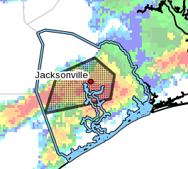
***Flash Flood Warning***
Until 700 PM EDT. Some locations that will experience flash flooding include... Jacksonville, Half Moon, Camp Lejeune Center, Catherine Lake, Richlands.
Turn around, don't drown when encountering flooded roads. Most flood deaths occur in vehicles.
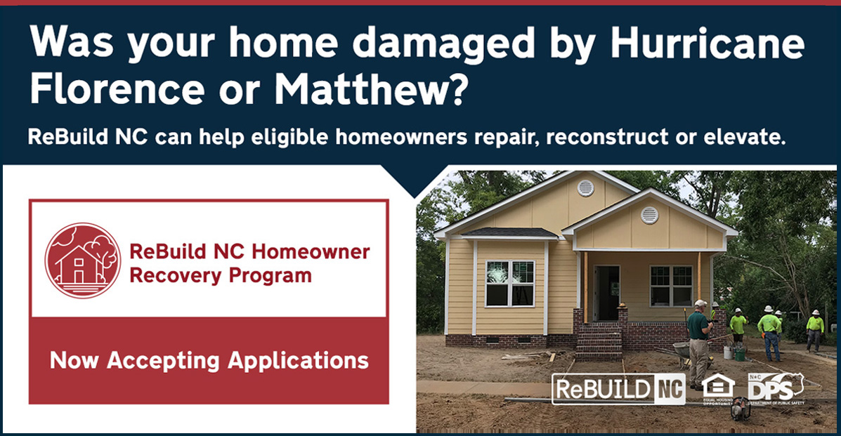
Did you know: @ReBuildNC_gov is accepting applications for the Homeowner Recovery Program. The program helps homeowners whose homes were damaged by Hurricane Florence or Matthew. Learn more: https://t.co/9yB4QsqksO #ReBuildNC
If you have information about Tyler Angel Cross, please contact JPD Detective Scott Eichelberger at 910-938-6440 or [email protected]. Information can also be anonymously texted via Text-A-Tip by typing TIP4CSJAX and your message to 274637 (CRIMES)
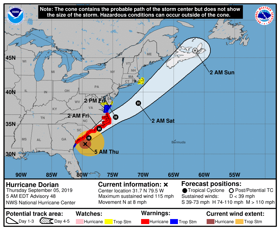
The 5 AM update shows that Hurricane Dorian is a Category 3 storm moving North at 8 mph. Residents of coastal eastern NC should prepare for hurricane conditions tonight and Fri morning. All preparations should be completed this morning. More coming later in our latest briefing.
A Heat Advisory is in effect for Eastern NC today for the dangerous combination of heat & humidity which will produce Heat Index values of 100-110 degrees. Remember stay hydrated, take frequent breaks, & spend time in the air conditioning. These conditions will persist all week.
Public Feedback Request: Onslow County is updating the Hazard Mitigation Plan. We have developed a community survey for our residents to participate in. Please take a few minutes to complete the survey. For questions call: 910-347-4270.
https://t.co/B94VT3PmbB
Heads up today Eastern NC! Thunderstorms with a high probability of producing damaging wind gusts are expected later today and into the first part of tonight. The SPC has upgraded to whole area to an Enhanced Risk. We will have a briefing with more details out soon. #ncwx
We’re in Jacksonville today! Stop by our booth at the Walmart at 2025 N Marine Blvd. We will be here until 2 PM or so, handing out a variety of FREE weather brochures. The focus is #hurricane preparedness.
Are you insured for a hurricane? Keep in mind that standard homeowners insurance doesn’t cover flooding, and flood insurance requires a 30-day waiting period! Find coverage at https://t.co/Zfyz36pbWG #HurricanePrep#HurricaneStrong
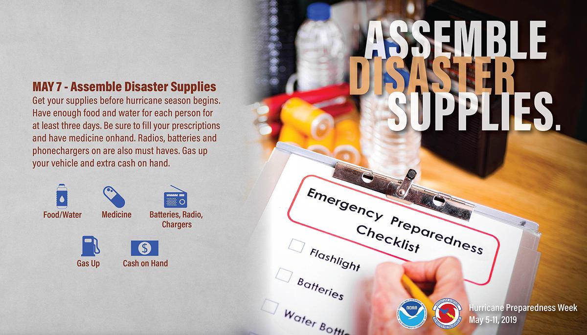
Just having enough supplies to make it through a hurricane isn’t enough. You need plenty to make it through what could be a long recovery period too. Prepare for AT LEAST one week. https://t.co/vhKa28UJek #HurricanePrep#HurricaneStrong
Are you in a hurricane evacuation zone, or in a home that would be otherwise unsafe in a hurricane? If so, think now, about where you’d go and how you’d get there if you're told to evacuate. https://t.co/upeESGLhyM #HurricanePrep#HurricaneStrong
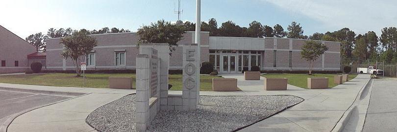
Join OCES and the Natl. Weather Service for a FREE Basic SKYWARN class on April 12th from 6:30p - 8:30p here at the Onslow EOC: 1180 Commons Dr. N, Jacksonville.
Register online at: https://t.co/9ykVw6s88r
@ThymetoSave We will be opening 4 shelters. Messages should be going out first thing in the morning. We are still urging citizens to leave the county if possible based on the current predictions.
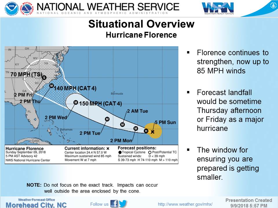
*Hurricane Florence Update*
09/10/18 - 9am update
Monitor Florence closely. Our potential of receiving very heavy rainfall and flooding is increasing. NWS anticipates we may begin to see rainfall as early as Wednesday night and could potentially stall after making landfall.
*Hurricane Florence Update***
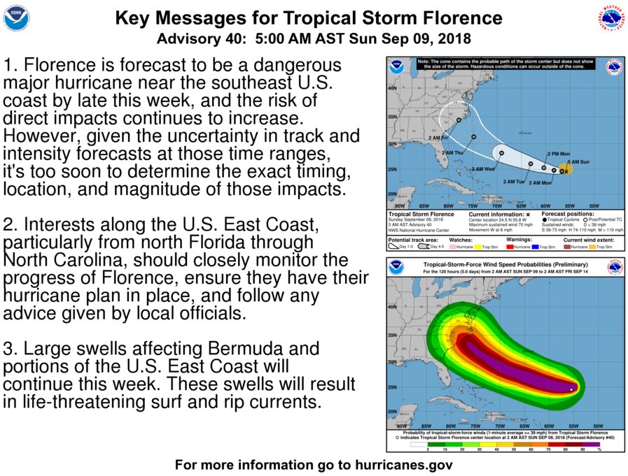
We encourage Onslow residents to monitor this storm closely and stay informed to potential local impacts and threats. Our chances continue to increase of seeing impacts to include dangerous winds, dangerous storm surge and significant rainfall.
*Hurricane Florence Update*
09/09/18 - 9am
Residents should continue to monitor updates for Florence and take this time to prepare. Chances are increasing that we will see strong winds and very heavy rainfall.
Visit: https://t.co/mXQ1sV66by for additional information.
*Hurricane Florence Update*
09/08/18 - 9am
The National Hurricane Center has increasing confidence that the east coast will see impacts. This could include tropical force winds and heavy rains. Continue to monitor the storm and take time this weekend to prepare.