PeakVisor calculates when the Sun and Moon cross the actual terrain skyline at any Panorama 3D point, for any date. Change the day or press play to watch light move across the landscape. Photographers, take note! 📷🎥
@VR_FR_Spotter Hey! The app is designed for navigation offline (as well as planning). So, you can basically plan a hike, identify mountains on the go, navigate the trail, and then have a collection of your outdoor adventures. All that works offline as long as you downloaded maps in advance.
PeakVisor calculates when the Sun and Moon cross the actual terrain skyline at any Panorama 3D point, for any date. Change the day or press play to watch light move across the landscape. Photographers, take note! 📷🎥
@volcaholic1 A ten-km ash plume makes even Klyuchevskoy look small. This volcanologists’ hut sits at 3,300 m between Klyuchevskaya Sopka and Kamen not a bad field office:
https://t.co/Id0m0qQx7x
@NatGeo I’d be curious how much ship noise overlaps with a sperm whale’s hearing range. Are they disturbed by the same frequencies we hear, or by parts of the soundscape we barely notice?
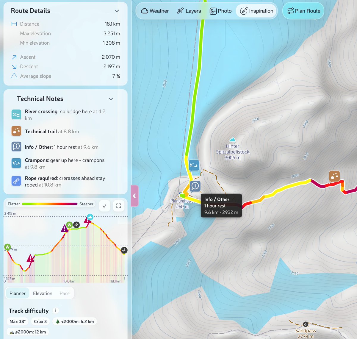
Built for mountain guides and group leaders, but useful whenever a route is being handed to someone else: alpine clubs, outdoor schools, trail-race organizers, hut-to-hut groups, and friends planning technical terrain.
A route line tells you where to go. It doesn’t tell your group where the last water source is, where to put on a helmet, or where the river crossing gets serious after rain.
Technical Notes pin those details directly to the track and carry them into the GPX when you share it.
@CopernicusEU Six degrees above average makes us wonder what is already changing below the surface. Are local species moving deeper or north, and are warmer-water species beginning to appear in the Gulf of Lion?
@pablo_artal@CasaArtales Clouds clearing just in time, an eclipse, and Luis’s birthday Murcia was unusually cooperative. The crescent through those thin clouds came out beautifully.