Happy 20th birthday, @OpenStreetMap! 🎉
We are happy to be part of this incredible global community that has made OSM an invaluable cartographic resource for the world. 🗺️
Here's to many more years of collaborative mapping and open cartography! ✨
#OSM20#OpenStreetMap
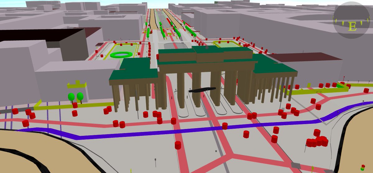
Would you like to learn about mobile signal coverage in educational institutions in Peru? @yunica__ has created an interactive 3D visualization tool ➡️https://t.co/Go9an7RC6b using OSM data & @OSIPTEL OpenData, showing the coverage & mobile signal strength across Peru's regions.
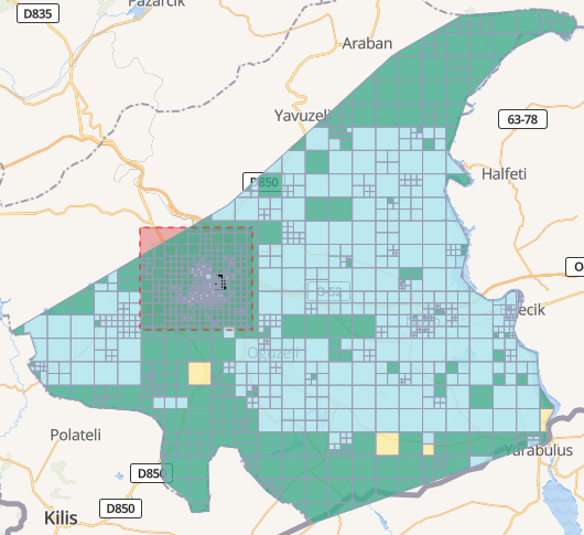
Currently, 48% of the validation is complete, and more work will be done to support the complete validation of the entire project.
If you are a user with an intermediate or advanced level, join us in the validation!
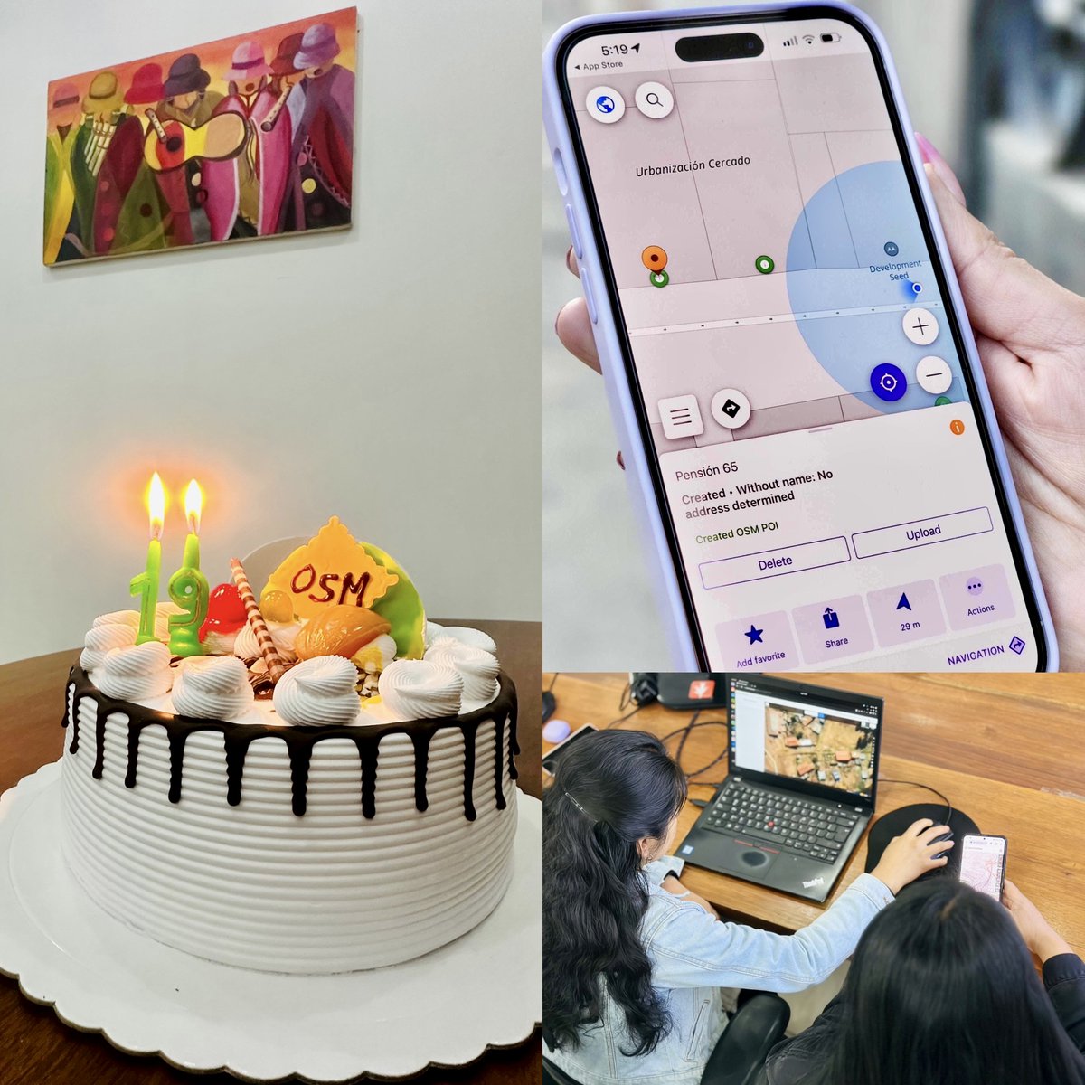
As part of the response to the #TurkeySyriaEathquake, many volunteer mappers joined to support @hotosm tasks. @developmentseed’s data team is #validating on Türkiye - Gaziantep project https://t.co/2s6L7e6h0g focusing on the priority area to ensure the quality of the added data.
Later today @yunica__ will be giving a lightning talk on the JOSM Magic Wand tool developed by our Data Team. Tune in!
Tomorrow you can also catch up with @_wille about OSMCha and @Rub21m about OSM Seed two other projects we are proud to support.
#MappingUSA#WikiConferenceNA
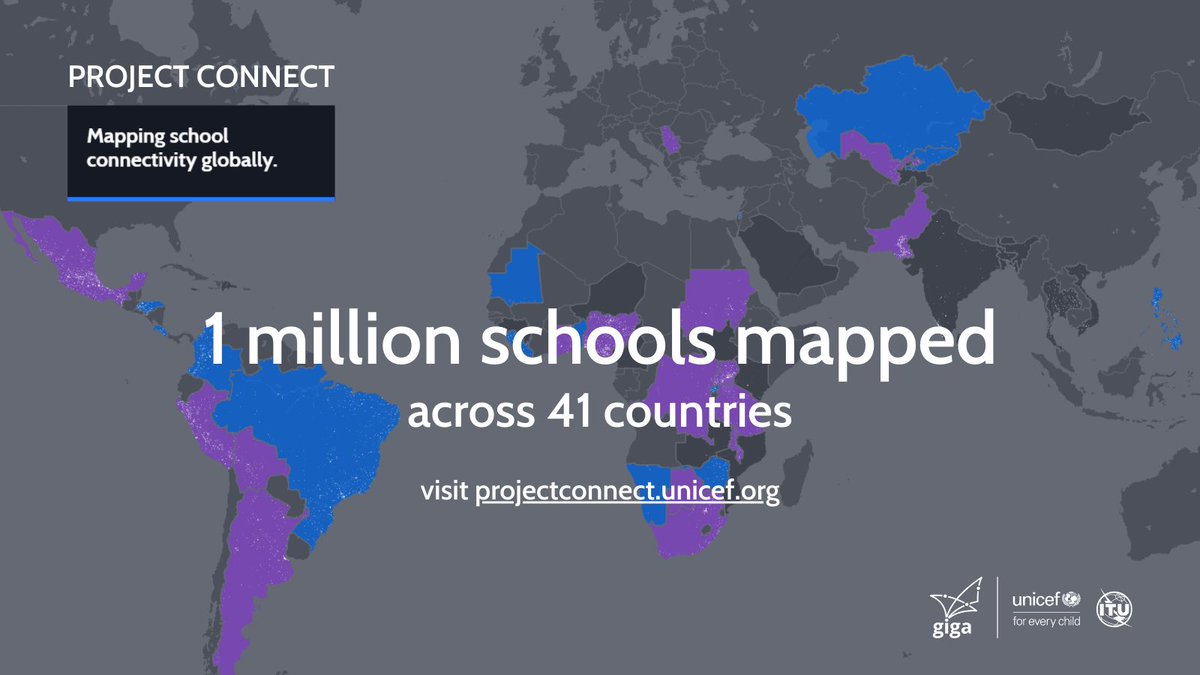
To connect every young person to the Internet and to a lifetime of opportunity, we need to #MapEverySchool - and we have now mapped 1 million schools 🚀 Explore the map: https://t.co/ONmEDbwDaL
Black Lives Matter.
Ours is not the most important voice right now. We are here in solidarity. We stand with the protesters and their demand for justice and action to put an end to racial injustice in policing.
https://t.co/M1HgUE3x6A
If you’re wondering whether it’s an overreaction to cancel large gatherings and public events (and I love basketball), here’s a useful primer as to why these measures can slow the spread of the virus and save lives. We have to look out for each other. https://t.co/Ld7Uc8sPTQ
Participa en el #SOTMLatam2018, donde se mostrará el mapeo asistido por #MachingLearning, desarrollado por el equipo de ML y el equipo de Datos de @developmentseed. Combinación que ayuda a producir 33 veces más rápido datos en #OpenStreetMap! https://t.co/3XwA46lWBE