Send us your snow reports and observations! What are you seeing in your area? You can do that via #mPing. These reports help us understand where it is snowing, if there's a rain/snow mix, or places where it is just raining. Thanks everyone, we appreciate it! #wawax
The ongoing cold trend will continue through this weekend. Another round of Cold Weather Advisories are in effect tonight through tomorrow morning for much of NW Oregon & SW Washington. These areas can expect temperatures and/or wind chills as low 15°F to 25°F.
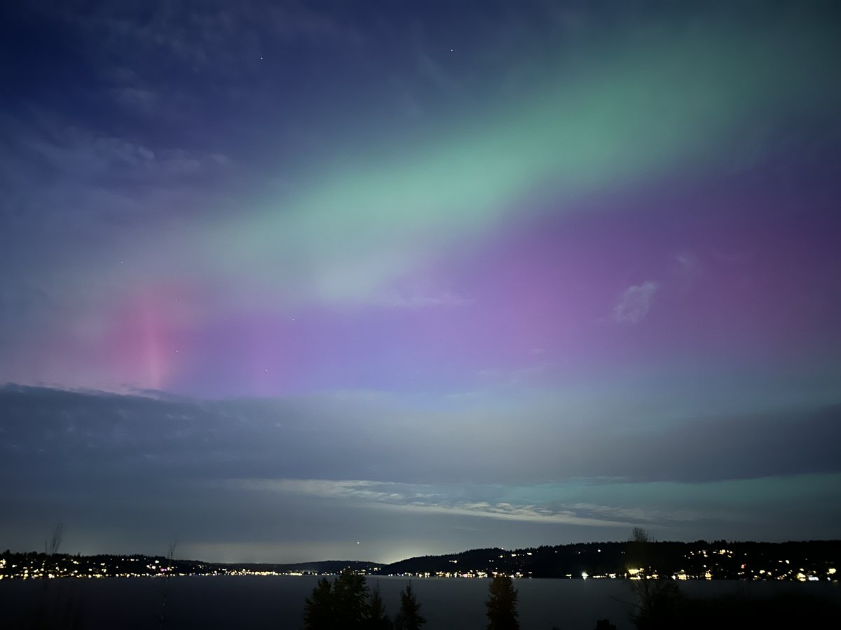
Aurora Borealis as seen from the office roof this evening over Lake Washington! High clouds will continue to increase tonight, but any breaks in the clouds will allow for the northern lights to be visible. #WAwx
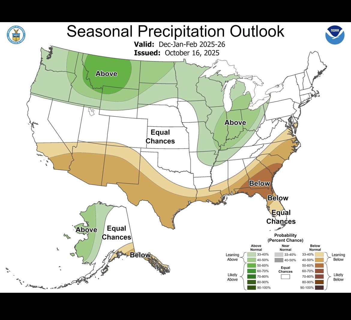
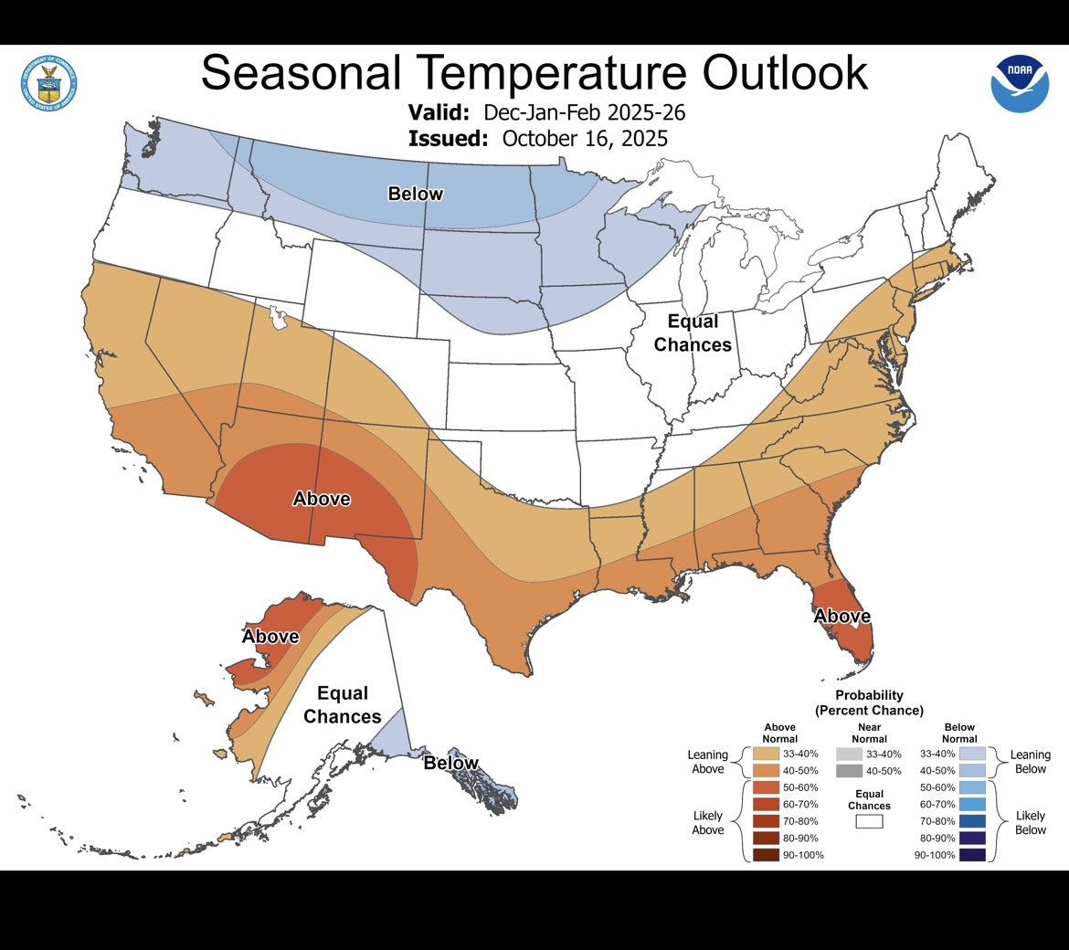
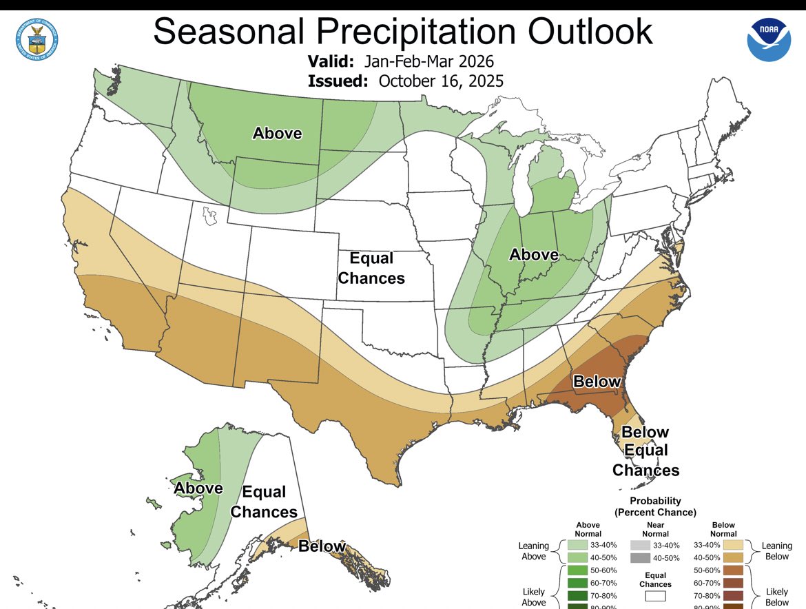
Oh boy is this something great to see! NWS predicts a colder and wetter than normal winter for the Pacific Northwest and Northern USA! You know what that means…. 🥶❄️ still could bust but I like this look! #lanina#winteroutlook#bcstorm
My former colleague @LoriMatsukawa used to call this the “frost on the pumpkins” night! We’ll see the first widespread frost of the season tomorrow morning—protect pets 🐕 and sensitive plants 🌱 from the cold!
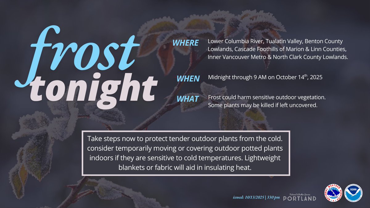
Clear skies, light wind, & cooler temps means one thing...frost. Frost is expected tonight & will be more widespread. So if you have sensitive plants outdoors, consider taking action.
To see if you're in this advisory, visit https://t.co/3SFImIwQhQ
🌨️Mountain Snow!
Colder air will filter into Western WA tonight through Monday, resulting in higher elevation snow. If you're heading out into the mountains, be aware of the forecast. Precipitation, along with colder temperatures, results in an increased risk of hypothermia!
What an absolutely stunning morning! The first snowfall of the season at Picture Lake. Words cannot describe the feeling this morning. Thankful we have this so close to us. #wawx#pnw#nature