El Paraná es un río fundamental para entender la geopolítica sudamericana y el más importante del subcontinente en términos sociales, políticos y económicos
Lo analiza @abelgillobo
https://t.co/ksaKVPjL8n
Day 23: ¿GHSL? | #30DayMapChallenge
I don't know what GHSL is, but instead I wanted to seize the occasion to propose a new cathegory for the challenge something like: "maps in other languages". I made this one while I was learning arabic for my friend Felipe Medina
Blending modes and effects in @ArcGISOnline have been super helpful in letting me make nice, smooth basemaps - one of my favorite additions in a long time.
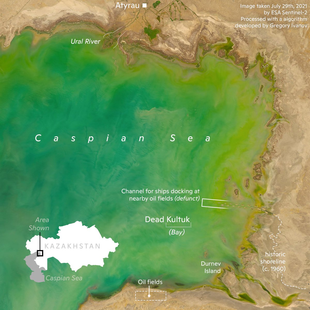
#30DayMapChallenge (water) a map of where water should be, but isn't: the receding coastline of the #Caspian Sea is shown vividly in this image from #Sentinel2. Big thanks to @ksituan for helping me interpret some of the oil infrastructure in the area.
#30DayMapChallenge (urban vs. rural) inspired by the #Canadian maps of @ksituan, I decided to show the most densely populated part of #Canada, from Toronto to Quebec (City).
Un territorio se construye a partir de su reconocimiento social y debe de existir en la cartografía del mundo conocido. ¿Cómo se ha reconocido el territorio latinoamericano según la visión "occidental" a lo largo de la historia? Gonzalo Prieto en @geoinfinita nos da una idea.