I am very proud of our new article describing a newly developed R package for #forest dynamic simulation based on #NFI data! Great work, @jernejjevsenak !
Machine Learning Forest Simulator (MLFS): R package for data-driven as... https://t.co/9WvSNz9vBY
First results of Tereza's mapping of the invisible world of smells. Great thanks to our Gottingen colleagues for help. https://t.co/f0D8rMc6bd ... and more to come soon 🤓🌳🌹
If you ever wondered how to make different use of your lidar scanned data (for people who cannot visit forest), here is a suggestion: https://t.co/IUy61tuZbt
Proud of this team of pioneering guys from different research areas (3xH 🤓)
#lidar#VirtualReality#DigitalTwins
@m_mokros Well, **it happens what can you do? Selfishly I am happy it is not one of our drones 🤷😎 On the other hand In contrast to manned aviation, material parts can be bought and replaced, pilots not … this research must go on 🙂🤓
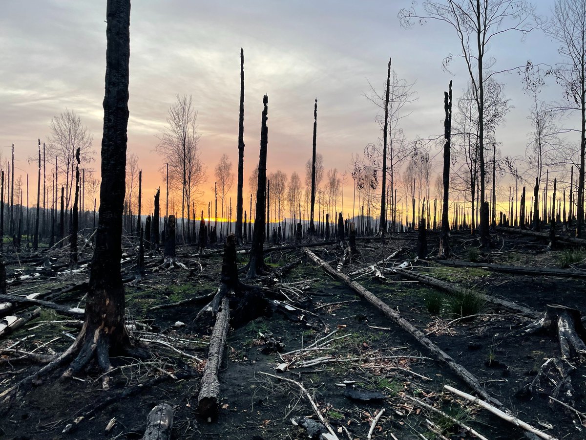
After firemen leave, the forest services are required to monitor the burned area. Aviation causes dangerous air movement; walking is nearly impossible at this extent. Drones are most likely the only solution(forestry education should take it to account)🌳🛩️https://t.co/q0vOdYjdeL
@Forests_MDPI @SamuliJunttila @mrb_campos @LindforsLauri@ep_fgi@AaltoUniversity@helsinkiuni Very interesting, this may perhaps also explain the branch movement measured by our colleague with UAV lidar on dead standing trees: https://t.co/SuduxalMA5
That would be really good indicator for forest status assessment by RS.
📢New App Announcement 🥳
#iScanForest
We are happy to announce the LiDAR-based app for #iPhone and #iPAd for tree mensuration (DBH accuracy under 2cm, positional error 1m/100m).
More info at https://t.co/dRij1UHbRg
Soon on AppStore
#forest#lidar#ScienceToPractice@Apple
Even the longest journey starts with the first step. And if you want to know how to make the second, third and all the other steps during the optimal trajectory for photogrammetry in forest stand, read this 🙂😎:
https://t.co/CRF20RMxoO
@TejaKattenborn @Felix_Schiefer OK we have such data from national parks including time series e.g. different ages of standing dead trees. It is multispectral but of course RGB composite is possible🙂
@HarriKaartinen @juha_hyyppa It looks like a drift of GPS position, this sometimes also happens above canopy. :( Propeller cages and manual supervision might be the way, maybe. The data looks really promising though, fingers crossed 😎
@juha_hyyppa @HarriKaartinen @KukkoAntero Yes, the proximity sensors are sensitive to larger branches only, unfortunately. We had nearly similar experience, but data was enough for a paper anyway 😁. https://t.co/qVycKVWvRx Propeller guards are useful. This is a nice topic to research, lot of luck next time 👍
13 is bad luck in some countries, 4 in another ones. :) Karel managed to get the new paper published on 13.4. This must bring luck🤓
How you can automatically measure trees in high density laser scans (from UAV):
https://t.co/zh6jxd9wh0
#UAV#laser#pointclouds