👏 Thank you to Gregory Yeoman for sharing how Surrey LRF are using ResilienceDirect Maps and NGD data to deliver flood planning and response at this weeks Lunch and Learn.
📹 All sessions are recorded and uploaded to ResilienceDirect 👇
https://t.co/FBq4yDG5ya
ResilienceDirect Spring Clean
👥Now is the perfect time to refresh your membership - remove those that have left, include new joiners.
ℹ️Is your content current? Review and archive the rest.📤
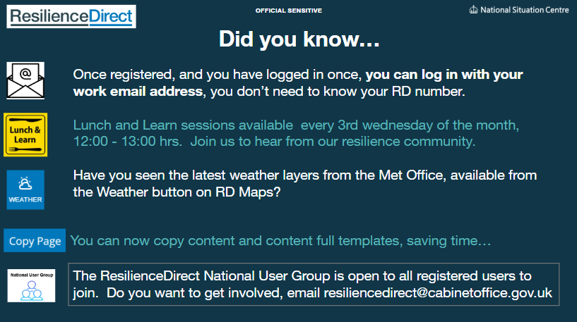
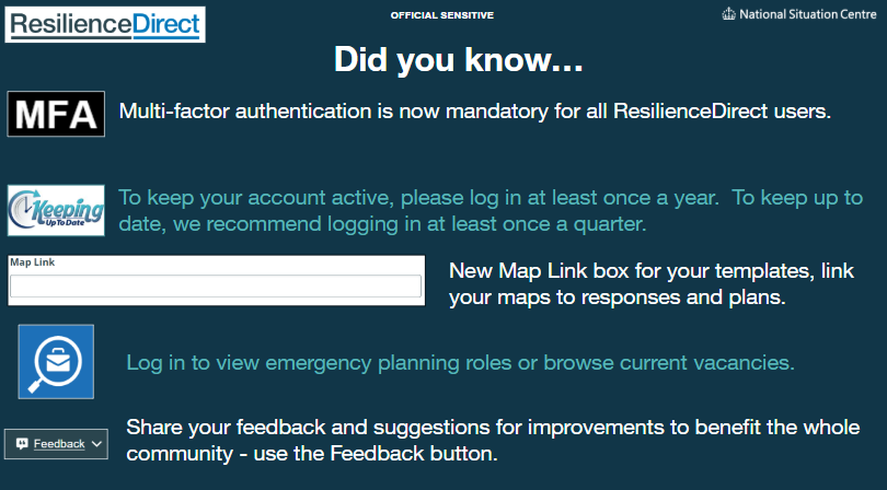
❓Knowledge Refresh - are you up to date? Check out the homepage news item
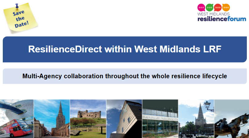
👏 Thank you to Luke Martin from West Midlands LRF for this week's informative Lunch and Learn and to those @RD_Gov users who joined.
📅 Join us on 20 May to hear from Greg Yeoman, Surrey LRF on how they use RD for multi-agency collaboration on.
📅 Join us Wed 15-Apr-26, 12:00-13:00 @RD_Gov Lunch and Learn
🗣️ Keynote Speaker: Luke Martin, West Midlands LRF
❓ How do Local Resilience Forums (LRFs) balance standard office tools with the specialist requirements of emergency management?
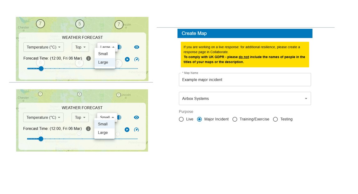
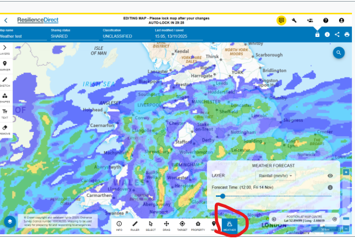
💡 Did you know new functionality has been added to @RD_Gov Maps?
🗺️ Support for Weather Animation and Configurable Icon Sizes.
🗺️ Support for What3Words and OS Grid References in CSV Assets.
🗺️ A new 'Major Incident' category you can select when creating your maps.
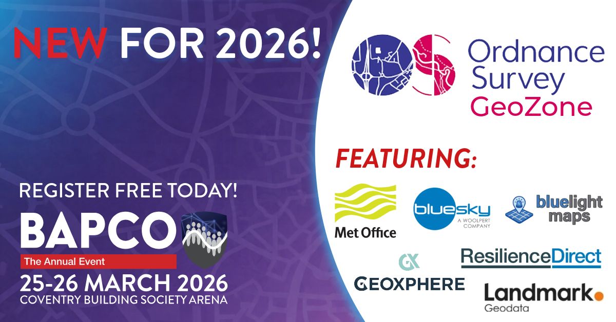
Day 1️⃣ @BAPCOEvent Annual Event with @OrdnanceSurvey Survey GeoZone.
🤝We are back tomorrow don’t forget to come and say hi and get your questions answered.
#BAPCO26
@RD_Gov are looking forward to being a part of the @OrdnanceSurvey GeoZone at this year's @BAPCOEvent.
👋 Don't forget to come and say hi and ask any questions you may have.
👏 Thank you to over 200+ RD users who joined today's lunch and Learn to hear more on recent RD Maps updates.
🖋️ If you would like to showcase how your organisations utilises RD during lunch and learn get in touch with the team.
📬 [email protected]
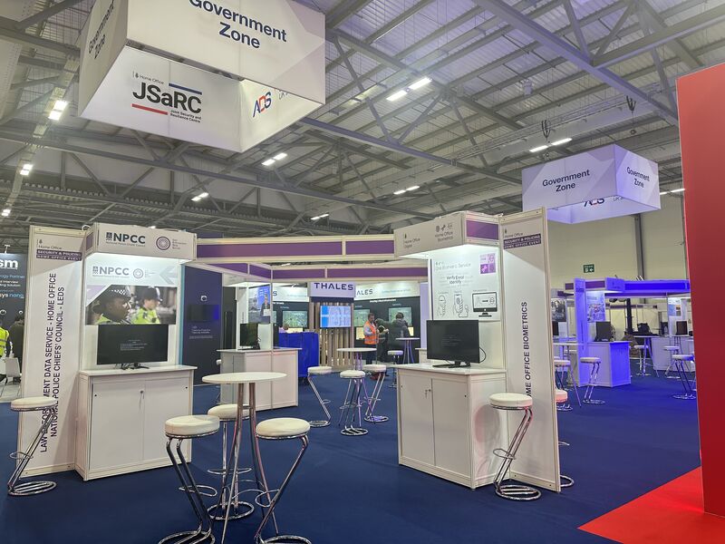
📣 We are exhibiting at Security & Policing 2026 – visit our stand in the Government Zone
🎟️ https://t.co/Qnint7dPgT
📅 10 - 12 March 2026
📍 Farnborough International Exhibition and Conference Centre
#SP26#SecurityandPolicing
📢 New RD Maps Functionality
🌪️ @metoffice Wind Gusts Layers
🌪️ Allows users to see the forecast up to 3 days out of the wind speed and direction.
🌪️ Information is collected and processed as soon as it's available from the Met Office from their hourly runs.
🤝Thank you to the Home Office's Martyn Laws team for an informative session and to to the record number of @RD_Gov users who joined.
⏭️ Lunch and Learn
📅 18 Mar 26 12:00 - 13:00
📖 Network Rail and JESIP
📣 Don't forget to join this month's ResilienceDirect Lunch and Learn.
📅 21 January 2026
🕛 12:00 - 13:00
📖 Overview of the CyberHub with MHCLG and NCSC and a cyber case study from Leicestershire.
⚠️ New RD Maps Functionality
🌧️ Enhanced rainfall layer from the Met Office.
🌧️ All authorised ResilienceDirect Maps users will be able to utilise the new dedicated 'Weather' button located on the bottom toolbar.
ℹ️ Find out more on the RD homepage
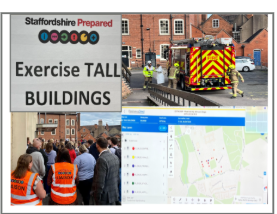
📢 Don't forget to join this months Lunch and Learn.
📖 Hear from Staffordshire LRF on their collaborative approach to improving multi-agency response capabilities.
📲 Dial in details on @RD_Gov
https://t.co/oE59AtwTv2