Heads up for all those using my feed during severe weather. My posts getting throttled here quite a bit when there are a lot of warnings. Please follow my FB feed for more info. Nothing I can do about it.
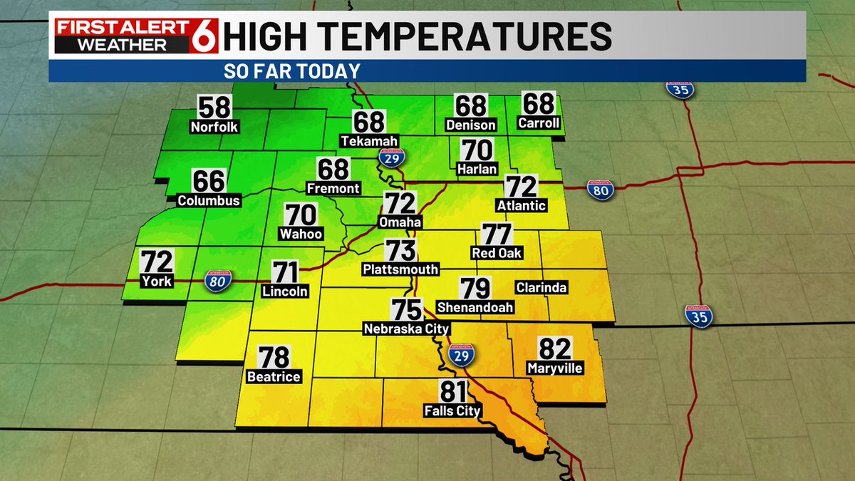
Showers are in the cards for some of us, especially west and northwest of the metro during the day. The farther southeast you live, the better the chances of you reaching the 70s this afternoon with sunshine. We aren't expecting a washout anywhere.
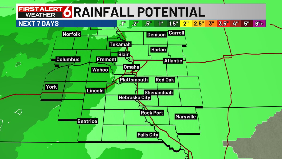
FIRST ALERT to most of the rainfall potential over the next 7 days now centered on Sun late into Mon. Heaviest on the Neb Side. Then temps in the 60s next week. Halloween will show up on the 10 day later today. I'd say there is a rain chance at some point that Sat at this point
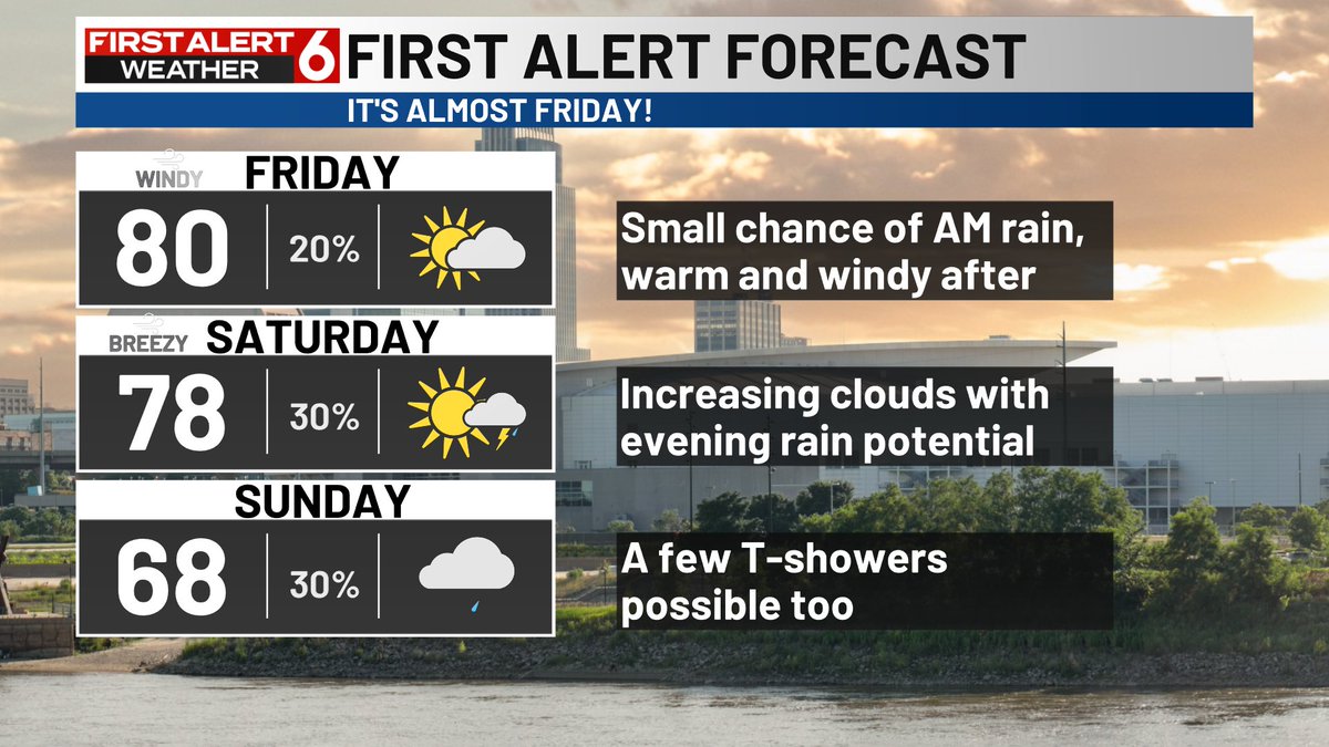
FIRST ALERT to a weekend that is trending warmer and warmer. Highs now should hit 80 on Saturday and have trended into the 70s Sunday. The rain chances keep pushing later too. Sunday evening should be the earliest rain at this point with most trending into Monday now.
FIRST ALERT to pretty incredible warmth the rest of the week. Highs near 80 are likely Thursday and Friday. Friday's highs will be helped by a south wind gusting to 30-35 mph as a few more clouds move in.
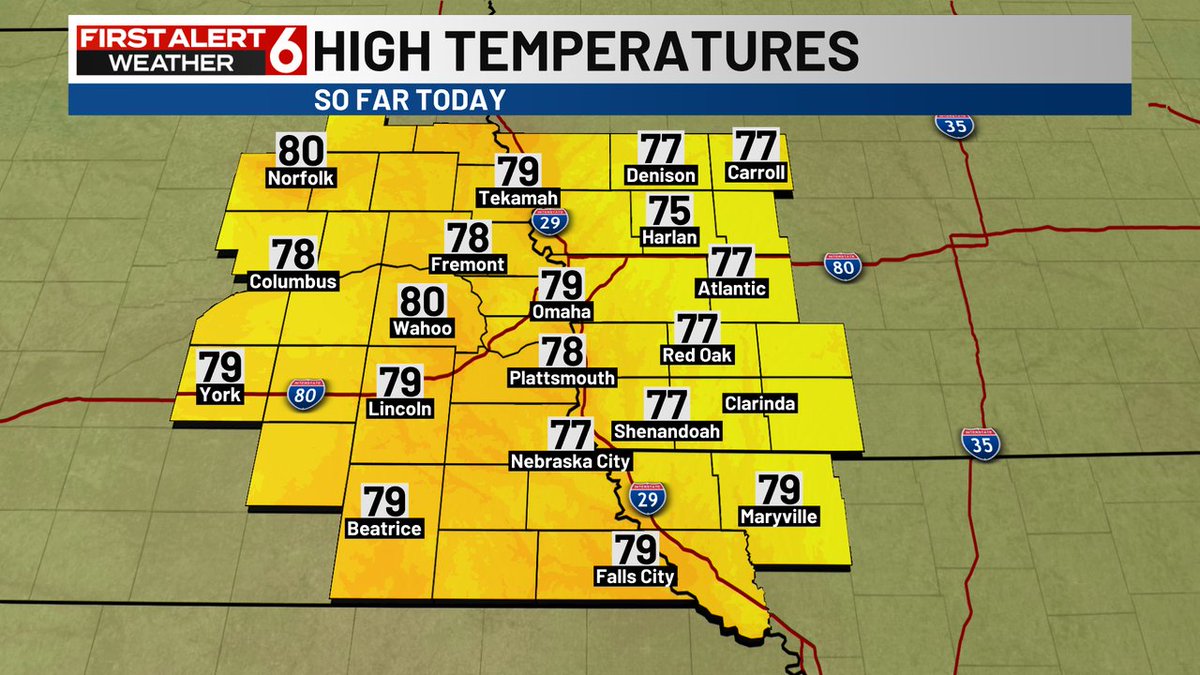
FIRST ALERT to a few showers early this morning but most of those should be gone by 7am. Clouds clear and the temperature climbs even higher this afternoon. Highs in the upper 70s are likely to be widespread with light south wind and low dew points.
Widespread 50s out there Wednesday morning are 5 to 15 degrees warmer than yesterday morning. Likely still need a jacket to start the day but you won't for very long. Highs surge into the upper 70s as you pick the kids up.
A few showers on the map early should move out before 7am. A mild morning in the 50s will turn into an even warmer afternoon in the 70s Wednesday. Low dew points and light wind again will lead to a wonderful October afternoon.
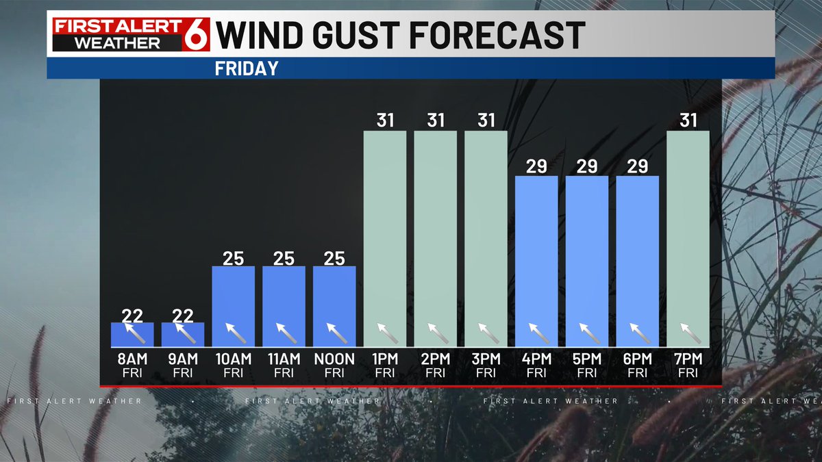
FIRST ALERT to the wind gusts picking up Friday that easily get to 30 mph and could spike to 40 mph, especially on the Neb side. South gusts to 30 mph are possible Saturday too. Some rain chances are possible late, especially west on Saturday night.
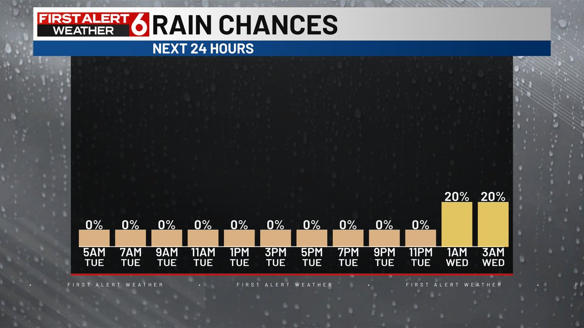
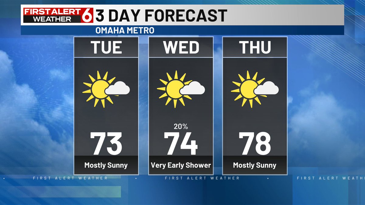
Really small chance of a spotty shower south of I-80 tonight into early Wednesday. Overall the vast majority of us stay dry the next 3 days. Gradually warming each day too.
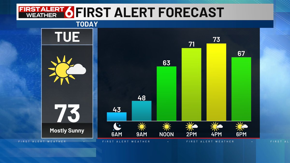
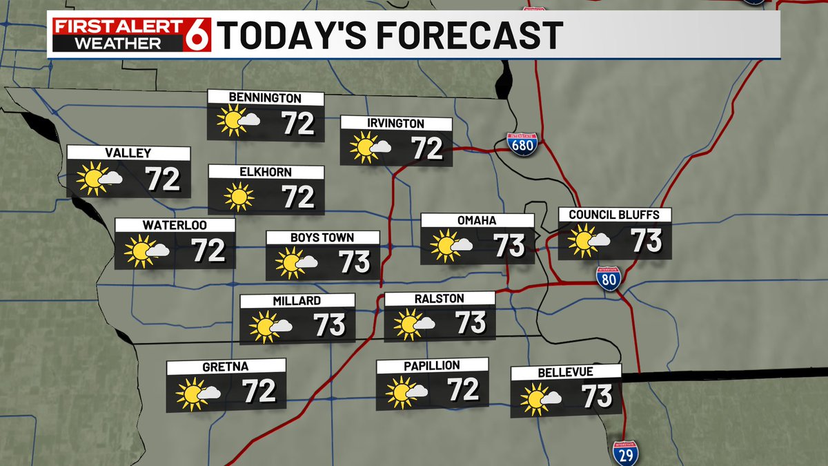
FIRST ALERT to another wonderful day ahead after a chilly start. Highs in the lower 70s are likely with abundant sunshine, light south wind and low dew points. There is a small chance of a shower later overnight into very early Wed. The best odds are south of I-80 for those.
Chilly temperatures win the 40s will again warm today. We should make it into the lower 70s over much of the area. South wind at 5-15 and low dew points will make it very enjoyable. There is a small chance of a shower south of I-80 tonight.