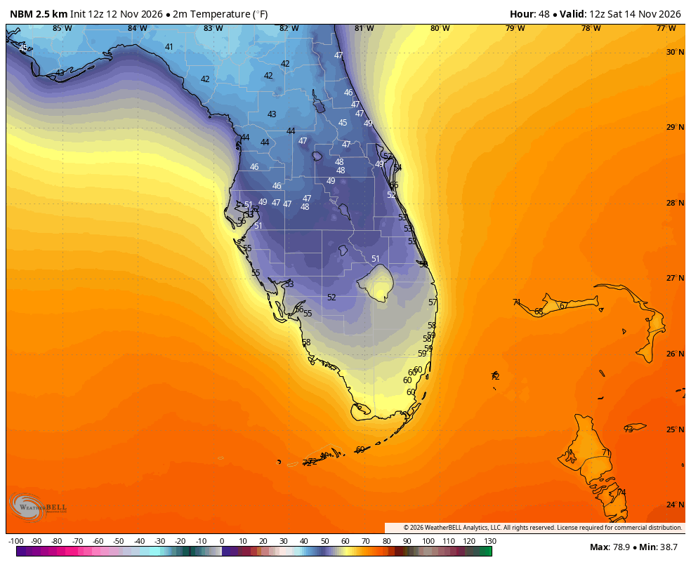
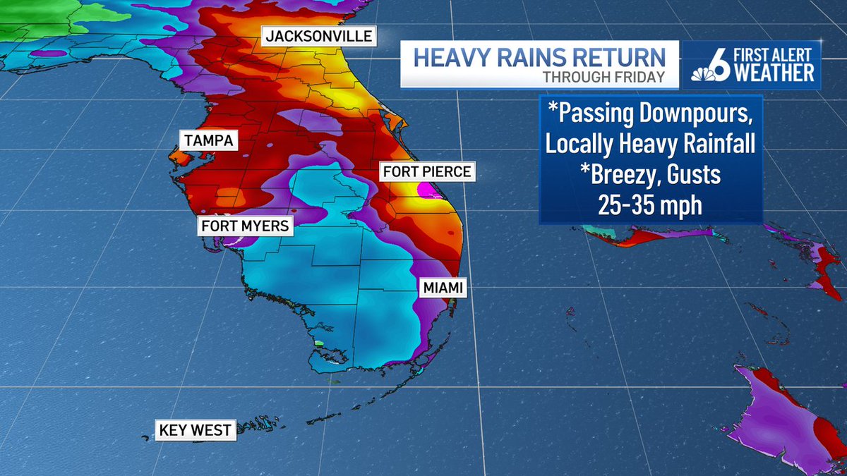
We're about to make a swift switch back to a wet and breezy weather pattern...with the threat for locally heavy rainfall - up and down the Florida east coast - through the end of the week.
Great take from seasoned forecaster — opinions are his own and not that of his employer.
But I believe we all would rather play with a full deck. 🃏
So , yes, give me all the balloon launches. Add the ACARS data.
But know when you’re at the gold mine vs. the junk yard.
@hailhavocwx What if it never was the balloons. What if it’s just an over reliance on deterministic outputs as gospel and a failure on Mets in the loop to correct appropriately. Instead they find the next thing to blame. Also anything FV3 core is hot trash but we act like everything is perf.
@backinblack_wx Agree with everything you said.
Better about using tools. All the way.
But the break from routine launch execution 0z / 12z always felt like a loss.
(In tandem with RIF…)
Just want to stand up where the org was and keep the science moving forward.
"Change you can believe in..."
That's my platform for the next three days.
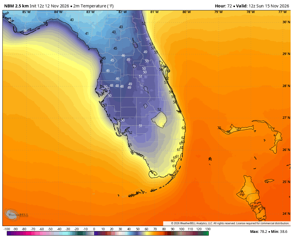
Enjoy the temporary cool down - I don't see readings like this for the next 10-14 days thereafter.
As is the case with every front... wind direction will be a major factor in how low temperatures go.
Right now, we're holding with morning lows in the upper 50s Saturday, lower 60s Sunday.
Any easterly (marine) component to the wind can nuke a "cool" leaning forecast.